|
Onondaga Lake Park
Onondaga Lake Park is an over 8-mile (12.8 km) linear greenway located on the shores of Onondaga Lake in Onondaga County, New York. The park is shared between the towns of Salina and Geddes and the city of Syracuse and is home to the Salt Museum, East Shore Recreation Trail and West Shore Trail. History East Shore Recreation Trail Over two and one-half miles long and twenty feet wide, this paved trail is used for in-line skating and bicycling. During the peak season of April to October, pedestrian use is allowed only if it does not impede wheeled users and stay within three feet of the shoulder and with no more than two abreast. Dogs are not allowed on the trail during peak season. Trams follow the center line. Shoreline Walking Trail Designated for walkers and runners, only foot traffic is allowed on this two mile long trail adjacent to the eastern lake shore. Distance markers along the route help users log their mileage. Special uses (strollers, children's bicycles with t ... [...More Info...] [...Related Items...] OR: [Wikipedia] [Google] [Baidu] |
Onondaga Lake
Onondaga Lake is a lake in Central New York, immediately northwest of and adjacent to Syracuse, New York. The southeastern end of the lake and the southwestern shore abut industrial areas and expressways; the northeastern shore and northwestern end border a series of parks and museums. Although it is near the Finger Lakes region, it is not traditionally counted as one of the Finger Lakes. Onondaga Lake is a dimictic lake, meaning that the lake water completely mixes from top to bottom twice a year. The lake is long and wide making a surface area of . The maximum depth of the lake is with an average depth of . Its drainage basin has a surface area of , encompassing Syracuse, Onondaga County except the eastern and northern edges, the southeastern corner of Cayuga County and the Onondaga Nation Territory, and supports approximately 450,000 people.() Onondaga Lake has two natural tributaries that contribute approximately 70% of the total water flow to the lake. These tributari ... [...More Info...] [...Related Items...] OR: [Wikipedia] [Google] [Baidu] |
Liverpool, New York
Liverpool is a lakeside village in Onondaga County, New York, United States. Its population was 2,347 at the 2010 census. The name was adopted from the city of Liverpool in the United Kingdom. The village is on Onondaga Lake, in the western part of the town of Salina and is northwest of Syracuse, of which it is a suburb. History The area was originally inhabited by the Iroquois, starting in the 16th century. In the mid-17th century, Canadian French Jesuits visited the area, setting up missions. These were not permanent, however. An example of these missions is Sainte Marie among the Iroquois, on Onondaga Lake just outside the village. Once the (Erie Canal) and (Oswego Canal) were built, the area was settled by Irish canal workers, Yankee settlers, and, later, German immigrants. The early recorded name for the village was "Little Ireland". The Lucius Gleason House and Liverpool Cemetery are listed on the National Register of Historic Places. Erie Canal and salt Early in ... [...More Info...] [...Related Items...] OR: [Wikipedia] [Google] [Baidu] |
Onondaga County, New York
Onondaga County ( ) is a county in the U.S. state of New York. As of the 2020 census, the population was 476,516. The county seat is Syracuse. Onondaga County is the core of the Syracuse, NY MSA. History The name ''Onondaga'' derives from the name of the Native American tribe who lived in this area at the time of European contact, one of the original Five Nations of the ''Haudenosaunee''. They called themselves (autonym) ''Onoda'gega'', sometimes spelled ''Onontakeka.'' The word means "People of the Hills." Sometimes the term was ''Onondagaono'' ("The People of the Hills"). The federally recognized Onondaga Nation has a reservation within the county, on which they have self-government. When counties were established in New York in 1683, the present Onondaga County was part of Albany County. This enormous county included the northern part of New York State as well as all of the present State of Vermont and, in theory, extended westward to the Pacific Ocean. It was re ... [...More Info...] [...Related Items...] OR: [Wikipedia] [Google] [Baidu] |
Salina, New York
Salina is a town in Onondaga County, New York, United States. The population was 33,710 at the 2010 census. The name of the town is derived from the Latin word for "salt". Salina is a northwestern suburb of the city of Syracuse. History The region was in the domain of the Onondaga tribe and later was within the Central New York Military Tract, although it was reserved for members of the Onondaga. Salina received its name in 1797, when the Surveyor General received authority to set aside a portion of the Salt Reservation for use in salt manufacture. The Salt Reservation had been created by a treaty with the Native Americans. It extended one mile around Onondaga Lake. In 1798, the Village of Salina was chartered. It was located in what is now the Washington Square neighborhood or "First Ward" of the current City of Syracuse and contained sixteen blocks. Each block was divided into four house lots, selling according to law, for no less than forty dollars. The area now know ... [...More Info...] [...Related Items...] OR: [Wikipedia] [Google] [Baidu] |
Geddes, New York
Geddes is a town in Onondaga County, New York, United States. The population was 17,118 at the 2010 census. The Town of Geddes is west of the neighborhood of Far Westside of Syracuse. The town is a western suburb of Syracuse. History The town was formed from the Town of Salina in 1848. It is named after James Geddes, a prominent early settler who settled at the head of Onondaga Lake in 1794 and developed the salt industry. There also was an Old Geddes Village which included part of the west side of Syracuse and Tipperary Hill, the village square being located near St. Mark's Circle. The village of Geddes (incorporated in 1832 and 1837) was annexed to the City of Syracuse on May 20, 1886 with a population of nearly 7,000. Today the town of Geddes still includes the Village of Solvay, which operates independently, and the hamlets of Westvale and Lakeland. Geddes is the youngest town in Onondaga County. Background Geddes was formed from Salina on March 18, 1848. It l ... [...More Info...] [...Related Items...] OR: [Wikipedia] [Google] [Baidu] |
Syracuse, New York
Syracuse ( ) is a City (New York), city in and the county seat of Onondaga County, New York, Onondaga County, New York, United States. It is the fifth-most populous city in the state of New York following New York City, Buffalo, New York, Buffalo, Yonkers, New York, Yonkers, and Rochester, New York, Rochester. At the United States Census 2020, 2020 census, the city's population was 148,620 and its Syracuse metropolitan area, metropolitan area had a population of 662,057. It is the economic and educational hub of Central New York, a region with over one million inhabitants. Syracuse is also well-provided with convention sites, with a Oncenter, downtown convention complex. Syracuse was named after the classical Greek city Syracuse, Sicily, Syracuse (''Siracusa'' in Italian), a city on the eastern coast of the Italian island of Sicily. Historically, the city has functioned as a major Crossroads (culture), crossroads over the last two centuries, first between the Erie Canal and its ... [...More Info...] [...Related Items...] OR: [Wikipedia] [Google] [Baidu] |
Interstate 690
Interstate 690 (I-690) is an auxiliary Interstate Highway that extends for through the vicinity of Syracuse, New York, in the United States. It is a spur of I-90 (here part of the New York State Thruway) that travels southeast from Thruway exit 39 in Van Buren to I-481 in DeWitt. In between, I-690 passes through the western suburbs of Syracuse before heading east through the city itself, where it meets I-81 in Downtown Syracuse. The expressway continues northwest of the thruway as New York State Route 690 (NY 690). Route description I-690 begins at a double trumpet interchange with the New York State Thruway (I-90) in the town of Van Buren. The six-lane, fully-shouldered limited-access highway continues north toward Baldwinsville as NY 690 while I-690 travels east from the junction. Even though I-690 continues north of the thruway as NY 690, the numbering system on I-690 does not continue with the route. The interchange with the thruway is labeled ... [...More Info...] [...Related Items...] OR: [Wikipedia] [Google] [Baidu] |
Lakeview Amphitheater
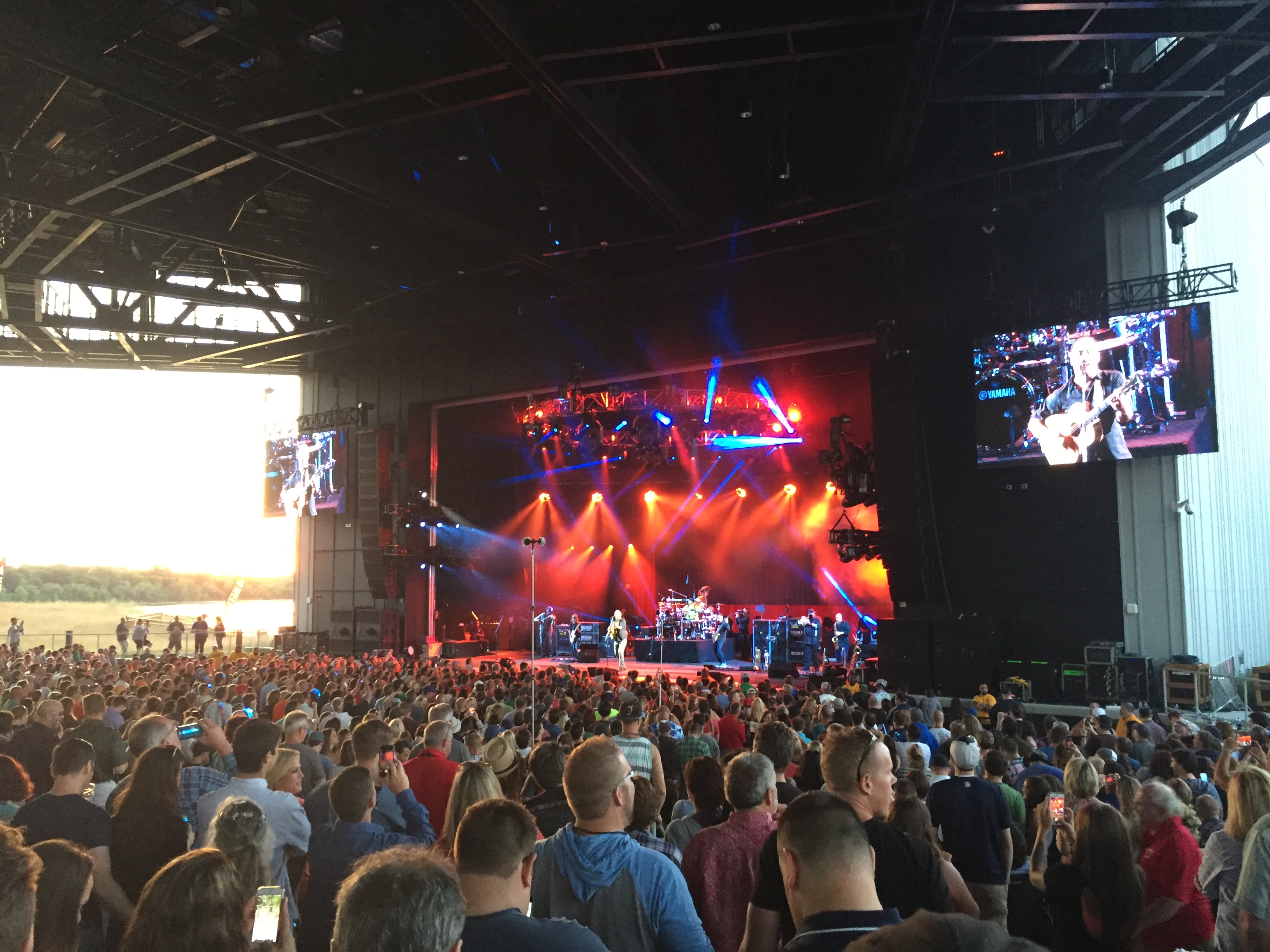
The St. Joseph's Health Amphitheater (formerly known as the Lakeview Amphitheater) is an outdoor concert venue located on the shores of Onondaga Lake in the Town of Geddes, near the western edge of Syracuse, New York. It is an extension of the Empire Expo Center, home to the Great New York State Fair. It replaced the aging Mohegan Sun Grandstand and is the main stage for concerts during the fair season. St. Joseph's Health Amphitheater holds 17,500 spectators - 5,000 seats under the pavilion and 12,500 lawn seats. History Plans for an amphitheater, at the time named "Lakehouse Concert Pavilion Performance Arts Center," located on the shores Onondaga Lake were announced in January 2014 by then-New York State Governor Andrew Cuomo as part of phase one of the Onondaga Lake Revitilzation program. The land for the amphitheater was unused land already owned by Onondaga County, part of which is a former landfill. The venue aimed to draw music and entertainment acts to Central New York ... [...More Info...] [...Related Items...] OR: [Wikipedia] [Google] [Baidu] |
Onondaga Park
Onondaga Park is an park in the city of Syracuse, New York. Man-made Hiawatha Lake is located within the park, which is situated in Syracuse's Strathmore neighborhood on the city's south side. Portions of the park were designed by famed urban planner George Kessler in the early 20th century. The park was placed on the National Register of Historic Places in 2002. Park description Onondaga Park consists of two neighboring sections, Lower Onondaga Park and Upper Onondaga Park. Upper and Lower Onondaga parks are linked with nearby Kirk Park via Onondaga Creek Boulevard, a parkway completed in 1930. The three parks, together with the parkway, form the only interconnected park system in Syracuse. Lower Onondaga Park Lower Onondaga Park is in size, and contains a baseball diamond and a greenhouse which supplies plants used by many of Syracuse's parks. This portion of the park was originally landscaped according to designs by urban planner George Kessler, who was hired to design ... [...More Info...] [...Related Items...] OR: [Wikipedia] [Google] [Baidu] |
County Parks In New York (state)
A county is a geographic region of a country used for administrative or other purposesChambers Dictionary, L. Brookes (ed.), 2005, Chambers Harrap Publishers Ltd, Edinburgh in certain modern nations. The term is derived from the Old French denoting a jurisdiction under the sovereignty of a count (earl) or a viscount.The Oxford Dictionary of English Etymology, C. W. Onions (Ed.), 1966, Oxford University Press Literal equivalents in other languages, derived from the equivalent of "count", are now seldom used officially, including , , , , , , , and ''zhupa'' in Slavic languages; terms equivalent to commune/community are now often instead used. When the Normans conquered England, they brought the term with them. The Saxons had already established the districts that became the historic counties of England, calling them shires;Vision of Britai– Type details for ancient county. Retrieved 31 March 2012 many county names derive from the name of the county town (county seat) with t ... [...More Info...] [...Related Items...] OR: [Wikipedia] [Google] [Baidu] |
Parks In Onondaga County, New York
A park is an area of natural, semi-natural or planted space set aside for human enjoyment and recreation or for the protection of wildlife or natural habitats. Urban parks are urban green space, green spaces set aside for recreation inside towns and cities. National parks and country parks are green spaces used for recreation in the countryside. State parks and provincial parks are administered by sub-national government states and agencies. Parks may consist of grassy areas, rocks, soil and trees, but may also contain buildings and other artifacts such as monuments, fountains or playground structures. Many parks have fields for playing sports such as baseball and football, and paved areas for games such as basketball. Many parks have trails for walking, biking and other activities. Some parks are built adjacent to bodies of water or watercourses and may comprise a beach or boat dock area. Urban parks often have benches for sitting and may contain picnic tables and barbecue gr ... [...More Info...] [...Related Items...] OR: [Wikipedia] [Google] [Baidu] |
Museums In Onondaga County, New York
A museum ( ; plural museums or, rarely, musea) is a building or institution that cares for and displays a collection of artifacts and other objects of artistic, cultural, historical, or scientific importance. Many public museums make these items available for public viewing through exhibits that may be permanent or temporary. The largest museums are located in major cities throughout the world, while thousands of local museums exist in smaller cities, towns, and rural areas. Museums have varying aims, ranging from the conservation and documentation of their collection, serving researchers and specialists, to catering to the general public. The goal of serving researchers is not only scientific, but intended to serve the general public. There are many types of museums, including art museums, natural history museums, science museums, war museums, and children's museums. According to the International Council of Museums (ICOM), there are more than 55,000 museums in 202 coun ... [...More Info...] [...Related Items...] OR: [Wikipedia] [Google] [Baidu] |


