|
Olinda Creek
Olinda Creek (Woiwurrung–Daungwurrung language, Woiwurrung: ''Gnurt-bille-worrun'') is a major tributary of the Yarra River in Victoria, Australia. Its origins are in the Dandenong Ranges, and it is notable for passing through the human settlement, settlement of Lilydale, Victoria, Lilydale (now a suburb of Melbourne) before joining with the Yarra near Coldstream, Victoria, Coldstream. History and Toponymy When Europeans first entered this area of southern Australia, they moved up the valley of the Olinda Creek (then called Running Creek because it was a perennial stream). The formal naming process began with the survey of Lilydale township by John Hardy (surveyor), John Hardy in 1859–60. At the same time that he named Lilydale, Hardy renamed the creek ‘Olinda’ after Alice Olinda Hodgkinson, daughter of Deputy Surveyor-General Clement Hodgkinson. A major dam wall was built to create Silvan Reservoir in 1926. This stopped water flowing into Olinda Creek at the northern ... [...More Info...] [...Related Items...] OR: [Wikipedia] [Google] [Baidu] |
Clement Hodgkinson
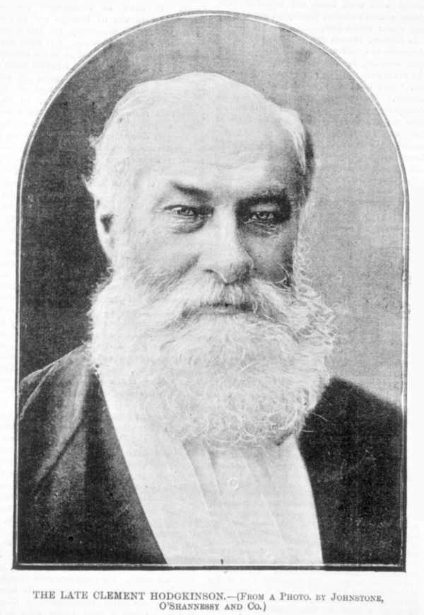
Clement Hodgkinson (1818 – 5 September 1893) was a notable English naturalist, explorer and surveyor of Australia. He was Victorian Assistant Commissioner of Crown Lands and Survey from 1861 to 1874. Exploration in New South Wales Qualified as a civil engineer, Hodgkinson left England in 1839 intending to become a pastoralist.Wright, R., (2002), ‘Hodgkinson, Clement, in R. Aitken and M. Looker (eds), ''Oxford Companion to Australian Gardens'', South Melbourne, Oxford University Press, p. 306. After his arrival, he bought into a cattle station near Kempsey, north of Sydney. A year later, the New South Wales colonial government hired Hodgkinson to survey and explore the northeastern areas of New South Wales as far as Moreton Bay. In March 1841 he explored the upper reaches of the Nambucca and Bellinger rivers, becoming in the process the first European to make contact with the local Aborigines there. He then followed the Macleay, Clarence, Hastings, Richmond and Tweed riv ... [...More Info...] [...Related Items...] OR: [Wikipedia] [Google] [Baidu] |
Tributary
A tributary, or affluent, is a stream or river that flows into a larger stream or main stem (or parent) river or a lake. A tributary does not flow directly into a sea or ocean. Tributaries and the main stem river drain the surrounding drainage basin of its surface water and groundwater, leading the water out into an ocean. The Irtysh is a chief tributary of the Ob river and is also the longest tributary river in the world with a length of . The Madeira River is the largest tributary river by volume in the world with an average discharge of . A confluence, where two or more bodies of water meet, usually refers to the joining of tributaries. The opposite to a tributary is a distributary, a river or stream that branches off from and flows away from the main stream. PhysicalGeography.net, Michael Pidwirny & S ... [...More Info...] [...Related Items...] OR: [Wikipedia] [Google] [Baidu] |
Port Phillip And Western Port Catchment
A port is a maritime facility comprising one or more wharves or loading areas, where ships load and discharge cargo and passengers. Although usually situated on a sea coast or estuary, ports can also be found far inland, such as Hamburg, Manchester and Duluth; these access the sea via rivers or canals. Because of their roles as ports of entry for immigrants as well as soldiers in wartime, many port cities have experienced dramatic multi-ethnic and multicultural changes throughout their histories. Ports are extremely important to the global economy; 70% of global merchandise trade by value passes through a port. For this reason, ports are also often densely populated settlements that provide the labor for processing and handling goods and related services for the ports. Today by far the greatest growth in port development is in Asia, the continent with some of the world's largest and busiest ports, such as Singapore and the Chinese ports of Shanghai and Ningbo-Zhou ... [...More Info...] [...Related Items...] OR: [Wikipedia] [Google] [Baidu] |
Rivers Of Victoria (Australia)
This is a list of rivers of Australia. Rivers are ordered alphabetically, by state. The same river may be found in more than one state as many rivers cross state borders. Longest rivers nationally Longest river by state or territory Although the Murray River forms much of the border separating New South Wales and Victoria, it is not Victoria's longest river because the New South Wales border is delineated by the river's southern bank rather than by the middle of the river. The only section of the river formally within Victoria is a stretch of approximately where it separates Victoria and South Australia. At this point, the middle of the river forms the border. Rivers by state or territory The following is a list of rivers located within Australian states and territories. Where a river crosses a state or territory boundary, it is listed in both states and territories. Where a river has a name that includes the word creek, it has been officially designated as a river. Aus ... [...More Info...] [...Related Items...] OR: [Wikipedia] [Google] [Baidu] |
Lillydale Lake
Lillydale Lake (the name retaining the earliest spelling and the name of the former Lillydale Shire) is an artificial lake and wetlands area created in Lilydale, an outer eastern suburb of Melbourne, Victoria, Australia. The park in which the lake is situated covers over and includes extensive recreational facilities. The lake covers 28 hectares with a 440 metre long dam wall. The ruins of the 1850s erCashin's flour millstand at the northern end of the dam wall. There are over 10 kilometres of shared trails, a community room and meeting facilities, a monster playground, toilets, barbecues and a picnic area. A boat launching ramp provides for non-powered boating. There are also two areas where dogs can exercise off leash. History Areas of Lilydale township are low-lying and susceptible to flooding from the Olinda Creek. In 1853 surveyor James Blackburn saw the site as a location for a water catchment though the Yan Yean Reservoir Yan Yean Reservoir is the oldest water sup ... [...More Info...] [...Related Items...] OR: [Wikipedia] [Google] [Baidu] |
Emerald Creek
Emerald is a gemstone and a variety of the mineral beryl (Be3Al2(SiO3)6) colored green by trace amounts of chromium or sometimes vanadium.Hurlbut, Cornelius S. Jr. and Kammerling, Robert C. (1991) ''Gemology'', John Wiley & Sons, New York, p. 203, . Beryl has a hardness of 7.5–8 on the Mohs scale. Most emeralds are highly included, so their toughness (resistance to breakage) is classified as generally poor. Emerald is a cyclosilicate. Etymology The word "emerald" is derived (via fro, esmeraude and enm, emeraude), from Vulgar Latin: ''esmaralda''/''esmaraldus'', a variant of Latin ''smaragdus'', which was a via grc, σμάραγδος (smáragdos; "green gem") from a Semitic language. According to Webster's Dictionary the term emerald was first used in the 14th century. Properties determining value Emeralds, like all colored gemstones, are graded using four basic parameters–the four ''C''s of connoisseurship: ''color'', ''clarity,'' ''cut'' and ''carat weight''. Norm ... [...More Info...] [...Related Items...] OR: [Wikipedia] [Google] [Baidu] |
Silvan Reservoir
The Silvan Reservoir is located in Silvan, Victoria, Silvan about east of Melbourne, Victoria (Australia), Victoria, Australia. It has a capacity of . The reservoir is operated by Melbourne Water. Operations Silvan is an off-stream storage reservoir, meaning that most of the water is sourced from other reservoirs as the actual catchment area of for Silvan is small. Water for Silvan is transferred from Upper Yarra Reservoir, Upper Yarra, O'Shannassy Reservoir, O'Shannassy and Thomson Dam, Thomson (via Upper Yarra) reservoirs. In turn, Silvan directly supplies water to many of Melbourne's eastern suburbs as well as other off-stream storage reservoirs, including Cardinia Reservoir, Cardinia and Greenvale Reservoir, Greenvale. History A severe drought in 1914 forced the government to search for a new water supply to handle Melbourne's ever-increasing needs. Construction took place between 1926 and 1931. It was officially opened on 7 July 1931. The reservoir was long, wide, cre ... [...More Info...] [...Related Items...] OR: [Wikipedia] [Google] [Baidu] |
John Hardy (surveyor)
John Hardy may refer to: * "John Hardy" (song) (first recorded 1924), an American folk song about a murderer, hanged in 1896 * John Hardy (aviator) (born 1942), Australian aviator and Administrator of the Northern Territory *John Hardy (composer) (born 1957), British composer, active since 1994 *John Hardy (geneticist) (born 1954), British human geneticist and molecular biologist *John Hardy (jewelry), jewelry company, founded in 1975 * John Hardy (fl. 1395–1406), MP for Wilton *John Hardy (MP for Bradford) (1773–1855), British MP and businessman and father of first Earl of Cranbrook * John Hardy (US politician) (1835–1913), U.S. Representative from New York *Sir John Hardy, 1st Baronet (1809–1888), British Conservative Member of Parliament *John Crumpton Hardy (1864–1938), President of the Mississippi Agricultural and Mechanical College * John Richard Hardy (1807–1858), Australian gold commissioner *John Stockdale Hardy (1793–1849), English attorney *John Spencer Hard ... [...More Info...] [...Related Items...] OR: [Wikipedia] [Google] [Baidu] |
Lilydale, Victoria
Lilydale is a town and outer suburb of Melbourne, Victoria, Australia, 34 km north-east from Melbourne's central business district, located within the Shire of Yarra Ranges local government area. Lilydale recorded a population of 17,348 at the . Situated in the Yarra Valley, it began as a town within the former Shire of Lillydale and is also notable as the burial site of Dame Nellie Melba (Lilydale Cemetery). It is both a residential area of metropolitan Melbourne and an industrial area on the city's rural-urban fringe. Toponymy Some prefer to believe the town was named after an 1852 song "Lilly Dale" by H. S. Thompson but evidence shows it was named after an early settler, Lilly de Castella. Most of Victoria has been named after prominent citizens or with traditional Aboriginal names. Lilly de Castella was one of four daughters of Lieutenant-Colonel Joseph Anderson and his wife Mary. Joseph Anderson was one of eight nominated (non-elected) members of the Victorian ... [...More Info...] [...Related Items...] OR: [Wikipedia] [Google] [Baidu] |
Human Settlement
In geography, statistics and archaeology, a settlement, locality or populated place is a community in which people live. The complexity of a settlement can range from a minuscule number of dwellings grouped together to the largest of cities with surrounding urbanized areas. Settlements may include hamlets, villages, towns and cities. A settlement may have known historical properties such as the date or era in which it was first settled, or first settled by particular people. In the field of geospatial predictive modeling, settlements are "a city, town, village or other agglomeration of buildings where people live and work". A settlement conventionally includes its constructed facilities such as roads, enclosures, field systems, boundary banks and ditches, ponds, parks and woods, wind and water mills, manor houses, moats and churches. History The earliest geographical evidence of a human settlement was Jebel Irhoud, where early modern human remains of ... [...More Info...] [...Related Items...] OR: [Wikipedia] [Google] [Baidu] |
Dandenong Ranges
The Dandenong Ranges (commonly just The Dandenongs) are a set of low mountain ranges, rising to 633 metres at Mount Dandenong, approximately east of Melbourne, Victoria, Australia. The ranges consist mostly of rolling hills, steeply weathered valleys and gullies covered in thick temperate rainforest, predominantly of tall mountain ash trees and dense ferny undergrowth. After European settlement in the region, the range was used as a major local source of timber for Melbourne. The ranges were popular with day-trippers from the 1870s onwards. Much of the Dandenongs were protected by parklands as early as 1882 and by 1987 these parklands were amalgamated to form the Dandenong Ranges National Park, which was subsequently expanded in 1997. The range receives light to moderate snowfalls a few times in most years, frequently between late winter and late spring. Today, The Dandenongs are home to over 100,000 residents and are popular amongst visitors, many of whom stay for the week ... [...More Info...] [...Related Items...] OR: [Wikipedia] [Google] [Baidu] |


