|
Old Santa Monica Forestry Station
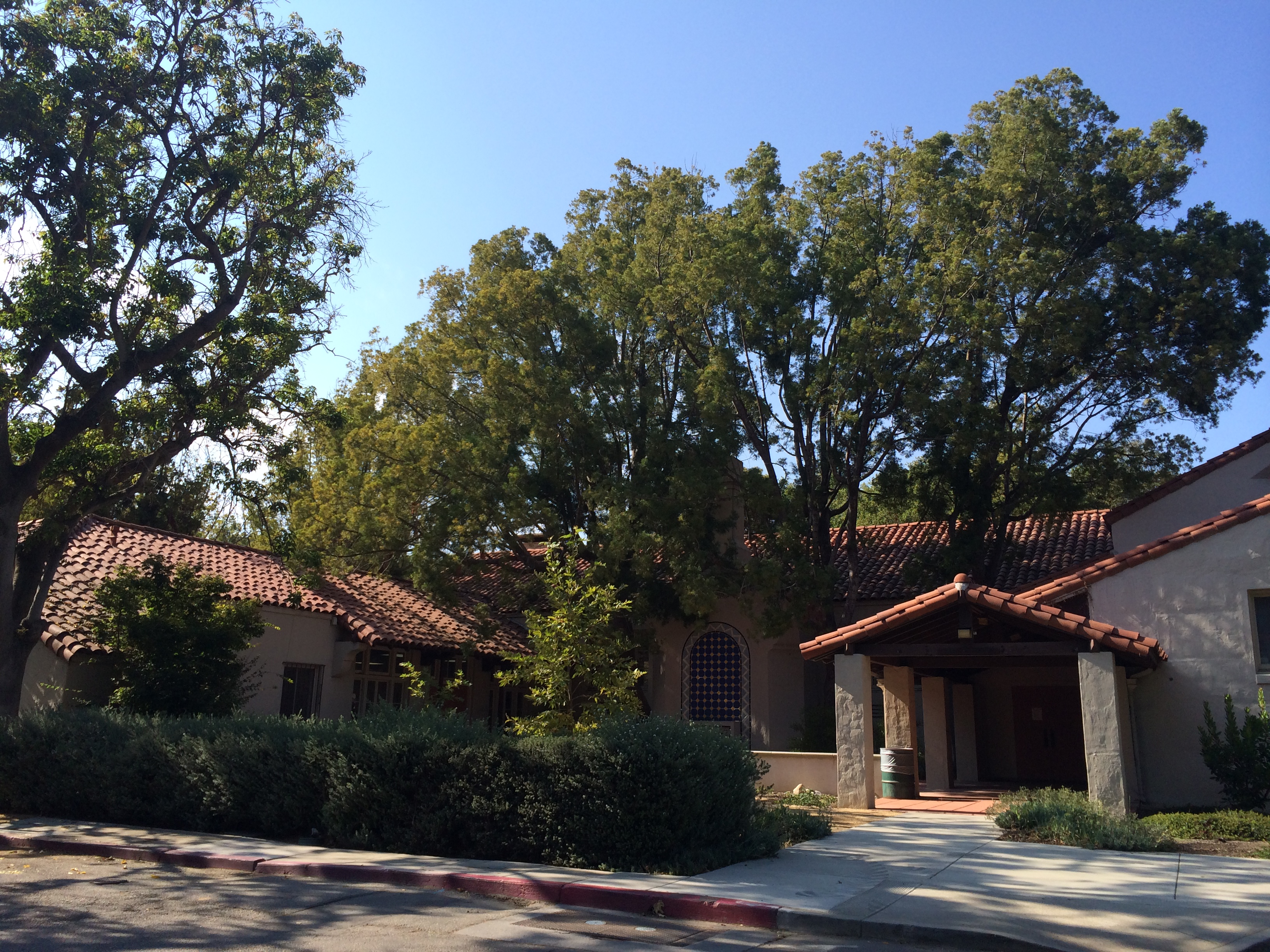
The Old Santa Monica Forestry Station is the nation's first experimental forestry station, built in 1887. The Old Santa Monica Forestry Station was designated a California Historic Landmark (No.840) on March 20, 1970. Old Santa Monica Forestry Station is located at Rustic Canyon in Los Angeles in the Santa Monica Mountains of Southern California in Los Angeles County. The site is south of what is now called Santa Monica Mountains National Recreation Area. In 1971 the state placed a marker near the entrance of the Rustic Canyon Recreation Center at the NW corner of Latimer and Hilltree Roads, at 601 Latimer Road, Los Angeles, CA 90402. This location is in what is now called Pacific Palisades. The hills and canyons around the Santa Monica Canyon were a land boom in the late 1880s. Abbot Kinney (1850-1920), from New Jersey, was a land developer and a conservationist. Kinney is best known for his " Venice of America" development in Los Angeles. Kinney was appointed to a thre ... [...More Info...] [...Related Items...] OR: [Wikipedia] [Google] [Baidu] |
Rustic Canyon, Los Angeles
Rustic Canyon is a residential neighborhood and canyon in eastern Pacific Palisades, on the west side of Los Angeles, California. It is along Rustic Creek, in the Santa Monica Mountains. Geography The residential neighborhood is bordered approximately by Sunset Boulevard to the north, Chautauqua Boulevard to the west, lower Santa Monica Canyon to the south, and Amalfi Drive and Mesa Drive to the east. The neighborhood is between the main section of Pacific Palisades and the Brentwood neighborhoods of Los Angeles, and the Santa Monica Canyon neighborhood of Santa Monica. It is distinctly isolated by its canyon geography and narrow streets. The canyon and creek, with less development, run north of Sunset Boulevard past Will Rogers State Historic Park, and into natural habitat within Topanga State Park. Rustic Canyon and Santa Monica Canyon are the southernmost of a series of coast-facing canyons which cut into the Santa Monica Mountains from Pacific Palisades through Malibu ... [...More Info...] [...Related Items...] OR: [Wikipedia] [Google] [Baidu] |
California Department Of Forestry And Fire Protection
The California Department of Forestry and Fire Protection (CAL FIRE) is the fire department of the California Natural Resources Agency in the U.S. state of California. It is responsible for fire protection in various areas under state responsibility totaling 31 million acres, as well as the administration of the state's private and public forests. In addition, the department provides varied emergency services in 36 of the state's 58 counties via contracts with local governments. The department's current director is Joe Tyler, who was appointed March 4, 2022, by Governor of California Gavin Newsom. Operations CAL FIRE's foremost operational role is to fight and prevent wildfire on 31 million acres of state forestland. The organization works in both suppression and prevention capacities on state land, and offers emergency services of various kinds in 36 out of California's 58 counties, through contracts with local governments. The organization also assists in response to a wide ... [...More Info...] [...Related Items...] OR: [Wikipedia] [Google] [Baidu] |
List Of California Ranchos
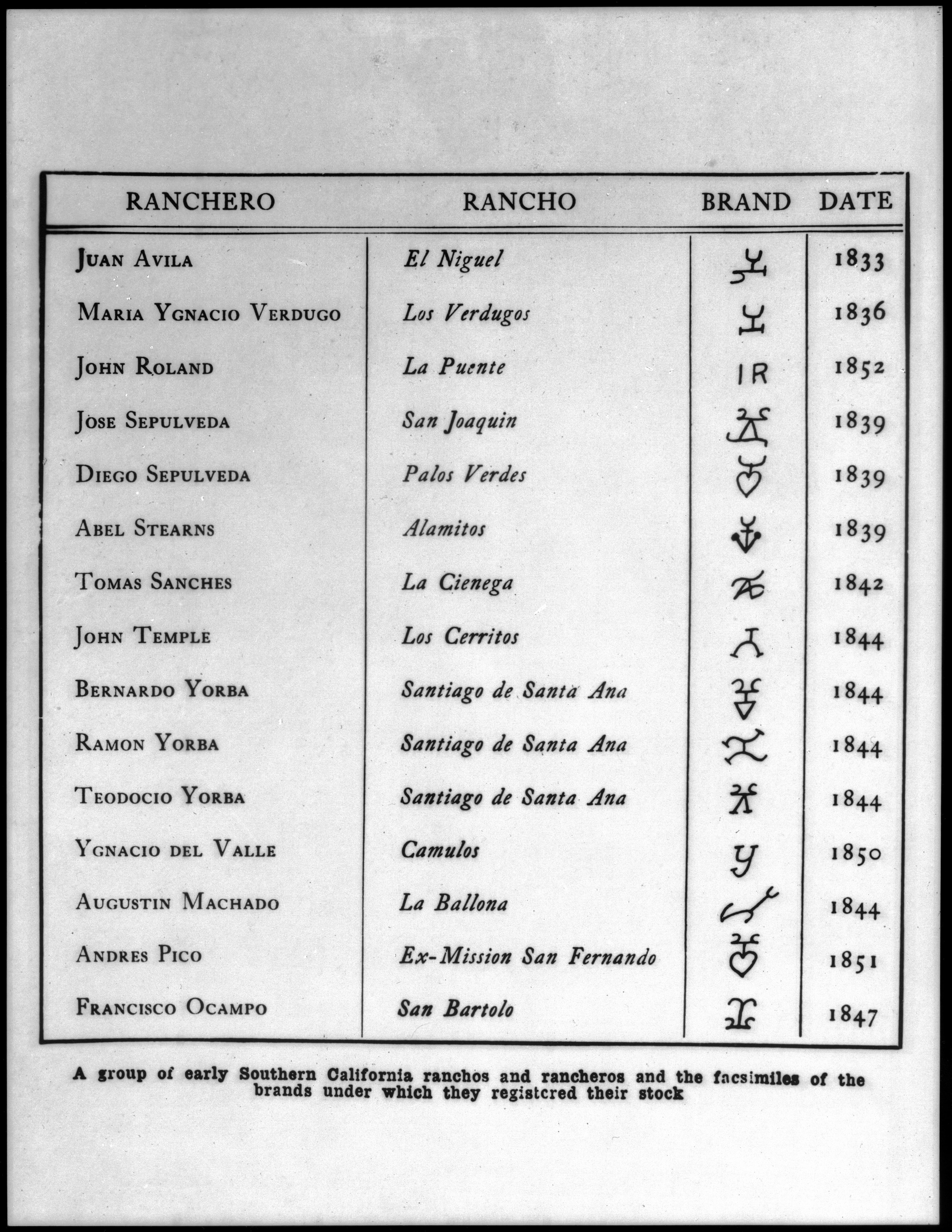
These California land grants were made by Spanish (1784–1821) and Mexican (1822–1846) authorities of Las Californias and Alta California to private individuals before California became part of the United States of America.Shumway, Burgess M.,1988, ''California Ranchos: Patented Private Land Grants Listed by County'', The Borgo Press, San Bernardino, CA, Under Spain, no private land ownership was allowed, so the grants were more akin to free leases. After Mexico achieved independence, the Spanish grants became actual land ownership grants. Following the Mexican–American War, the 1848 Treaty of Guadalupe Hidalgo provided that the land grants would be honored. Alta California ranchos in Mexico From 1773 to 1836, the border between Alta California and Baja California was about 30 miles south of the Mexico–United States border drawn by the Treaty of Guadalupe Hidalgo that ended the Mexican–American War in 1848. Under the Siete Leyes constitutional reforms of 1836, the Alt ... [...More Info...] [...Related Items...] OR: [Wikipedia] [Google] [Baidu] |
California Historical Landmarks In Los Angeles County
List table of the properties and districts — listed on the California Historical Landmarks in Los Angeles County, Southern California. :*Note: ''Click the "Map of all coordinates" link to the right to view a Google map of all properties and districts with latitude and longitude coordinates in the table below.'' See also *List of California Historical Landmarks * National Register of Historic Places listings in Pasadena, California *National Register of Historic Places listings in Los Angeles County, California *National Register of Historic Places listings in Los Angeles, California This is a List of the National Register of Historic Places in the city of Los Angeles. (For those in the rest of Los Angeles County, go here.) Current listings :' ... References {{DEFAULTSORT:Californ ... [...More Info...] [...Related Items...] OR: [Wikipedia] [Google] [Baidu] |
University Of California
The University of California (UC) is a public land-grant research university system in the U.S. state of California. The system is composed of the campuses at Berkeley, Davis, Irvine, Los Angeles, Merced, Riverside, San Diego, San Francisco, Santa Barbara, and Santa Cruz, along with numerous research centers and academic abroad centers. The system is the state's land-grant university. Major publications generally rank most UC campuses as being among the best universities in the world. Six of the campuses, Berkeley, Davis, Irvine, Los Angeles, Santa Barbara, and San Diego are considered Public Ivies, making California the state with the most universities in the nation to hold the title. UC campuses have large numbers of distinguished faculty in almost every academic discipline, with UC faculty and researchers having won 71 Nobel Prizes as of 2021. The University of California currently has 10 campuses, a combined student body of 285,862 students, 24,400 faculty members, 1 ... [...More Info...] [...Related Items...] OR: [Wikipedia] [Google] [Baidu] |
Santa Monica Bay
Santa Monica Bay is a bight (geography), bight of the Pacific Ocean in Southern California, United States. Its boundaries are slightly ambiguous, but it is generally considered to be the part of the Pacific within an imaginary line drawn between Point Dume, in Malibu, California, Malibu, and the Palos Verdes Peninsula. Its eastern shore forms the western boundary of the Los Angeles Westside and South Bay, Los Angeles, South Bay regions. Although it was fed by the Los Angeles River until the river's catastrophic change of course in 1825, the only stream of any size now flowing into it is Ballona Creek. Smaller waterways draining into the bay include Malibu Creek, Topanga Canyon, Topanga Creek, and Santa Monica neighborhoods#Santa Monica Canyon, Santa Monica Creek. The Santa Monica Bay is home to some of the most famous beaches in the world, including Malibu Lagoon State Beach (Surfrider), Will Rogers State Beach, Santa Monica State Beach, and Dockweiler State Beach. Several pi ... [...More Info...] [...Related Items...] OR: [Wikipedia] [Google] [Baidu] |
Pacific Ocean
The Pacific Ocean is the largest and deepest of Earth's five oceanic divisions. It extends from the Arctic Ocean in the north to the Southern Ocean (or, depending on definition, to Antarctica) in the south, and is bounded by the continents of Asia and Oceania in the west and the Americas in the east. At in area (as defined with a southern Antarctic border), this largest division of the World Ocean—and, in turn, the hydrosphere—covers about 46% of Earth's water surface and about 32% of its total surface area, larger than Earth's entire land area combined .Pacific Ocean . '' Britannica Concise.'' 2008: Encyclopædia Britannica, Inc. The centers of both the |
KCET
KCET (channel 28) is a secondary PBS member television station in Los Angeles, California, United States. It is owned by the Public Media Group of Southern California alongside the market's primary PBS member, Huntington Beach–licensed KOCE-TV (channel 50). The two stations share studios at The Pointe (on West Alameda Avenue and Bob Hope Drive, between The Burbank Studios and Walt Disney Studios complexes) in Burbank; KCET's transmitter is located atop Mount Wilson in the San Gabriel Mountains (north of Sierra Madre). History Background of educational television in Southern California KCET was the second attempt at establishing an educational station in the Los Angeles area: KTHE, operated by the University of Southern California, had previously broadcast on channel 28, beginning on September 22, 1953. It was the second educational television station in the United States, signing on six months and four days after KUHT in Houston, but ceased broadcasting after only nine month ... [...More Info...] [...Related Items...] OR: [Wikipedia] [Google] [Baidu] |
Eucalyptus
''Eucalyptus'' () is a genus of over seven hundred species of flowering trees, shrubs or mallees in the myrtle family, Myrtaceae. Along with several other genera in the tribe Eucalypteae, including '' Corymbia'', they are commonly known as eucalypts. Plants in the genus ''Eucalyptus'' have bark that is either smooth, fibrous, hard or stringy, leaves with oil glands, and sepals and petals that are fused to form a "cap" or operculum over the stamens. The fruit is a woody capsule commonly referred to as a "gumnut". Most species of ''Eucalyptus'' are native to Australia, and every state and territory has representative species. About three-quarters of Australian forests are eucalypt forests. Wildfire is a feature of the Australian landscape and many eucalypt species are adapted to fire, and resprout after fire or have seeds which survive fire. A few species are native to islands north of Australia and a smaller number are only found outside the continent. Eucalypts have been grow ... [...More Info...] [...Related Items...] OR: [Wikipedia] [Google] [Baidu] |
Arcadia Bandini De Stearns Baker
Arcadia Bandini de Stearns Baker (1827–1912) was a wealthy Californio landowner and socialite of Los Angeles. She played an important role in the elite society of Los Angeles and, later, Santa Monica. She was married to two wealthy Anglo-American men over the course of her life, Abel Stearns and then Colonel Robert S. Baker. Like many ''californias'' of her time, Arcadia Bandini provided to her Anglo husbands opportunities for entrance into and alliances within the established ''californio'' elite society. She was a skilled businesswoman in her own right, as well as a renowned hostess and organizer of balls and other social functions. Through her Bandini family wealth and the wealth of her husbands, Arcadia Bandini de Stearns Baker amassed an enormous estate and fortune, and upon her death was one of the wealthiest women in America. In her later life, she was considered "the great benefactress of Santa Monica" for her investments in and contributions to the development of the ... [...More Info...] [...Related Items...] OR: [Wikipedia] [Google] [Baidu] |
John Percival Jones
John Percival Jones (January 27, 1829November 27, 1912) was an American politician who served for 30 years as a Republican United States Senator from Nevada. He made a fortune in silver mining and was a co-founder of the town of Santa Monica, California. Early life John P. Jones, one of thirteen children of Thomas Jones (1793–1871) and Mary A. Jones, was born in Hay-on-Wye, England. The family immigrated to the United States and settled in Cleveland, Ohio in 1831. Thomas Jones purchased property, and established himself in business as a marble manufacturer. California Gold Rush In 1849 John P. Jones went to California to participate in the Gold rush. He settled in Trinity County, California where he engaged in mining and farming. He served as county sheriff, and was a member of the California state senate from 1863 to 1867. In 1867 he was the nominee of the Republican party for Lieutenant-Governor. Comstock Lode Nevada In 1868, Jones moved to Gold Hill, Nevada where he wa ... [...More Info...] [...Related Items...] OR: [Wikipedia] [Google] [Baidu] |
Venice Canal Historic District
The Venice Canal Historic District is embedded in the residential Venice suburb of Los Angeles, California. The historic district is noteworthy for possessing man-made wetland canals, built in 1905 by developer Abbot Kinney as part of his Venice of America. Kinney sought to recreate the appearance and feel of Venice, Italy, in coastal Los Angeles County. The names of the canals were given by Abbot Kinney as follows: Aldebaren Canal, Altair Canal, Cabrillo Canal, Coral Canal, Grand Canal, Lion Canal and Venus Canal. Another set of canals were built south of the Venice Canals, originally known as the New Amsterdam Canals by investors and architects, namely Howland, Sherman and Clark, for whom two canals were named. These canals are roughly bounded by Eastern Court on the east, Court A on the south, Strongs Drive on the west, and Court E on the north. There are four east-west canals (Carroll Canal, Linnie Canal, Howland Canal, and Sherman Canal) and two north-south canals (East ... [...More Info...] [...Related Items...] OR: [Wikipedia] [Google] [Baidu] |


.jpg)

.jpg)

