|
Old Noarlunga
Old Noarlunga (formerly Noarlunga) is a suburb in the Australian state of South Australia located about south of the state capital of Adelaide. Originally settled around 1840, the town retains its village atmosphere in spite of encroaching suburbia. Etymology Contemporary Australian linguists believe the name 'Noarlunga' is derived from the Kaurna ''nurlo'' (corner/curve/bend) + ''ngga'' (place). History In the early years of settlement, the surrounding area was cleared for wheat farming, and a flour mill was built in the town in 1843 along with wharves used to transport produce down the Onkaparinga River to Port Noarlunga via barge. The town still has a stone bridge across the Onkaparinga, making the town a focal point for travel further down the coast. In 1846, the Hundred of Noarlunga land division was proclaimed, extending along the coast from the Sturt River to Onkaparinga, but named after the indigenous term ''nurlo'' (curve) for the horse-shoe bend of the Onkaparin ... [...More Info...] [...Related Items...] OR: [Wikipedia] [Google] [Baidu] |
Southern Adelaide
In South Australia, one of the states of Australia, there are many areas which are commonly known by regional names. Regions are areas that share similar characteristics. These characteristics may be natural such as the Murray River, the coastline, desert or mountains. Alternatively, the characteristics may be cultural, such as common land use. South Australia is divided by numerous sets of regional boundaries, based on different characteristics. In many cases boundaries defined by different agencies are coterminous. Informal divisions Convention and common use has divided South Australia into a number of regions. These do not always have strict boundaries between them and have no general administrative function or status. Many of them correspond to regions used by various administrative or government agencies, but they do not always have the same boundaries or aggregate in the same way. The generally accepted regions are: * Adelaide Plains (the northern part is sometimes kno ... [...More Info...] [...Related Items...] OR: [Wikipedia] [Google] [Baidu] |
Kaurna Language
Kaurna ( or ) is a Pama-Nyungan language historically spoken by the Kaurna peoples of the Adelaide Plains of South Australia. The Kaurna peoples are made up of various tribal clan groups, each with their own ''parnkarra'' district of land and local dialect. These dialects were historically spoken in the area bounded by Crystal Brook and Clare in the north, Cape Jervis in the south, and just over the Mount Lofty Ranges. Kaurna ceased to be spoken on an everyday basis in the 19th century and the last known native speaker, Ivaritji, died in 1929. Language revival efforts began in the 1980s, with the language now frequently used for ceremonial purposes, such as dual naming and welcome to country ceremonies. Classification R. M. W. Dixon (2002) classified Kaurna as a dialect of the Kadli language, along with Ngadjuri, Narungga, and Nukunu, and "Nantuwara", with ''kadli'' meaning "dog" in these varieties. However this name has not gained wide acceptance and is not recorded as a la ... [...More Info...] [...Related Items...] OR: [Wikipedia] [Google] [Baidu] |
South Road, Adelaide
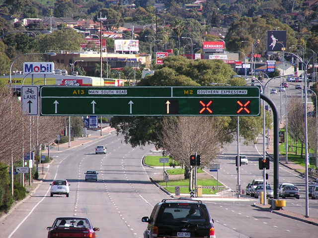
South Road and its southern section as Main South Road outside of Adelaide is a major north–south conduit connecting Adelaide and the Fleurieu Peninsula, in South Australia. It is one of Adelaide's most important arterial and bypass roads. As South Road, it is designated part of route A2 within suburban Adelaide, and as Main South Road, it is designated part of routes A13 and B23. The northern part of South Road contributes the central component of the North–South Corridor, a series of road projects under construction or planning that will eventually provide a continuous expressway between Old Noarlunga and Gawler. Route South Road commences from the intersection with Port River Expressway and Salisbury Highway in Wingfield and runs directly south, through much of Adelaide's inner western suburbs, close to the Adelaide city centre; it is complimented by (and in some instances, subsumed into) the North-South Motorway and either runs directly underneath it at ground level w ... [...More Info...] [...Related Items...] OR: [Wikipedia] [Google] [Baidu] |
City Of Onkaparinga
The City of Onkaparinga () is a local government area (LGA) located on the southern fringe of Adelaide, South Australia. It is named after the Onkaparinga River, whose name comes from ''Ngangkiparinga'', a Kaurna word meaning women's river. It is the largest LGA in South Australia, with a population of over 170,000 people in both urban and rural communities and is also geographically expansive, encompassing an area of 518.3 km². The council is headquartered in the Noarlunga Centre with area offices situated in Aberfoyle Park, Woodcroft and Willunga. History The council was formed on 1 July 1997 as the City of Happy Valley, Noarlunga and Willunga from the amalgamation of the former City of Happy Valley and City of Noarlunga with part of the District Council of Willunga. It adopted the City of Onkaparinga name from 22 December 1997. Culture The South Australian Writers' Centre and the City of Onkaparinga co-hosted the biennial South Australian Writers' Festival (2001– ... [...More Info...] [...Related Items...] OR: [Wikipedia] [Google] [Baidu] |
District Council Of Willunga
The District Council of Willunga, was a local government area in South Australia seated at Willunga from 1853 until 1997. History The District Council of Willunga was established on 18 August 1853 to govern the Hundred of Willunga and the southernmost portion of the Hundred of Kuitpo, one of the sets of earliest local government bodies to be created in the state. The district was bounded on the north-west by the Onkaparinga River up to the present-day boundary between Blewitt Springs and Clarendon. It was bounded on the north-east by straight lines passing to the Wickam Hill and North Mount Magnificent trig stations. The ridgelines making up the southern borders of the hundreds of Kuitpo and Willunga formed the southern boundary of the district, passing through the South Mount Magnificent trig station, Willunga Hill and Sellicks Hill. The council area thus included all of the present-day McLaren Vale wine region and the forestry area known as Lower Meadows or Dingabledinga. ... [...More Info...] [...Related Items...] OR: [Wikipedia] [Google] [Baidu] |
District Of Morphett Vale
A district is a type of administrative division that, in some countries, is managed by the local government. Across the world, areas known as "districts" vary greatly in size, spanning regions or counties, several municipalities, subdivisions of municipalities, school district, or political district. By country/region Afghanistan In Afghanistan, a district (Persian ps, ولسوالۍ ) is a subdivision of a province. There are almost 400 districts in the country. Australia Electoral districts are used in state elections. Districts were also used in several states as cadastral units for land titles. Some were used as squatting districts. New South Wales had several different types of districts used in the 21st century. Austria In Austria, the word is used with different meanings in three different contexts: * Some of the tasks of the administrative branch of the national and regional governments are fulfilled by the 95 district administrative offices (). The area a dis ... [...More Info...] [...Related Items...] OR: [Wikipedia] [Google] [Baidu] |
District Council Of Noarlunga
The City of Noarlunga, formerly the District Council of Noarlunga, was a local government area in South Australia from 1856 until 1997. History The District Council of Noarlunga was established on 21 August 1856 following lobbying by residents at Noarlunga on either side of the Onkaparinga River. The council area was formed from part of the District Council of Willunga on the south bank and part of the District Council of Morphett Vale on the north bank. The remainder of Morphett Vale council was annexed by Noarlunga 75 years later on 12 May 1932 along with part of the District Council of Clarendon. This was as part of the statewide push in the early 1930s to consolidate local government into fewer governing bodies as promulgated in the '' Local Government Areas (Re-arrangement) Acts 1929 and 1931''. On 6 March 1997 the Noarlunga council was amalgamated with the City of Happy Valley and District Council of Willunga to form the City of Happy Valley, Noarlunga and Willunga ... [...More Info...] [...Related Items...] OR: [Wikipedia] [Google] [Baidu] |
South Australia Company
The South Australian Company, also referred to as the South Australia Company, was formed in London on 9 October 1835, after the '' South Australia (Foundation) Act 1834'' had established the new British Province of South Australia, with the South Australian Colonization Commission set up to oversee implementation of the Act. The South Australian Company was a commercial enterprise, and not officially connected to the British Government or the Colonization Commission, but turned out to be indispensable in allowing emigration to the new colony to begin. The founding board of the company, headed by George Fife Angas, consisted of wealthy British merchants, with the purpose of developing a new settlement in South Australia, building a new colony by meeting an essential financial obligations of the ''South Australia Act 1834''. It bought up unsold land to the level required by the Act for emigration to be allowed to begin. During the first years of settlement, the company built a gr ... [...More Info...] [...Related Items...] OR: [Wikipedia] [Google] [Baidu] |
Sturt River
The Sturt River, also known as the Sturt Creek and ''Warri Parri'' (''Warriparri'') in the Kaurna language, is a river located in the Adelaide region of the Australian state of South Australia. Course and features The Sturt River rises in Upper Sturt in the Adelaide Hills, it flows through Coromandel Valley, the Sturt Gorge Recreation Park, Marion and Morphettville, before meeting the Patawalonga River in Glenelg North. Along with Brown Hill Creek, it is one of the Patawalonga's most important tributaries. It is considered a significant urban waterway, and was used by the indigenous Kaurna people as a link between the hills and the sea. The Sturt River catchment area extends over , from Heathfield in the Mount Lofty Ranges, to Glenelg North. The river descends over its course. History The first inhabitants of the greater Adelaide area, the Kaurna people, referred to Sturt River as ''Warri Parri'', or 'the windy place by the river'. They used it as a movement corridor be ... [...More Info...] [...Related Items...] OR: [Wikipedia] [Google] [Baidu] |
Hundred Of Noarlunga
The Hundred of Noarlunga is a cadastral unit of hundred in South Australia covering the far south-western Adelaide metropolitan area south and west of the Sturt River and north and west of the Onkaparinga River. It is one of the eleven hundreds of the County of Adelaide stretching from Glenelg in the northwest to Port Noarlunga in the southwest; and spanning inland between the Sturt and Onkaparinga to Bridgewater in the Adelaide foothills. It was named in 1846 by Governor Frederick Robe, Noarlunga being likely derived from 'nurlongga', an indigenous word referring to the curvature in the Onkaparinga River at Old Noarlunga, dubbed Horseshoe Bend by European settlers. Etymology Contemporary Australian linguists believe the name "Noarlunga" is derived from the Kaurna ''nurlo'' (corner/curve/bend) + ''ngga'' (place). Early South Australian Christian missionaries, Christian Teichelmann and Clamor Schürmann, recorded this meaning of the word in 1840, among about 2000 translations ... [...More Info...] [...Related Items...] OR: [Wikipedia] [Google] [Baidu] |
Port Noarlunga, South Australia
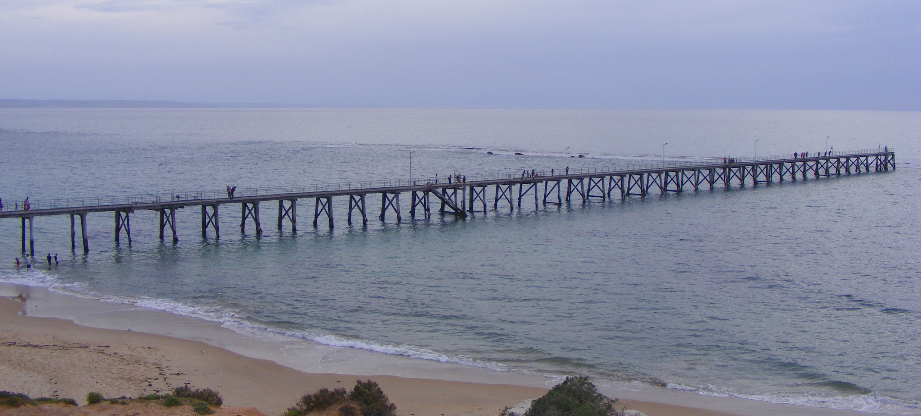
Port Noarlunga is a suburb in the City of Onkaparinga, South Australia. It is a small sea-side suburb, population 2,918, about to the south of the Adelaide city centre and was originally created as a sea port. This area is now popular as a holiday destination or for permanent residents wishing to commute to Adelaide or work locally. There is a jetty that connects to a long natural reef that is exposed at low tide. The beach is large and very long and has reasonable surfing in the South Port area whose name is taken from its location - "South of the Port". It is known as Tainbarang or Tainbarilla by the traditional owners, the Kaurna people, and is of significance as being the site of a freshwater spring said to be created by the tears of Tjilbruke, the creator being. A reserve known as the Tutu Wirra Reserve, on Witton Bluff, is the location of the stone cairn commemorating the second spring created by Tjilbruke on his journey down the coast. The suburb is bounded to the ... [...More Info...] [...Related Items...] OR: [Wikipedia] [Google] [Baidu] |
Horseshoe Inn, Noarlunga, 1865
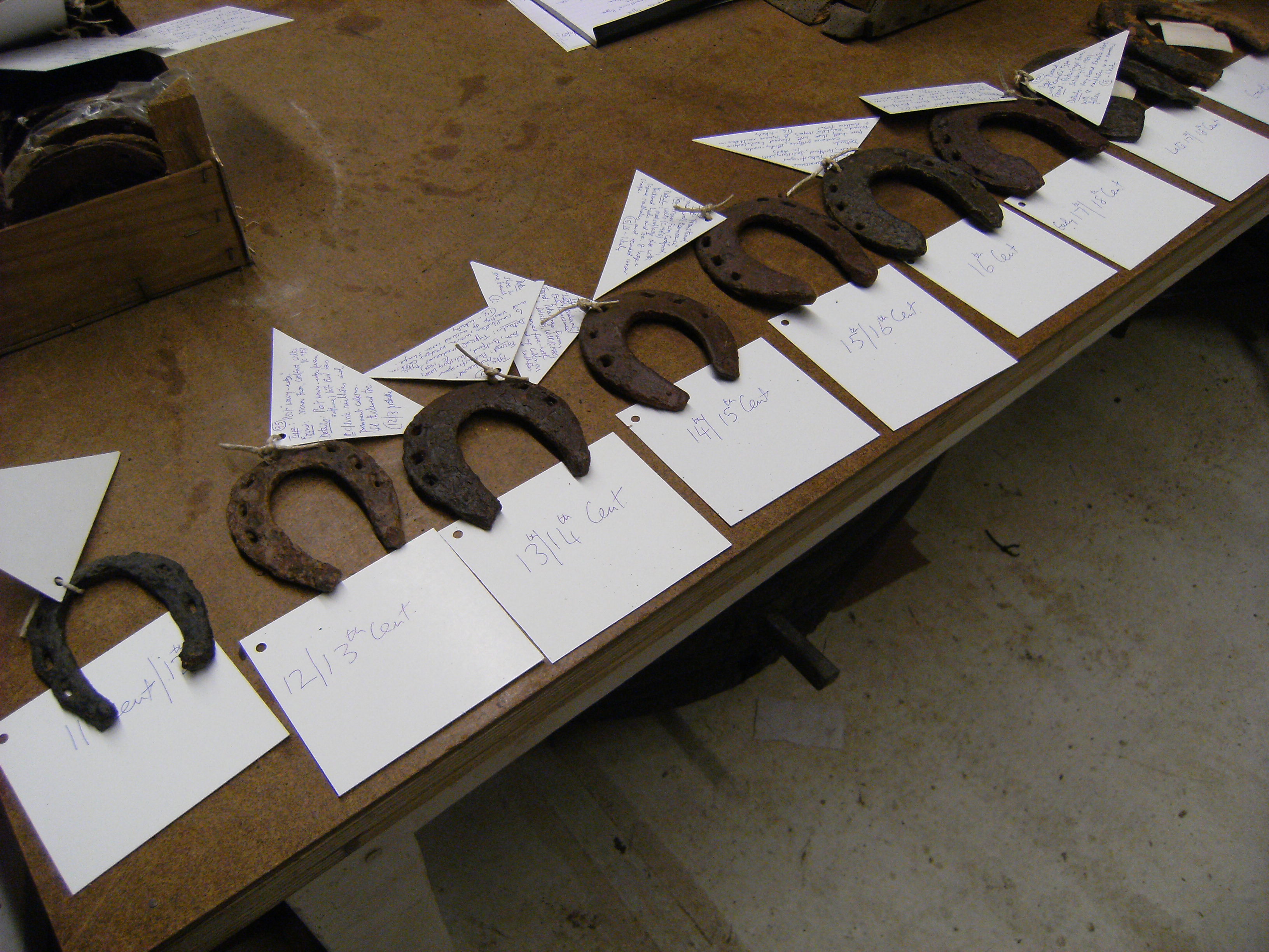
A horseshoe is a fabricated product designed to protect a horse hoof from wear. Shoes are attached on the palmar surface (ground side) of the hooves, usually nailed through the insensitive hoof wall that is anatomically akin to the human toenail, although much larger and thicker. However, there are also cases where shoes are glued. Horseshoes are available in a wide variety of materials and styles, developed for different types of horse and for the work they do. The most common materials are steel and aluminium, but specialized shoes may include use of rubber, plastic, magnesium, titanium, or copper.Price, Steven D. (ed.) ''The Whole Horse Catalog: Revised and Updated'' New York:Fireside 1998 , pp. 84–87. Steel tends to be preferred in sports in which a strong, long-wearing shoe is needed, such as polo, eventing, show jumping, and western riding events. Aluminium shoes are lighter, making them common in horse racing where a lighter shoe is desired, and often facilitate ... [...More Info...] [...Related Items...] OR: [Wikipedia] [Google] [Baidu] |


.jpg)

