|
Oklahoma State Highway 48
State Highway 48 (abbreviated SH-48) is a state highway in eastern Oklahoma that runs nearly from Bryan County to Pawnee County. SH-48 has one lettered spur, SH-48A, in Johnston County. Route description SH-48 begins at SH-78 six miles (10 km) north of Durant. Running north, it is five miles (8 km) to the first highway intersection, SH-22, just west of Kenefic. Highway 48 continues on to the north, passing through the community of Folsom, and at Coleman, SH-48A spurs off to the west, towards the town of Milburn. Seven miles ahead is Wapanucka, and the junction with SH-7. Nine miles past Wapanucka, SH-31 intersects, heading to the east, and in seven more miles Highway 48 reaches the town of Tupelo. Just north of Tupelo, SH-48 intersects SH-3, and then continues for to Allen, where it joins SH-1 for a seven-mile (11 km) concurrency to Atwood. At Atwood, SH-48 splits off to the north, crosses the Canadian River,(the road originally angled west parallel ... [...More Info...] [...Related Items...] OR: [Wikipedia] [Google] [Baidu] |
Oklahoma Department Of Transportation
The Oklahoma Department of Transportation (ODOT) is an government agency, agency of the government of Oklahoma responsible for the construction and maintenance of the state's transportation infrastructure. Under the leadership of the Oklahoma Secretary of Transportation, Oklahoma secretary of transportation and ODOT executive director, the department maintains public infrastructure that includes highways and state-owned railroads and administers programs for county roads, city streets, public transit, passenger rail, waterways and active transportation. Along with the Oklahoma Turnpike Authority, the department is the primary infrastructure construction and maintenance agency of the State.Okla. Stat. tit. 47, § 2-106.2A ODOT is overseen by the Oklahoma Transportation Commission, composed of nine members appointed by the governor of Oklahoma, Oklahoma Senate and Oklahoma House of Representatives. Tim Gatz, a professional landscape architect with a bachelor's degree in landscape ar ... [...More Info...] [...Related Items...] OR: [Wikipedia] [Google] [Baidu] |
State Highway 3 (Oklahoma)
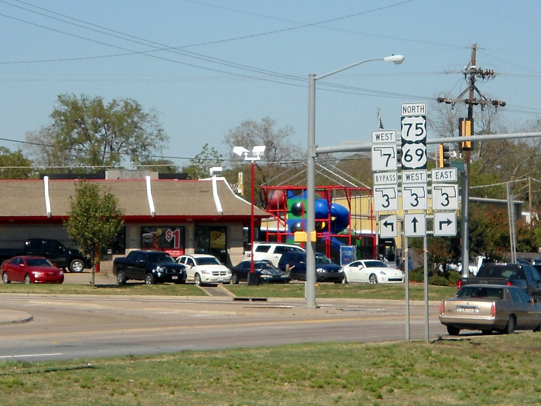
State Highway 3, also abbreviated as SH-3 or OK-3, is a highway maintained by the United States, U.S. state of Oklahoma. Traveling diagonally through Oklahoma, from the Panhandle to the far southeastern corner of the state, SH-3 is the longest state highway in the Oklahoma road system, at a total length of via SH-3E (#SH-3E/3W split, see below). Route description In the northwest Highway 3 begins at the Colorado state line north of Boise City, Oklahoma. At this terminus, it is Concurrency (road), concurrent with U.S. Highway 287 (Oklahoma), US-287/U.S. Highway 385 (Oklahoma), US-385. It remains concurrent with the two U.S. Routes until reaching Boise City, where it encounters a traffic circle which contains five other highways. After the circle, U.S. Highway 385 (Oklahoma), US-385 splits off, and SH-3 overlaps US-287, U.S. Highway 56 (Oklahoma), US-56, U.S. Highway 64 (Oklahoma), US-64, and U.S. Highway 412 (Oklahoma), US-412, though US-56 and US-287 both split off within the ... [...More Info...] [...Related Items...] OR: [Wikipedia] [Google] [Baidu] |
Okemah, Oklahoma
Okemah ( or ) is the largest city in and the county seat of Okfuskee County, Oklahoma, United States. It is the birthplace of folk music legend Woody Guthrie. Thlopthlocco Tribal Town, a federally recognized Muscogee Indian tribe, is headquartered in Okemah. The population was 3,078 at the 2020 census, a 6.1 percent decline from 3,223 at the 2010 census. History Historically occupied by the Osage and Quapaw, who ceded their lands to the United States by 1825, the area was assigned to the Creek Nation and specifically the Thlopthlocco Tribal Town after Indian Removal of tribes from the Southeast United States in the 1830s. Okemah was named after a Kickapoo Indian chief. In March 1902, Chief ''Okemah'' built a bark house in his tribe's traditional fashion. He had come to await the opening of the townsite, which took his name on April 22, 1902. In the Kickapoo language, ''okemah'' means "things up high," such as a highly placed person or town, or high ground. In preparation for ... [...More Info...] [...Related Items...] OR: [Wikipedia] [Google] [Baidu] |
State Highway 56 (Oklahoma)
State Highway 56 (abbreviated SH-56 or OK-56) is a state highway in the U.S. state of Oklahoma. The road serves Seminole County, Okfuskee County, and Okmulgee Counties in central and east-central Oklahoma. In Seminole County, it is also designated as the Seminole Nation Highway in honor of the contributions the Seminole Nation has made to the state of Oklahoma. SH-56 begins at an intersection with US-377 four miles (6 km) east of Konawa, and extends to US-75 in Okmulgee. The highway's total length is . SH-56 was first added to the state highway system in 1929. It was gradually extended to its present length between then and 1942. Route description SH-56 begins at the junction of SH-39 and US-377/ SH-3E/ SH-99 four miles (6 km) east of Konawa. From here, the highway and heads east, curving through the hilly terrain of southeastern Seminole County. The highway passes through the town of Sasakwa east of US-377. At Sasakwa, the road turns north, crossing the Lit ... [...More Info...] [...Related Items...] OR: [Wikipedia] [Google] [Baidu] |
Interstate 40 (Oklahoma)
Interstate 40 (I-40) is an Interstate Highway in Oklahoma that runs across the state from Texas to Arkansas. West of Oklahoma City, it parallels and replaces old U.S. Highway 66 (US-66), and, east of Oklahoma City, it parallels US-62, US-266, and US-64. I-40 is the longest Interstate highway in Oklahoma. Cities along the route include Erick, Sayre, Elk City, Clinton, Weatherford, Oklahoma City and its suburbs (El Reno, Yukon, Del City, and Midwest City), Shawnee, Okemah, Henryetta, Checotah, and Sallisaw. Route description I-40 enters Oklahoma near Texola in Beckham County. It crosses the North Fork of the Red River near Sayre and runs through southern Elk City. It then cuts across northwest Washita County before entering Custer County. There, it passes through Clinton and Weatherford. After leaving Weatherford, I-40 then runs across northern Caddo County. After that, it enters the Oklahoma City metropolitan area at Canadian County. I-40 runs thr ... [...More Info...] [...Related Items...] OR: [Wikipedia] [Google] [Baidu] |
North Canadian River
The North Canadian River is a river, long, in Oklahoma in the United States. It is a tributary of the Canadian River, draining an area of U.S. Geological Survey. National Hydrography Dataset/Watershed Boundary Dataset, area data covering North Canadian River watershed (4-digit Hydrologic Unit Codes 1110), viewed iThe National Map accessed 2019-09-25 in a watershed that includes parts of northeastern New Mexico and the Texas Panhandle. A portion of the river flowing through Oklahoma City was renamed the Oklahoma River in 2004. Course The North Canadian River is formed by the confluence of the Beaver River and Wolf Creek, northeast of the town of Fort Supply in Woodward County, Oklahoma. It flows generally eastward and southeastward, through Woodward, Major, Dewey, Blaine, Canadian, Oklahoma, Lincoln, Pottawatomie, Seminole, Hughes, Okfuskee, Okmulgee, and McIntosh counties, through the cities and towns of Woodward, Oklahoma City, and Shawnee. It is dammed near Canton ... [...More Info...] [...Related Items...] OR: [Wikipedia] [Google] [Baidu] |
Bearden, Oklahoma
Bearden is a town in Okfuskee County, Oklahoma, Okfuskee County, Oklahoma, United States. The population was 133 at the 2010 United States Census, 2010 census. Geography Bearden is located at (35.357993, -96.388291). According to the United States Census Bureau, the town has a total area of , all land. Demographics As of the census of 2000, there were 140 people, 49 households, and 36 families residing in the town. The population density was 18.5 people per square mile (7.2/km2). There were 66 housing units at an average density of . The racial makeup of the town was 87.86% White (U.S. Census), White, 7.86% African American (U.S. Census), African American, 2.14% Native American (U.S. Census), Native American, 0.71% from Race (United States Census), other races, and 1.43% from two or more races. Hispanic (U.S. Census), Hispanic or Latino (U.S. Census), Latino of any race were 0.71% of the population. There were 49 households, out of which 40.8% had children under the age of 18 ... [...More Info...] [...Related Items...] OR: [Wikipedia] [Google] [Baidu] |
State Highway 99A (Oklahoma)
State Highway 99, abbreviated SH-99, is a north–south state highway through central Oklahoma. It runs from the Texas border at Lake Texoma to the Kansas border near Lake Hulah. It is long. The highway overlaps US-377 for over half its length. SH-99 continues as K-99 after crossing the border into Kansas. This road continues for to the Nebraska border, where it becomes Nebraska Highway 99, which lasts an additional . Thus, SH-99 is part of a triple-state highway numbered "99", which lasts a total of . State Highway 99 began as State Highway 48, a short highway connecting Ada to Holdenville. This highway was gradually expanded until it became a border-to-border route. In 1938, it was renumbered to match K-99, which was renumbered from K-11 the same day. Route description US-377/SH-99 US-377 crosses Lake Texoma on a bridge from Grayson County, Texas into Marshall County, Oklahoma. This is the southern terminus of SH-99, which will concur with US-377 all the way to the ... [...More Info...] [...Related Items...] OR: [Wikipedia] [Google] [Baidu] |
State Highway 9 (Oklahoma)
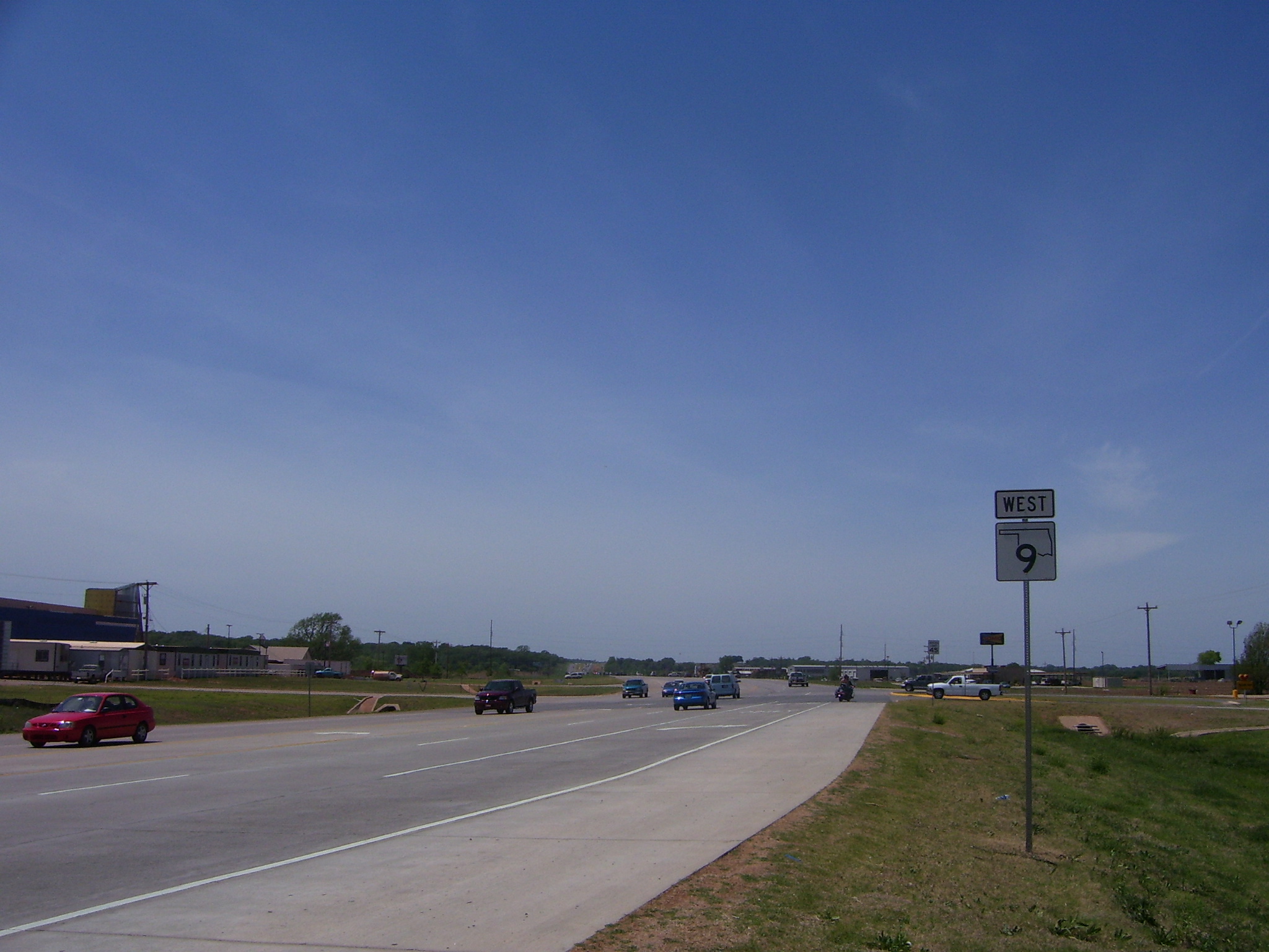
State Highway 9, abbreviated as SH-9, OK-9, or simply Highway 9, is a major east–west highway in the U.S. state of Oklahoma. Spanning across the central part of the state, SH-9 begins at the Texas state line near Madge, Oklahoma, and ends at the Arkansas state line near Fort Smith, Arkansas. State Highway 9 is a major highway around the Norman area. At , SH-9 is Oklahoma's second-longest state highway (second to State Highway 3). Route description West of Interstate 35 From the western terminus at State Highway 203 along the Texas border, the highway travels due east for and intersects with SH-30 between Madge and Vinson. SH-9 continues east for without intersecting another highway until meeting US-283 and SH-34 north of Mangum. The highway overlaps the other two routes for , going north, before splitting off and heading east again through Granite and Lone Wolf. East of Lone Wolf, the highway forms a concurrency with SH-44. Near Hobart, SH-9 overlaps US-183 for (ag ... [...More Info...] [...Related Items...] OR: [Wikipedia] [Google] [Baidu] |
Hughes County, Oklahoma
Hughes County is a county located in south central U.S. state of Oklahoma. As of the 2010 census, the population was 14,003. Its county seat is Holdenville. The county was named for W. C. Hughes, an Oklahoma City lawyer who was a member of the Oklahoma Constitutional Convention.James C. Milligan, "Hughes County." ''Encyclopedia of Oklahoma History and Culture''. Retrieved January 18, 2013. History The area now occupied by Hughes County was part of Indian Territory in the 19th Century. The Creeks settled in the northern part, which fell within the Wewoka District of the , while the Choct ...[...More Info...] [...Related Items...] OR: [Wikipedia] [Google] [Baidu] |
Holdenville, Oklahoma
Holdenville is a city in and county seat of Hughes County, Oklahoma, United States. The population was 5,771 at the 2010 census, an increase of 22 percent from 4,732 at the 2000 census.CensusViewer:Holdenville, Oklahoma Population. Retrieved October 20, 2013. It is home to The Pork Group, a subsidiary of ; the Holdenville State Fish Hatchery, one of four operated by the ; the Davis Correctional Facility, a 1,600 bed |
Canadian River
The Canadian River is the longest tributary of the Arkansas River in the United States. It is about long, starting in Colorado and traveling through New Mexico, the Texas Panhandle, and Oklahoma. The drainage area is about .Dianna Everett, "Canadian River." ''Encyclopedia of Oklahoma History and Culture''. Retrieved October 7, 2013. The Canadian is sometimes referred to as the South Canadian River to differentiate it from the that flows into it. Etymology On John C. ...[...More Info...] [...Related Items...] OR: [Wikipedia] [Google] [Baidu] |


