|
Ohio State Route 87
State Route 87 (SR 87) is an east–west highway in northeastern Ohio, a U.S. state. Its western terminus is at Public Square in downtown Cleveland. It is one of 9 other routes to enter downtown Cleveland at Public Square. 87 ends at an intersection with SR 5 and SR 7 in Kinsman Township. Route description SR 87 begins at Public Square in Cleveland, at an intersection with US 6 / US 42 / SR 3. It is concurrent with US 422 and SR 8 for just over (as well as SR 14 and SR 43 for a short segment), and then leaves the concurrency to occupy a section of Woodland Avenue. The route heads eastward and becomes Buckeye Road, and then Shaker Boulevard, which is a divided boulevard with RTA commuter rail tracks (the "Rapid") between the east- and westbound lanes as it travels through Shaker Heights. At Richmond Road in Beachwood, SR 87 joins SR 175 from the north and heads south approximately to Chagrin Boulevard, where the route leaves SR 175 and ... [...More Info...] [...Related Items...] OR: [Wikipedia] [Google] [Baidu] |
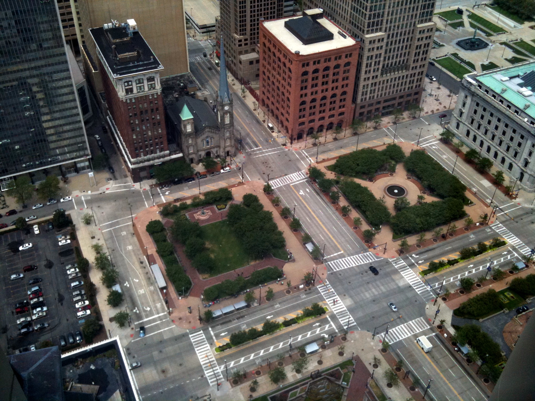
Public Square, Cleveland
Public Square is the central plaza of Downtown Cleveland, Ohio. Based on an 18th-century New England model, it was part of the original 1796 town plat overseen by city founder General Moses Cleaveland of the Connecticut Land Company. The historical center of the city's downtown, it was added to the National Register of Historic Places in 1975. The square is centered on the former intersection of Superior Avenue and Ontario Street. Cleveland's three tallest buildings, Key Tower, 200 Public Square and the Terminal Tower, face the square. Other landmarks adjacent to Public Square include the 1855 Old Stone Church and the former Higbee's department store made famous in the 1983 film ''A Christmas Story'', which has been occupied by the Jack Cleveland Casino since 2012. Originally designed as four separate squares bisected by Superior Avenue and Ontario Street, the square was redeveloped in 2016 by the city into a more pedestrian-friendly environment by routing most traffic arou ... [...More Info...] [...Related Items...] OR: [Wikipedia] [Google] [Baidu] |
American Planning Association
The American Planning Association (APA) is a professional organization representing the field of urban planning in the United States. APA was formed in 1978, when two separate professional planning organizations, the American Institute of Planners and the American Society of Planning Officials, were merged into a single organization. The American Institute of Certified Planners is now the organization's professional branch. Functions Like many professional organizations, the American Planning Association's main function is to serve as a forum for the exchange of ideas between people who work in the field of urban planning. The organization keeps track of the various improvement efforts underway around the country, which may include the improvement or construction of new parks, highways and roads, or residential developments. The organization is also a starting point for people looking for employment. The association also publishes the ''Journal of the American Planning Asso ... [...More Info...] [...Related Items...] OR: [Wikipedia] [Google] [Baidu] |
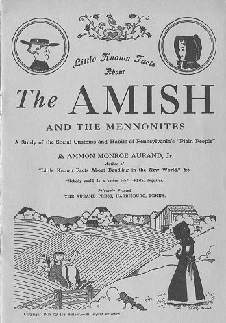
Amish
The Amish (; pdc, Amisch; german: link=no, Amische), formally the Old Order Amish, are a group of traditionalist Anabaptist Christian church fellowships with Swiss German and Alsatian origins. They are closely related to Mennonite churches, another Anabaptist denomination. The Amish are known for simple living, plain dress, Christian pacifism, and slowness to adopt many conveniences of modern technology, with a view neither to interrupt family time, nor replace face-to-face conversations whenever possible, and a view to maintain self-sufficiency. The Amish value rural life, manual labor, humility and '' Gelassenheit'' (submission to God's will). The history of the Amish church began with a schism in Switzerland within a group of Swiss and Alsatian Mennonite Anabaptists in 1693 led by Jakob Ammann. Those who followed Ammann became known as Amish. In the second half of the 19th century, the Amish divided into Old Order Amish and Amish Mennonites; the latter do not abstain fr ... [...More Info...] [...Related Items...] OR: [Wikipedia] [Google] [Baidu] |
Ohio State Route 168
State Route 168 (SR 168) is north–south state highway in the northeastern portion of the U.S. state of Ohio. The southern terminus of State Route 168, which doubles as the southern endpoint of State Route 528, is along State Route 88 at a signalized intersection with U.S. Route 422 in the hamlet of Parkman. State Route 168's northern terminus, which is concurrently the northern endpoint of State Route 700, is at the junction with State Route 87 at a traffic circle in Burton. Route description State Route 168 is located entirely within the southeastern quadrant of Geauga County. The route is not included as a part of the National Highway System, a network of highways deemed most vital to the nation's economy, mobility and defense. History As it appeared when it was first designated in 1924, State Route 168 followed what is currently the portion of State Route 87 between State Route 168's current northern terminus in Burton and the State Route 45 in the uninc ... [...More Info...] [...Related Items...] OR: [Wikipedia] [Google] [Baidu] |
Burton, Ohio
Burton is a village in Geauga County, Ohio, United States. The population was 1,452 at the 2010 census. Burton is the location of Century Village, run by the Geauga Historical Society. The museum village is composed of 19th-century buildings moved there from other locations. Many special events are held there each year, as well as at the Geauga County Fairgrounds, also in Burton. History Burton was founded in 1798 and is Geauga County's oldest settlement. Like many other early settlements in the Connecticut Western Reserve, Burton has a town square patterned after the village greens of New England. In 1972, an incident in Burton lead to a U.S. Supreme Court case. Hugo Zacchini performed a human cannonball act at Burton's annual Geauga County Fair, and WEWS-TV recorded and aired the entire act against his wishes and without compensating him, as was required by Ohio law. In '' Zacchini v. Scripps-Howard Broadcasting Co.'', the high court ruled in 1977 that the First Amendment di ... [...More Info...] [...Related Items...] OR: [Wikipedia] [Google] [Baidu] |
Newbury, Ohio
Newbury State is an unincorporated community in Geauga County, in the U.S. state of Ohio. It is a rural suburb of Cleveland. History A variant name is Newbury. A post office called Newbury has been in operation since 1823. The name Newbury is derived from Newburyport, Massachusetts. Education Newbury is part of the West Geauga School District which is based in bordering Chester Township Notable people *Coyote Peterson, YouTube YouTube is a global online video platform, online video sharing and social media, social media platform headquartered in San Bruno, California. It was launched on February 14, 2005, by Steve Chen, Chad Hurley, and Jawed Karim. It is owned by ... personality and wildlife educator References Unincorporated communities in Geauga County, Ohio Unincorporated communities in Ohio {{GeaugaCountyOH-geo-stub ... [...More Info...] [...Related Items...] OR: [Wikipedia] [Google] [Baidu] |
Ohio State Route 44
State Route 44 (SR 44) is a north–south state highway in the northeastern portion of the U.S. state of Ohio. It runs from a southern terminus at State Route 43 in Waynesburg to a northern terminus at the entrance to Headlands Beach State Park near Painesville. spans from Painesville Township in the north to Waynesburg in the south. Various sections of SR 44 are named for individuals.Ohio Revised Codebr>Chapter 5533/ref> Major junctions SR 44C State Route 44C (SR 44C) is the approach of former SR 44 to the State Route 44/ State Route 5 interchange in Rootstown Township, just north of Interstate 76 Interstate 76 may refer to: Interstate Highways in the United States * Interstate 76 (Colorado–Nebraska) * Interstate 76 (Ohio–New Jersey), running through Pennsylvania Video gaming * ''Interstate '76 ''Interstate '76'' is a vehicular .... References {{Reflist 044 Transportation in Stark County, Ohio Transportation in P ... [...More Info...] [...Related Items...] OR: [Wikipedia] [Google] [Baidu] |
Punderson State Park
Punderson State Park is a public recreation area in Newbury, Ohio. The state park features a lake and a lodge that enjoys a reputation for being haunted. The state park has facilities for swimming, fishing, camping, yurt hurdling, golf, disc golf, and sledding in wintertime. History The site was developed as a castle in the early 1800s by land agent Lemuel Punderson, one of the area's first settlers. After summer cottages, a hotel and Tudor-style lodge were constructed, the Ohio Division of Wildlife purchased the land and lake in 1948, then transferred control to the Division of Parks and Recreation for development as a state park in 1951. In popular culture On August 22, 1882, the pioneers of Newbury held a reunion on the lake, with a reading of Albert G. Riddle Albert Gallatin Riddle (May 28, 1816 – May 15, 1902) was a U.S. Representative from Ohio. Early life Born in Monson, Massachusetts, Riddle moved with his parents to Newbury, in the Western Reserve of Ohio, in ... [...More Info...] [...Related Items...] OR: [Wikipedia] [Google] [Baidu] |
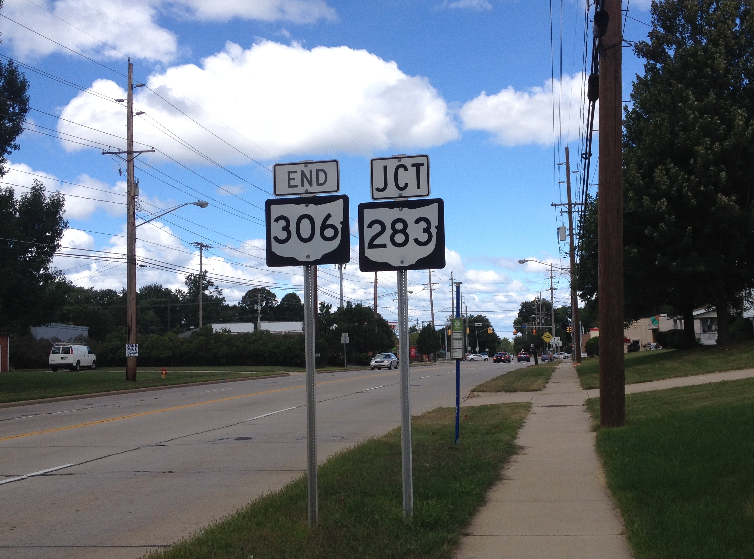
Ohio State Route 306
State Route 306 (SR 306) is a north–south state highway in northeastern Ohio, running from its southern terminus at SR 43 in Aurora to its northern terminus at SR 283 in Mentor. Most of the road from Aurora north to Kirtland is part of the former Chillicothe Turnpike and is known as Chillicothe Road. The Kirtland Temple, the first temple built by the Latter Day Saint movement (Mormons), is located on SR 306 in central Kirtland. History SR 306 was first designated in 1932 following its current route between US 322 and SR 283. In 1935, the Aurora-US 422 segment was brought into the state highway system, but as SR 382. By 1937, the two routes were united as SR 306; also at this time, the road connecting Aurora and Hudson was included as the southernmost segment of SR 306. In 1942, the Hudson-Aurora segment was removed from the state highway system, but by this time, the entire route had been paved. No major changes have occurred to the routing since that time. Major juncti ... [...More Info...] [...Related Items...] OR: [Wikipedia] [Google] [Baidu] |
Moreland Hills, Ohio
Moreland Hills is an affluent suburb in the Greater Cleveland area in the US state of Ohio. The population was 3,320 at the 2010 census. History In 1815, settlement began near the point where State Route 87 crosses the Chagrin River. Orange Township was established in 1820 and became known for its steam sawmills, cheese factories and farms. The village, which in 1831 was still part of Orange Township, was the birthplace of James A. Garfield, the 20th President of the United States. In 1897, the Cleveland-Chagrin Falls Railway spurred residential development in the area as it served as a commuter line to employment opportunities in Cleveland. In the early 20th century, Orange Township was divided into five municipalities, Moreland Hills, Hunting Valley, Orange Village, Pepper Pike and Woodmere. Moreland Hills was incorporated as a village in 1929, encompassing the southeast quadrant of the original Orange Township. Moreland Hills adopted a village charter in 1972, defining the ... [...More Info...] [...Related Items...] OR: [Wikipedia] [Google] [Baidu] |
Ohio State Route 91
State Route 91 (SR 91), formerly known as Inter-county Highway 91 until 1921 and State Highway 91 in 1922, is a north–south state highway in the northeastern portion of the U.S. state of Ohio. Its southern terminus is at U.S. Route 224 (East Waterloo Road) in Springfield Township, east of Akron. Its northern terminus is at State Route 283 (Lakeshore Boulevard) on the Timberlake/ Eastlake border less than one mile (1.6 km) south of Lake Erie. The route is known as Canton Road from its southern terminus to just north of its interchange with Interstate 76 in Akron (Canton Road continues south as County Route 66, a former portion of State Route 8). North of this interchange, it is called Darrow Road until it enters the city of Tallmadge, where it is named South Avenue south of the Tallmadge Circle, and North Avenue north of the circle. It next passes through the Munroe Falls village limits and is known as South Main Street and North Main Street. It becomes Darro ... [...More Info...] [...Related Items...] OR: [Wikipedia] [Google] [Baidu] |
Pepper Pike, Ohio
Pepper Pike is a city in eastern Cuyahoga County, Ohio, United States. The population was 6,796 as of the 2020 census. It is an affluent suburb of the Cleveland metropolitan area. History In 1763, sixteen pioneers settled the area along the eastern border of present-day Cuyahoga County. In 1763, Orange Township was established, which included the present municipalities of Pepper Pike, Hunting Valley, Ohio, Hunting Valley, Moreland Hills, Ohio, Moreland Hills, Orange, Ohio, Orange Village and Woodmere, Ohio, Woodmere. Orange Township was the birthplace of President of the United States, President James Garfield, James A. Garfield in 1831. By the late 1880s, dairy farming and cheese production became the primary industry of the township. In 1924, residents of the northwestern quadrant of Orange Township voted to separate, and the village of Pepper Pike was incorporated. The name "Pepper Pike" was supposedly selected after the Pepper family, who lived and worked along the primary tr ... [...More Info...] [...Related Items...] OR: [Wikipedia] [Google] [Baidu] |
.jpg)


