|
Oberhalbstein Range
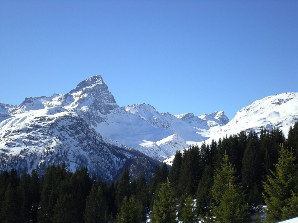
The Oberhalbstein Alps (german: Oberhalbsteiner Alpen) or Platta Group ( it, Alpi del Platta) are a mountain range in the Alps of eastern Switzerland and northern Italy. They are considered to be part of the Central Eastern Alps. The Oberhalbstein Alps are separated from the Lepontine Alps in the west by the Splügen Pass; from the Plessur Alps in the north by the river Albula; from the Albula Alps in the east by the Septimer Pass and the river Gelgia; from the Bernina Range in the south by the Val Bregaglia The Val Bregaglia ( lmo, Val Bregaja; german: Bergell, ; rm, ) is an alpine valley of Switzerland and Italy at the base of which runs the river Mera ( lmo, Maira in Switzerland). Most of the valley falls within the Swiss district of Maloja .... The Oberhalbstein Alps are drained by the rivers Hinterrhein, Gelgia, Liro and Mera. Peaks The main peaks of the Oberhalbstein Alps are: Passes The main mountain passes of the Oberhalbstein Alps are: See also ... [...More Info...] [...Related Items...] OR: [Wikipedia] [Google] [Baidu] |
Alpine Club Classification Of The Eastern Alps
The Alpine Club classification of the Eastern Alps (german: Alpenvereinseinteilung der Ostalpen, AVE) is a common division of the Eastern Alps into 75 mountain ranges, based on the Moriggl Classification (ME) first published in 1924 by the German and Austrian Alpine Club. The present-day division established for the German-speaking world (less Switzerland) was compiled by the German, Austrian and South Tyrol Alpine Clubs and published in 1984 and is also used for the basic numbering of Alpine Club maps for mountaineering. Classification system The Eastern Alps are divided into four main areas: the Northern Limestone Alps, the Central Eastern Alps, the Southern Limestone Alps, and the Western Limestone Alps. These four main ranges are further divided into 75 sub-groups. The Northern Limestone and Central Eastern Alps are the largest with 27 groups each, while the Southern Limestone Alps have 15. The six groups of the Western Limestone Alps are also classed with the Central Easter ... [...More Info...] [...Related Items...] OR: [Wikipedia] [Google] [Baidu] |
Mera (river, Switzerland)
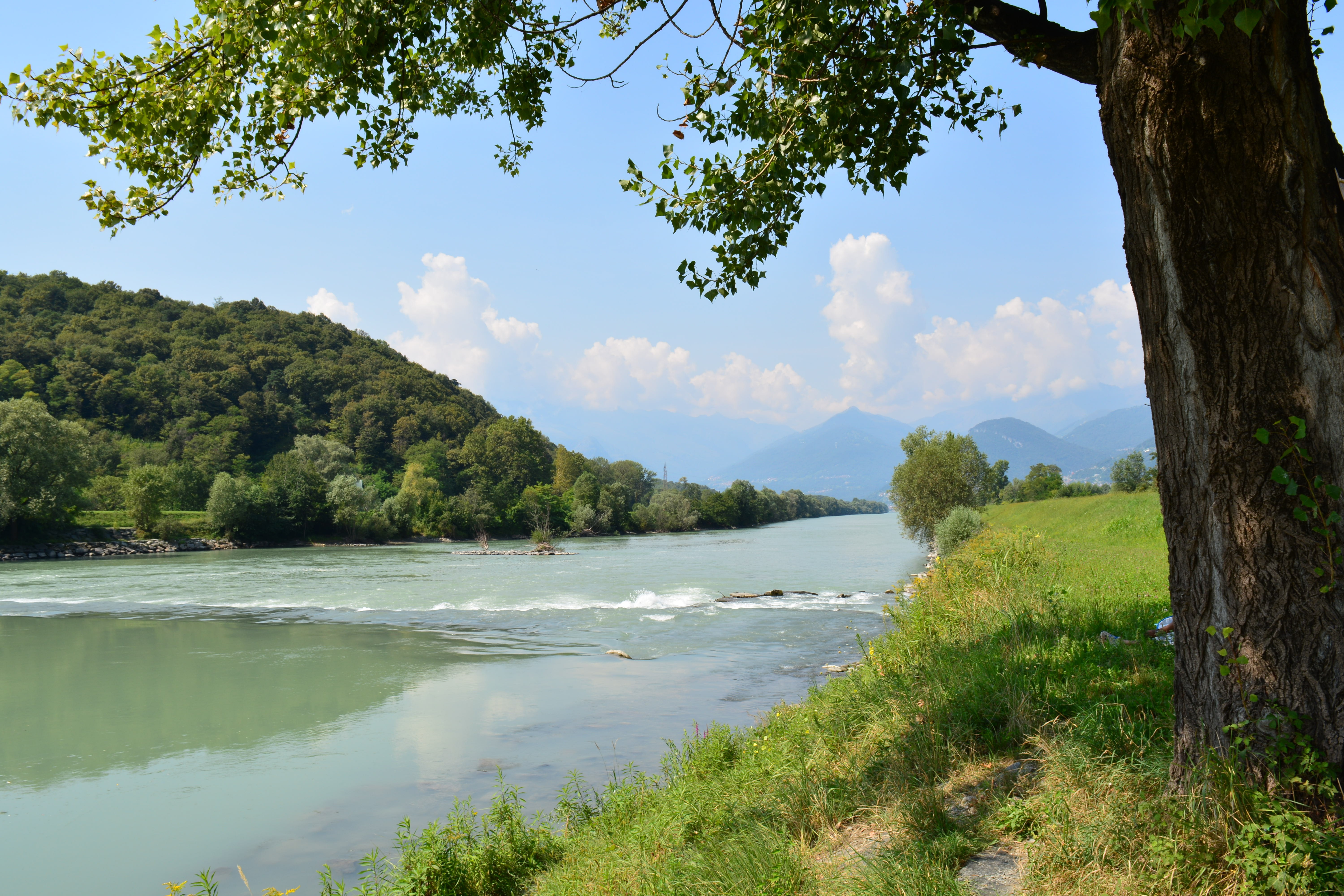
The Mera ( lmo, Maira) is a river in Switzerland and Italy. Its source is near the Piz Mungiroi, in the Grisons, Switzerland. First, it flows east in the direction to Maloja Pass, then turns west through the Val Bregaglia (german: Bergell) and crosses the border to Italy in Castasegna (Dogana). It is joined by the Acquafraggia close to Piuro, and then turns south at Chiavenna, just before it receives the river Liro from the right at Prata Camportaccio. The Mera ends in Lake Como, near Sorico in the Province of Como The Province of Como ( it, Provincia di Como; german: Provinz Como; Comasco: ) is a province in the north of the Lombardy region of Italy and borders the Swiss cantons of Ticino and Grigioni to the North, the Italian provinces of Sondrio and Le ....https://translate.yandex.ru/?utm_source=main_stripe_big&lang=ru-en&text=meri%20%D0%BC%D0%BE%D1%80%D0%B5%20%D0%B2%20%D0%B2%D0%B5%D0%BF%D1%81%D1%81%D0%BA%D0%BE%D0%BC%20%D1%8F%D0%B7%D1%8B%D0%BA%D0%B5 References Exter ... [...More Info...] [...Related Items...] OR: [Wikipedia] [Google] [Baidu] |
Piz Curvér
Piz Curvér is a mountain of the Oberhalbstein Range, between Andeer and Savognin Savognin (in local Romansh dialect ''Suagnign''; it, Savognino; german: Schweiningen, official name until 1890) is a village and former municipality in the Sursés in the district of Albula in the canton of Grisons in Switzerland. On 1 January 20 ..., in the canton of Graubünden. With a height of above sea level, it is the highest point of the chain north of the pass Fuorcla Cotschna. On its eastern flank lies the holy pilgrimage site of Ziteil, at above sea level. External links Piz Curvér on Hikr Mountains of the Alps Mountains of Switzerland Mountains of Graubünden Two-thousanders of Switzerland Andeer Surses {{Graubünden-mountain-stub ... [...More Info...] [...Related Items...] OR: [Wikipedia] [Google] [Baidu] |
Tscheischhorn
The Tscheischhorn is a mountain of the Oberhalbstein Alps, overlooking Juf in Graubünden, Switzerland ). Swiss law does not designate a ''capital'' as such, but the federal parliament and government are installed in Bern, while other federal institutions, such as the federal courts, are in other cities (Bellinzona, Lausanne, Luzern, Neuchâtel .... References External links Tscheischhorn on Hikr Mountains of the Alps Alpine three-thousanders Mountains of Graubünden Mountains of Switzerland Avers {{Graubünden-mountain-stub ... [...More Info...] [...Related Items...] OR: [Wikipedia] [Google] [Baidu] |
Surettahorn
The Surettahorn (also known as ''Pizzo Suretta'') is a mountain in the Oberhalbstein Range of the Alps located on the border between Italy and Switzerland. It overlooks the Splügen Pass The Splügen Pass (german: Splügenpass; it, Passo dello Spluga; rm, Pass dal Spleia ) is an Alpine mountain pass of the Lepontine Alps. It connects the Swiss, Grisonian Splügen to the north below the pass with the Italian Chiavenna to the ... on its west side. The Surettahorn has two summits: ''Punta Nera'' () and ''Punta Rossa'' (). References External links Surettahorn on HikrSurettahorn on Summitpost Mountains of the Alps Alpine three-thousanders Mountains of Switzerland Mountains of Italy Italy–Switzerland border International mountains of Europe Mountains of Graubünden Sufers Rheinwald {{Sondrio-mountain-stub ... [...More Info...] [...Related Items...] OR: [Wikipedia] [Google] [Baidu] |
Piz Bles
Piz Bles is a mountain in the Oberhalbstein Alps, located on the border between Italy (Lombardy) and Switzerland (Graubünden). On its northwestern side lies the lake Lago di Lei Lago di Lei is a reservoir in the Valle di Lei, powering the Hinterrhein storage power stations. The reservoir is almost entirely in Italy, but the barrage was built on territory ceded by Italy to Switzerland (municipality of Ferrera, Grisons .... References External links Piz Bles on Hikr Mountains of the Alps Alpine three-thousanders Mountains of Graubünden Mountains of Lombardy Italy–Switzerland border International mountains of Europe Mountains of Switzerland Bregaglia {{Graubünden-mountain-stub ... [...More Info...] [...Related Items...] OR: [Wikipedia] [Google] [Baidu] |
Piz Grisch
Piz Grisch is a mountain of the Oberhalbstein Alps The Oberhalbstein Alps (german: Oberhalbsteiner Alpen) or Platta Group ( it, Alpi del Platta) are a mountain range in the Alps of eastern Switzerland and northern Italy. They are considered to be part of the Central Eastern Alps. The Oberhalbstein ..., overlooking Innerferrera in the Swiss canton of Graubünden. A small glacier lies at the base of its northern face, the Glatscher da Sut Fuina. Panorama References External links * Piz Grisch on Hikr Ferrera Mountains of the Alps Alpine three-thousanders Mountains of Switzerland Mountains of Graubünden {{Graubünden-mountain-stub ... [...More Info...] [...Related Items...] OR: [Wikipedia] [Google] [Baidu] |
Cima Da Lägh
Cima da Lägh (also known as ''Cima di Lago'') is a mountain in the Oberhalbstein Range of the Alps, located on the border between Italy and Switzerland. On its southern side it overlooks the Val Bregaglia The Val Bregaglia ( lmo, Val Bregaja; german: Bergell, ; rm, ) is an alpine valley of Switzerland and Italy at the base of which runs the river Mera ( lmo, Maira in Switzerland). Most of the valley falls within the Swiss district of Maloja i .... References External links Cima da Lägh on Hikr Mountains of the Alps Alpine three-thousanders Mountains of Switzerland Mountains of Italy Italy–Switzerland border International mountains of Europe Mountains of Graubünden Bregaglia {{Graubünden-mountain-stub ... [...More Info...] [...Related Items...] OR: [Wikipedia] [Google] [Baidu] |
Pizz Gallagiun
Pizz Gallagiun (also known as ''Pizzo Galleggione'') is a mountain of the Oberhalbstein Range, located on the border between Italy and Switzerland. On its southern side it overlooks the Val Bregaglia The Val Bregaglia ( lmo, Val Bregaja; german: Bergell, ; rm, ) is an alpine valley of Switzerland and Italy at the base of which runs the river Mera ( lmo, Maira in Switzerland). Most of the valley falls within the Swiss district of Maloja i .... On its northern side it overlooks the Val Madris. References External links Pizz Gallagiun on Hikr Mountains of the Alps Alpine three-thousanders Mountains of Graubünden Mountains of Lombardy Italy–Switzerland border International mountains of Europe Mountains of Switzerland Bregaglia {{Lombardy-geo-stub ... [...More Info...] [...Related Items...] OR: [Wikipedia] [Google] [Baidu] |
Piz Duan
Piz Duan is a mountain of the Oberhalbstein Range, overlooking Vicosoprano and the Val Bregaglia The Val Bregaglia ( lmo, Val Bregaja; german: Bergell, ; rm, ) is an alpine valley of Switzerland and Italy at the base of which runs the river Mera ( lmo, Maira in Switzerland). Most of the valley falls within the Swiss district of Maloja i ..., in the Swiss canton of Graubünden. References External links Piz Duan on HikrPiz Duan on Summitpost Mountains of the Alps Alpine three-thousanders Mountains of Switzerland Mountains of Graubünden Bregaglia {{Graubünden-mountain-stub ... [...More Info...] [...Related Items...] OR: [Wikipedia] [Google] [Baidu] |
Pizzo Stella
Pizzo Stella or Pizzo Sterla is a mountain of Lombardy, Italy, located north of Chiavenna. On its northern side it overlooks the Valle di Lei and the lake Lago di Lei Lago di Lei is a reservoir in the Valle di Lei, powering the Hinterrhein storage power stations. The reservoir is almost entirely in Italy, but the barrage was built on territory ceded by Italy to Switzerland (municipality of Ferrera, Grisons .... References External linksPizzo Stella on Hikr {{DEFAULTSORT:Stella Mountains of the Alps Alpine three-thousanders [...More Info...] [...Related Items...] OR: [Wikipedia] [Google] [Baidu] |
Piz Timun
Piz Timun (also known as ''Pizzo d'Emet'') is a mountain of the Oberhalbstein Range, located on the border between Italy and Switzerland. On its eastern side it overlooks the artificial lake Lago di Lei. See also *List of mountains of Graubünden *List of most isolated mountains of Switzerland A ''list'' is any set of items in a row. List or lists may also refer to: People * List (surname) Organizations * List College, an undergraduate division of the Jewish Theological Seminary of America * SC Germania List, German rugby union ... References External links Piz Timun on Hikr Mountains of the Alps Alpine three-thousanders Mountains of Graubünden Mountains of Lombardy Italy–Switzerland border International mountains of Europe Mountains of Switzerland Ferrera {{Graubünden-mountain-stub ... [...More Info...] [...Related Items...] OR: [Wikipedia] [Google] [Baidu] |


