|
OGC Reference Model
The OGC Reference Model describes a framework for the ongoing work of the Open Geospatial Consortium The Open Geospatial Consortium (OGC), an international voluntary consensus standards organization for geospatial content and location-based services, sensor web and Internet of Things, GIS data processing and data sharing. It originated in 1994 ... (OGC) and their specifications and implementing interoperable solutions and applications for geospatial services, data, and applications. It is not an OGC standard. It has the following purposes: * Provides a foundation for coordination and understanding (both internal and external to OGC) of ongoing OGC activities and the Technical Baseline; * Update/Replacement of parts of the 1998 OpenGIS Guide; * Describes the OGC requirements baseline for geospatial interoperability; * Describes the OGC architecture framework through a series of non-overlapping viewpoints: including existing and future elements; * Regularize the development of d ... [...More Info...] [...Related Items...] OR: [Wikipedia] [Google] [Baidu] |
Open Geospatial Consortium
The Open Geospatial Consortium (OGC), an international voluntary consensus standards organization for geospatial content and location-based services, sensor web and Internet of Things, GIS data processing and data sharing. It originated in 1994 and involves more than 500 commercial, governmental, nonprofit and research organizations in a consensus process encouraging development and implementation of open standards. History A predecessor organization, OGF, the Open GRASS Foundation, started in 1992. From 1994 to 2004 the organization also used the name Open GIS Consortium. The OGC website gives a detailed history of the OGC. Standards Most of the OGC standards depend on a generalized architecture captured in a set of documents collectively called the ''Abstract Specification'', which describes a basic data model for representing geographic features. Atop the Abstract Specification members have developed and continue to develop a growing number of specifications, or ''stand ... [...More Info...] [...Related Items...] OR: [Wikipedia] [Google] [Baidu] |
Geographic Information Systems
A geographic information system (GIS) is a type of database containing geographic data (that is, descriptions of phenomena for which location is relevant), combined with software tools for managing, analyzing, and visualizing those data. In a broader sense, one may consider such a system to also include human users and support staff, procedures and workflows, body of knowledge of relevant concepts and methods, and institutional organizations. The uncounted plural, ''geographic information systems'', also abbreviated GIS, is the most common term for the industry and profession concerned with these systems. It is roughly synonymous with geoinformatics and part of the broader geospatial field, which also includes GPS, remote sensing, etc. Geographic information science, the academic discipline that studies these systems and their underlying geographic principles, may also be abbreviated as GIS, but the unambiguous GIScience is more common. GIScience is often considered a subdiscip ... [...More Info...] [...Related Items...] OR: [Wikipedia] [Google] [Baidu] |
Reference Models
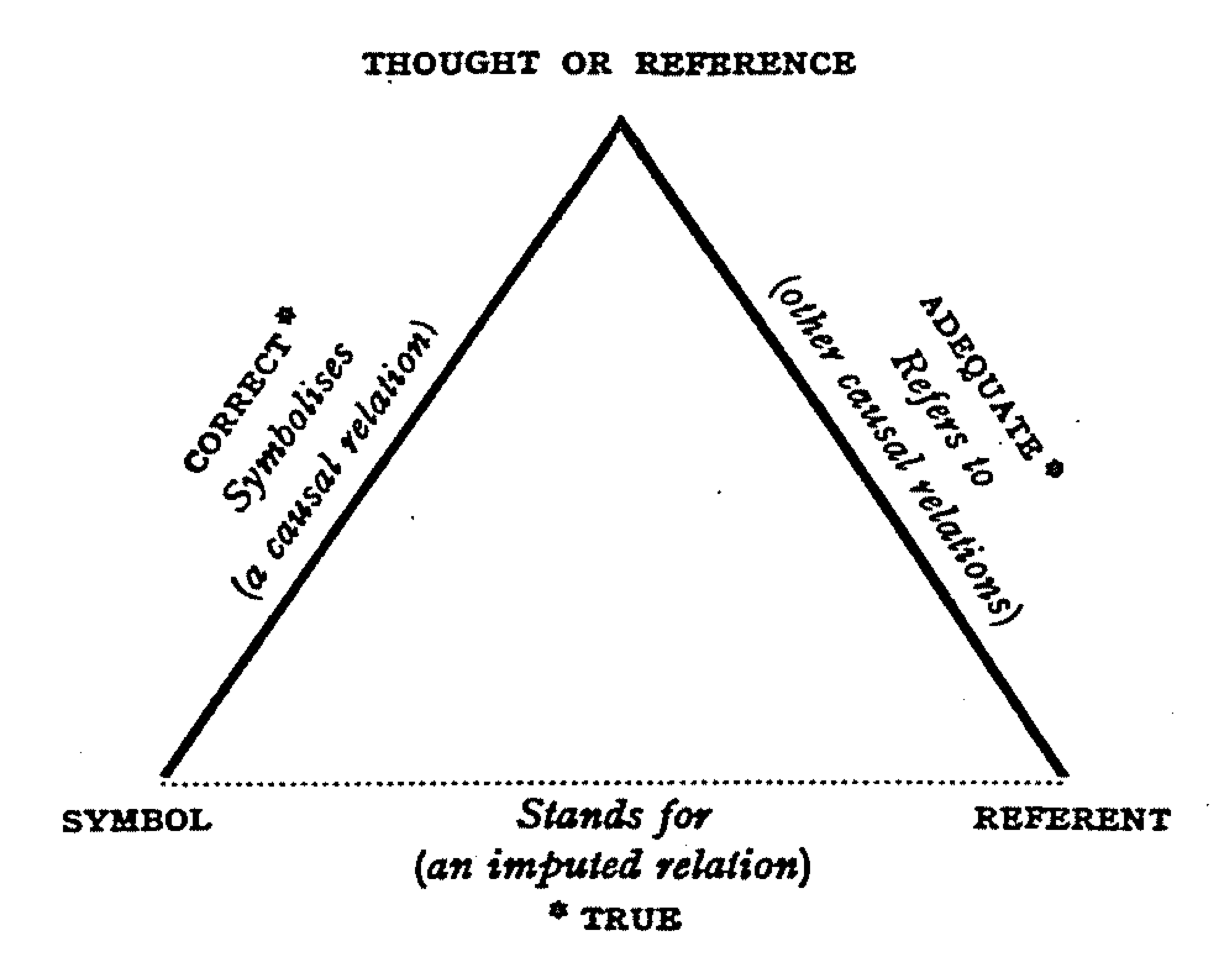
Reference is a relationship between objects in which one object designates, or acts as a means by which to connect to or link to, another object. The first object in this relation is said to ''refer to'' the second object. It is called a ''name'' for the second object. The second object, the one to which the first object refers, is called the ''referent'' of the first object. A name is usually a phrase or expression, or some other symbolic representation. Its referent may be anything – a material object, a person, an event, an activity, or an abstract concept. References can take on many forms, including: a thought, a sensory perception that is audible (onomatopoeia), visual (text), olfactory, or tactile, emotional state, relationship with other, spacetime coordinate, symbolic or alpha-numeric, a physical object or an energy projection. In some cases, methods are used that intentionally hide the reference from some observers, as in cryptography. References feature in many sph ... [...More Info...] [...Related Items...] OR: [Wikipedia] [Google] [Baidu] |

