|
Oddanchatram Vegetable Market
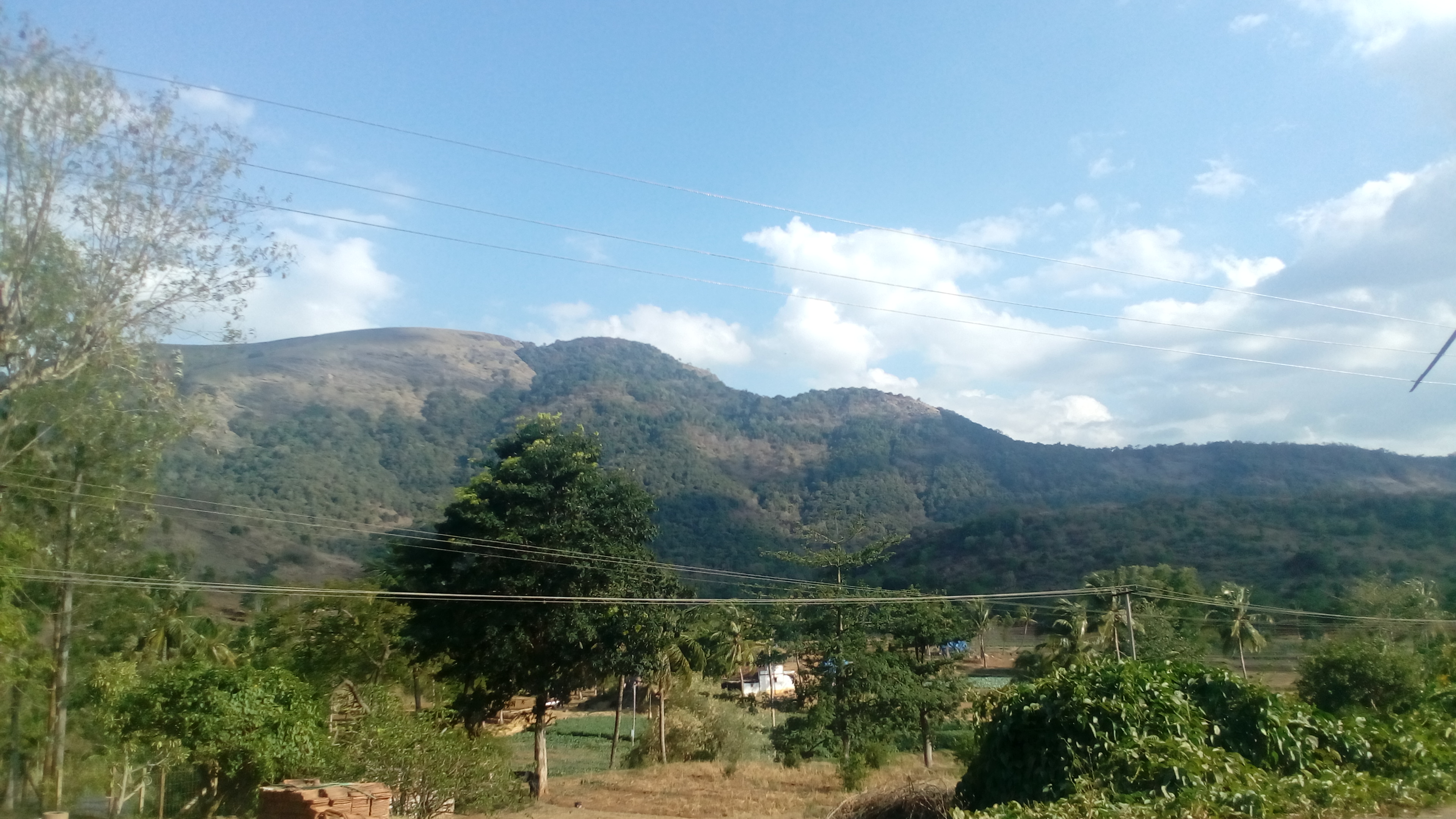
Oddanchatram () is a town in Dindigul district in the Indian state of Tamil Nadu. Oddanchatram is a region in the southwest of Tamil Nadu. The Town was carved out of Madurai District in 1985. Oddanchatram is also famous for vegetable and cattle market. As of 2011, the town had a population of 30,064. It is known as vegetable city of Tamil Nadu. Oddanchatram vegetable market is the largest supplying of vegetables in Tamilnadu and Kerala. Agriculture is the major economic support for the town. Geography It is located at the base of the western ghats in South India. Water body - Parapalar Dam Demographics According to 2011 census, Oddanchatram had a population of 30,064 with a gender-ratio of 994 females for every 1,000 males, much above the national average of 929. A total of 2,676 were under the age of six, constituting 1,378 males and 1,298 females. Scheduled Castes and Scheduled Tribes accounted for 20.3% and 0.06% of the population respectively. The average literacy of ... [...More Info...] [...Related Items...] OR: [Wikipedia] [Google] [Baidu] |
States And Territories Of India
India is a federal union comprising 28 states and 8 union territories, with a total of 36 entities. The states and union territories are further subdivided into districts and smaller administrative divisions. History Pre-independence The Indian subcontinent has been ruled by many different ethnic groups throughout its history, each instituting their own policies of administrative division in the region. The British Raj mostly retained the administrative structure of the preceding Mughal Empire. India was divided into provinces (also called Presidencies), directly governed by the British, and princely states, which were nominally controlled by a local prince or raja loyal to the British Empire, which held ''de facto'' sovereignty ( suzerainty) over the princely states. 1947–1950 Between 1947 and 1950 the territories of the princely states were politically integrated into the Indian union. Most were merged into existing provinces; others were organised into ... [...More Info...] [...Related Items...] OR: [Wikipedia] [Google] [Baidu] |
Oddanchatram (state Assembly Constituency)
Oddanchatram is a state assembly constituency in Dindigul district in Tamil Nadu, India. Its State Assembly Constituency number is 128. It comes under Dindigul Lok Sabha constituency Dindigul is a Lok Sabha (Parliament of India) constituency in Tamil Nadu. Its Tamil Nadu Parliamentary Constituency number is 22 of 39. Assembly segments 2009-present Before 2009 # Tirumanagalam (moved to Virudhunagar constituency after 2009) .... It is one of the 234 State Legislative Assembly Constituencies in Tamil Nadu, in India. Madras State Tamil Nadu Election results 2021 2016 2011 2006 2001 1996 1991 1989 1984 1980 1977 1971 1967 1962 1957 ... [...More Info...] [...Related Items...] OR: [Wikipedia] [Google] [Baidu] |
Palani
Palani ( or ''Palni'' as in British records, is a town and a taluk headquarters in Dindigul district of the western part of Tamil Nadu state in India. It is located about south-east of Coimbatore and north-west of Madurai, from Kodaikanal. The Palani Murugan Temple or Arulmigu Dhandayuthapani Swamy Temple (Thiru Avinankudi), dedicated to Lord Murugan is situated on a hill overlooking the town. The temple is visited by more than 7 million pilgrims each year. As of 2011, the town had a population of 126,751 which makes it the second largest town in the district after Dindigul. Etymology The town derives its name from the compounding of two Tamil words ''pazham'' meaning ''fruit'' and ''nee'' meaning ''you'', a reference to poet Avvaiyar's song praising Lord Muruga which forms part of the legend of the Palani Murugan temple. Palani is pronounced using the retroflex approximant ''ɻ'' (ழ) and is thus also spelt using the 'zh' digraph as "Pazhani". But the actual correct wo ... [...More Info...] [...Related Items...] OR: [Wikipedia] [Google] [Baidu] |
Thanjavur
Thanjavur (), also Tanjore, Pletcher 2010, p. 195 is a city in the Indian state of Tamil Nadu. Thanjavur is the 11th biggest city in Tamil Nadu. Thanjavur is an important center of South Indian religion, art, and architecture. Most of the Great Living Chola Temples, which are UNESCO World Heritage Monuments, are located in and around Thanjavur. The foremost among these, the Brihadeeswara Temple, is located in the centre of the city. Thanjavur is also home to Tanjore painting, a painting style unique to the region. Thanjavur is the headquarters of the Thanjavur District. The city is an important agricultural centre located in the Kaveri Delta and is known as the ''Rice bowl of Tamil Nadu''. Thanjavur is administered by a municipal corporation covering an area of and had a population of 290,720 in 2011. Roadways are the major means of transportation, while the city also has rail connectivity. The nearest airport is Tiruchirapalli International Airport, located away from th ... [...More Info...] [...Related Items...] OR: [Wikipedia] [Google] [Baidu] |
Tiruchirappalli
Tiruchirappalli () ( formerly Trichinopoly in English), also called Tiruchi or Trichy, is a major tier II city in the Indian state of Tamil Nadu and the administrative headquarters of Tiruchirappalli district. The city is credited with being the best livable city and the cleanest city of Tamil Nadu, as well as the fifth safest city for women in India. It is the fourth largest city as well as the fourth largest urban agglomeration in the state. Located south of Chennai and north of Kanyakumari, Tiruchirappalli sits almost at the geographic centre of Tamil Nadu state. The Cauvery Delta begins west of the city where the Kaveri river splits into two, forming the island of Srirangam which is now incorporated into the Tiruchirappalli City Municipal Corporation. The city occupies an area of and had a population of 916,857 in 2011. Tiruchirappalli's recorded history begins in the 3rd century BC, when it was under the rule of the Cholas. The city has also been ruled by the Pall ... [...More Info...] [...Related Items...] OR: [Wikipedia] [Google] [Baidu] |
NH 83
National Highway 83 (NH 83) is a primary national highway in India. NH-83 runs in an east-west direction, entirely within the state of Tamil Nadu in India. 4-laning of Pollachi to Dindigul stretch was approved in 2018. Route NH83 connects Coimbatore, Pollachi, Udumalpet , Palani, Oddanchatram, Dindigul, Tiruchirappalli, Thanjavur, Needamangalam, Thiruvarur and Nagapattinam in the state of Tamil Nadu. Junctions : Terminal near Coimbatore. : near Dindigul : near Dindigul : near Dindigul : near Tiruchirappalli : near Tiruchirappalli : near Thanjavur : Terminal near Kolebira. See also * List of National Highways in India * List of National Highways in India by state List of the new National Highway numbers (state-wise). Andhra Pradesh Arunachal Pradesh Assam Bihar Chhattisgarh Goa ... References External links NH 83 on OpenStr ... [...More Info...] [...Related Items...] OR: [Wikipedia] [Google] [Baidu] |
Kodaikanal
Kodaikanal () is a hill station which is located in Dindigul district in the state of Tamil Nadu, India. Its name in the Tamil language means "The Gift of the Forest". Kodaikanal is referred to as the "Princess of Hill stations" and has a long history as a retreat and tourist destination. Kodaikanal was established in 1845 as a refuge from the high temperatures and tropical diseases of the plains.Mitchell Nora, ''Indian Hill Station: Kodaikanal'', University of Chicago, Dept. of Geographych 2, Rational for Tropical Hill Sations, pp13-15 1972. Original from the University of California Digitized 28 January 2008 Much of the local economy is based on the hospitality industry serving tourism. As of 2011, the city had a population of 36,501. Etymology It is not known who first used this name or what they intended it to mean. The word ''Kodaikanal'' is an amalgamation of two words: ''kodai'' and ''kanal''. The Tamil language has at least four possible interpretations of the name ... [...More Info...] [...Related Items...] OR: [Wikipedia] [Google] [Baidu] |
Nagapattinam
Nagapattinam (''nākappaṭṭinam'', previously spelt Nagapatnam or Negapatam) is a town in the Indian state of Tamil Nadu and the administrative headquarters of Nagapattinam District. The town came to prominence during the period of Medieval Cholas (9th–12th century CE) and served as their important port for commerce and east-bound naval expeditions. The Chudamani Vihara in Nagapattinam constructed by the Srivijayan king Sri Mara Vijayattungavarman of the Sailendra dynasty with the help of Rajaraja Chola I was an important Buddhist structure in those times. Nagapattinam was settled by the Portuguese and, later, the Dutch under whom it served as the capital of Dutch Coromandel from 1660 to 1781. In November 1781, the town was conquered by the British East India Company. It served as the capital of Tanjore district from 1799 to 1845 under Madras Presidency of the British. It continued to be a part of Thanjavur district in Independent India. In 1991, it was made the headquar ... [...More Info...] [...Related Items...] OR: [Wikipedia] [Google] [Baidu] |
Coimbatore
Coimbatore, also spelt as Koyamputhur (), sometimes shortened as Kovai (), is one of the major metropolitan cities in the Indian state of Tamil Nadu. It is located on the banks of the Noyyal River and surrounded by the Western Ghats. Coimbatore is the second largest city in Tamil Nadu after Chennai in terms of population and the 16th largest urban agglomeration in India as per the census 2011. It is administered by the Coimbatore Municipal Corporation and is the administrative capital of Coimbatore District. In 1981 Coimbatore formed as third municipal corporation in Tamil Nadu after Chennai and Madurai. Podanur Junction is the oldest Railway station in Coimbatore City. The city is one of the largest exporters of Jewellery, Wet grinders, Poultry and Auto Components; the "Coimbatore Wet Grinder" and the "Kovai Cora Cotton" are recognised as Geographical Indications by the Government of India. Being a hub of textile industry in South India, the city is sometimes referred to as ... [...More Info...] [...Related Items...] OR: [Wikipedia] [Google] [Baidu] |
Tiruppur
Tiruppur or Tirupur ( ) is a city in the Indian state of Tamil Nadu. Tiruppur is the administrative headquarters of Tiruppur district and the fifth largest city as well as an urban agglomeration in Tamil Nadu. Located on the banks of Noyyal River, it has been ruled at different times, by the Early Pandyas, Medieval Cholas, Later Cholas, Mysore Kingdom and the British. It is about southwest of the state capital Chennai about east of Coimbatore south of Erode and north of Dharapuram. Tiruppur is administered by municipal corporation which was established in 2008 and the total area of the corporation is 159.6 km2 divided into 60 wards. The total population of the city as per the 2011 census is 877,778. Tiruppur is a part of the Tiruppur constituency that elects its member of parliament. Tiruppur is a major textile and knit wear hub contributing to 90% of total cotton knit wear exports from India. The textile industry provides employment to over six lakh people and co ... [...More Info...] [...Related Items...] OR: [Wikipedia] [Google] [Baidu] |
Dharapuram
Dharapuram (;) is a town situated along the banks of Amaravati River in Tiruppur district in the Indian state of Tamil Nadu. Dharapuram is one of the oldest towns in South India and was the capital of Kongu Nadu under the Cheras, Western Ganga Dynasty and later Kongu Cholas, at which time it was known as Viradapuram. Amaravathi River flows through the town. As of 2011, the town had a population of 67,007. The city houses famous temples including ''Agatheeswarar'' Temple, ''Kaadu Hanumanthasamy'' temple and many others. Dharapuram Town is a small agricultural marketing centre for a large rural hinterland in the Tirupur District. The town is 50 km towards of the District Headquarters Tirupur, 35 km towards the Vellakovil, 75 km towards the Erode, 35 km towards the Palani and 72 km towards the industrial town Coimbatore. The nearest airport is Coimbatore International Airport located 70 km from Dharapuram. History Dharapuram was part of the Chera ... [...More Info...] [...Related Items...] OR: [Wikipedia] [Google] [Baidu] |


.jpg)


