|
Oatley Railway Station
Oatley railway station is a heritage-listed railway station located on the Illawarra line, in the Sydney suburb of Oatley in the Georges River Council local government area of New South Wales, Australia. The station is served by Sydney Trains T4 line services. It was designed and built by the NSW Government Railway and from 1905 to 1992. It is also known as the Oatley Railway Station group. The property was added to the New South Wales State Heritage Register on 2 April 1999. Oatley is notable as the end point of the first section of track to be electrified for regular passenger services, with services from Central commencing on 1 March 1926. Historically, some services used to terminate at Oatley before returning north; this is no longer the case but the points remain in place. In January 2017 an upgrade to the station was opened, including a new overhead footbridge with lifts. History The Oatley area was named after James Oatley, who was granted in the area, calle ... [...More Info...] [...Related Items...] OR: [Wikipedia] [Google] [Baidu] |
Oatley, New South Wales
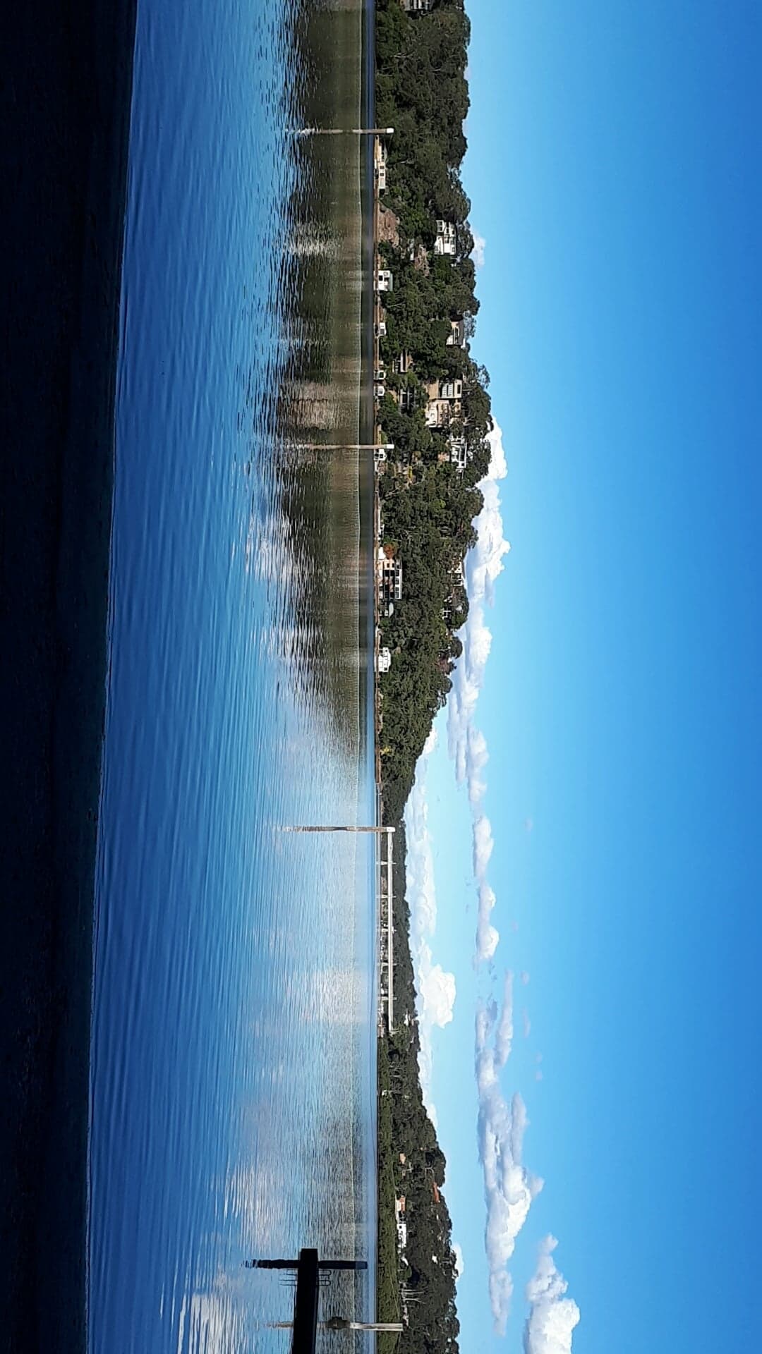
Oatley is a suburb in Southern Sydney in the state of New South Wales, Australia. It is located south of the Sydney central business district and is part of the St George area. Oatley lies in the local government area of Georges River Council. It lies on the northern side of the tidal estuary of the Georges River and its foreshore includes part of Oatley Bay and Lime Kiln Bay, and all of Neverfail Bay, Gungah Bay and Jewfish Bay. History Aboriginal history The area now known as Oatley lies either on the traditional lands of the Dharug people or the coastal Eora people, both of whom spoke a common language. It lies close to the lands on the Tharawal on the south bank of the river. Georges River Council acknowledges that the Biddegal/Bidjigal/Bedegal clan of the Eora are the original inhabitants and custodians of all land and water in the Georges River region. Evidence of Aboriginal occupation of the land now known as Oatley exists in the form of numerous shell mi ... [...More Info...] [...Related Items...] OR: [Wikipedia] [Google] [Baidu] |
Gungal, New South Wales
Gungal is a locality in the Upper Hunter Shire of New South Wales, Australia. Gungal is located on the Golden Highway, between Sandy Hollow Sandy Hollow is a small rural town in New South Wales, Australia in Muswellbrook Shire. The town is located on the Golden Highway in the far west of the Upper Hunter Region, about 260 km north of Sydney. It is located around halfway betwee ... and Merriwa. The abandoned Merriwa branch of the railway crossed the main road at a level crossing at Gungal. References Towns in the Hunter Region Suburbs of Upper Hunter Shire {{UpperHunterShire-geo-stub ... [...More Info...] [...Related Items...] OR: [Wikipedia] [Google] [Baidu] |
Governor Of New South Wales
The governor of New South Wales is the viceregal representative of the Australian monarch, King Charles III, in the state of New South Wales. In an analogous way to the governor-general of Australia at the national level, the governors of the Australian states perform constitutional and ceremonial functions at the state level. The governor is appointed by the king on the advice of the premier of New South Wales, and serves in office for an unfixed period of time—known as serving ''At His Majesty's pleasure''—though five years is the general standard of office term. The current governor is retired jurist Margaret Beazley, who succeeded David Hurley on 2 May 2019. The office has its origin in the 18th-century colonial governors of New South Wales upon its settlement in 1788, and is the oldest continuous institution in Australia. The present incarnation of the position emerged with the Federation of Australia and the ''New South Wales Constitution Act 1902'', which defined t ... [...More Info...] [...Related Items...] OR: [Wikipedia] [Google] [Baidu] |
St James, New South Wales
St James is a locality within the City of Sydney, centred on St. James' Church on King Street. The locality includes much of Hyde Park, those parts of the city from Elizabeth Street through to Macquarie Street. St James' railway station was opened in 1926 as part of the City Railway. It is an underground station, constructed below Hyde Park. The station was the first electric railway service to enter an Australian city centre.https://www.engineersaustralia.org.au/portal/heritage/sydney-city-railway-1926 The station is part of the Sydney Trains network, offering direct services to Kingsford Smith (Sydney) Airport. David Jones' used the name "St. James" as its private label A private label, also called a private brand or private-label brand, is a brand owned by a company, offered by that company alongside and competing with brands from other businesses. A private-label brand is almost always offered exclusively by th ... in the second half of the twentieth century, reflecting ... [...More Info...] [...Related Items...] OR: [Wikipedia] [Google] [Baidu] |
Penshurst Railway Station
Penshurst railway station is on the Redhill to Tonbridge Line and is located approximately two miles north of Penshurst in Kent, in the village of Chiddingstone Causeway in England. It is measured from via . History Penshurst station was opened by the South Eastern Railway on 26 May 1842. Penshurst Airfield, which was in operation from 1916 to 1936, and again from 1940 to 1946 as RAF Penshurst, was within ¼ mile (400 m) of the station. In 1967 the station became unstaffed following which the original station buildings were demolished. In 1993 the line was electrified and services started to run through to London rather than being an extension of the to North Downs Line service. Prior to electrification a new down platform was constructed opposite the up platform. New signalling was installed when the signal box was closed. In 2007, a PERTIS (Permit to Travel) machine was installed at the street entrance to the Tonbridge-bound platform (since replaced by a mod ... [...More Info...] [...Related Items...] OR: [Wikipedia] [Google] [Baidu] |
Mortdale, New South Wales
Mortdale is a suburb located in southern Sydney, in the state of New South Wales, Australia. Mortdale is located 20 kilometres south of the Sydney central business district and is part of the St George area. Mortdale is situated in the local government area of Georges River Council. Mortdale extends south to Lime Kiln Bay, on the Georges River. Mortdale Heights is a locality in the western corner of the suburb. History Mortdale has been known in the past as Mort's Road, Mort's Hill, Mort's Crossing, Mort's Township and Mort Dale. The suburb was named after Sydney industrialist Thomas Sutcliffe Mort (1816–1878), who was famous for pioneering the refrigeration of shipping meat and the construction of Mort's Dock, Balmain. Thomas Mort purchased the land from Robert Townson (1763–1827), who had been granted land in the Hurstville area with his brother John Townson. A small farming community started when the land around Mort's Road was subdivided into 17 farms. The Hurstvi ... [...More Info...] [...Related Items...] OR: [Wikipedia] [Google] [Baidu] |
Penshurst, New South Wales
Penshurst () is a suburb in southern Sydney, in the state of New South Wales, Australia. Penshurst is located 17 kilometres south of the Sydney central business district and is part of the St George area. Penshurst features low to medium-density housing. It has a predominantly older population however it is increasingly being populated by a new generation of migrant families who are attracted by its proximity to Hurstville. History Penshurst was named after Penshurst, Kent, England. Originally part of the land grant to Robert Townson (1763–1827), the land was acquired in 1830 by John Connell, who left it to his grandsons J.C. and E.P. Laycock. Connell's Bush was subdivided by the Laycocks and the western part sold to Thomas Sutcliffe Mort. The early work in the area was timber-cutting and small farming. The railway station opened 17 May 1890. A large portion of Penshurst located south of the railway line is referred to as the MacRae's Estate, as it was once owned by the M ... [...More Info...] [...Related Items...] OR: [Wikipedia] [Google] [Baidu] |
Como, New South Wales
Como is a suburb in southern Sydney, located on the southern banks of the Georges River, in the state of New South Wales, Australia. It is located south of the Sydney central business district in the local government area of the Sutherland Shire. The postcode is 2226, which it shares with neighboring suburbs Jannali, Bonnet Bay, and Como West. The postal locality (suburb) of Como West was originally created in 1939 from within the greater Como locality and is bounded to the west by the Woronora River. The shoreline across Como features Bonnet Bay, Scylla Bay and Carina Bay. History The area now known as Como lies in the tradition lands of the Tharawal (Dharawal) people on the southern bank of the Georges River. The Sutherland Shire Council recognises Tharawal-speaking people as the traditional custodians of the area. Well before it became Como, the locality had previously been known as Woronora. Circa early 1883, a small weatherboard and iron-roofed building called the Woron ... [...More Info...] [...Related Items...] OR: [Wikipedia] [Google] [Baidu] |
Sutherland Railway Station
Sutherland railway station is located on the Illawarra line, serving the Sydney suburb of Sutherland. It is served by Sydney Trains T4 line services and NSW TrainLink South Coast line services. History Sutherland station opened on 26 December 1885 as the interim terminus of the Illawarra line when it was extended from Hurstville. The station opened for general rail traffic on 1 March 1886. It consisted of a brick station facing both the road and railway, a goods shed, and a stationmaster's residence. On 9 March 1886, the line was extended to Waterfall. On 16 December 1939, Sutherland became a junction station with the opening of the Cronulla line. Although the electric wires continued south to Loftus and Royal National Park, until this was extended to Waterfall in 1980, Sutherland was the transfer station for services to Wollongong. Upgrades On 15 November 1993, an upgraded footbridge with a new ticket office and lifts was opened by Minister for Transport Bruce Baird. A nu ... [...More Info...] [...Related Items...] OR: [Wikipedia] [Google] [Baidu] |
Kogarah, New South Wales
Kogarah () is a suburb of Southern Sydney, in the state of New South Wales, Australia. Kogarah is located 14 kilometres (9 miles) south-west of the Sydney central business district and is considered to be the centre of the St George area. Location Kogarah took its name from Kogarah Bay, a small bay on the northern shore of the Georges River. The suburb originally stretched to the bay but has since been divided up to form the separate suburbs of Kogarah Bay and Beverley Park. Kogarah has a mixture of residential, commercial and light industrial areas. It is also known for its large number of schools (including primary school, high school and tertiary education) and health care services (including two hospitals and many medical centers). The NRL side, St George Illawarra Dragons have their Sydney office based at nearby Jubilee Oval, often referred to as Kogarah Oval. Kogarah features all types of residential developments from low density detached houses, to medium densit ... [...More Info...] [...Related Items...] OR: [Wikipedia] [Google] [Baidu] |
Rockdale, New South Wales
Rockdale is a suburb in southern Sydney, in the state of New South Wales, Australia. Rockdale is located 13 kilometres south of the Sydney central business district and is part of the St George area. Rockdale is one of the administrative centres for the local government area of the Bayside Council. Since 1985 Rockdale has been a twinned city with Bitola, in the Republic of Macedonia. History Rockdale was known by Europeans as Frog Hollow, then White Gum Flat and later as West Botany. The name ''Rockdale'' was suggested in 1878 by the first postmistress, Mrs Mary Ann Geeves. The name for the district gained more credence when the local railway station on the new Illawarra rail line, opened on 15 October 1884, was also given the name Rockdale.''A Century of Progress: Rockdale 1871-1971'' compiled by Rockdale Municipal Council, produced by Paul Horne and printed by Posters Pty, Ltd, Lane Cove The West Botany Municipality, declared on 13 January 1871 with two wards, West Botany and ... [...More Info...] [...Related Items...] OR: [Wikipedia] [Google] [Baidu] |
Arncliffe, New South Wales
Arncliffe is a suburb in southern Sydney, in the state of New South Wales, Australia. Arncliffe is located 11 kilometres south of the Sydney central business district, in the local government area of the Bayside Council. Arncliffe is south of the Cooks River and Wolli Creek, close to Sydney Airport. Arncliffe is a mostly residential area featuring low-density detached and semi-detached houses and some medium density town houses and blocks of flats. There are also some areas of commercial and light industrial developments. History ] Arncliffe's name comes from a small village called Arncliffe, North Yorkshire, Arncliffe in North Yorkshire, England. The name appears in the Domesday Book of 1086, as 'Arneclif', meaning Eagle Cliff. In his book "A Village Called Arncliffe" (1997) Ron Rathbone relates that an early land speculator, William Hirst, created a subdivision in 1840 named The Village of Arncliffe Estate. William Hirst was born in Settle, Yorkshire. Settle is a market t ... [...More Info...] [...Related Items...] OR: [Wikipedia] [Google] [Baidu] |


