|
Oakmont, Maryland
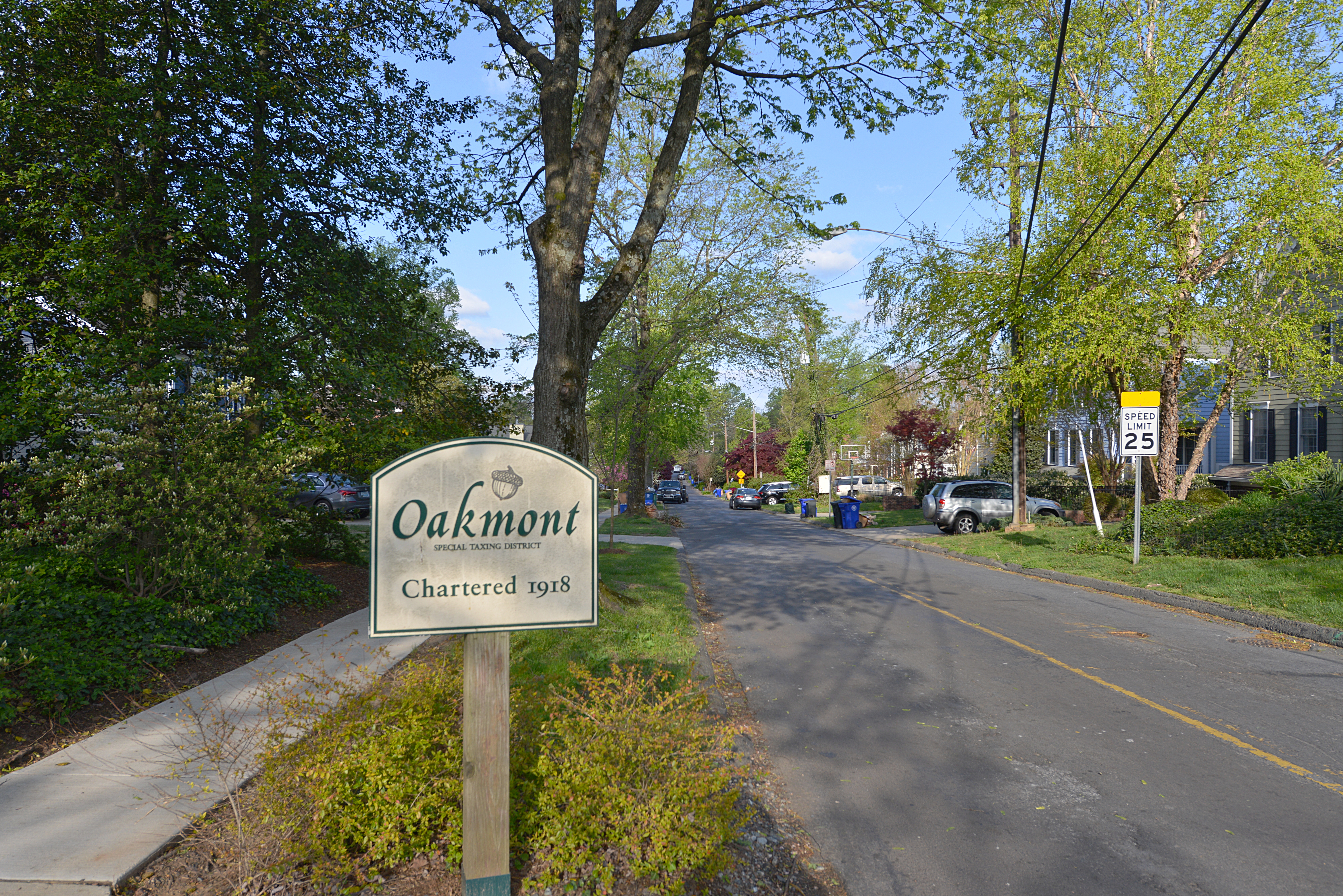
Oakmont is a village and special taxing district in Montgomery County, Maryland, United States. Chartered in 1918, the village includes both sides of Oak Place and the south side of Oakmont Avenue, across Old Georgetown Road from the National Institutes of Health The National Institutes of Health, commonly referred to as NIH (with each letter pronounced individually), is the primary agency of the United States government responsible for biomedical and public health research. It was founded in the late ..., in the Bethesda postal area. The village has approximately 145 inhabitants in 52 homes. External links Oakmont Special Taxing District Web site 1918 establishments in Maryland Populated places established in 1918 Villages in Maryland Villages in Montgomery County, Maryland {{MontgomeryCountyMD-geo-stub ... [...More Info...] [...Related Items...] OR: [Wikipedia] [Google] [Baidu] |
Oakmont Maryland Sign Street 20210422 082450 1
Oakmont is a borough in Allegheny County, in the U.S. state of Pennsylvania. It is a Pittsburgh suburb and part of the Pittsburgh Metro Area. The population was 6,303 as of the 2010 Census. Incorporated as a town in 1889, this Allegheny River community began in 1816 when a farmer, Michael Bright, bought a large tract of land northeast of Pittsburgh. The settlement took its name from a landmark tree, as the deed description reads, "Beginning at a black oak on the bank of the Allegheny River ..." The borough is best known for the nearby Oakmont Country Club, a premier golf course which has been the site of numerous U.S. Open golf tournaments, including the 2016 U.S. Open. Geography Oakmont is located at (40.519518, -79.837620). According to the United States Census Bureau, the borough has a total area of , of which is land and , or 8.99%, is water. The business district of town is on relatively flat land near the Allegheny River, but the main residential area is on the upward ... [...More Info...] [...Related Items...] OR: [Wikipedia] [Google] [Baidu] |
Village (United States)
In the United States, the meaning of village varies by geographic area and legal jurisdiction. In many areas, "village" is a term, sometimes informal, for a type of administrative division at the local government level. Since the Tenth Amendment to the United States Constitution prohibits the federal government from legislating on local government, the states are free to have political subdivisions called "villages" or not to and to define the word in many ways. Typically, a village is a type of municipality, although it can also be a special district or an unincorporated area. It may or may not be recognized for governmental purposes. In informal usage, a U.S. village may be simply a relatively small clustered human settlement without formal legal existence. In colonial New England, a village typically formed around the meetinghouses that were located in the center of each town.Joseph S. Wood (2002), The New England Village', Johns Hopkins University Press Many of these colon ... [...More Info...] [...Related Items...] OR: [Wikipedia] [Google] [Baidu] |
Special-purpose District
Special districts (also known as special service districts, special district governments, limited purpose entities, or special-purpose districts) are independent, special-purpose governmental units that exist separately from local governments such as county, municipal, and township governments, with substantial administrative and fiscal independence. They are formed to perform a single function or a set of related functions. The term ''special district governments'' as defined by the U.S. Census Bureau excludes school districts. In 2017, the U.S. had more than 51,296 special district governments. Census definition The United States Census counts government units across all States. This includes "special districts." To count the special districts the Census must define the special districts so as to address all such governmental entities across the broad spectrum of 50 states' definitions and interpretations. The Census's full definition is:Special district governments are indepe ... [...More Info...] [...Related Items...] OR: [Wikipedia] [Google] [Baidu] |
Montgomery County, Maryland
Montgomery County is the most populous county in the state of Maryland. As of the 2020 census, the county's population was 1,062,061, increasing by 9.3% from 2010. The county seat and largest municipality is Rockville, although the census-designated place of Germantown is the most populous place within the county. Montgomery County, which adjoins Washington, D.C., is part of the Washington–Arlington–Alexandria, DC–VA–MD–WV metropolitan statistical area, which in turn forms part of the Baltimore–Washington combined statistical area. Most of the county's residents live in unincorporated locales, of which the most urban are Silver Spring and Bethesda, although the incorporated cities of Rockville and Gaithersburg are also large population centers, as are many smaller but significant places. The average household income in Montgomery County is among the highest in the United States. It has the highest percentage (29.2%) of residents over 25 years of age who hold po ... [...More Info...] [...Related Items...] OR: [Wikipedia] [Google] [Baidu] |
Maryland
Maryland ( ) is a state in the Mid-Atlantic region of the United States. It shares borders with Virginia, West Virginia, and the District of Columbia to its south and west; Pennsylvania to its north; and Delaware and the Atlantic Ocean to its east. Baltimore is the largest city in the state, and the capital is Annapolis. Among its occasional nicknames are '' Old Line State'', the ''Free State'', and the '' Chesapeake Bay State''. It is named after Henrietta Maria, the French-born queen of England, Scotland, and Ireland, who was known then in England as Mary. Before its coastline was explored by Europeans in the 16th century, Maryland was inhabited by several groups of Native Americans – mostly by Algonquian peoples and, to a lesser degree, Iroquoian and Siouan. As one of the original Thirteen Colonies of England, Maryland was founded by George Calvert, 1st Baron Baltimore, a Catholic convert"George Calvert and Cecilius Calvert, Barons Baltimore" William Hand Browne, ... [...More Info...] [...Related Items...] OR: [Wikipedia] [Google] [Baidu] |
Maryland Route 187
Maryland Route 187 (MD 187) is a state highway in the U.S. state of Maryland. Known as Old Georgetown Road, the highway runs from MD 355 and MD 410 in Bethesda north to Executive Boulevard in North Bethesda. MD 187 is a four- to six-lane highway that runs parallel to MD 355 through suburban areas of southern Montgomery County. The highway was paved through Bethesda by 1910. The remainder of MD 187 was constructed in the mid- to late 1920s. The highway was relocated at its northern end and expanded to a divided highway over most of its length in the late 1960s. MD 187's interchanges with Interstate 270 (I-270) and I-495 were built in the late 1950s and early 1960s, respectively; the former interchange was reconstructed in the early 2000s. The northern terminus was cut back from MD 355 to Executive Boulevard in 2016. Route description MD 187 begins at an intersection with MD 355 (Wisconsin Avenue) and westbound MD 410 (East–West Highway) next to the Bethesda station alo ... [...More Info...] [...Related Items...] OR: [Wikipedia] [Google] [Baidu] |
National Institutes Of Health
The National Institutes of Health, commonly referred to as NIH (with each letter pronounced individually), is the primary agency of the United States government responsible for biomedical and public health research. It was founded in the late 1880s and is now part of the United States Department of Health and Human Services. The majority of NIH facilities are located in Bethesda, Maryland, and other nearby suburbs of the Washington metropolitan area, with other primary facilities in the Research Triangle Park in North Carolina and smaller satellite facilities located around the United States. The NIH conducts its own scientific research through the NIH Intramural Research Program (IRP) and provides major biomedical research funding to non-NIH research facilities through its Extramural Research Program. , the IRP had 1,200 principal investigators and more than 4,000 postdoctoral fellows in basic, translational, and clinical research, being the largest biomedical research instit ... [...More Info...] [...Related Items...] OR: [Wikipedia] [Google] [Baidu] |
Bethesda, Maryland
Bethesda () is an unincorporated, census-designated place in southern Montgomery County, Maryland. It is located just northwest of Washington, D.C. It takes its name from a local church, the Bethesda Meeting House (1820, rebuilt 1849), which in turn took its name from Jerusalem's Pool of Bethesda. The National Institutes of Health's main campus and the Walter Reed National Military Medical Center are in Bethesda, in addition to a number of corporate and government headquarters. As an unincorporated community, Bethesda has no official boundaries. According to the 2020 U.S. census, the community had a total population of 68,056. History Bethesda is located in a region that was populated by the Piscataway and Nacotchtank tribes at the time of European colonization. Fur trader Henry Fleet became the first European to visit the area, reaching it by sailing up the Potomac River. He stayed with the Piscataway tribe from 1623 to 1627, either as a guest or prisoner (historical accounts ... [...More Info...] [...Related Items...] OR: [Wikipedia] [Google] [Baidu] |
1918 Establishments In Maryland
This year is noted for the end of the World War I, First World War, on the eleventh hour of the eleventh day of the eleventh month, as well as for the Spanish flu pandemic that killed 50–100 million people worldwide. Events Below, the events of World War I have the "WWI" prefix. January * January – 1918 flu pandemic: The "Spanish flu" (influenza) is first observed in Haskell County, Kansas. * January 4 – The Finnish Declaration of Independence is recognized by Russian Soviet Federative Socialist Republic, Soviet Russia, Sweden, German Empire, Germany and France. * January 9 – Battle of Bear Valley: U.S. troops engage Yaqui people, Yaqui Native American warriors in a minor skirmish in Arizona, and one of the last battles of the American Indian Wars between the United States and Native Americans. * January 15 ** The keel of is laid in Britain, the first purpose-designed aircraft carrier to be laid down. ** The Red Army (The Workers and Peasants Red Army) ... [...More Info...] [...Related Items...] OR: [Wikipedia] [Google] [Baidu] |
Populated Places Established In 1918
Population typically refers to the number of people in a single area, whether it be a city or town, region, country, continent, or the world. Governments typically quantify the size of the resident population within their jurisdiction using a census, a process of collecting, analysing, compiling, and publishing data regarding a population. Perspectives of various disciplines Social sciences In sociology and population geography, population refers to a group of human beings with some predefined criterion in common, such as location, Race (human categorization), race, ethnicity, nationality, or religion. Demography is a social science which entails the statistical study of populations. Ecology In ecology, a population is a group of organisms of the same species who inhabit the same particular geographical area and are capable of Sexual reproduction, interbreeding. The area of a sexual population is the area where interbreeding, inter-breeding is possible between any pai ... [...More Info...] [...Related Items...] OR: [Wikipedia] [Google] [Baidu] |
Villages In Maryland
A village is a clustered human settlement or community, larger than a hamlet but smaller than a town (although the word is often used to describe both hamlets and smaller towns), with a population typically ranging from a few hundred to a few thousand. Though villages are often located in rural areas, the term urban village is also applied to certain urban neighborhoods. Villages are normally permanent, with fixed dwellings; however, transient villages can occur. Further, the dwellings of a village are fairly close to one another, not scattered broadly over the landscape, as a dispersed settlement. In the past, villages were a usual form of community for societies that practice subsistence agriculture, and also for some non-agricultural societies. In Great Britain, a hamlet earned the right to be called a village when it built a church. [...More Info...] [...Related Items...] OR: [Wikipedia] [Google] [Baidu] |


.png)


