|
Nyzy
Nyzy ( uk, Низи; russian: Низы) is an urban-type settlement in Sumy Raion, Sumy Oblast, Ukraine. It is located on the left bank of the Psel (river), Psel, about south of Sumy. Nyzy belongs to Sad rural hromada, one of the hromadas of Ukraine. Population: Economy Transportation Nyzy railway station is a terminus of the railway line from Boromlia railway station, Boromlia, however, it does not have much passenger traffic. The closest station with more passenger traffic is Imeni Vasylya Nesvita railway station, Imeni Vasylya Nesvita, near Nyzhnya Syrovatka, east of the settlement, on the railway connecting Vorozhba and Kharkiv via Sumy. The settlement has access to Highway H07 (Ukraine), Highway H07 which runs north to Sumy and west to Romny, and Kyiv. References {{authority control Urban-type settlements in Sumy Raion ... [...More Info...] [...Related Items...] OR: [Wikipedia] [Google] [Baidu] |
Nyzy Railway Station
Nyzy (Ukrainian: Низи) is a railway station in Nyzy, Sumy Oblast, Ukraine. The station is a terminus station on the Imeni Vasylya Nesvita-Nyzy line of the Sumy Directorate of Southern Railways (Ukraine), Southern Railways. The distance to is .Україна. Атлас залізниць. Мірило 1:750 000. — К. : ДНВП «Картографія», 2008. — 80 с. — ISBN 978-966-475-082-7. The station serves only freight trains from Imeni Vasylya Nesvita station. The movement of trains is organized by means of an electric rod system and telephone. This station provides services for the reception and delivery of goods by car and small shipments, which are loaded with whole cars. Thus loading is conducted only on access tracks and in places not public. History Nyzy station opened in 1905, when a railway line was laid from Hrebinnykivka railway station, Hrebinnykivka station to the Sukhanov sugar factory (currently inoperable). Passenger service On November 1 ... [...More Info...] [...Related Items...] OR: [Wikipedia] [Google] [Baidu] |
Imeni Vasylya Nesvita Railway Station
Imeni Vasylya Nesvita (named after Vasyl Nesvit, Vasyl Nesvit's, Ukrainian: Імені Василя Несвіта), until 2012 Hrebinnykivka, is a railway transfer station near Verkhnya Syrovatka, Sumy Oblast, Ukraine. The station is at a junction of the Imeni Vasylya Nesvita-Nyzy and Basy-Boromlya lines of the Sumy Directorate of Southern Railways, and is primarily used for transfers from the main line to the Nyzy branch. The distance to Nyzy is . The station is located between Syrovatka ( away) and Boromlya ( away) stations. History The station was opened on December 22, 1913, under the name Hrebinnykivka. On October 8, 2012, the station was renamed in honor of the former head of Southern Railways Vasyl Nesvit. Passenger service On November 16, 2010, the movement of railcars was opened on the Hrebinnykivka (now Imeni Vasylya Nesvita) - Nyzy line. But despite the low fare of the rail bus, it was unused, and was soon canceled. Passenger and suburban trains stop at t ... [...More Info...] [...Related Items...] OR: [Wikipedia] [Google] [Baidu] |
List Of Urban-type Settlements In Ukraine
On 1 January 2006 there were 885 urban-type settlements ( uk, селище міського типу, translit.: ''selysche mis'koho typu'') in Ukraine. Below is the list of ''all'' urban-type settlements by subdivisions and population, which is given according to the 2001 Ukrainian Census. __TOC__ Urban-type settlements in Ukraine (by subdivisions) Autonomous Republic of Crimea , Cherkasy Oblast , Chernihiv Oblast , Chernivtsi Oblast , Dnipropetrovsk Oblast , Donetsk Oblast , Ivano-Frankivsk Oblast , Kharkiv Oblast , Kherson Oblast , Khmelnytskyi Oblast , Kyiv Oblast , Kirovohrad Oblast , Luhansk Oblast , Lviv Oblast , Mykolaiv Oblast , Odessa Oblast , Poltava Oblast , Rivne Oblast , Sevastopol , Sumy Oblast , Ternopil Oblast , Vinnytsia Oblast , Volyn Oblast , Zakarpattia Oblast , Zaporizhzhia Oblast , Zhytomyr Oblast See also * List of places named after people#Ukraine * Administrative divisions of Ukraine * Raio ... [...More Info...] [...Related Items...] OR: [Wikipedia] [Google] [Baidu] |
Psel (river)
The Psel (, translit. ''Psyol''; , translit. ''Psel, Ps'ol, Pslo'') is a river, a left tributary of the Dnieper, which flows through Russia and Ukraine. The Psel has a length of and a drainage basin of .Псёл The river's right bank is high and steep, unlike the low, left bank. Its periods of freezing range from December until the end of February to the beginning of April. Tributaries The following rivers are tributaries to the river Psel (from source to mouth): Left: Ilyok,[...More Info...] [...Related Items...] OR: [Wikipedia] [Google] [Baidu] |
Hromada
A hromada ( uk, територіальна громада, lit=territorial community, translit=terytorialna hromada) is a basic unit of administrative division in Ukraine, similar to a municipality. It was established by the Government of Ukraine on 12 June 2020. Similar terms exist in Poland (''gromada'') and in Belarus (''hramada''). The literal translation of this term is "community", similarly to the terms used in western European states, such as Germany ('' Gemeinde''), France (''commune'') and Italy (''comune''). History In history of Ukraine and Belarus, hromadas appeared first as village communities, which gathered their meetings for discussing and resolving current issues. In the 19th century, there were a number of political organizations of the same name, particularly in Belarus. Prior to 2020, the basic units of administrative division in Ukraine were rural councils, settlement councils and city councils, which were often referred to by the generic term ''hromada ... [...More Info...] [...Related Items...] OR: [Wikipedia] [Google] [Baidu] |
Romny
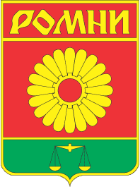
Romny ( uk, Ромни́, ) is a city in northern Ukraine, Ukrainian Sumy Oblast. It is located on the Romen (river), Romen River. Romny serves as the administrative centre of Romny Raion. It is administratively incorporated as a City of regional significance (Ukraine), city of oblast significance and does not belong to the raion. The villages of Lutschky (438 inhabitants), Kolisnykove (43 inhabitants) and Hrabyne belong to the Romny Municipality. Population: History The city was founded in AD 902. On September 16, 2002 the city celebrated its 1,100th anniversary. Romny was first mentioned in documents in 1096 (as Romen, ; the name, originally that of the river, is of Baltic origin, cf. Lithuanian language, Lithuanian ''romus'' 'quiet'). At various times, it passed under Mongol Empire, Mongol, Grand Duchy of Lithuania, Lithuanian, Polish–Lithuanian Commonwealth, Polish and Russian Empire, Russian rule. By 1638, the city had a population of 6,000 inhabitants, which made it b ... [...More Info...] [...Related Items...] OR: [Wikipedia] [Google] [Baidu] |
Highway H07 (Ukraine)
H07 is an important Ukraine national highway (State Highways (Ukraine), H-highway) in Kyiv Oblast, Kyiv, Chernihiv Oblast, Chernihiv, and Sumy Oblast, Sumy Oblasts, Ukraine, running mainly west-east, and connecting Kyiv (if switching to another highway at Brovary) with Yunakivka in a more or less straight line. It begins in Brovary at Highway M01 (Ukraine), Highway M01/European route E95, Highway E95, and passes through Krasylivka, Hoholiv, Rusaniv, Peremoha, Nova Basan, Novyi Bykiv, Pohreby, Rudivka, Pryluky, Okhyrky, Sribne, Kharkove, Lavirkove, Romny, Korovyntsi, Nedryhailiv, Vylshana, Komyshanka, Shtepivka, Sula, Sad, Sumy, Stetskivka, Pysarivka, and Yunakivka, before ending at the Russian border. The road then continues as the R200 highway (Russia), R200 to Kursk. Accessibility Marshrutka, Marshrutkas from Kyiv to Sumy actually prefer to first travel by means of Highway M03 (Ukraine), Highway M03, then turning onto the P60 road (Ukraine), P60 at Pyryatyn, and only then turnin ... [...More Info...] [...Related Items...] OR: [Wikipedia] [Google] [Baidu] |
Kharkiv
Kharkiv ( uk, wikt:Харків, Ха́рків, ), also known as Kharkov (russian: Харькoв, ), is the second-largest List of cities in Ukraine, city and List of hromadas of Ukraine, municipality in Ukraine.Kharkiv "never had eastern-western conflicts" ''Euronews'' (23 October 2014) Located in the northeast of the country, it is the largest city of the historic Sloboda Ukraine, Slobozhanshchyna region. Kharkiv is the administrative centre of Kharkiv Oblast and of the surrounding Kharkiv Raion. The latest population is Kharkiv was founded in 1654 as Kharkiv fortress, and after these humble beginnings, it grew to be a major centre of industry, trade and Ukrainian culture in the Russian Empire. At the beginning of the 20th century, ... [...More Info...] [...Related Items...] OR: [Wikipedia] [Google] [Baidu] |
Vorozhba
Vorozhba (, ) is a city in Bilopillia Raion, Sumy Oblast, Ukraine Ukraine ( uk, Україна, Ukraïna, ) is a country in Eastern Europe. It is the second-largest European country after Russia, which it borders to the east and northeast. Ukraine covers approximately . Prior to the ongoing Russian inv .... Population: References Cities in Sumy Oblast Kharkov Governorate Cities of district significance in Ukraine {{Sumy-geo-stub ... [...More Info...] [...Related Items...] OR: [Wikipedia] [Google] [Baidu] |
Boromlia Railway Station
Boromlia ( uk, Боромля) is a railway station in Novhorodske (near Boromlia), Sumy Oblast, Ukraine. It is at the intersection of three lines of the Sumy Directorate of Southern Railways: the Boromlia-Lebedynska line, the Basy-Boromlia line, and the Boromlia-Kyrykivka line. The station is located away from station and away from Skryahivka station. History The station was opened in 1878 as part of the Kharkiv-Mykolaiv Railway. In the same year, the station adopted its first train - a small train with coal, which was supplied for the furnace of the only roller mill in the district. In the following years, traffic at the station became much more active, and the station sent an average of more than one million tons of cargo per year, mostly bread, and received twice less cargo. In 1895 a small branch was built to the Lebedynska station, thanks to which the station became a hub. The station, like the village (8 km from the station), got its name from the river Boromlia ... [...More Info...] [...Related Items...] OR: [Wikipedia] [Google] [Baidu] |
Sad Rural Hromada
Sadness is an emotional pain associated with, or characterized by, feelings of disadvantage, loss, despair, grief, helplessness, disappointment and sorrow. An individual experiencing sadness may become quiet or lethargic, and withdraw themselves from others. An example of severe sadness is depression, a mood which can be brought on by major depressive disorder or persistent depressive disorder. Crying can be an indication of sadness. Sadness is one of the six basic emotions described by Paul Ekman, along with happiness, anger, surprise, fear, and disgust. Childhood Sadness is a common experience in childhood. Sometimes, sadness can lead to depression. Some families may have a (conscious or unconscious) rule that sadness is "not allowed", but Robin Skynner has suggested that this may cause problems, arguing that with sadness "screened off", people can become shallow and manic. Pediatrician T. Berry Brazelton suggests that acknowledging sadness can make it easier for ... [...More Info...] [...Related Items...] OR: [Wikipedia] [Google] [Baidu] |
Sumy Oblast
Sumy Oblast ( uk, Сумська́ о́бласть, translit=Sumska oblast; also referred to as Sumshchyna – uk, Су́мщина) is an oblast (province) in the northeastern part of Ukraine. Population: The oblast was created in its most recent form, from the merging of raions from Kharkiv Oblast, Chernihiv Oblast, and Poltava Oblast in 1939 by the Presidium of the Supreme Soviet of the Soviet Union. The administrative center of the oblast is the city of Sumy. Other important cities within the oblast include Konotop, Okhtyrka, Romny, and Shostka. The oblast has a heavy mix of agriculture and industry, with over 600 industrial locations. Importantly, seven rivers pass through the oblast. Geography The Sumy Oblast is situated in the northeastern part of Ukraine. It is situated on a border of two historical regions of Ukraine — Cossack Hetmanate (annexed by Russia in the 18th century as Little Russia, previously known as Severia) and Sloboda Ukraine. Elevation is 110 ... [...More Info...] [...Related Items...] OR: [Wikipedia] [Google] [Baidu] |


