|
Ntimbale Dam
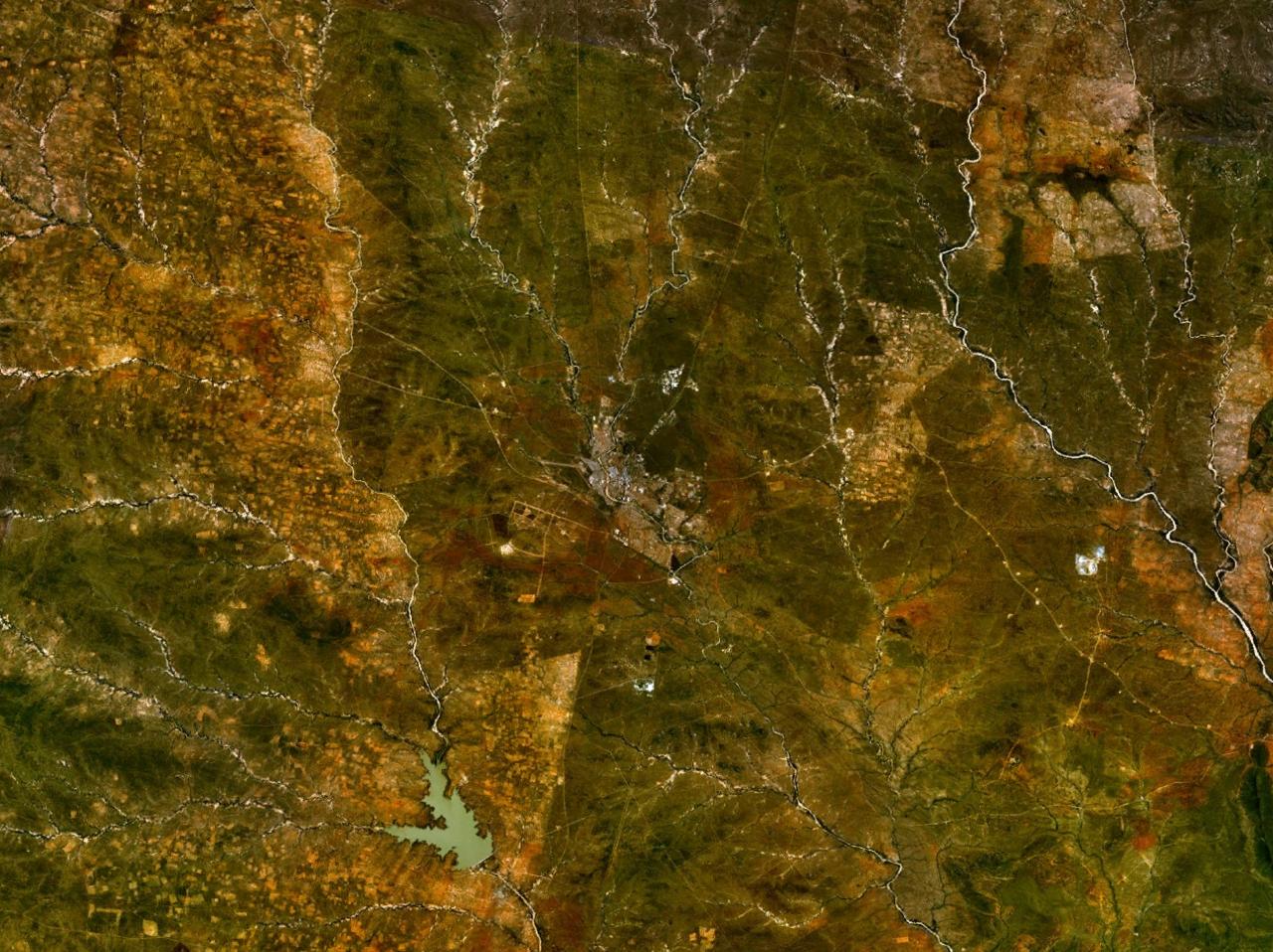
The Ntimbale Dam is a dam on the Tati River in Botswana. It has a capacity of . Construction The dam project was assigned to Knight Piésold by the Botswana Department of Water Affairs. Knight Piésold undertook the Feasibility study in 1996–97, assisted in the tender process, prepared the detailed design and supervised construction between 2004 and 2009. The dam is a roller-compacted concrete dam high, with a central ogee spillway. PPC Cement of South Africa, which has a blending and packing plant in Gaborone, supplied the cement for the project. The dam complex includes pump stations and a water treatment plant, and supplies water to villages in the North East District and neighboring parts of the Central District. The dam cost an estimated P205 million. While it was being built, a water-transfer scheme costing P280 million was undertaken to connect all of the 51 villages in the North East District. President Ian Khama Seretse Khama Ian Khama (born 27 February 1953) ... [...More Info...] [...Related Items...] OR: [Wikipedia] [Google] [Baidu] |
Botswana
Botswana (, ), officially the Republic of Botswana ( tn, Lefatshe la Botswana, label=Setswana, ), is a landlocked country in Southern Africa. Botswana is topographically flat, with approximately 70 percent of its territory being the Kalahari Desert. It is bordered by South Africa to the south and southeast, Namibia to the west and north, and Zimbabwe to the northeast. It is connected to Zambia across the short Zambezi River border by the Kazungula Bridge. A country of slightly over 2.3 million people, Botswana is one of the most sparsely populated countries in the world. About 11.6 percent of the population lives in the capital and largest city, Gaborone. Formerly one of the world's poorest countries—with a GDP per capita of about US$70 per year in the late 1960s—it has since transformed itself into an upper-middle-income country, with one of the world's fastest-growing economies. Modern-day humans first inhabited the country over 200,000 years ago. The Tswana ethnic ... [...More Info...] [...Related Items...] OR: [Wikipedia] [Google] [Baidu] |
North-East District (Botswana)
The North-East District is one of the administrative districts of Botswana. Its capital is Francistown. In 2011, North-East had a population of 60,264 people. The district is predominantly occupied by Kalanga-speaking people, the BaKalanga. The district is administered by a district administration and district council, which are responsible for local administration. In the north and east, North-East borders the Matabeleland South Province of Zimbabwe, and the border in the east is predominantly along the Ramokgwebana River. In the south and west, the district borders the Central District along the Shashe River. Geography Most parts of Botswana have tableland slopes sliding from east to west. It is predominantly savannah, with tall grasses, bushes, and trees. The region has an average elevation of around above sea level. The annual precipitation is around , most of which is received during the summer season from November to May. There are conflicts between agricultural expansion ... [...More Info...] [...Related Items...] OR: [Wikipedia] [Google] [Baidu] |
Ogee
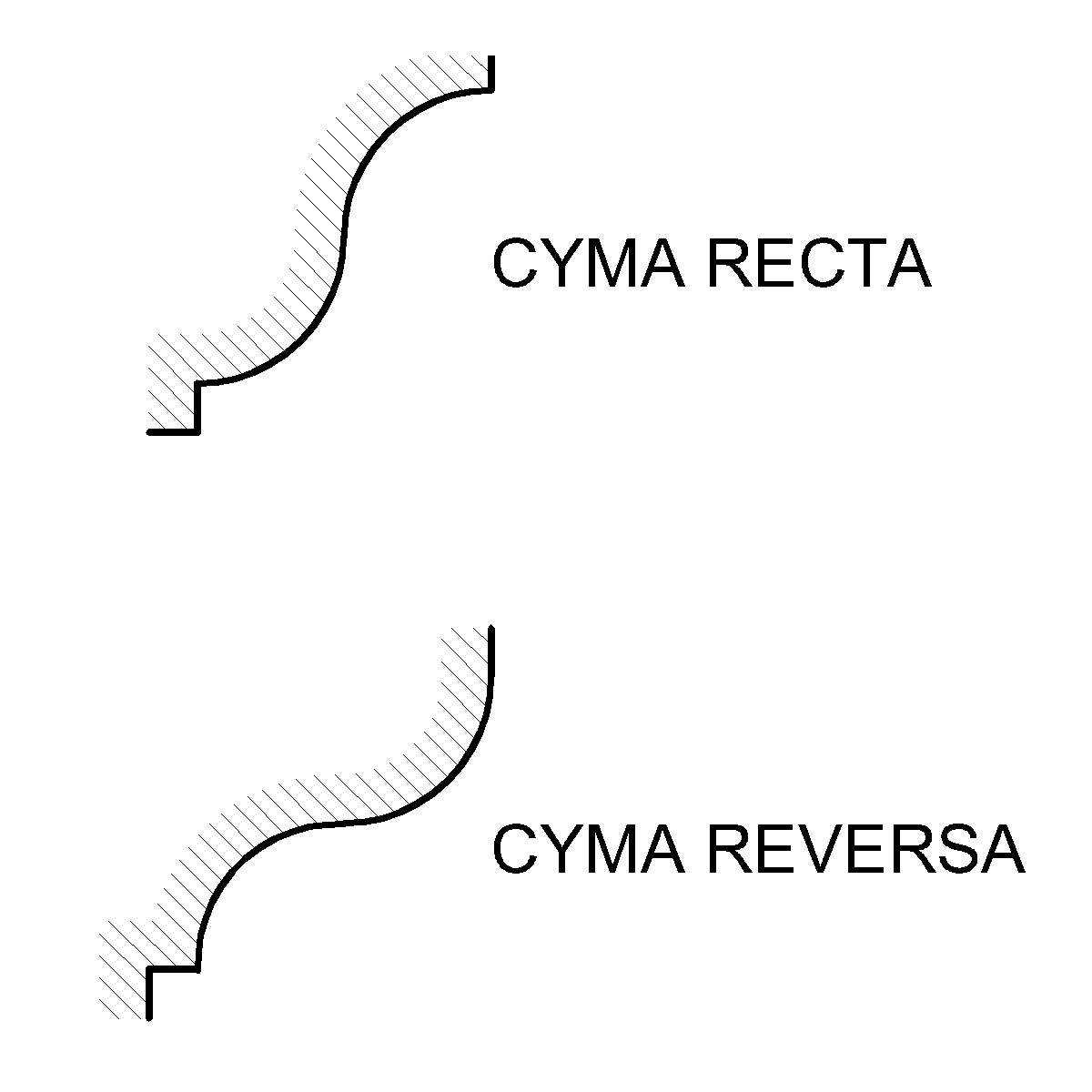
An ogee ( ) is the name given to objects, elements, and curves—often seen in architecture and building trades—that have been variously described as serpentine-, extended S-, or sigmoid-shaped. Ogees consist of a "double curve", the combination of two semicircular curves or arcs that, as a result of a point of inflection from concave to convex or ''vice versa'', have ends of the overall curve that point in opposite directions (and have tangents that are approximately parallel). First seen in textiles in the 12th century, the use of ogee elements—in particular, in the design of arches—has been said to characterise various Gothic and Gothic Revival architectural styles. The shape has many such uses in architecture from those periods to the present day, including in the ogee arch in these architectural styles, where two ogees oriented as mirror images compose the sides of the arch, and in decorative molding designs, where single ogees are common profiles (see opening image) ... [...More Info...] [...Related Items...] OR: [Wikipedia] [Google] [Baidu] |
Tati River
The Tati River is a river in northeast Botswana, a tributary of the Shashe River, which in turn is a tributary of the Limpopo River. The river flows through Francistown, where it is joined by the Ntshe (or Inchwe) River from the left. History About 1865 a hunter came across traces of old gold diggings near the Tati. He invited Karl Mauch to accompany him on his next trip, and in 1866 Mauch announced that he had found the Tati goldfields extending about which started the first gold rush in Southern Africa the following year. In 1869 the Englishman Daniel Francis came to hunt for gold on the river, before heading south to the Kimberley diamond fields in 1870. The gold was hard to extract, and the gold rush died down. Francis returned in 1880 and obtained mining rights from King Lobengula. Mining activity revived in the 1880s and 1890s, and Francistown was established in 1897 when the railway arrived. The town was named after Francis, who owned most of the land in the area. Use ... [...More Info...] [...Related Items...] OR: [Wikipedia] [Google] [Baidu] |
Knight Piésold
A knight is a person granted an honorary title of knighthood by a head of state (including the Pope) or representative for service to the monarch, the church or the country, especially in a military capacity. Knighthood finds origins in the Greek ''hippeis'' and ''hoplite'' (ἱππεῖς) and Roman '' eques'' and ''centurion'' of classical antiquity. In the Early Middle Ages in Europe, knighthood was conferred upon mounted warriors. During the High Middle Ages, knighthood was considered a class of lower nobility. By the Late Middle Ages, the rank had become associated with the ideals of chivalry, a code of conduct for the perfect courtly Christian warrior. Often, a knight was a vassal who served as an elite fighter or a bodyguard for a lord, with payment in the form of land holdings. The lords trusted the knights, who were skilled in battle on horseback. Knighthood in the Middle Ages was closely linked with horsemanship (and especially the joust) from its origins in the 12 ... [...More Info...] [...Related Items...] OR: [Wikipedia] [Google] [Baidu] |
PPC Cement
PPC may refer to: Computing * Personal programmable calculator, programmable calculators for personal use * Pay-per-click, an internet advertising model * PearPC, a PowerPC platform emulator * Peercoin, a peer-to-peer cryptocurrency * Peripheral pin controller, a feature present in the StrongARM CPU family that controls IO ports * Pocket PC, Microsoft's specification for handheld devices * ZEOS PPC, an early MS-DOS 5.0-based palmtop PC by ZEOS * PowerPC, a microprocessor architecture * PPC Ltd., a supplier of cement, lime, and related products in southern Africa * Protected procedure call, a messaging facility in computer operating systems Business and economics * Presbyterian Publishing Corporation, a publishing agency of the American Presbyterian Church * Production Possibility Curve, a graph that shows the different quantities of two goods that an economy could efficiently produce with limited productive resources * Public Power Corporation (Δημόσια Επιχείρη ... [...More Info...] [...Related Items...] OR: [Wikipedia] [Google] [Baidu] |
Central District (Botswana)
Central is the largest of Botswana's districts in terms of area and population. It encompasses the traditional homeland of the Bamangwato people. Some of the most politically connected Batswana have come from the Central District, including former President Sir Seretse Khama, former President Festus Mogae, and former President Lt. General Seretse Ian Khama. The district borders the Botswanan districts of Chobe in the north, North-West in the northwest, Ghanzi in the west, Kweneng in southwest, Kgatleng in the south and North-East in the northeast, as well as Zimbabwe also in the northeast (Matabeleland North and Matabeleland South Provinces) and South Africa in the southeast (Limpopo Province). As of 2011, the total population of the district was 576,064 compared to 501,381 in 2001. The growth rate of population during the decade was 1.40. The population in the district was 28.45 per cent of the total population in the country. Main population centers in Central include Palapye ... [...More Info...] [...Related Items...] OR: [Wikipedia] [Google] [Baidu] |
Ian Khama
Seretse Khama Ian Khama (born 27 February 1953) is a Botswana politician and former military officer who was the fourth President of the Republic of Botswana from 1 April 2008 to 1 April 2018. After serving as Commander of the Botswana Defence Force, he entered politics and was Vice-President of Botswana from 1998 to 2008, then succeeded Festus Mogae as President on 1 April 2008. He won a full term in the 2009 election and was re-elected in October 2014. Early life Ian Khama is the second child of Sir Seretse Khama (1 July 1921 – 13 July 1980), Botswana's foremost independence leader and its president from 1966 to 1980, and Lady Khama. He was born in Chertsey, Surrey, while his father was living in exile in the United Kingdom, due to the opposition by the colonial government and the emergent apartheid regime in South Africa to his marriage to a white woman. He is also the grandson of Sekgoma II (1869–1925), who was the paramount chief of the Bamangwato people, and the ... [...More Info...] [...Related Items...] OR: [Wikipedia] [Google] [Baidu] |
Reservoirs And Dams In Botswana
A reservoir (; from French ''réservoir'' ) is an enlarged lake behind a dam. Such a dam may be either artificial, built to store fresh water or it may be a natural formation. Reservoirs can be created in a number of ways, including controlling a watercourse that drains an existing body of water, interrupting a watercourse to form an embayment within it, through excavation, or building any number of retaining walls or levees. In other contexts, "reservoirs" may refer to storage spaces for various fluids; they may hold liquids or gasses, including hydrocarbons. ''Tank reservoirs'' store these in ground-level, elevated, or buried tanks. Tank reservoirs for water are also called cisterns. Most underground reservoirs are used to store liquids, principally either water or petroleum. Types Dammed valleys Dammed reservoirs are artificial lakes created and controlled by a dam constructed across a valley, and rely on the natural topography to provide most of the basin of the ... [...More Info...] [...Related Items...] OR: [Wikipedia] [Google] [Baidu] |


