|
Norwegian National Road 7
Norwegian National Road 7 ( no, Riksvei 7, ) is a national road in Norway which runs from the town of Hønefoss in Viken county to the village of Granvin in Vestland county. The route is long and runs east–west through Viken and Vestland counties over the vast Hardangervidda plateau. The road begins at the European route E16 highway just south of Heradsbygda in Ringerike municipality and runs through the Sogna river valley to the village of Sokna (this part is called the ''Soknedalsveien''). It then continues further on to Hamremoen and up along the east side of the lake Krøderen to Gulsvik where it crosses the river and then follows the Hallingdalen valley through Flå, Nesbyen, Gol, Torpo, Ål, Hol, and Geilo (this part is called the ''Hallingdalsveien''). From there, the road begins its path across the Hardangervidda plateau via Ustaoset and Haugastøl, passing the Vøringsfossen waterfall while descending down through 4 tunnels (including the 1,893-meter Mà ... [...More Info...] [...Related Items...] OR: [Wikipedia] [Google] [Baidu] |
European Route E16
European route E16 is the designation of a main west-east road through Northern Ireland, Scotland, Norway and Sweden, from Derry to Gävle, via Belfast, Glasgow, Edinburgh, previously by ferry to Bergen, Voss, through the Gudvanga Tunnel and the Lærdal Tunnel (the world's longest road tunnel), Lærdal, over Filefjell to Fagernes, Hønefoss, Gardermoen and Kongsvinger. In Sweden, it passes Malung, Falun and ends in Gävle. United Kingdom *Northern Ireland **: Derry - **: - Antrim **: Antrim - Belfast (Multiplex with and between and Belfast) *Great Britain **: Glasgow (Interchange with at ) - Edinburgh (Interchange with at ) In Northern Ireland, it follows the A6 from Derry to Randalstown, then the M22 and M2 to Belfast. In Scotland it follows the M8 from Glasgow to Edinburgh. E16 meets the E1 and E18 in Belfast, the E5 in Glasgow, the E15 in Edinburgh. European routes are not signposted in the UK. There is no ferry anymore between the United Kingdom and ... [...More Info...] [...Related Items...] OR: [Wikipedia] [Google] [Baidu] |
Norwegian Public Roads Administration
The Norwegian Public Roads Administration ( no, Statens vegvesen) is a Norwegian government agency responsible for national and county public roads in Norway. This includes planning, construction and operation of the national and county road networks, driver training and licensing, vehicle inspection, and subsidies to car ferries. The agency is led by the Directorate of Public Roads (Vegdirektoratet), and is subordinate to the Ministry of Transport and Communications. The Norwegian Public Roads Administration is divided into five regions and thirty districts, which are subordinate to the directorate. The directorate is based in Oslo. The Norwegian Public Roads Administration is one of the largest government agencies of Norway in terms of budget. In matters concerning national roads, the agency is subordinate to the ministry and in matters concerning county roads subordinate to the county administration. Core activities The Norwegian Public Roads Administration strives to ensure ... [...More Info...] [...Related Items...] OR: [Wikipedia] [Google] [Baidu] |
Hallingdalen
Hallingdal ( en, Halling Valley) is a valley as well as a traditional district located in the traditional and electoral district Buskerud in Viken county in Norway. It consists of six municipalities: Flå, Nes, Gol, Hemsedal, Ål and Hol. Hallingdal is one of the major valleys of eastern Norway, on an area of 5,830 square kilometers. Hallingdal lies in the northern part of the county of Buskerud. The valley stretches from Gulsvik by Lake Krøderen to the border with Hordaland and Sogn og Fjordane. Central to the geography is relatively flat mountain area which lies above sea level. The valley is V-shaped and is drained by the Hallingdal River which originates in the western parts of Hardangervidda and flows eastwards later southwards through Hallingdal. Etymology The Old Norse form of the name was ''Haddingjadalr''. The first recorded case beginning with ''Hall-'' is from 1443. The first element seems to be the genitive case of the name of the people ''Haddingjar'' or o ... [...More Info...] [...Related Items...] OR: [Wikipedia] [Google] [Baidu] |
Vallavik Tunnel
The Vallavik Tunnel ( no, Vallaviktunnelen) is a road tunnel in Vestland county, Norway. The tunnel begins on the north edge of the village of Eide in the municipality of Voss and runs to the southeast, ending at the small farm of Vallaviki in the municipality of Ulvik. The tunnel is part of Norwegian National Road 13 and Norwegian County Road 7. The tunnel was originally opened on 27 April 1985. In 2013, a roundabout and a long branch were added near the southern end of the tunnel to connect with the newly constructed Hardanger Bridge. The branch passes directly over the older Djønno Tunnel The Djønno Tunnel ( no, Djønnotunnelen) is a road tunnel in the municipality of Ulvik in Vestland county, Norway. The long tunnel is located on Norwegian County Road 302, just southwest of the Vallaviki farm. The tunnel was opened in 1981 .... References Voss Ulvik Road tunnels in Vestland Tunnels completed in 1985 1985 establishments in Norway {{Norway-tunnel-st ... [...More Info...] [...Related Items...] OR: [Wikipedia] [Google] [Baidu] |
Fjord
In physical geography, a fjord or fiord () is a long, narrow inlet with steep sides or cliffs, created by a glacier. Fjords exist on the coasts of Alaska, Antarctica, British Columbia, Chile, Denmark, Germany, Greenland, the Faroe Islands, Iceland, Ireland, Kamchatka, the Kerguelen Islands, Labrador, Newfoundland, New Zealand, Norway, Novaya Zemlya, Nunavut, Quebec, the Patagonia region of Argentina and Chile, Russia, South Georgia Island, Tasmania, United Kingdom, and Washington state. Norway's coastline is estimated to be long with its nearly 1,200 fjords, but only long excluding the fjords. Formation A true fjord is formed when a glacier cuts a U-shaped valley by ice segregation and abrasion of the surrounding bedrock. According to the standard model, glaciers formed in pre-glacial valleys with a gently sloping valley floor. The work of the glacier then left an overdeepened U-shaped valley that ends abruptly at a valley or trough end. Such valleys are fjords when ... [...More Info...] [...Related Items...] OR: [Wikipedia] [Google] [Baidu] |
Eid Fjord
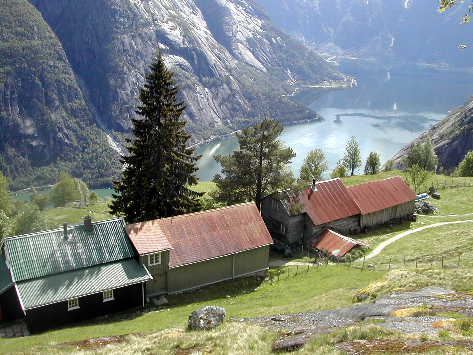
The Eid Fjord ( no, Eidfjorden) is the innermost part of the Hardanger Fjord in Norway. It extends eastwards from the Utne Fjord and Sørfjorden. The Eid Fjord lies in the municipalities of Ullensvang, Ulvik, and Eidfjord in Vestland county. The inner part of the ford is called the Simadal Fjord ( no, Simadalsfjorden). The villages of Ringøy and Bjotveit lie on the south side of the fjord, and Djønno lies on the north side. Further into the fjord, village on the north side include Vangsbygdi and, to the east, Bruravik. From Bruravik there was a ferry connection to Brimnes on the south side of the fjord. This ferry was part of the route between Bergen and Oslo across the Hardangervidda Plateau on Norwegian National Road 7. In 2013 the ferry connection was replaced by the Hardanger Bridge. At Bruravik the Osa Fjord ( no, Odafjorden) extends to the northeast. The outermost part of the Osa Fjord is also known as the Bagns Fjord ( no, Bagnsfjorden). Deeper into the fjord, it m ... [...More Info...] [...Related Items...] OR: [Wikipedia] [Google] [Baidu] |
Måbødalen
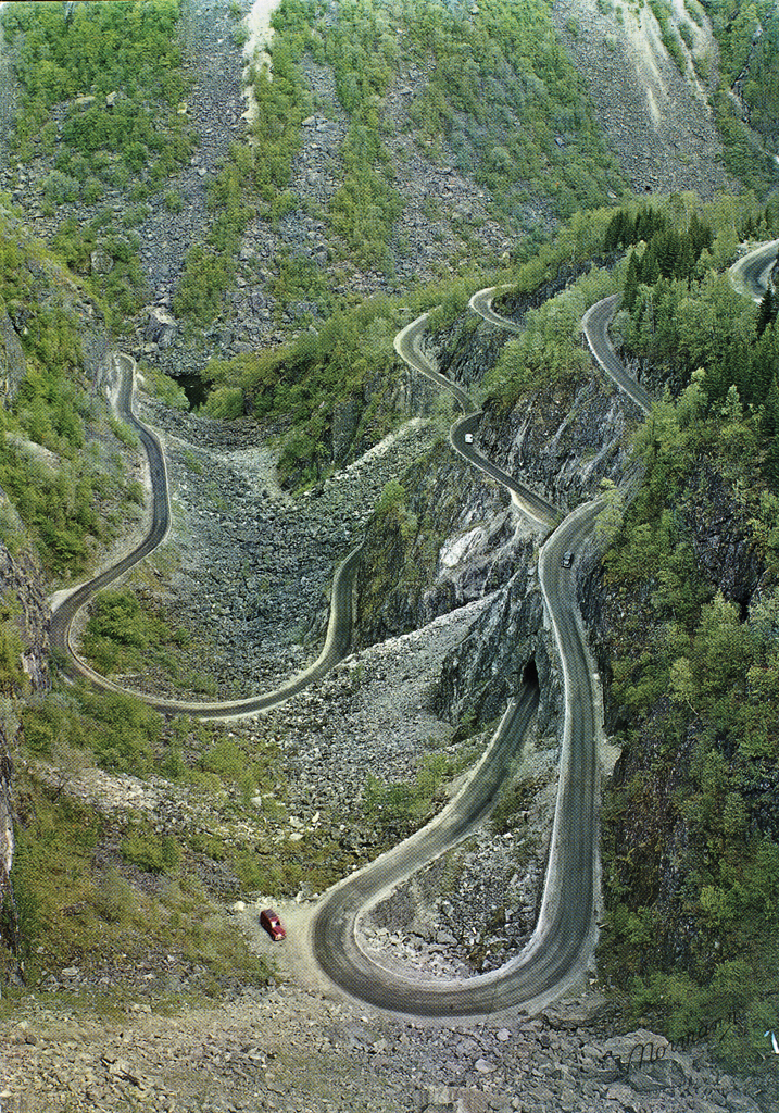
Måbødalen ( en, Måbø Valley) is a narrow valley in Eidfjord Municipality in Vestland county, Norway. The long valley begins at the village of Øvre Eidfjord and ends at the Sysendalen valley on the western side of the Hardangervidda plateau. The valley contains one of the most notable waterfalls in the country: Vøringfossen, which is easily accessible via Norwegian National Road 7 (Rv7). The first road through the Måbødalen valley was built from 1900 to 1916. Consisting of three tunnels and three bridges, including the Måbø Bridge, it is characterized by its many hairpin turns. The road is widely used by pedestrians and cyclists today and it is regarded as a good example of early 20th century road engineering. This was the first road connection between Eastern and Western Norway over the Hardangervidda plateau when it was finally completed in 1928. A new road through Måbødalen was opened in 1986, and it replaced the old road (which was not removed). The new road i ... [...More Info...] [...Related Items...] OR: [Wikipedia] [Google] [Baidu] |
Måbø Tunnel
The Måbø Tunnel ( no, Måbøtunnelen) is a tunnel along Norwegian National Road 7 in the municipality of Eidfjord in Vestland county, Norway. The tunnel is the longest of the four tunnels in the Måbø Valley. It was completed in 1984 and was officially opened together with the other tunnels in 1986. The road and its tunnel system replaced the narrow and difficult road through the Måbø Valley that was opened in 1916. The old route through the Måbø Valley has been preserved as a hiking and cycling route. The route has been included in the National Protection Plan for Roads, Bridges, and Road-Related Cultural Heritage and was protected by the Norwegian Directorate for Cultural Heritage in 2009. On August 15, 1988, a bus carrying schoolchildren and parents from Kista, Sweden suffered a brake failure in the Måbø Tunnel and drove into the tunnel wall. Sixteen people died in the accident An accident is an unintended, normally unwanted event that was not directly caused ... [...More Info...] [...Related Items...] OR: [Wikipedia] [Google] [Baidu] |
Ustaoset
Ustaoset is a village in Hol municipality, Buskerud, Norway. It is located on Norwegian National Road 7 (''Riksvei 7''). Ustaoset is situated above sea level and is the finish for the cross country ski event Skarverennet. Ustaoset first came to prominence in 1909 with the opening of the Bergen Line (''Bergensbanen''). The rail line between Oslo to Bergen provides year-round access to this high mountain valley. Ustaoset has a rail station on the Bergen Line running between Geilo and Finse, as well as a hotel and mountain resort cabins. Families from both cities built cabins, some now over one hundred years old, from which they could ski in the winters and hike in the summers. Reaching the summit of Folarskardnuten, at the highest point in the region, on skis or on foot is a notable achievement. Because of Norway's strict controls over building and land use, new Ustaoset cabins are difficult if not impossible to build making the rare cabin that comes on the market much in ... [...More Info...] [...Related Items...] OR: [Wikipedia] [Google] [Baidu] |
Geilo
is a centre in the municipality of Hol in Viken (county), Viken county, Norway. Geilo is primarily a ski resort town, with around 2,500 inhabitants. It is situated in the valley of Hallingdal, 250 km from Oslo and 260 km from Bergen, Norway, Bergen. The Bergen Line facilitated Geilo's development as the first skiing resort in the country, and it is still one of the largest. It is also known for having some of the most luxurious and expensive holiday cabins in Norway. The center of the town lies at 800 meters above sea level, and its highest point is 1178 meters above sea level. Etymology The ski resort is named after the old farm Gjeilo. The name is the dative plural of ''geil'' f 'fenced road for cattle'. Access The Bergen Line (''Bergensbanen''), the main rail line between Oslo and Bergen, runs right through the centre of town. Geilo train station (''Geilo stasjon'') with roughly five trains a day connects to either Bergen (to the west) or Oslo (to the east). The c ... [...More Info...] [...Related Items...] OR: [Wikipedia] [Google] [Baidu] |

.jpg)


