Norwalk River
   HOME
*


Norwalk River
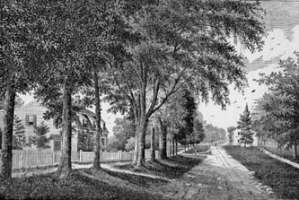
The Norwalk River is a river in southwestern Connecticut, United States, approximately long.U.S. Geological Survey. National Hydrography Dataset high-resolution flowline dataThe National Map accessed April 1, 2011 The word "Norwalk" comes from the Algonquian word "noyank" meaning "point of land". Description The Norwalk River originates in ponds located in Ridgefield, Connecticut. These ponds empty into Ridgefield’s approximately "Great Swamp". The river continues through Ridgefield, and is augmented by the "Great Pond" ( above sea level), one of the purest lakes in Connecticut due to its being fed by underwater springs. The river is closely paralleled by U.S. Route 7 as it flows southward through Branchville, Georgetown, Wilton, and Norwalk, where it is joined by the Silvermine River and then flows into Norwalk Harbor and finally into Long Island Sound. Recreational fishing continues to be a popular sport along the course of the river, in addition to oystering at th ...
[...More Info...]      
[...Related Items...]     OR:     [Wikipedia]   [Google]   [Baidu]  


picture info

Ridgefield, Connecticut
Ridgefield is a town in Fairfield County, Connecticut Connecticut () is the southernmost state in the New England region of the Northeastern United States. It is bordered by Rhode Island to the east, Massachusetts to the north, New York to the west, and Long Island Sound to the south. Its cap ..., United States. Situated in the foothills of the Berkshire Mountains, the 300-year-old community had a population of 25,033 at the 2020 United States Census, 2020 census. The Ridgefield (CDP), Connecticut, town center, which was formerly a borough (Connecticut), borough, is defined by the U.S. Census Bureau as a census-designated place. History Ridgefield was first settled by English colonists from Norwalk, Connecticut, Norwalk and Milford, Connecticut, Milford in 1708, when a group of settlers purchased land from Chief Katonah, Chief Catoonah of the Ramapough Mountain Indians, Ramapo tribe. The town was incorporated under a royal charter from the Connecticut General Assembly ...
[...More Info...]      
[...Related Items...]     OR:     [Wikipedia]   [Google]   [Baidu]  


picture info

Angling
Angling is a fishing technique that uses a fish hook or "angle" (from Old English ''angol'') attached to a fishing line to tether individual fish in the mouth. The fishing line is usually manipulated via a fishing rod, although rodless techniques such as handlining and longlining also exist. Modern angling rods are usually fitted with a reel that functions as a cranking device for storing, retrieving and releasing out the line, although Tenkara fishing and cane pole fishing are two rod-angling methods that do not use any reel. The hook itself can be additionally weighted with a dense tackle called a sinker, and is typically dressed with an appetizing bait to attract the fish and enticing it into swallowing the hook, but sometimes an inedible fake bait with multiple attached hooks (known as a lure) is used instead of a single hook with edible bait. A bite indicator, such as a float or a quiver tip, is often used to relay underwater status of the hook to the surface. When ...
[...More Info...]      
[...Related Items...]     OR:     [Wikipedia]   [Google]   [Baidu]  


picture info

Connecticut Placenames Of Native American Origin
Connecticut () is the southernmost state in the New England region of the Northeastern United States. It is bordered by Rhode Island to the east, Massachusetts to the north, New York to the west, and Long Island Sound to the south. Its capital is Hartford and its most populous city is Bridgeport. Historically the state is part of New England as well as the tri-state area with New York and New Jersey. The state is named for the Connecticut River which approximately bisects the state. The word "Connecticut" is derived from various anglicized spellings of "Quinnetuket”, a Mohegan-Pequot word for "long tidal river". Connecticut's first European settlers were Dutchmen who established a small, short-lived settlement called House of Hope in Hartford at the confluence of the Park and Connecticut Rivers. Half of Connecticut was initially claimed by the Dutch colony New Netherland, which included much of the land between the Connecticut and Delaware Rivers, although the first major ...
[...More Info...]      
[...Related Items...]     OR:     [Wikipedia]   [Google]   [Baidu]  


picture info

Rivers Of Fairfield County, Connecticut
A river is a natural flowing watercourse, usually freshwater, flowing towards an ocean, sea, lake or another river. In some cases, a river flows into the ground and becomes dry at the end of its course without reaching another body of water. Small rivers can be referred to using names such as creek, brook, rivulet, and rill. There are no official definitions for the generic term river as applied to geographic features, although in some countries or communities a stream is defined by its size. Many names for small rivers are specific to geographic location; examples are "run" in some parts of the United States, "burn" in Scotland and northeast England, and "beck" in northern England. Sometimes a river is defined as being larger than a creek, but not always: the language is vague. Rivers are part of the water cycle. Water generally collects in a river from precipitation through a drainage basin from surface runoff and other sources such as groundwater recharge, springs, a ...
[...More Info...]      
[...Related Items...]     OR:     [Wikipedia]   [Google]   [Baidu]  


picture info

Geography Of Norwalk, Connecticut
Geography (from Greek: , ''geographia''. Combination of Greek words ‘Geo’ (The Earth) and ‘Graphien’ (to describe), literally "earth description") is a field of science devoted to the study of the lands, features, inhabitants, and phenomena of Earth. The first recorded use of the word γεωγραφία was as a title of a book by Greek scholar Eratosthenes (276–194 BC). Geography is an all-encompassing discipline that seeks an understanding of Earth and its human and natural complexities—not merely where objects are, but also how they have changed and come to be. While geography is specific to Earth, many concepts can be applied more broadly to other celestial bodies in the field of planetary science. One such concept, the first law of geography, proposed by Waldo Tobler, is "everything is related to everything else, but near things are more related than distant things." Geography has been called "the world discipline" and "the bridge between the human and t ...
[...More Info...]      
[...Related Items...]     OR:     [Wikipedia]   [Google]   [Baidu]  


picture info

List Of Rivers Of Connecticut
Most of Connecticut's rivers flow into Long Island Sound and from there the waters mix into the Atlantic Ocean. A few extremely eastern rivers flow into Block Island Sound. The list is arranged by drainage basin from east to west, with respective tributaries indented from downstream to upstream under each larger stream's name. By drainage basin (east to west) Block Island Sound *Pawcatuck River – easternmost CT river basin **Shunock River **'' Ashaway River (Rhode Island)'' *** Green Fall River **Wood River Long Island Sound * Mystic River ** Whitford Brook * Poquonock River *Thames River **Oxoboxo River **Shetucket River ***Quinebaug River ****Pachaug River **** Blackwell Brook ****Moosup River ****Five Mile River ****Little River (Quinebaug River tributary) **** French River ***Little River (Shetucket River tributary) *** Merrick Brook **** Beaver Brook ***Natchaug River ****Mount Hope River *****Fenton River ****Bigelow Brook **** Still River (Natchaug River tribu ...
[...More Info...]      
[...Related Items...]     OR:     [Wikipedia]   [Google]   [Baidu]  


picture info

Drainage Basin
A drainage basin is an area of land where all flowing surface water converges to a single point, such as a river mouth, or flows into another body of water, such as a lake or ocean. A basin is separated from adjacent basins by a perimeter, the '' drainage divide'', made up of a succession of elevated features, such as ridges and hills. A basin may consist of smaller basins that merge at river confluences, forming a hierarchical pattern. Other terms for a drainage basin are catchment area, catchment basin, drainage area, river basin, water basin, and impluvium. In North America, they are commonly called a watershed, though in other English-speaking places, "watershed" is used only in its original sense, that of a drainage divide. In a closed drainage basin, or endorheic basin, the water converges to a single point inside the basin, known as a sink, which may be a permanent lake, a dry lake, or a point where surface water is lost underground. Drainage basins are similar ...
[...More Info...]      
[...Related Items...]     OR:     [Wikipedia]   [Google]   [Baidu]  


picture info

History Of Norwalk, Connecticut
The history of Norwalk, Connecticut ranges from pre-contact cultures and Native Americans to the 21st century. Population Pre-Contact During an era when Native Americans had discovered the New World, Native Americans had unquestionably inhabited the area later recorded in history as Norwalk, Connecticut. Even before then many, but not all, such cultures of indigenous people came, dwelled, hunted wild animals for food, and left the area sporadically through time. Artifacts, discarded and left behind now identified by archaeologists as being consistent with cultures as far back as the earliest known peoples of North American. Known in modern time as the Paleoindian Period, sites consistent with these eras have been found in three areas of modern-day Norwalk, Connecticut. Some of these artifacts were used by hunter-gatherers roughly 5,000 B.P. to 10,200 BP. Bitter rock shelter According to an article published in ''Bulletin of the Massachusetts Archaeological Society'' ...
[...More Info...]      
[...Related Items...]     OR:     [Wikipedia]   [Google]   [Baidu]  


Flood Of 1955 (Connecticut)
The Flood of 1955 was one of the worst floods in Connecticut's history. Two back-to-back hurricanes saturated the land and several river valleys in the state, causing severe flooding in August 1955. The rivers most affected were the Mad River and Still River in Winsted, the Naugatuck River, the Farmington River, and the Quinebaug River. The towns that suffered much loss include Farmington, Putnam, Naugatuck, Waterbury, and Winsted. 87 people died during the flooding, and property damage across the state was estimated at more than $200 million, in 1955 figures. The floods prompted changes in safety measures, river monitoring, and zoning laws. Background Causes The flooding was caused by the rains from two hurricanes, Hurricane Connie and Hurricane Diane. On August 11, Hurricane Connie swept through the East Coast—missing Connecticut, but bringing about 4 to 6 inches of rainfall to the state on August 13. Hurricane Diane came through the following week. The path ...
[...More Info...]      
[...Related Items...]     OR:     [Wikipedia]   [Google]   [Baidu]  


picture info

Disaster Area
A disaster area is a region or a locale that has been heavily damaged by either natural, technological or social hazards. Disaster areas affect the population living in the community by dramatic increase in expense, loss of energy, food and services; and finally increase the risk of disease for citizens. An area that has been struck with a natural, technological or sociological hazard that opens the affected area for national or international aid. Natural hazard A natural hazard is a negative process of phenomena created naturally (tornadoes, hurricanes, tsunamis, floods, earthquakes) that will affect people or the environment. Tornadoes Tornadoes are narrow, aggressively rotating columns of air that come from the base of a thunderstorm, and are the most violent of storms. Tornadoes are usually hard to see unless they form a condensations funnel, or loft a significant amount of dust and debris. Tornadoes take place in several parts of the world, such as Australia, Europe, Africa ...
[...More Info...]      
[...Related Items...]     OR:     [Wikipedia]   [Google]   [Baidu]  


Dwight D
Dwight may refer to: People * Dwight (given name) * Dwight D. Eisenhower (1890–1969), 34th president of the United States and former military officer *New England Dwight family of American educators, military and political leaders, and authors * Ed Dwight (born 1933), American test pilot, participated in astronaut training program * Mabel Dwight (1875–1955), American artist * Elton John (born Reginald Dwight in 1947), English singer, songwriter and musician Places Canada * Dwight, Ontario, village in the township of Lake of Bays, Ontario United States * Dwight (neighborhood), part of an historic district in New Haven, Connecticut * Dwight, Illinois, village in Livingston and Grundy counties * Dwight, Kansas, city in Morris County * Dwight, Michigan, an unincorporated community * Dwight, Nebraska, village in Butler County * Dwight, North Dakota, city in Richland County * Dwight Township, Livingston County, Illinois * Dwight Township, Michigan Institutions * Dwight Correctional ...
[...More Info...]      
[...Related Items...]     OR:     [Wikipedia]   [Google]   [Baidu]  


picture info

Flood
A flood is an overflow of water ( or rarely other fluids) that submerges land that is usually dry. In the sense of "flowing water", the word may also be applied to the inflow of the tide. Floods are an area of study of the discipline hydrology and are of significant concern in agriculture, civil engineering and public health. Human changes to the environment often increase the intensity and frequency of flooding, for example land use changes such as deforestation and removal of wetlands, changes in waterway course or flood controls such as with levees, and larger environmental issues such as climate change and sea level rise. In particular climate change's increased rainfall and extreme weather events increases the severity of other causes for flooding, resulting in more intense floods and increased flood risk. Flooding may occur as an overflow of water from water bodies, such as a river, lake, or ocean, in which the water overtops or breaks levees, resulting ...
[...More Info...]      
[...Related Items...]     OR:     [Wikipedia]   [Google]   [Baidu]