|
North Western Fells
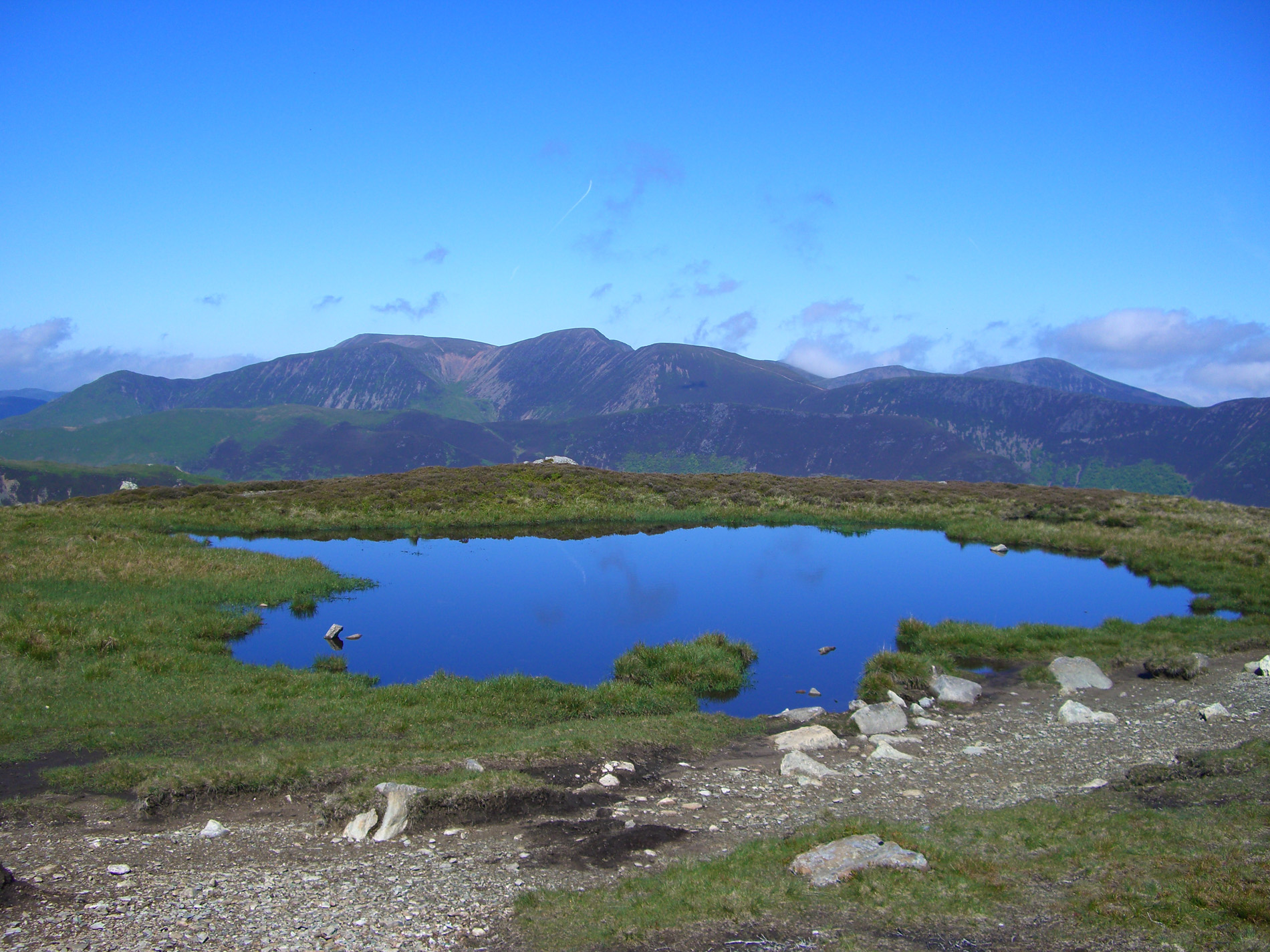
The North Western Fells are a group of hills in the English Lake District. Including such favourites as Catbells and Grisedale Pike, they occupy an oval area beneath the Buttermere and Borrowdale valley systems. The North Western Fells are characterised by soaring east-west ridges and an absence of mountain tarns. Partition of the Lakeland Fells The Lake District is a National Park in the north west of the country which, in addition to its lakes, contains a complex range of hills. These are known locally as fells and range from low hills to the highest ground in England. Hundreds of tops exist and many writers have attempted to draw up definitive lists. In doing so the compilers frequently divide the range into smaller areas to aid their description. The most influential of all such authors was Alfred Wainwright whose ''Pictorial Guide to the Lakeland Fells'' series has sold in excess of 2 million copies, [...More Info...] [...Related Items...] OR: [Wikipedia] [Google] [Baidu] |
Grasmoor
Grasmoor is a mountain in the north-western part of the Lake District, northern England. It is the highest peak in a group of hills between the villages of Lorton, Braithwaite and Buttermere, and overlooks Crummock Water. Grasmoor is distinguished by its steep western flank, dropping dramatically to Crummock Water. This face is however not suitable for rock climbers as there is little clean rock, although Alfred Wainwright describes a challenging route up the face in his ''Pictorial Guides to the Lakeland Fells''.Alfred Wainwright: ''A Pictorial Guide to the Lakeland Fells, Book 6, The North Western Fells'': Westmorland Gazette (1964): To the east the fell is linked to others by Crag Hill and Coledale Hause. Grasmoor is also home to the most extensive scree slopes in the North Western Fells. Name Grasmoor takes its name from the Old Norse element ''grise'', meaning wild boar. This element appears in other Lake District place names, including Grisedale Pike and Grizedale Forest ... [...More Info...] [...Related Items...] OR: [Wikipedia] [Google] [Baidu] |
Honister Pass
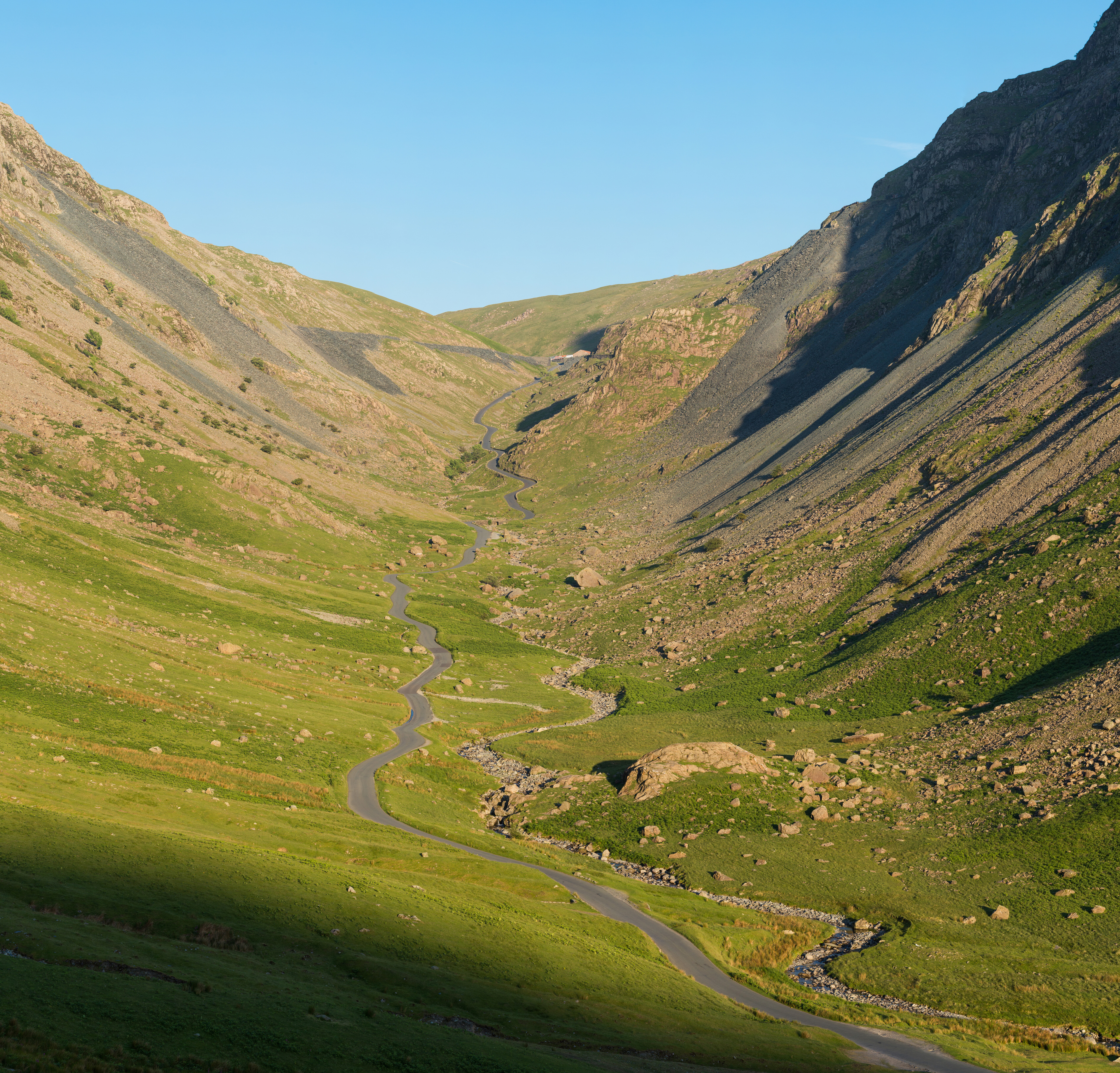
Honister Pass is a mountain pass in the English Lake District. It is located on the B5289 road, linking Seatoller, in the valley of Borrowdale, to Gatesgarth at the southern end of Buttermere. The pass reaches an altitude of , making it one of the highest in the region, and also one of the steepest, with gradients of up to 1-in-4 (25%). The saddle at the watershed is known as Honister Hause, using the Cumbrian word ''hause'' for such a feature. Honister Pass is one of three passes that link the tourist area around Keswick, including Derwent Water and Borrowdale, with the valley of the River Cocker, including the lakes of Buttermere, Crummock Water and Loweswater. From north to south these passes are Whinlatter Pass, Newlands Pass and Honister Pass. Honister Slate Mine and Honister Hause Youth Hostel are located at the summit of the pass. Footpaths lead from the summit of the pass to Fleetwith Pike to the west, Grey Knotts to the south, and Dale Head to the north. Honis ... [...More Info...] [...Related Items...] OR: [Wikipedia] [Google] [Baidu] |
Dale Head
Dale Head is a fell in the north-western sector of the Lake District, in northern England. It is 753 metres or 2,470 feet above sea level and stands immediately north of Honister Pass, the road between Borrowdale and Buttermere. Topography The North-Western Fells occupy the area between the rivers Derwent and Cocker, a broadly oval swathe of hilly country, elongated on a north-south axis. Two roads cross from east to west, dividing the fells into three convenient groups. Dale Head is the highest fell in the southern sector. Dale Head is the apex of two hill ridges. The principal ridge descends from Dale Head to the north-east and forms several other fells, each given a chapter by Alfred Wainwright in his Pictorial Guides to the Lakeland Fells. These are High Spy, Maiden Moor and Catbells (alternative spelling, Cat Bells). This ridge forms the western side of Borrowdale and overlooks Derwent Water. The other ridge descends to the north-west and includes the fells o ... [...More Info...] [...Related Items...] OR: [Wikipedia] [Google] [Baidu] |
High Spy
High Spy is a fell in the English Lake District it is situated on the ridge that separates the Newlands Valley from Borrowdale, eight kilometres (five miles) south of Keswick. Topography The fell reaches a height of 653 metres (2142 feet) and is defended by crags to the east and west as it falls away steeply to the valleys. It is a distinctive fell that has 148 metres (486 feet) of topographic prominence from the higher adjoining fell of Dale Head and so misses being a Marilyn by only two metres. Geologically the fell is made up of Borrowdale Volcanics. The meaning of the fell's name is obscure but may mean a “lookout post”, referring to some lost fort in the area. In the past it has been known as Scawdel Fell and Lobstone Band and these names are still used on maps to label other parts of the fell.ukonline.co.uk. deta ... [...More Info...] [...Related Items...] OR: [Wikipedia] [Google] [Baidu] |
Maiden Moor
Maiden Moor is a fell in the English Lake District, it stands south of the town of Keswick and is part of the high ground that separates the Newlands Valley and Borrowdale, it has a modest height of and so fails to be mentioned on many UK mountain lists but it does have a separate chapter in Alfred Wainwright’s Pictorial Guide to the Lakeland Fells. Name The meaning of the fell's name is obscure, the name "Maiden" is given to many prehistoric hill forts but there is no evidence that a hill fort ever existed on the fell, it may refer to a place where games or rituals were played where maidens took part. Topography The fell's main natural features are Bull Crag which lies below the summit on the Newlands side and the hollow of Yewthwaite Combe which stands beneath the col linking the fell with Catbells on the Newlands side. Geology The Maiden Moor ridge is an example of the Buttermere Formation, an olistostrome of disrupted, sheared and folded mudstone, siltstone and ... [...More Info...] [...Related Items...] OR: [Wikipedia] [Google] [Baidu] |
Whinlatter Pass
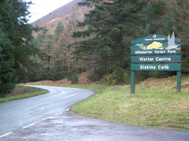
The Whinlatter Pass is a mountain pass in the English Lake District. It is located on the B5292 road linking Braithwaite, to the west of Keswick, with High Lorton to the south of Cockermouth. To the north the pass is flanked by Whinlatter fell, while to the south the Whiteside, Hopegill Head and Grisedale Pike fells borders the pass. From the top of the pass, paths climb Whinlatter and Grisedale Pike. There is also a Forestry Commission tourist centre there. The Whinlatter Pass is one of three passes that link the tourist area around Keswick, including Derwent Water and Borrowdale, with the valley of the River Cocker, including the lakes of Buttermere, Crummock Water and Loweswater. From north to south these passes are the Whinlatter Pass, the Newlands Pass, and the Honister Pass. The Whinlatter Pass can be icy in winter, but it is a less severe route than the other two passes. The Pass was used for the first King of the Mountains climb on the second stage of the 2016 ... [...More Info...] [...Related Items...] OR: [Wikipedia] [Google] [Baidu] |
Braithwaite
Braithwaite is a village in the northern Lake District, in Cumbria, England. Historically in Cumberland, it lies just to the west of Keswick and to the east of the Grisedale Pike ridge, in the Borough of Allerdale. It forms part of the civil parish of Above Derwent. The eastern end of the Whinlatter Pass road is in the village. The A66 road bypasses Braithwaite, but does not enter the village. Braithwaite is situated around Coledale Beck, a brook which joins Newlands Beck shortly after passing through the village. Newlands Beck (coming from the Newlands Valley) then flows north towards Bassenthwaite Lake. Braithwaite has a Village Shop by the Low Bridge, several pubs, including the Coledale Inn, the Royal Oak and the Middle Ruddings Hotel. Braithwaite is easily accessible due to its close proximity to the A66. It has a campsite with a caravan park, B + Bs, pubs and guest houses. It has a wide range of sports including sailing, climbing, abseiling, canoeing, hang-gliding, ... [...More Info...] [...Related Items...] OR: [Wikipedia] [Google] [Baidu] |
Cat Bells And Friars Crag
The cat (''Felis catus'') is a domestic species of small carnivorous mammal. It is the only domesticated species in the family Felidae and is commonly referred to as the domestic cat or house cat to distinguish it from the wild members of the family. Cats are commonly kept as house pets but can also be farm cats or feral cats; the feral cat ranges freely and avoids human contact. Domestic cats are valued by humans for companionship and their ability to kill rodents. About 60 cat breeds are recognized by various cat registries. The cat is similar in anatomy to the other felid species: they have a strong flexible body, quick reflexes, sharp teeth, and retractable claws adapted to killing small prey. Their night vision and sense of smell are well developed. Cat communication includes vocalizations like meowing, purring, trilling, hissing, growling, and grunting as well as cat-specific body language. Although the cat is a social species, they are a solitary hunter. As a preda ... [...More Info...] [...Related Items...] OR: [Wikipedia] [Google] [Baidu] |
Cockermouth
Cockermouth is a market town and civil parish in the Borough of Allerdale in Cumbria, England, so named because it is at the confluence of the River Cocker as it flows into the River Derwent. The mid-2010 census estimates state that Cockermouth has a population of 8,204, increasing to 8,761 at the 2011 Census. Historically a part of Cumberland, Cockermouth is situated outside the English Lake District on its northwest fringe. Much of the architectural core of the town remains unchanged since the basic medieval layout was filled in the 18th and 19th centuries. The regenerated market place is now a central historical focus within the town and reflects events from its 800-year history. The town is prone to flooding and experienced severe floods in 2005, 2009, and 2015. Etymology ''Cockermouth'' is "the mouth of the River Cocker"; the river takes its name from the Brythonic Celtic word ''kukrā'', meaning 'the crooked one'. It has frequently been noted on lists of unusual ... [...More Info...] [...Related Items...] OR: [Wikipedia] [Google] [Baidu] |
Bassenthwaite Lake
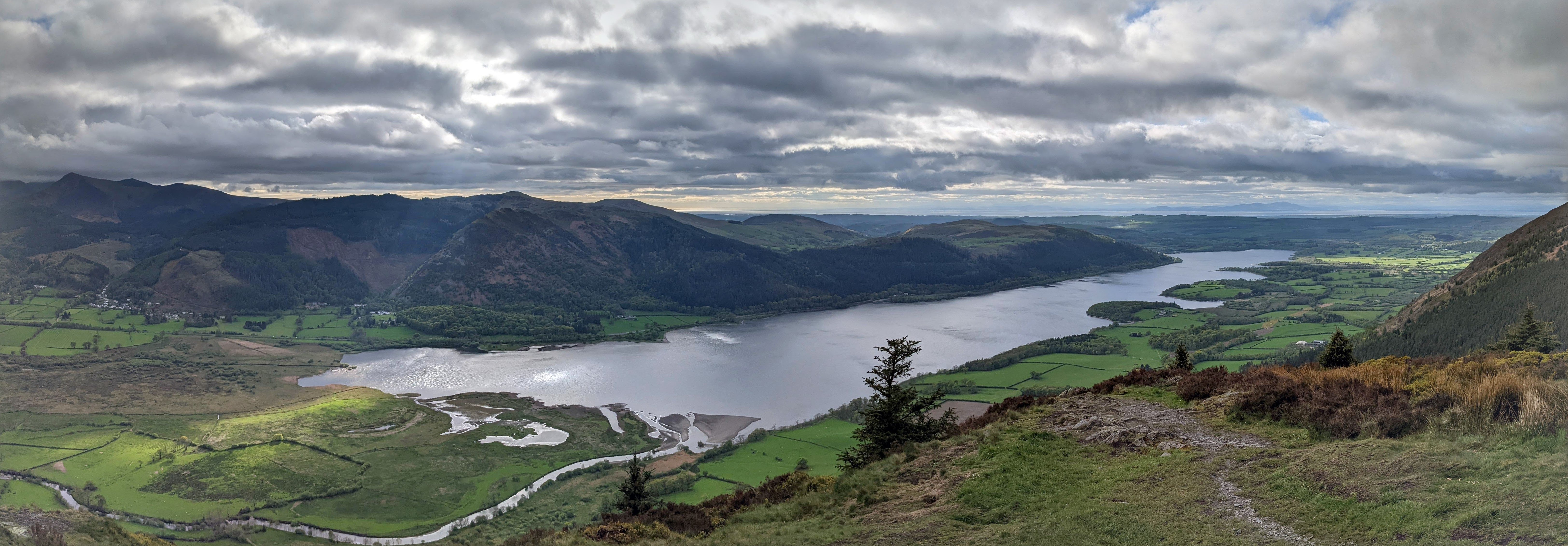
Bassenthwaite Lake is one of the largest water bodies in the English Lake District. It is long and narrow, approximately long and wide, but is also extremely shallow, with a maximum depth of about . It is the only body of water in the Lake District to use the word ''"lake"'' in its name, all the others being ''"waters"'' (for example, Derwentwater), ''"meres"'' (for example, Windermere) or ''"tarns"'' (for example, Dock Tarn). It is fed by, and drains into, the River Derwent. The lake lies at the foot of Skiddaw, near the town of Keswick. Some maps dating from the 18th century do in fact mark this lake with the name ''Bassenwater'', and the use of the name ''Broadwater'' for this lake is also attested. The A66 dual carriageway runs roughly north–south along the western side of the lake. The lay-bys are popular spots for photographers and bird watchers looking for osprey. The section running south towards Keswick was built along the course of the former Cockermouth, K ... [...More Info...] [...Related Items...] OR: [Wikipedia] [Google] [Baidu] |
Derwent Water
Derwentwater, or Derwent Water, is one of the principal bodies of water in the Lake District National Park in north west England. It lies wholly within the Borough of Allerdale, in the county of Cumbria. The lake occupies part of Borrowdale and lies immediately south of the town of Keswick. It is both fed and drained by the River Derwent. It measures approximately long by wide and is some deep. There are several islands within the lake, one of which is inhabited. Derwentwater is a place of considerable scenic value. It is surrounded by hills (known locally as fells), and many of the slopes facing Derwentwater are extensively wooded. A regular passenger launch operates on the lake, taking passengers between various landing stages. There are seven lakeside marinas, the most popular stops being Keswick, Portinscale and the Lodore Falls, from which boats may be hired. Recreational walking is a major tourist activity in the area and there is an extensive network of foot ... [...More Info...] [...Related Items...] OR: [Wikipedia] [Google] [Baidu] |
Crummock Water
Crummock Water is a lake in the Lake District in Cumbria, North West England situated between Buttermere to the south and Loweswater to the north. Crummock Water is long, wide and deep. The River Cocker is considered to start at the north of the lake, before then flowing into Lorton Vale. The hill of Mellbreak runs the full length of the lake on its western side; as Alfred Wainwright described it 'no pairing of hill and lake in Lakeland have a closer partnership than these'. The lake is owned by the National Trust. "The meaning of 'Crummock' seems to be 'Crooked one', from British" ( Brythonic Celtic) "'crumbaco'-'crooked'". This may refer to the winding course of the River Cocker, which flows out of the lake, or refer to the bending nature of the lake itself. The word "'water' is the main Lakeland term for 'lake'". Scale Force, the highest waterfall in the Lake District, feeds the lake and has a drop of . Water from the lake was treated at Cornhow water treatment works, n ... [...More Info...] [...Related Items...] OR: [Wikipedia] [Google] [Baidu] |


