|
North Meols
North Meols is a civil parish and electoral ward in the West Lancashire district of Lancashire, England. The parish covers the village of Banks and the hamlet of Hundred End. The population of the parish/ward at the 2011 census was 4,146. Historically the parish covered a wider area including much of what is now Southport. Ancient parish The civil parish is based on an ancient parish located to the north and east of the town of Southport, which straddled what is now the border between the counties of Merseyside and Lancashire. North Meols included Crossens, Marshside and Churchtown in the north of Southport, and then extended east towards Preston to encompass the rural villages of Banks, Far Banks and Hundred End, Mere Brow and Holmes in West Lancashire. It was bounded to the south by the Martin Mere wetland. History Dating from before the Norman conquest, this area of small farming and fishing villages was originally known as Otegrimeles, from the Norse word "melr", ... [...More Info...] [...Related Items...] OR: [Wikipedia] [Google] [Baidu] |
West Lancashire
West Lancashire is a local government district with borough status in Lancashire, England. The council is based in Ormskirk, and the largest town in the borough is Skelmersdale. At the 2011 Census, the population of the borough was 110,685. History The district was created on 1 April 1974 under the Local Government Act 1972, as a non-metropolitan district, with Lancashire County Council as the higher tier authority providing county-level services. West Lancashire covered the whole territory of two former districts and parts of another two districts, all of which were abolished at the same time: *Ormskirk Urban District *Skelmersdale and Holland Urban District *West Lancashire Rural District (majority of former district's territory; remainder went to Merseyside) *Wigan Rural District (parishes of Dalton, Parbold and Wrightington; remainder went to Greater Manchester) In 2009 the district was awarded borough status, causing the council to change its name from West Lancashir ... [...More Info...] [...Related Items...] OR: [Wikipedia] [Google] [Baidu] |
Mere Brow
Mere Brow is a small village in Lancashire, England, situated between Tarleton and Banks, just off the A565 road. It is 6 miles (9 km) east of Southport and 10 miles (15 km) south west of Preston. It is administered by the West Lancashire Borough Council and the Tarleton parish council. It is in the West Lancashire parliamentary constituency. Mere Brow is the second largest village in the parish of Tarleton, the largest being Tarleton and the smallest being Holmes and Sollom. History Mere Brow and the neighbouring village of Holmes were part of the ancient parish of North Meols but now are part of Tarleton parish. The name Mere Brow is believed to have come from the time when it was the most northerly settlement on Martin Mere. Economy Mere Brow was primarily an agricultural village due to the excellent soil, although there was fishing activity for many years. Production of flowers and vegetables is common on the farms around the village. The village has a public ho ... [...More Info...] [...Related Items...] OR: [Wikipedia] [Google] [Baidu] |
Tudor Revival Architecture
Tudor Revival architecture (also known as mock Tudor in the UK) first manifested itself in domestic architecture in the United Kingdom in the latter half of the 19th century. Based on revival of aspects that were perceived as Tudor architecture, in reality it usually took the style of English vernacular architecture of the Middle Ages that had survived into the Tudor period. The style later became an influence elsewhere, especially the British colonies. For example, in New Zealand, the architect Francis Petre adapted the style for the local climate. In Singapore, then a British colony, architects such as R. A. J. Bidwell pioneered what became known as the Black and White House. The earliest examples of the style originate with the works of such eminent architects as Norman Shaw and George Devey, in what at the time was considered Neo-Tudor design. Tudorbethan is a subset of Tudor Revival architecture that eliminated some of the more complex aspects of Jacobethan in favour of m ... [...More Info...] [...Related Items...] OR: [Wikipedia] [Google] [Baidu] |
English Country House
An English country house is a large house or mansion in the English countryside. Such houses were often owned by individuals who also owned a town house. This allowed them to spend time in the country and in the city—hence, for these people, the term distinguished between town and country. However, the term also encompasses houses that were, and often still are, the full-time residence for the landed gentry who ruled rural Britain until the Reform Act 1832. Frequently, the formal business of the counties was transacted in these country houses, having functional antecedents in manor houses. With large numbers of indoor and outdoor staff, country houses were important as places of employment for many rural communities. In turn, until the agricultural depressions of the 1870s, the estates, of which country houses were the hub, provided their owners with incomes. However, the late 19th and early 20th centuries were the swansong of the traditional English country house lifest ... [...More Info...] [...Related Items...] OR: [Wikipedia] [Google] [Baidu] |
Greaves Hall
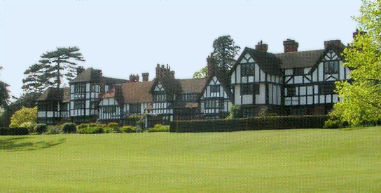
Greaves Hall was a country house on the outskirts of Banks in Lancashire, England, built in a Tudorbethan style for Thomas Talbot Leyland Scarisbrick in 1900. History Thomas Scarisbrick born in 1874, built Greaves Hall in 1900 on a 124-acre (0.50 km2) site given by his father as a wedding present when he married Josephine Chamberlain of Cleveland, Ohio, USA in 1895. The mansion was surrounded by sculptured lawns, gardens with ornamental trees and flowering shrubs. The hall had approximately 55 rooms, open areas situated on the ground, first, second and attic floors and a vast basement. A porter's lodge by the main entrance, a gardener's lodge, engineer's workshop, laundry and general workshop in mock Tudor style were built in close proximity. The Scarisbricks remained at Greaves Hall until after the First World War when they moved to Scarisbrick Hall and sold the estate to a consortium of farmers from Banks. The mansion stood empty while the land was cultivated by the consortiu ... [...More Info...] [...Related Items...] OR: [Wikipedia] [Google] [Baidu] |
Listed Building
In the United Kingdom, a listed building or listed structure is one that has been placed on one of the four statutory lists maintained by Historic England in England, Historic Environment Scotland in Scotland, in Wales, and the Northern Ireland Environment Agency in Northern Ireland. The term has also been used in the Republic of Ireland, where buildings are protected under the Planning and Development Act 2000. The statutory term in Ireland is " protected structure". A listed building may not be demolished, extended, or altered without special permission from the local planning authority, which typically consults the relevant central government agency, particularly for significant alterations to the more notable listed buildings. In England and Wales, a national amenity society must be notified of any work to a listed building which involves any element of demolition. Exemption from secular listed building control is provided for some buildings in current use for worship, ... [...More Info...] [...Related Items...] OR: [Wikipedia] [Google] [Baidu] |
War Memorial, The Parish Church Of St Stephen In The Banks - Geograph
War is an intense armed conflict between states, governments, societies, or paramilitary groups such as mercenaries, insurgents, and militias. It is generally characterized by extreme violence, destruction, and mortality, using regular or irregular military forces. Warfare refers to the common activities and characteristics of types of war, or of wars in general. Total war is warfare that is not restricted to purely legitimate military targets, and can result in massive civilian or other non-combatant suffering and casualties. While some war studies scholars consider war a universal and ancestral aspect of human nature, others argue it is a result of specific socio-cultural, economic or ecological circumstances. Etymology The English word ''war'' derives from the 11th-century Old English words ''wyrre'' and ''werre'', from Old French ''werre'' (also ''guerre'' as in modern French), in turn from the Frankish *''werra'', ultimately deriving from the Proto-Germanic *''we ... [...More Info...] [...Related Items...] OR: [Wikipedia] [Google] [Baidu] |
A565 Road
The A565 is a road in England that is around long and runs from Liverpool in Merseyside to Tarleton in Lancashire. It is a primary route linking the town of Southport to Liverpool and to Preston (latterly via the connecting A59), having been designated a trunk road as part of the Trunk Roads Act 1946. Route The A565 starts in Liverpool at the junction with the A5052 road and A5053 road respectively, at the south end of Great Howard Street; a spur also heads southbound from this junction for . From Liverpool, the road follows a north-bound alignment through Bootle, Crosby and on to Formby where it passes along a bypass. After the bypass, the road heads towards Southport where it meets the A570 Scarisbrick New Road before continuing north-east through Banks and into Lancashire, ultimately reaching Tarleton where it meets and becomes the A59 road. History 19th century Much of the present day A565 route from Liverpool to Thornton is unchanged since the Victorian age. 20th cen ... [...More Info...] [...Related Items...] OR: [Wikipedia] [Google] [Baidu] |
Beeching Axe
The Beeching cuts (also Beeching Axe) was a plan to increase the efficiency of the nationalised railway system in Great Britain. The plan was outlined in two reports: ''The Reshaping of British Railways'' (1963) and ''The Development of the Major Railway Trunk Routes'' (1965), written by Richard Beeching and published by the British Railways Board. The first report identified 2,363 stations and of railway line for closure, amounting to 55% of stations, 30% of route miles, and 67,700 British Rail positions, with an objective of stemming the large losses being incurred during a period of increasing competition from road transport and reducing the rail subsidies necessary to keep the network running. The second report identified a small number of major routes for significant investment. The 1963 report also recommended some less well-publicised changes, including a switch to the now-standard practice of containerisation for rail freight, and the replacement of some services wit ... [...More Info...] [...Related Items...] OR: [Wikipedia] [Google] [Baidu] |
West Lancashire Railway
The West Lancashire Railway (WLR) ran northeast from Southport to Preston in northwest England. History Construction was started by Samuel Swire the Mayor of Southport, on 19 April 1873. It opened on 15 September 1882. A branch was constructed from Penwortham to the Blackburn line at Whitehouse Junction allowing direct services from East Lancashire Railway to Southport. In 1881 a further branch was constructed from east of Hesketh Bank station southwards to Tarleton Lock on the Rufford Branch of the Leeds and Liverpool Canal by the River Douglas. This was mainly intended for goods, but a passenger service did run on the branch until 1912/3. The branch closed completely in 1930. Expansion, bankruptcy and take-over It also sponsored the Liverpool, Southport and Preston Junction Railway, opened in 1887 to provide greater access to Liverpool (in competition with its rival the Lancashire and Yorkshire Railway) and in an attempt to forge a commercial alliance with the Manchester ... [...More Info...] [...Related Items...] OR: [Wikipedia] [Google] [Baidu] |
Wirral Peninsula
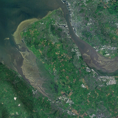
Wirral (; ), known locally as The Wirral, is a peninsula in North West England. The roughly rectangular peninsula is about long and wide and is bounded by the River Dee to the west (forming the boundary with Wales), the River Mersey to the east, and the Irish Sea to the north. Historically, the Wirral was wholly in Cheshire; in the Domesday Book, its border with the rest of the county was placed at "two arrow falls from Chester city walls". However, since the Local Government Act 1972, only the southern third has been in Cheshire, with almost all the rest lying in the Metropolitan Borough of Wirral, Merseyside. An area of saltmarsh to the south-west of the peninsula lies in the Welsh county of Flintshire. The most extensive urban development is on the eastern side of the peninsula. The Wirral contains both affluent and deprived areas, with affluent areas largely in the west, south and north of the peninsula, and deprived areas concentrated in the east, especially Bir ... [...More Info...] [...Related Items...] OR: [Wikipedia] [Google] [Baidu] |
Meols
Meols (sometimes known as Great Meols) is a village on the northern coast of the Wirral Peninsula, England. It is contiguous with the town of Hoylake immediately to the west. Historically in Cheshire, since 1 April 1974 it has been part of the Metropolitan Borough of Wirral, in the metropolitan county of Merseyside. The 2001 census recorded the population of Meols as 5,110. In the 2011 census specific population figures for Meols were not available. The total population of the Hoylake and Meols local government ward was 13,348. History Meols was named as such by the Vikings; its original name from the Old Norse for 'sand dunes' was ', becoming ''melas'' by the time of the Domesday Survey. Impressive archaeological finds dating back to the Neolithic period suggest that the site was an important centre in antiquity. Since about 1810, a large number of artefacts have been found relating to pre-Roman Carthage, the Iron Age, the Roman Empire, Armenia, the Anglo-Saxons and t ... [...More Info...] [...Related Items...] OR: [Wikipedia] [Google] [Baidu] |


.jpg)


