|
North Fork Crystal River
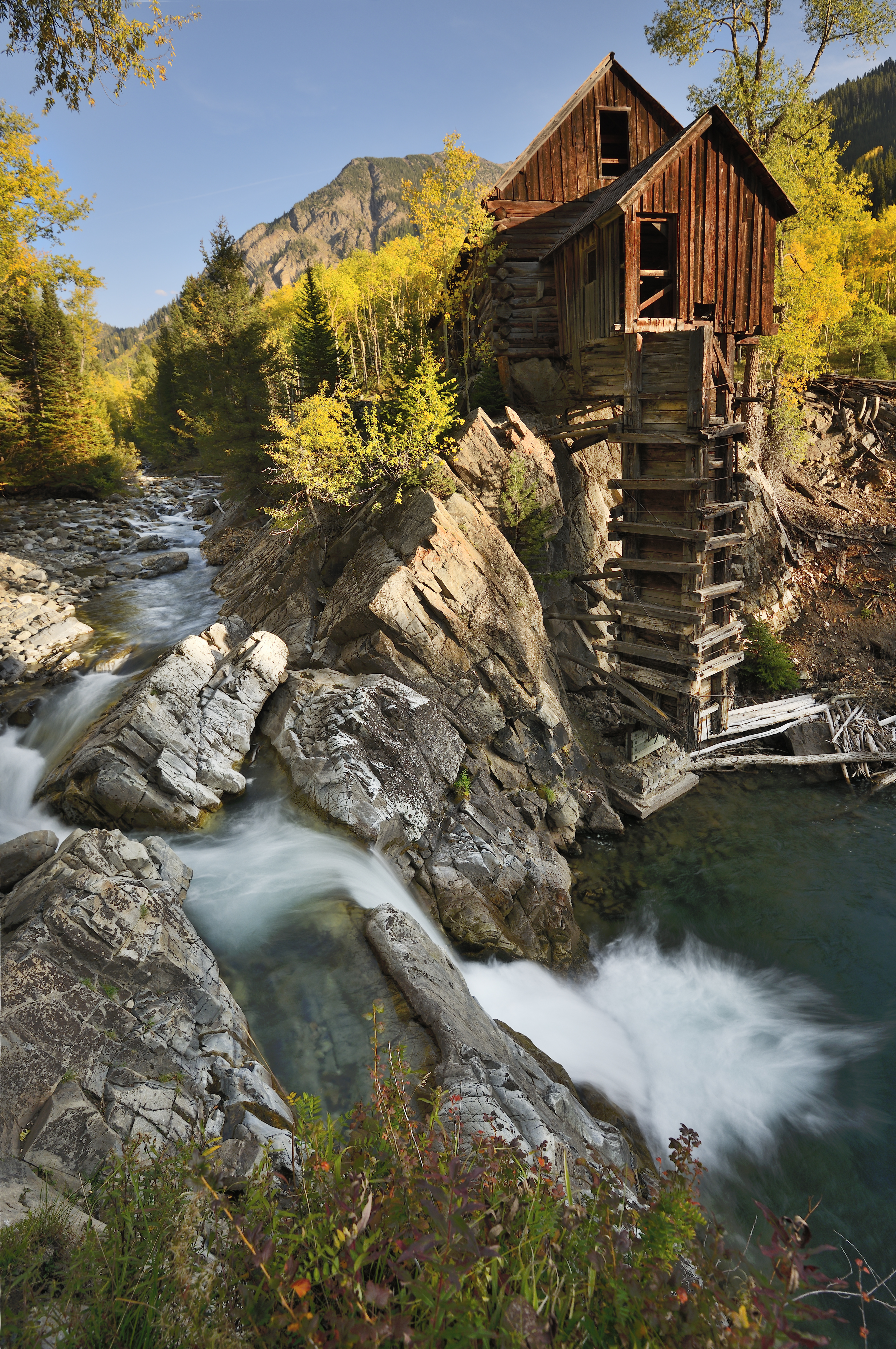
North Fork Crystal River is a tributary of the Crystal River (Colorado), Crystal River in Gunnison County, Colorado. The stream flows from a source in the Maroon Bells-Snowmass Wilderness to a confluence with the South Fork Crystal River in the White River National Forest that forms the Crystal River. Class VI rapids not usually run, do not attempt to run at peak or high flows. Short but very continuous whitewater. See also *List of rivers of Colorado References Rivers of Colorado Rivers of Gunnison County, Colorado Tributaries of the Colorado River in Colorado {{Colorado-river-stub ... [...More Info...] [...Related Items...] OR: [Wikipedia] [Google] [Baidu] |
South Fork Crystal River
South Fork Crystal River is a tributary of the Crystal River (Colorado), Crystal River in Gunnison County, Colorado, United States. The stream's source is the confluence of Rock Creek and the East Fork South Fork Crystal River, East Fork in the White River National Forest. It flows through Crystal Canyon to a confluence with the North Fork Crystal River that forms the Crystal River. See also *List of rivers of Colorado References Rivers of Colorado Rivers of Gunnison County, Colorado Tributaries of the Colorado River in Colorado {{Colorado-river-stub ... [...More Info...] [...Related Items...] OR: [Wikipedia] [Google] [Baidu] |
Crystal River (Colorado)
The Crystal River is a tributary of the Roaring Fork River, approximately long, in Gunnison and Pitkin counties in Colorado, United States. Description The river drains a glacial valley, called the Coal Basin, south of Carbondale which was historically known as a center of coal mining in southwestern Colorado. It rises in northern Gunnison County in the Elk Mountains on the north side of Schofield Pass, passing through the ghost town of Crystal City, still inhabited by a few summer residents. It then flows north past Marble, then into Pitkin County past Redstone. It joins the Roaring Fork below Carbondale. State Highway 133 follows the river along much of its route north of Marble. From Crystal City to Marble the river flows through the Crystal River Canyon, a narrow valley with numerous snowslide runs, rockfalls, and other hazardous terrain. Although it is locally known as a fishing and hiking attraction the unpaved and largely un-maintained mining road, designated ... [...More Info...] [...Related Items...] OR: [Wikipedia] [Google] [Baidu] |
Roaring Fork River
Roaring Fork River is a tributary of the Colorado River, approximately long, in west central Colorado in the United States. The river drains a populated and economically vital area of the Colorado Western Slope called the Roaring Fork Valley or Roaring Fork Watershed, which includes the resort city of Aspen and the resorts of Aspen/Snowmass. It rises in the Sawatch Range in eastern Pitkin County, on the west side of Independence Pass on the continental divide. It flows northwest past Aspen, Woody Creek, and Snowmass. It receives the Fryingpan River at Basalt. below Carbondale, it receives the Crystal River from the south. It joins the Colorado in Glenwood Springs. The entire area that drains into the Roaring Fork River is known as the Roaring Fork Watershed. This area is and about the same size as the state of Rhode Island. The river flows through canyons along most of its route and is a popular destination for recreation whitewater rafting. The river supplies water th ... [...More Info...] [...Related Items...] OR: [Wikipedia] [Google] [Baidu] |
Colorado River
The Colorado River ( es, Río Colorado) is one of the principal rivers (along with the Rio Grande) in the Southwestern United States and northern Mexico. The river drains an expansive, arid drainage basin, watershed that encompasses parts of seven U.S. states and two Mexican states. The name Colorado derives from the Spanish language for "colored reddish" due to its heavy silt load. Starting in the central Rocky Mountains of Colorado, it flows generally southwest across the Colorado Plateau and through the Grand Canyon before reaching Lake Mead on the Arizona–Nevada border, where it turns south toward the Mexico–United States border, international border. After entering Mexico, the Colorado approaches the mostly dry Colorado River Delta at the tip of the Gulf of California between Baja California and Sonora. Known for its dramatic canyons, whitewater rapids, and eleven National parks of the United States, U.S. National Parks, the Colorado River and its tributaries are a v ... [...More Info...] [...Related Items...] OR: [Wikipedia] [Google] [Baidu] |
Tributary
A tributary, or affluent, is a stream or river that flows into a larger stream or main stem (or parent) river or a lake. A tributary does not flow directly into a sea or ocean. Tributaries and the main stem river drain the surrounding drainage basin of its surface water and groundwater, leading the water out into an ocean. The Irtysh is a chief tributary of the Ob river and is also the longest tributary river in the world with a length of . The Madeira River is the largest tributary river by volume in the world with an average discharge of . A confluence, where two or more bodies of water meet, usually refers to the joining of tributaries. The opposite to a tributary is a distributary, a river or stream that branches off from and flows away from the main stream. PhysicalGeography.net, Michael Pidwirny & S ... [...More Info...] [...Related Items...] OR: [Wikipedia] [Google] [Baidu] |
Gunnison County, Colorado
Gunnison County is a county located in the U.S. state of Colorado. As of the 2020 census, the population was 16,918. The county seat is Gunnison. The county was named for John W. Gunnison, a United States Army officer and captain in the Army Topographical Engineers, who surveyed for the transcontinental railroad in 1853. History Archeological studies have dated the Ute people's appearance in the Uncompahgre region of Colorado as early as 1150 A.D. Possibilities exist that they are descendants of an earlier people living in the area as far back as 1500 B.C. They were a nomadic people moving about the Western Slope of Colorado in the various parts of the year. In the early to mid-1600s the Spaniards of New Mexico introduced the horse which changed their patterns of hunting taking them across the divide to the eastern slopes and into conflict with the Plains Indians which soon became their bitter enemies. The first recorded expedition of Western Colorado wilderness was led by ... [...More Info...] [...Related Items...] OR: [Wikipedia] [Google] [Baidu] |
Maroon Bells-Snowmass Wilderness
Maroon ( US/ UK , Australia ) is a brownish crimson color that takes its name from the French word ''marron'', or chestnut. "Marron" is also one of the French translations for "brown". According to multiple dictionaries, there are variabilities in defining the color maroon. The ''Cambridge English Dictionary'' defines maroon as a dark reddish-purple color while its "American Dictionary" section defines maroon as dark brown-red. This suggests slight perceptual differences in the U.K. versus North America. Lexico online dictionary defines maroon as a brownish-red. Similarly, Dictionary.com defines maroon as a dark brownish-red. The ''Oxford English Dictionary'' describes maroon as "a brownish crimson (strong red) or claret (purple color) color," while the Merriam-Webster online dictionary simply defines it as a dark red. In the sRGB color model for additive color representation, the web color called maroon is created by turning down the brightness of pure red to abou ... [...More Info...] [...Related Items...] OR: [Wikipedia] [Google] [Baidu] |
White River National Forest
White River National Forest is a United States National Forest, National Forest in northwest Colorado. It is named after the White River (Green River), White River that passes through its northern section. It is the most visited National Forest in the United States, primarily from users of the twelve ski areas within its boundaries. The forest contains 2,285,970 acres (3,571.8 sq mi, or 9,250.99 km²). In descending order of land area it is located in parts of Eagle County, Colorado, Eagle, Pitkin County, Colorado, Pitkin, Garfield County, Colorado, Garfield, Summit County, Colorado, Summit, Rio Blanco County, Colorado, Rio Blanco, Mesa County, Colorado, Mesa, Gunnison County, Colorado, Gunnison, Routt County, Colorado, Routt, and Moffat County, Colorado, Moffat counties. The White River National Forest provides significant habitat for deer, elk, mountain sheep, mountain goat, bear, mountain lion, bobcat, lynx, moose, raptors, waterfowl, trout and many other species of wil ... [...More Info...] [...Related Items...] OR: [Wikipedia] [Google] [Baidu] |
List Of Rivers Of Colorado
This is a list of streams in the U.S. State of Colorado. __TOC__ Alphabetical list The following alphabetical list includes many important streams that flow through the State of Colorado, including all 158 named rivers. Where available, the total extent of the stream's drainage basin is shown after the name. The names of the 17 Colorado rivers with a drainage basin of more than 10,000 square kilometers (3,900 sq mi), about three times the area of Rhode Island, are shown in bold. # Adams Fork Conejos River # Alamosa River 383 km2 (148 mi2) # Animas River 3,562 km2 (1,375 mi2) # Apishapa River 2,798 km2 (1,080 mi2) #Arikaree River 4,429 km2 (1,710 mi2) # Arkansas River 478,501 km2 (184,750 mi2) # Aspen Brook # Bear Creek 4,500 km2 (1,737 mi2) # Bear Creek 339 km2 (131 mi2) # Bear River # Beaver Creek 2,939 km2 (1,135 mi2) #Big Dry Creek (Littleton, Colorado) #Big Dry Creek (Westminster, Colorado ... [...More Info...] [...Related Items...] OR: [Wikipedia] [Google] [Baidu] |
Rivers Of Colorado
This is a list of streams in the U.S. State of Colorado. __TOC__ Alphabetical list The following alphabetical list includes many important streams that flow through the State of Colorado, including all 158 named rivers. Where available, the total extent of the stream's drainage basin is shown after the name. The names of the 17 Colorado rivers with a drainage basin of more than 10,000 square kilometers (3,900 sq mi), about three times the area of Rhode Island, are shown in bold. # Adams Fork Conejos River #Alamosa River 383 km2 (148 mi2) #Animas River 3,562 km2 (1,375 mi2) # Apishapa River 2,798 km2 (1,080 mi2) #Arikaree River 4,429 km2 (1,710 mi2) #Arkansas River 478,501 km2 (184,750 mi2) # Aspen Brook # Bear Creek 4,500 km2 (1,737 mi2) # Bear Creek 339 km2 (131 mi2) # Bear River # Beaver Creek 2,939 km2 (1,135 mi2) #Big Dry Creek (Littleton, Colorado) #Big Dry Creek (Westminster, Colorado) # B ... [...More Info...] [...Related Items...] OR: [Wikipedia] [Google] [Baidu] |
Rivers Of Gunnison County, Colorado
A river is a natural flowing watercourse, usually freshwater, flowing towards an ocean, sea, lake or another river. In some cases, a river flows into the ground and becomes dry at the end of its course without reaching another body of water. Small rivers can be referred to using names such as Stream#Creek, creek, Stream#Brook, brook, rivulet, and rill. There are no official definitions for the generic term river as applied to Geographical feature, geographic features, although in some countries or communities a stream is defined by its size. Many names for small rivers are specific to geographic location; examples are "run" in some parts of the United States, "Burn (landform), burn" in Scotland and northeast England, and "beck" in northern England. Sometimes a river is defined as being larger than a creek, but not always: the language is vague. Rivers are part of the water cycle. Water generally collects in a river from Precipitation (meteorology), precipitation through a ... [...More Info...] [...Related Items...] OR: [Wikipedia] [Google] [Baidu] |


