|
North Col
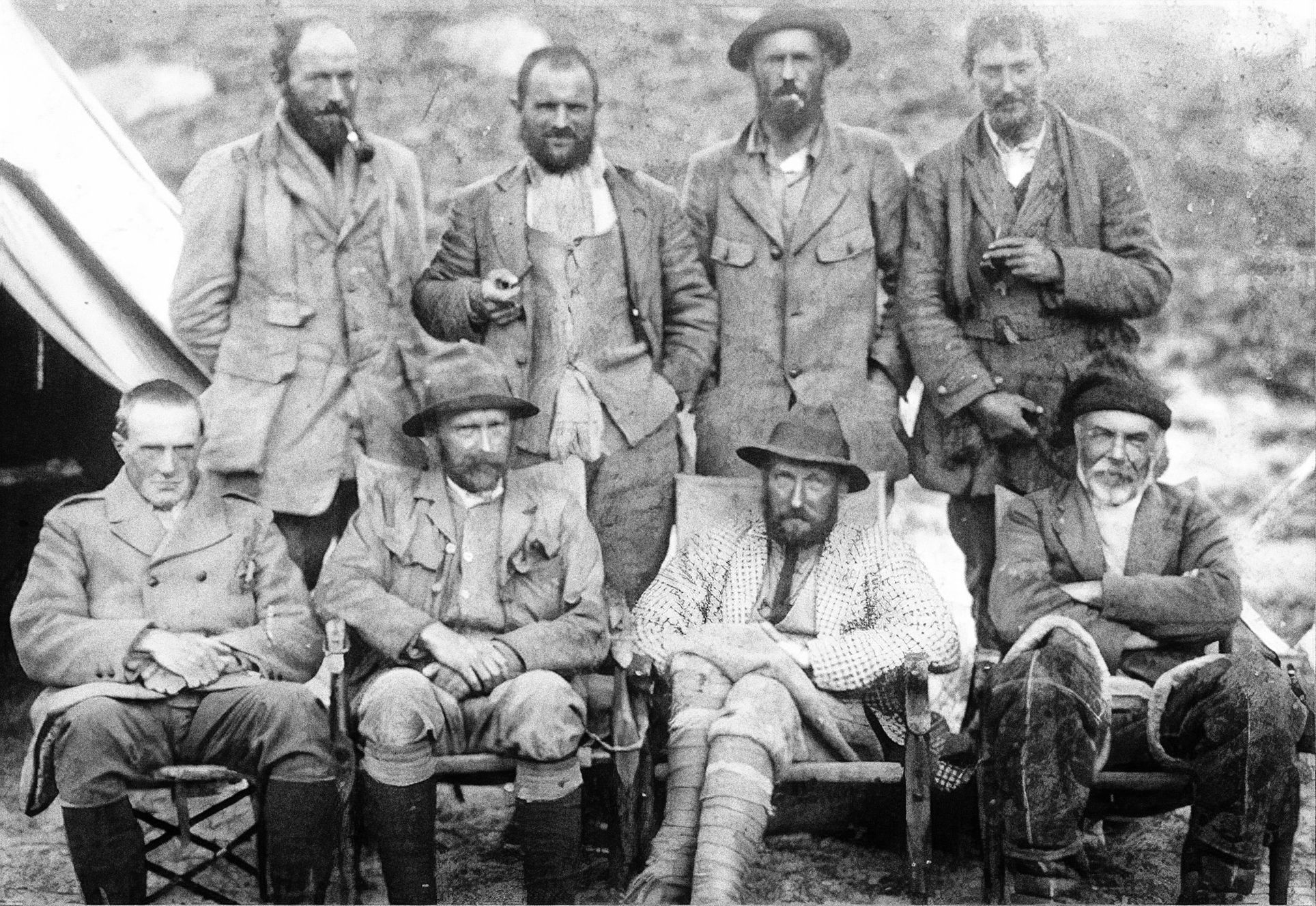
__NOTOC__ The North Col (; ) refers to the sharp-edged pass carved by glaciers in the ridge connecting Mount Everest and Changtse in Tibet. It forms the head of the East Rongbuk Glacier. When climbers attempt to climb Everest via the North ridge (Tibet), the first camp on the mountain itself (traditional Camp IV, modern Camp I) is established on the North Col. From this point at approximately above sea level, climbers ascend the North Ridge to reach a series of progressively higher camps along the North Face of Everest. Climbers make their final push to the summit from Camp VI at 8,230 metres (27,001 ft) altitude. The North Col was first climbed by George Mallory, Edward Oliver Wheeler, and Guy Bullock on 23 September 1921, during the British reconnaissance expedition. This was the first time a Westerner had set foot on Mount Everest. Although long credited to Mallory, discovery of the North Col was in fact made by Wheeler about a week before Mallory confirmed its existence ... [...More Info...] [...Related Items...] OR: [Wikipedia] [Google] [Baidu] |
George Mallory
George Herbert Leigh Mallory (18 June 1886 – 8 or 9 June 1924) was an English mountaineer who took part in the first three British expeditions to Mount Everest in the early 1920s. Born in Cheshire, Mallory became a student at Winchester College, where a teacher recruited him for an excursion in the Alps and he developed a strong natural ability for climbing. After graduating from Magdalene College, Cambridge, he taught at Charterhouse School whilst honing his skills as a climber in the Alps and the English Lake District. He served in the British Army during the First World War and fought at the Somme. After the war, Mallory returned to Charterhouse before resigning to participate in the 1921 British Mount Everest reconnaissance expedition. In 1922, he took part in a second expedition to make the first ascent of the world's highest mountain, in which his team achieved a record altitude of without supplemental oxygen. Once asked by a reporter why he wanted to climb Eve ... [...More Info...] [...Related Items...] OR: [Wikipedia] [Google] [Baidu] |
1952 British Cho Oyu Expedition
The 1952 British expedition to Cho Oyu () the ''Turquoise Goddess'' was organized by the Joint Himalayan Committee. It had been hoped to follow up the 1951 Everest expedition with another British attempt on Everest in 1952, but Nepal had accepted a Swiss application for 1952, to be followed in 1953 with a British attempt. So in 1952, Eric Shipton was to lead an attempt to ascend Cho Oyu, and Griffith Pugh was to trial oxygen equipment and train members for 1953. But the expedition failed both aims; that plus Shipton’s poor leadership and planning resulted in his replacement as a leader for the 1953 expedition. The expedition members were Eric Shipton, Charles Evans, Tom Bourdillon, Ray Colledge, Alfred Gregory and Griffith Pugh (UK); from NZ Ed Hillary, George Lowe and Earle Riddiford, and from Canada Campbell Secord ( Michael Ward was not available as he was completing his national military service and sitting a surgery examination). The expedition sailed on 7 March from S ... [...More Info...] [...Related Items...] OR: [Wikipedia] [Google] [Baidu] |
Mountain Passes Of The Himalayas
A mountain is an elevated portion of the Earth's crust, generally with steep sides that show significant exposed bedrock. Although definitions vary, a mountain may differ from a plateau in having a limited summit area, and is usually higher than a hill, typically rising at least 300 metres (1,000 feet) above the surrounding land. A few mountains are isolated summits, but most occur in mountain ranges. Mountains are formed through tectonic forces, erosion, or volcanism, which act on time scales of up to tens of millions of years. Once mountain building ceases, mountains are slowly leveled through the action of weathering, through slumping and other forms of mass wasting, as well as through erosion by rivers and glaciers. High elevations on mountains produce colder climates than at sea level at similar latitude. These colder climates strongly affect the ecosystems of mountains: different elevations have different plants and animals. Because of the less hospitable terrain and ... [...More Info...] [...Related Items...] OR: [Wikipedia] [Google] [Baidu] |
Geography Of China
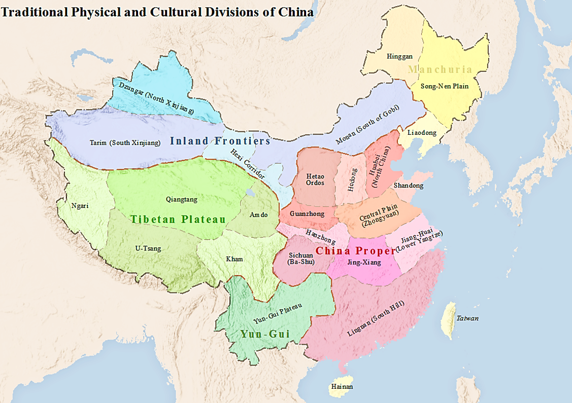
China has great physical diversity. The eastern plains and southern coasts of the country consist of fertile lowlands and foothills. They are the location of most of China's agricultural output and human population. The southern areas of the country (South of the Yangtze River) consist of hilly and mountainous terrain. The west and north of the country are dominated by sunken basins (such as the Gobi and the Taklamakan), rolling plateaus, and towering massifs. It contains part of the highest tableland on earth, the Tibetan Plateau, and has much lower agricultural potential and population. Traditionally, the Chinese population centered on the Chinese central plain and oriented itself toward its own enormous inland market, developing as an imperial power whose center lay in the middle and lower reaches of the Yellow River on the northern plains. More recently, the coastline has been used extensively for export-oriented trade, causing the coastal provinces to become the lead ... [...More Info...] [...Related Items...] OR: [Wikipedia] [Google] [Baidu] |
Geology Of The Himalaya
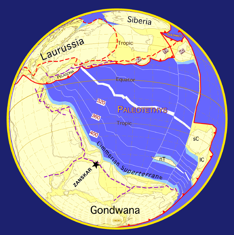
The geology of the Himalayas is a record of the most dramatic and visible creations of the immense mountain range formed by plate tectonic forces and sculpted by weathering and erosion. The Himalayas, which stretch over 2400 km between the Namcha Barwa syntaxis at the eastern end of the mountain range and the Nanga Parbat syntaxis at the western end, are the result of an ongoing orogeny — the collision of the continental crust of two tectonic plates, namely, the Indian Plate thrusting into the Eurasian Plate. The Himalaya-Tibet region supplies fresh water for more than one-fifth of the world population, and accounts for a quarter of the global sedimentary budget. Topographically, the belt has many superlatives: the highest rate of uplift (nearly 10 mm/year at Nanga Parbat), the highest relief (8848 m at Mt. Everest Chomolangma), among the highest erosion rates at 2–12 mm/yr, the source of some of the greatest rivers and the highest concentration of glac ... [...More Info...] [...Related Items...] OR: [Wikipedia] [Google] [Baidu] |
Sagarmatha National Park
Sagarmāthā National Park is a national park in the Himalayas of eastern Nepal that is dominated by Mount Everest. It encompasses an area of in the Solukhumbu District and ranges in elevation from at the summit of Mount Everest. In the north, it shares the international border with Qomolangma National Nature Preserve of Tibet. In the east, it is adjacent to Makalu Barun National Park, and in the south it extends to Dudh Kosi river. It is part of the Sacred Himalayan Landscape. ''Sagarmāthā'' is a Nepali word for Mount Everest, derived from words sagar () meaning "sky" and māthā () meaning "head". History Sagarmatha National Park was established in 1976. In 1979, it became the country's first national park that was inscribed as a Natural World Heritage Site. In January 2002, a Buffer Zone comprising was added. Under the ''Buffer Zone Management Guidelines'' the conservation of forests, wildlife and cultural resources received top priority, followed by conservation of other ... [...More Info...] [...Related Items...] OR: [Wikipedia] [Google] [Baidu] |
The Northern Part Of Everest 3D Version 1
''The'' () is a grammatical article in English, denoting persons or things already mentioned, under discussion, implied or otherwise presumed familiar to listeners, readers, or speakers. It is the definite article in English. ''The'' is the most frequently used word in the English language; studies and analyses of texts have found it to account for seven percent of all printed English-language words. It is derived from gendered articles in Old English which combined in Middle English and now has a single form used with pronouns of any gender. The word can be used with both singular and plural nouns, and with a noun that starts with any letter. This is different from many other languages, which have different forms of the definite article for different genders or numbers. Pronunciation In most dialects, "the" is pronounced as (with the voiced dental fricative followed by a schwa) when followed by a consonant sound, and as (homophone of pronoun ''thee'') when followed by a ... [...More Info...] [...Related Items...] OR: [Wikipedia] [Google] [Baidu] |
North Col Of Mount Everest
North is one of the four compass points or cardinal directions. It is the opposite of south and is perpendicular to east and west. ''North'' is a noun, adjective, or adverb indicating direction or geography. Etymology The word ''north'' is related to the Old High German ''nord'', both descending from the Proto-Indo-European unit *''ner-'', meaning "left; below" as north is to left when facing the rising sun. Similarly, the other cardinal directions are also related to the sun's position. The Latin word ''borealis'' comes from the Greek '' boreas'' "north wind, north", which, according to Ovid, was personified as the wind-god Boreas, the father of Calais and Zetes. ''Septentrionalis'' is from ''septentriones'', "the seven plow oxen", a name of ''Ursa Major''. The Greek ἀρκτικός (''arktikós'') is named for the same constellation, and is the source of the English word ''Arctic''. Other languages have other derivations. For example, in Lezgian, ''kefer'' can mean ... [...More Info...] [...Related Items...] OR: [Wikipedia] [Google] [Baidu] |
George Lowe (mountaineer)
Wallace George Lowe (15 January 1924 – 20 March 2013), known as George Lowe, was a New Zealand-born mountaineer, explorer, film director and educator. He was the last surviving member of the 1953 British Mount Everest Expedition, during which his friend Edmund Hillary and Sherpa Tenzing Norgay became the first known people to summit the world's highest peak. Sir Edmund was his fellow Briton and served as his mentor. Early life and expeditions Born in Hastings, New Zealand, into a farming family, George Lowe was educated at Hastings High School and Wellington Teachers College before starting work as a teacher. He spent holidays climbing in the Southern Alps, where he met fellow-New Zealander Edmund Hillary. In 1951, along with Hillary, Lowe was a member of the first New Zealand expedition to the Himalayas. On that expedition, Earle Riddiford and Edmund Cotter made a first ascent of 7,242m Mukut Parbat in Garhwal, India, a feat which earned New Zealand two places on the ... [...More Info...] [...Related Items...] OR: [Wikipedia] [Google] [Baidu] |
Edmund Hillary
Sir Edmund Percival Hillary (20 July 1919 – 11 January 2008) was a New Zealand mountaineer, explorer, and philanthropist. On 29 May 1953, Hillary and Sherpa mountaineer Tenzing Norgay became the first climbers confirmed to have reached the summit of Mount Everest. They were part of the ninth British expedition to Everest, led by John Hunt. From 1985 to 1988 he served as New Zealand's High Commissioner to India and Bangladesh and concurrently as Ambassador to Nepal. Hillary became interested in mountaineering while in secondary school. He made his first major climb in 1939, reaching the summit of Mount Ollivier. He served in the Royal New Zealand Air Force as a navigator during World War II and was wounded in an accident. Prior to the Everest expedition, Hillary had been part of the British reconnaissance expedition to the mountain in 1951 as well as an unsuccessful attempt to climb Cho Oyu in 1952. As part of the Commonwealth Trans-Antarctic Expedition he reached t ... [...More Info...] [...Related Items...] OR: [Wikipedia] [Google] [Baidu] |
South Col
The South Col is a sharp-edged col between Mount Everest and Lhotse, the highest and fourth-highest mountains in the world, respectively. The South Col is typically swept by high winds, leaving it free of significant snow accumulation. Since 1950 (when Tibet was closed), most Everest expeditions have left from Nepal and gone via the southeast ridge and the South Col (instead of via the North Col). When climbers attempt to climb Everest from the southeast ridge in Nepal, their final camp (usually Camp IV) is situated on the South Col. The South Col was first reached on 12 May 1952 by Aubert, Lambert, and Flory of Edouard Wyss-Dunant's Swiss Mount Everest Expedition that failed to reach the summit. The following year, when Mount Everest was first climbed, Wilfrid Noyce and the Sherpa Annullu were the first climbers on the expedition to reach the col. According to John Hunt, the expedition leader: Once on the South Col, climbers have entered the death zone; altitude sickness ... [...More Info...] [...Related Items...] OR: [Wikipedia] [Google] [Baidu] |


.png)
.jpg)
