|
North Carolina Highway 84
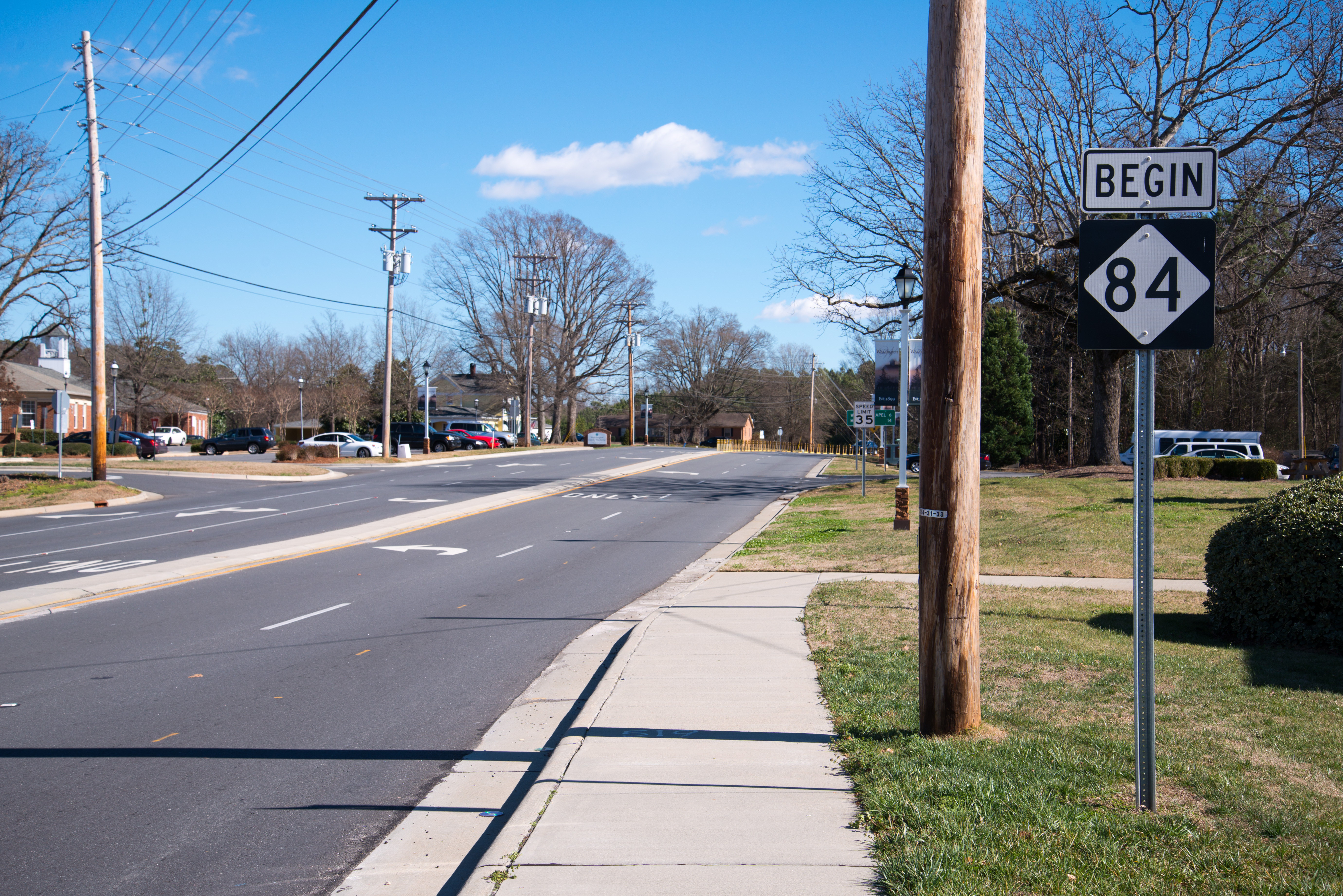
North Carolina Highway 84 (NC 84) is a primary state highway in the U.S. state of North Carolina. It serves to connect the town of Weddington, North Carolina, Weddington to the city of Monroe, North Carolina, Monroe. Route description NC 84 begins at an intersection with North Carolina Highway 16, NC 16 (Providence Road) in Weddington, carrying the name Weddington Road. It carries two undivided lanes of traffic eastward, with a speed limit before leaving town. Immediately after its western terminus is a roundabout with Weddington–Matthews, North Carolina, Matthews Road. The route also passes by Weddington's town hall. The route then enters wooded land, serving mostly homes along its route with a few open fields along the way. The route then passes through Wesley Chapel, North Carolina, Wesley Chapel, where it serves a shopping area (at the Waxhaw Indian Trail Road intersection) and passes between several residential subdivisions. As it nears Monroe, it conn ... [...More Info...] [...Related Items...] OR: [Wikipedia] [Google] [Baidu] |
Weddington, North Carolina
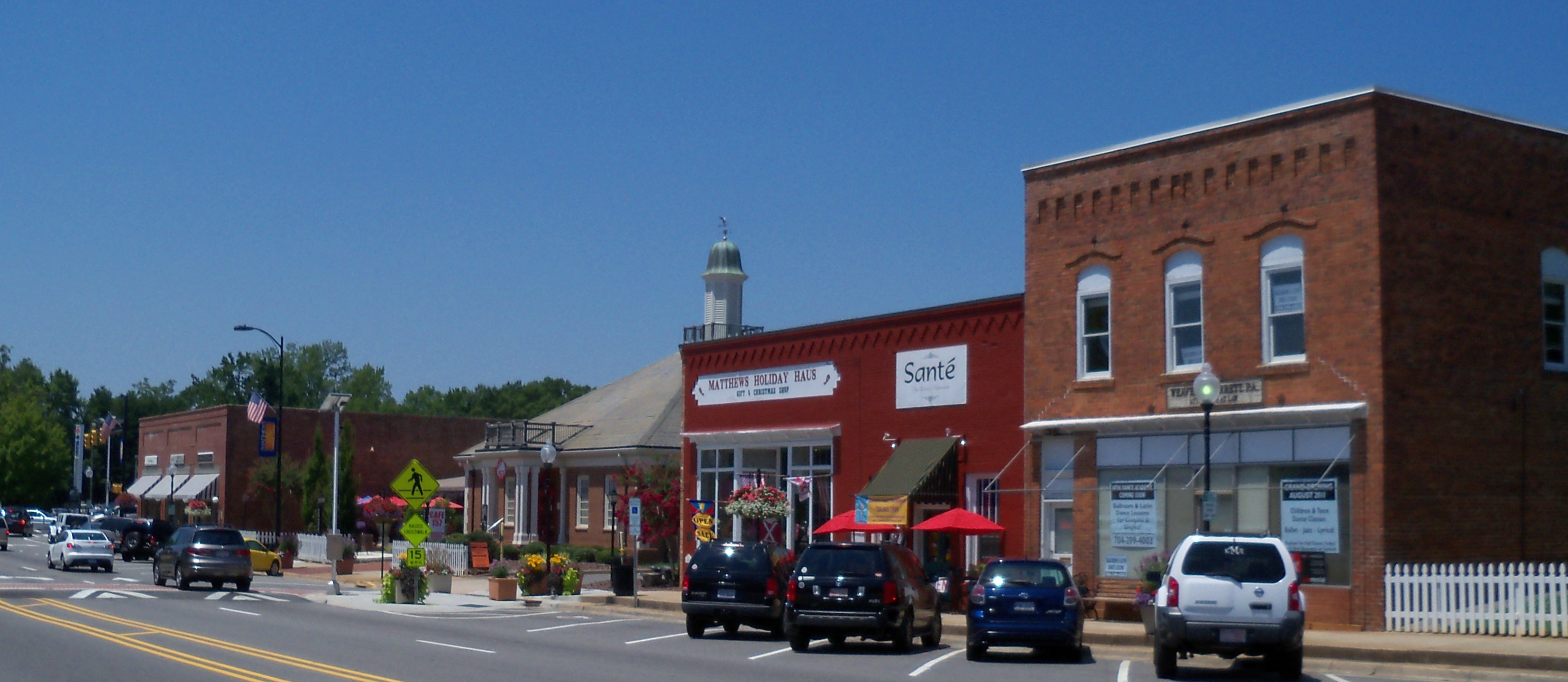
Weddington is a suburban town in Union County, North Carolina, Union County, North Carolina, United States. A small portion of the town extends into Mecklenburg County, North Carolina, Mecklenburg County. The population was 9,459 at the 2010 census. It is a suburb in the Charlotte metropolitan area. The current mayor of Weddington is Craig Horn. Geography Weddington is located at (35.022007, -80.731808). According to the United States Census Bureau, the town has a total area of 15.9 square miles (41.2 km), of which 15.8 square miles (40.9 km) is land and 0.1 square mile (0.3 km) (0.69%) is water. Demographics 2020 census As of the 2020 United States census, there were 13,181 people, 3,424 households, and 3,065 families residing in the town. 2010 census At the 2010 United States Census, 2010 census there were 9,459 people, 2,772 households, and 2,561 families in the town. The population density was 424.0 people per square mile (163.7/km). There ... [...More Info...] [...Related Items...] OR: [Wikipedia] [Google] [Baidu] |
Monroe, North Carolina
Monroe is a city in and the county seat of Union County, North Carolina, United States. The population increased from 32,797 in 2010 to 34,551 in 2020. It is within the rapidly growing Charlotte metropolitan area. Monroe has a council-manager form of government. History Monroe was founded as a planned settlement. In 1843, the first Board of County Commissioners, appointed by the General Assembly, selected an area in the center of the county as the county seat, and Monroe was incorporated that year. It was named for James Monroe, the country's fifth president. It became a trading center for the agricultural areas of the Piedmont region, which cultivated tobacco. Monroe was home to the Starlite Speedway in the 1960s to 1970s. On May 13, 1966, the 1/2 mile dirt track hosted NASCAR's 'Independent 250.' Darel Dieringer won the race. Since 1984, Ludwig drums and timpani have been manufactured in Monroe. As part of the developing Charlotte metropolitan area, in the 21st century, ... [...More Info...] [...Related Items...] OR: [Wikipedia] [Google] [Baidu] |
Union County, North Carolina
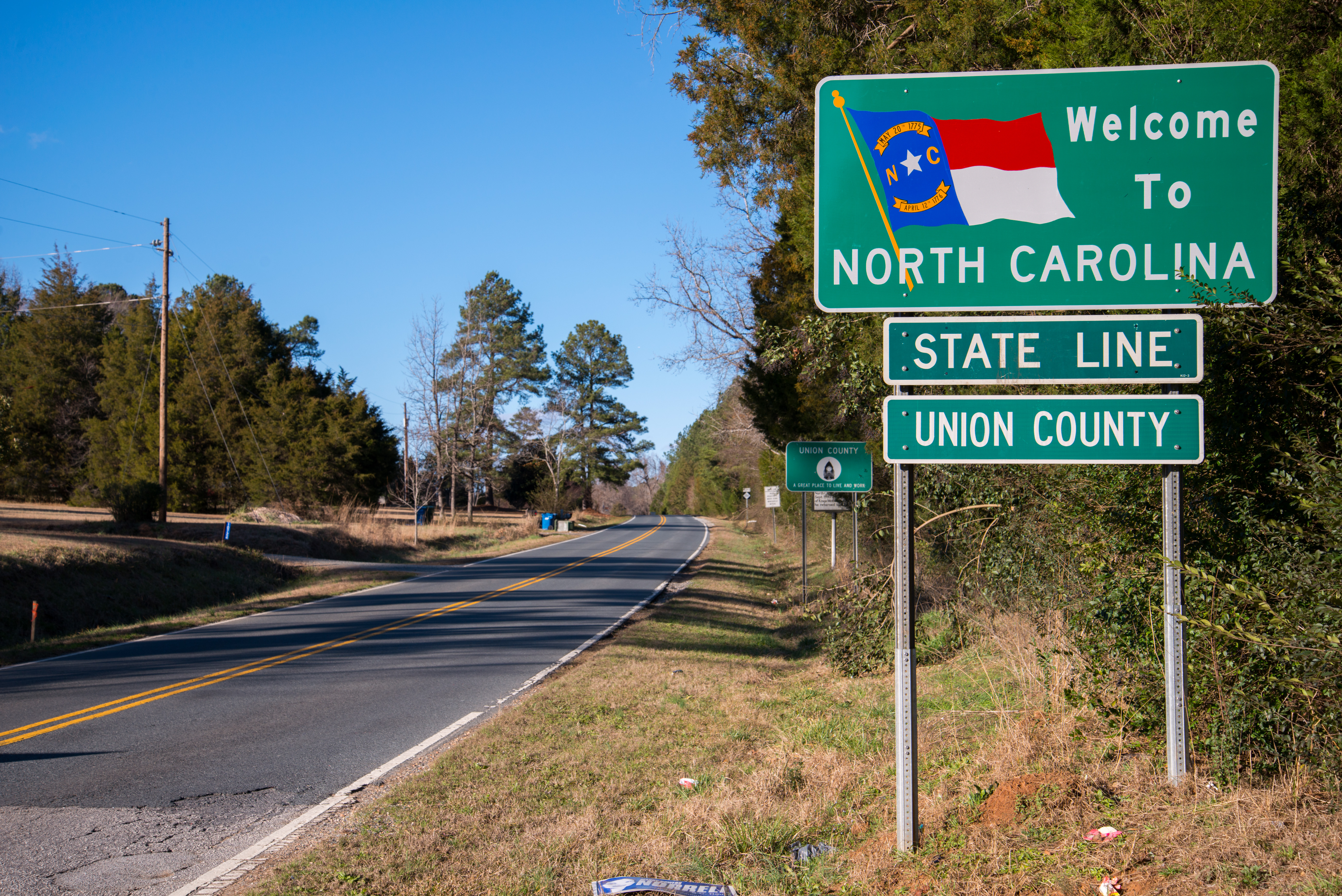
Union County is a county located in the U.S. state of North Carolina. As of the 2020 census, the population was 238,267. Its county seat is Monroe. Union County is included in the Charlotte- Concord- Gastonia, NC- SC Metropolitan Statistical Area. History The county was formed in 1842 from parts of Anson County and Mecklenburg County. Its name was a compromise between Whigs, who wanted to name the new county for Henry Clay, and Democrats, who wanted to name it for Andrew Jackson. The Helms, Starnes, McRorie, and Belk families were prominent in the town as well as Monroe and Charlotte. Most of these families came from Goose Creek Township. Monroe, the county seat of Union County, also became a focal point during the Civil Rights Movement. In 1958, local NAACP Chapter President Robert F. Williams defended a nine-year-old African-American boy who had been kissed by a white girl in an incident known as the Kissing Case. A second African-American boy, aged seven, was also co ... [...More Info...] [...Related Items...] OR: [Wikipedia] [Google] [Baidu] |
State Highway
A state highway, state road, or state route (and the equivalent provincial highway, provincial road, or provincial route) is usually a road that is either ''numbered'' or ''maintained'' by a sub-national state or province. A road numbered by a state or province falls below numbered national highways (Canada being a notable exception to this rule) in the hierarchy (route numbers are used to aid navigation, and may or may not indicate ownership or maintenance). Roads maintained by a state or province include both nationally numbered highways and un-numbered state highways. Depending on the state, "state highway" may be used for one meaning and "state road" or "state route" for the other. In some countries such as New Zealand, the word "state" is used in its sense of a sovereign state or country. By this meaning a state highway is a road maintained and numbered by the national government rather than local authorities. Countries Australia Australia's State Route system covers u ... [...More Info...] [...Related Items...] OR: [Wikipedia] [Google] [Baidu] |
North Carolina
North Carolina () is a state in the Southeastern region of the United States. The state is the 28th largest and 9th-most populous of the United States. It is bordered by Virginia to the north, the Atlantic Ocean to the east, Georgia and South Carolina to the south, and Tennessee to the west. In the 2020 census, the state had a population of 10,439,388. Raleigh is the state's capital and Charlotte is its largest city. The Charlotte metropolitan area, with a population of 2,595,027 in 2020, is the most-populous metropolitan area in North Carolina, the 21st-most populous in the United States, and the largest banking center in the nation after New York City. The Raleigh-Durham-Cary combined statistical area is the second-largest metropolitan area in the state and 32nd-most populous in the United States, with a population of 2,043,867 in 2020, and is home to the largest research park in the United States, Research Triangle Park. The earliest evidence of human occupation i ... [...More Info...] [...Related Items...] OR: [Wikipedia] [Google] [Baidu] |
Weddington NC 84 Begin ''
{{disambig ...
Weddington may refer to: Individuals * Sarah Weddington (19452021), attorney in the ''Roe vs. Wade'' abortion case, former member of the Texas House of Representatives from Austin * Susan Weddington, state chairman of the Republican Party of Texas from 1997 to 2003 * W. Carlton Weddington (born 1970), a former Ohio state legislator convicted of bribery in 2012 Places * Weddington, Arkansas, United States * Weddington, Kent, a location in England * Weddington, North Carolina, United States * Weddington, Warwickshire, an area of Nuneaton, Warwickshire, England, United Kingdom Music * "Weddington Street", a song by Frank Gambale from his 1985 album ''Brave New Guitar ''Brave New Guitar'' is the first studio album by jazz guitarist Frank Gambale, released in 1985 through Legato Records. Track listing Personnel Credits adapted from CD edition liner notes: *Frank Gambale – guitar, vocals, producer *Jon Cro ... [...More Info...] [...Related Items...] OR: [Wikipedia] [Google] [Baidu] |
North Carolina Highway 16
North Carolina Highway 16 (NC 16) is a 143.8-mile (231.4 km) primary state highway in the U.S. state of North Carolina. Traveling in a north–south direction, it connects the cities and towns of Charlotte, Newton, Conover, Taylorsville, Wilkesboro and Jefferson, linking the Charlotte metropolitan area with the mountainous High Country. NC 16 is part of a three-state route 16 that connects the Charlotte region with northwestern West Virginia. Route description NC 16 is part of a three-state highway 16, that totals , from Waxhaw, North Carolina to St. Marys, West Virginia. NC 16 begins as a two-lane road in Waxhaw, from its intersection with NC 75 (Main Street), it travels north along Broome Street to Weddington, where it widens to four-lane and becomes Providence Road. After crossing the Union-Mecklenburg county line, it enters Charlotte's city limit. Along Providence Road, NC 16 connects with I-485 (exit 57) and NC 51 (P ... [...More Info...] [...Related Items...] OR: [Wikipedia] [Google] [Baidu] |
Roundabout
A roundabout is a type of circular intersection or junction in which road traffic is permitted to flow in one direction around a central island, and priority is typically given to traffic already in the junction.''The New Shorter Oxford English Dictionary,'' Volume 2, Clarendon Press, Oxford (1993), page 2632 Engineers use the term modern roundabout to refer to junctions installed after 1960 that incorporate various design rules to increase safety. Both modern and non-modern roundabouts, however, may bear street names or be identified colloquially by local names such as rotary or traffic circle. Compared to stop signs, traffic signals, and earlier forms of roundabouts, modern roundabouts reduce the likelihood and severity of collisions greatly by reducing traffic speeds and minimizing T-bone and head-on collisions. Variations on the basic concept include integration with tram or train lines, two-way flow, higher speeds and many others. For pedestrians, traffic exiting the ... [...More Info...] [...Related Items...] OR: [Wikipedia] [Google] [Baidu] |
Matthews, North Carolina
Matthews is a town in southeastern Mecklenburg County, North Carolina, United States. It is a suburb of Charlotte. The population was 27,198 according to the 2010 Census. History In the early 19th century, the new settlement that would become Matthews was unofficially named Stumptown for the copious amount of tree stumps left from making way for cotton farms. The community's name later changed to Fullwood, named after appointed area postmaster John Miles Fullwood. The establishment of a sawmill and the cotton and timber industry helped Fullwood change into a town. Prior to the first train arriving on December 15, 1874, Fullwood acted as a stagecoach stop between Charlotte and Monroe. The town was incorporated into a municipal corporation in 1879, and was renamed Matthews in honor of Edward Matthews, who was director of the Central Carolina Railroad, which would later become known as the Seaboard Air Line Railroad. Geography Matthews is located at (35.116851, −80.7164 ... [...More Info...] [...Related Items...] OR: [Wikipedia] [Google] [Baidu] |
Wesley Chapel, North Carolina
Wesley Chapel is a village in Union County, North Carolina, United States. The population was 8,681 at the 2020 census and was estimated to be 8,883 in 2021. Geography Wesley Chapel is located in the townships of Monroe and Sandy Ridge in eastern Union County, North Carolina. Part of the Charlotte metropolitan area, it sits east of Weddington, north of Waxhaw, west of Monroe, and south of Indian Trail. According to the United States Census Bureau, the village has a total area of 9.8 square miles (25.39 sq km). It has a population density of 787.4 people per square mile. The majority of the village's area is land, aside from Price Mill Creek and some small residential ponds. NC-84 passes through the village as Weddington Road. The village's main attractions are its central business district, known as Wesley Chapel Village Commons, and Dogwood Park. History The village of Wesley Chapel's existence can be traced back to the establishment of Wesley Chapel United Methodis ... [...More Info...] [...Related Items...] OR: [Wikipedia] [Google] [Baidu] |
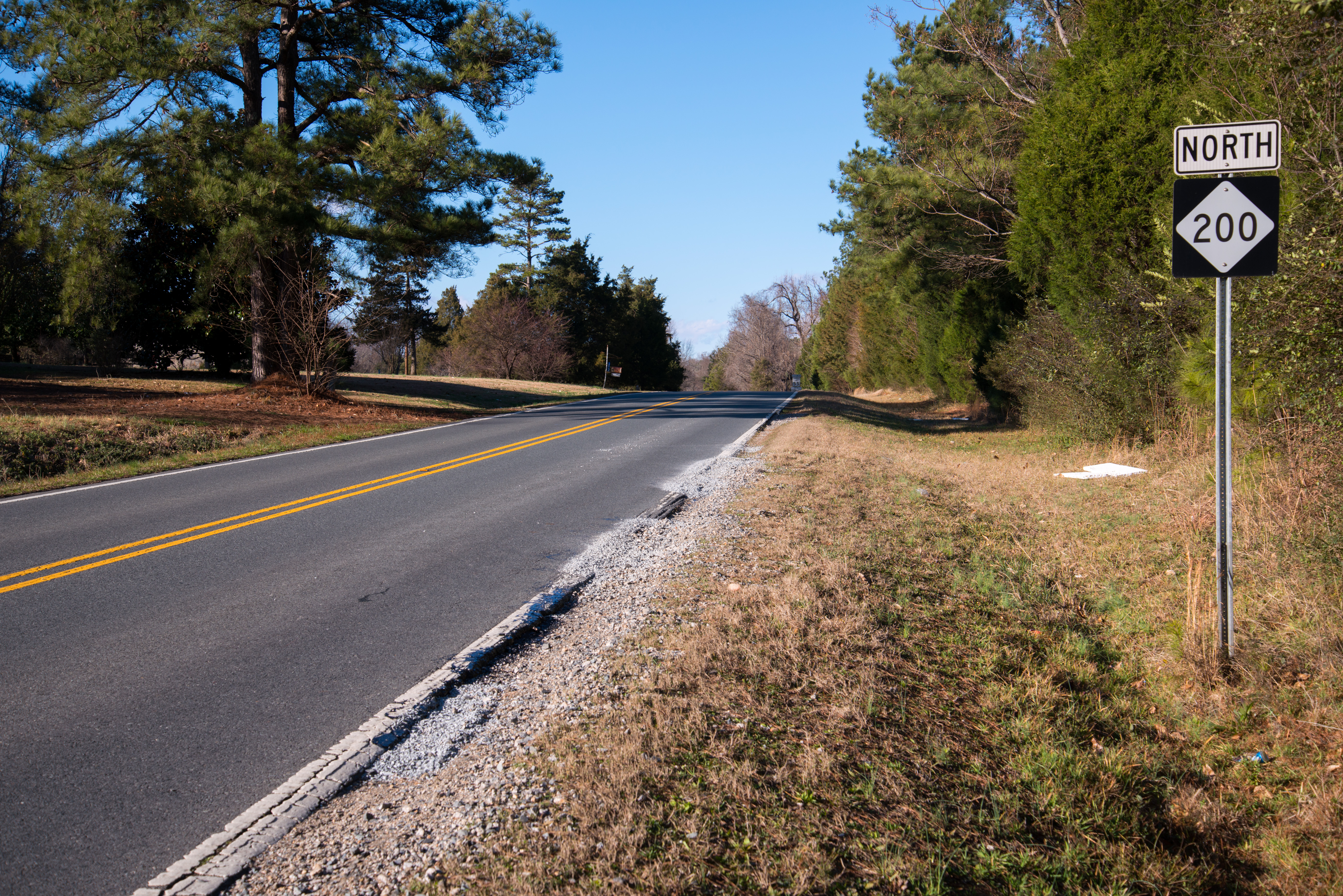
North Carolina Highway 200
North Carolina Highway 200 (NC 200) is a primary state highway in the U.S. state of North Carolina. The highway runs north–south from the South Carolina state line near the community of JAARS, to US 601 near Concord. Route description NC 200 traverses , starting at the South Carolina state line, through the city of Monroe, and the towns of Stanfield and Locust, before ending at US 601 near Concord. For its length, it is a two-lane rural highway except in Monroe where it is a four-lane road from Charlotte Avenue to US 74 and a six-lane divided highway on its concurrency with US 74 and US 601. History Established in 1930, it traveled from Monroe at US 74/ NC 20/ NC 25/ NC 151 south to the South Carolina state line where it changed into SC 93 (renumbered to SC 200 in 1937). Between 1931-36, NC 200 was realigned north of Old Highway Road near Jackson. In 1936, the highway was extended north via Fran ... [...More Info...] [...Related Items...] OR: [Wikipedia] [Google] [Baidu] |
North Carolina Highway 262
North Carolina Highway 16 (NC 16) is a 143.8-mile (231.4 km) primary state highway in the U.S. state of North Carolina. Traveling in a north–south direction, it connects the cities and towns of Charlotte, Newton, Conover, Taylorsville, Wilkesboro and Jefferson, linking the Charlotte metropolitan area with the mountainous High Country. NC 16 is part of a three-state route 16 that connects the Charlotte region with northwestern West Virginia. Route description NC 16 is part of a three-state highway 16, that totals , from Waxhaw, North Carolina to St. Marys, West Virginia. NC 16 begins as a two-lane road in Waxhaw, from its intersection with NC 75 (Main Street), it travels north along Broome Street to Weddington, where it widens to four-lane and becomes Providence Road. After crossing the Union-Mecklenburg county line, it enters Charlotte's city limit. Along Providence Road, NC 16 connects with I-485 (exit 57) and NC 51 (Pin ... [...More Info...] [...Related Items...] OR: [Wikipedia] [Google] [Baidu] |
