|
North Barrier
North Barrier is a narrow rock ridge which descends northward from Campbell Peak to Mount Separation, and then along the northwest flank of Compton Glacier in northern Heard Island. The descriptive name was applied by ANARE (Australian National Antarctic Research Expeditions The Australian National Antarctic Research Expeditions (ANARE ) is the historical name for the Australian Antarctic Program (AAp) administered for Australia by the Australian Antarctic Division (AAD). History Australia has had a long involv ...) in 1948. Ridges of Antarctica {{Subantarctic-geo-stub ... [...More Info...] [...Related Items...] OR: [Wikipedia] [Google] [Baidu] |
Campbell Peak
Campbell Peak () is a peak, high, standing northeast of Mawson Peak, the summit of Heard Island. It was surveyed in 1948 by the Australian National Antarctic Research Expeditions (ANARE), who named it for Group-Captain Stuart A. Campbell, Royal Australian Air Force. Campbell visited Heard Island in 1929 as aircraft pilot with the British Australian and New Zealand Antarctic Research Expedition led by Douglas Mawson Sir Douglas Mawson OBE FRS FAA (5 May 1882 – 14 October 1958) was an Australian geologist, Antarctic explorer, and academic. Along with Roald Amundsen, Robert Falcon Scott, and Sir Ernest Shackleton, he was a key expedition leader during ..., and again as leader of ANARE when a research station was established on the island in December 1947. References Mountains of Heard Island and McDonald Islands {{Subantarctic-geo-stub ... [...More Info...] [...Related Items...] OR: [Wikipedia] [Google] [Baidu] |
Mount Separation
Mount Separation () is a rocky peak, 1,480 m, standing 1 nautical mile (1.9 km) northeast of Campbell Peak on the northeast flank of Big Ben, the dominating mountain on Heard Island. Surveyed in 1948 by the ANARE (Australian National Antarctic Research Expeditions The Australian National Antarctic Research Expeditions (ANARE ) is the historical name for the Australian Antarctic Program (AAp) administered for Australia by the Australian Antarctic Division (AAD). History Australia has had a long involv ...) and probably so named by them because this feature lies somewhat apart from the main cluster of peaks near the summit of Big Ben. Mountains of Heard Island and McDonald Islands {{Subantarctic-geo-stub ... [...More Info...] [...Related Items...] OR: [Wikipedia] [Google] [Baidu] |
Compton Glacier
Compton Glacier is a glacier, long, flowing northeast from the lower slopes of the Big Ben massif to the northeast side of Heard Island in the southern Indian Ocean. Its terminus is located at Compton Lagoon, between Gilchrist Beach and Fairchild Beach. To the northwest of Compton Glacier is Ealey Glacier, whose terminus is located close southeast of Cape Bidlingmaier. To the southeast of Compton Glacier is Brown Glacier, whose terminus is located at Brown Lagoon. Round Hill separates Compton Glacier from Brown Glacier. Since the ANARE survey of 1947/48, the glacier has retreated significantly, exposing much more of Compton Lagoon. Evidence for significant loss was recorded as early as 1963, with an expedition describing the glacier as no longer smooth, but crevassed. By the late 1970s it had retreated 1.6 km and by the time of a 1987 survey, it was 2.5 km inland from its 1947 front. Discovery and naming The lower reaches of this glacier were charted and named ... [...More Info...] [...Related Items...] OR: [Wikipedia] [Google] [Baidu] |
Heard Island
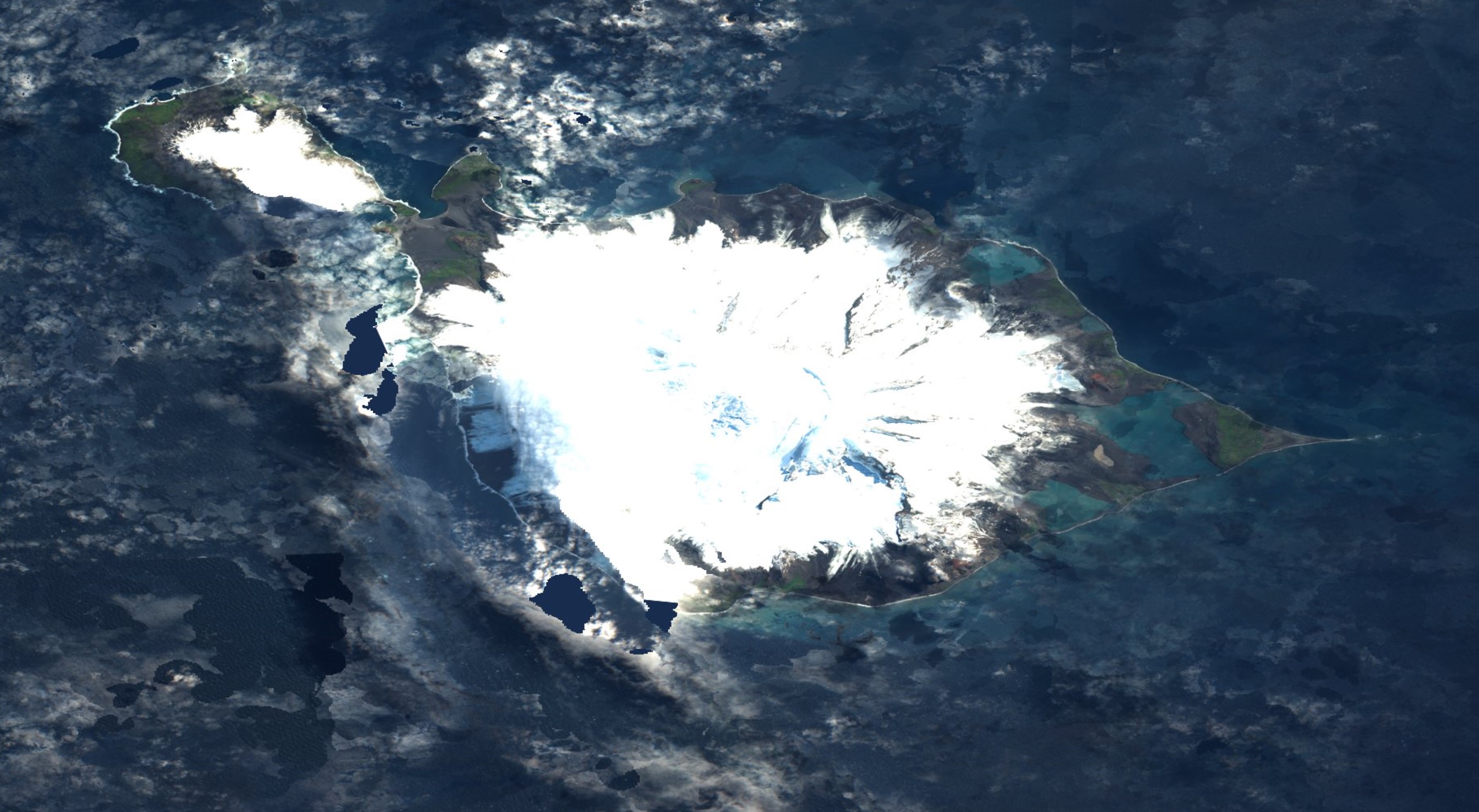
The Territory of Heard Island and McDonald Islands (HIMI) is an Australian external territory comprising a volcanic group of mostly barren Antarctic islands, about two-thirds of the way from Madagascar to Antarctica. The group's overall size is in area and it has of coastline. Discovered in the mid-19th century, the islands lie on the Kerguelen Plateau in the Indian Ocean and have been an Australian territory since 1947. They contain Australia's only two active volcanoes. The summit of one, Mawson Peak, is higher than any mountain in all other Australian states or territories, except Dome Argus, Mount McClintock and Mount Menzies in the Australian Antarctic Territory. The islands are among the most remote places on Earth: They are located about southwest of Perth, southwest of Cape Leeuwin, Australia, southeast of South Africa, southeast of Madagascar, north of Antarctica, and southeast of the Kerguelen Islands (part of French Southern and Antarctic Lands). The isla ... [...More Info...] [...Related Items...] OR: [Wikipedia] [Google] [Baidu] |
Australian National Antarctic Research Expeditions
The Australian National Antarctic Research Expeditions (ANARE ) is the historical name for the Australian Antarctic Program (AAp) administered for Australia by the Australian Antarctic Division (AAD). History Australia has had a long involvement in south polar regions since as early as Douglas Mawson's Australasian Antarctic Expedition in 1911. Further Australian exploration of the Antarctic continent was conducted during the British Australian and New Zealand Antarctic Research Expedition (BANZARE), which was conducted over the years 1929–1931. The Australian National Antarctic Research Expeditions were established in 1947 with expeditions to Macquarie Island and Heard Island. In 1948 the Australian Antarctic Division (AAD) was established to administer the expedition program. ANARE Name The name ANARE fell out of official use in the early 2000s. However current and former Australian Antarctic expeditioners continue to use the term informally as a means of identifica ... [...More Info...] [...Related Items...] OR: [Wikipedia] [Google] [Baidu] |


.jpg)