|
Nordperd
The Nordperd ''(Perd = Slavic for protrusion or prominence)'' is a cape on the German Baltic Sea island of Rügen. It is part of the Southeast Rügen Biosphere Reserve and the Mönchgut Nature Reserve. The cape forms the eastern point of the island of Rügen and the district of Vorpommern-Rügen. The roughly long headland has the shape of an isosceles triangle, which ends in a roughly high wooded cliff at its tip. The Nordperd has been protected by coastal defence measures and is thus relatively unaffected by the normal active processes of a graded shoreline. The Nordperd section of the Mönchgut Nature Reserve has an area of . Its terrain typically consists of dry grasslands, sycamore-ash woods on the cliff slopes and beaches and shallow waterbodies. The northern section of beach, with a spa promenade at the Baltic Sea coastal resort Göhren, is separated by Cape Nordperd from the beach at Göhren running southwards. Between Göhren Pier and the Nordperd lies the Buskam, ... [...More Info...] [...Related Items...] OR: [Wikipedia] [Google] [Baidu] |
Göhren, Rügen
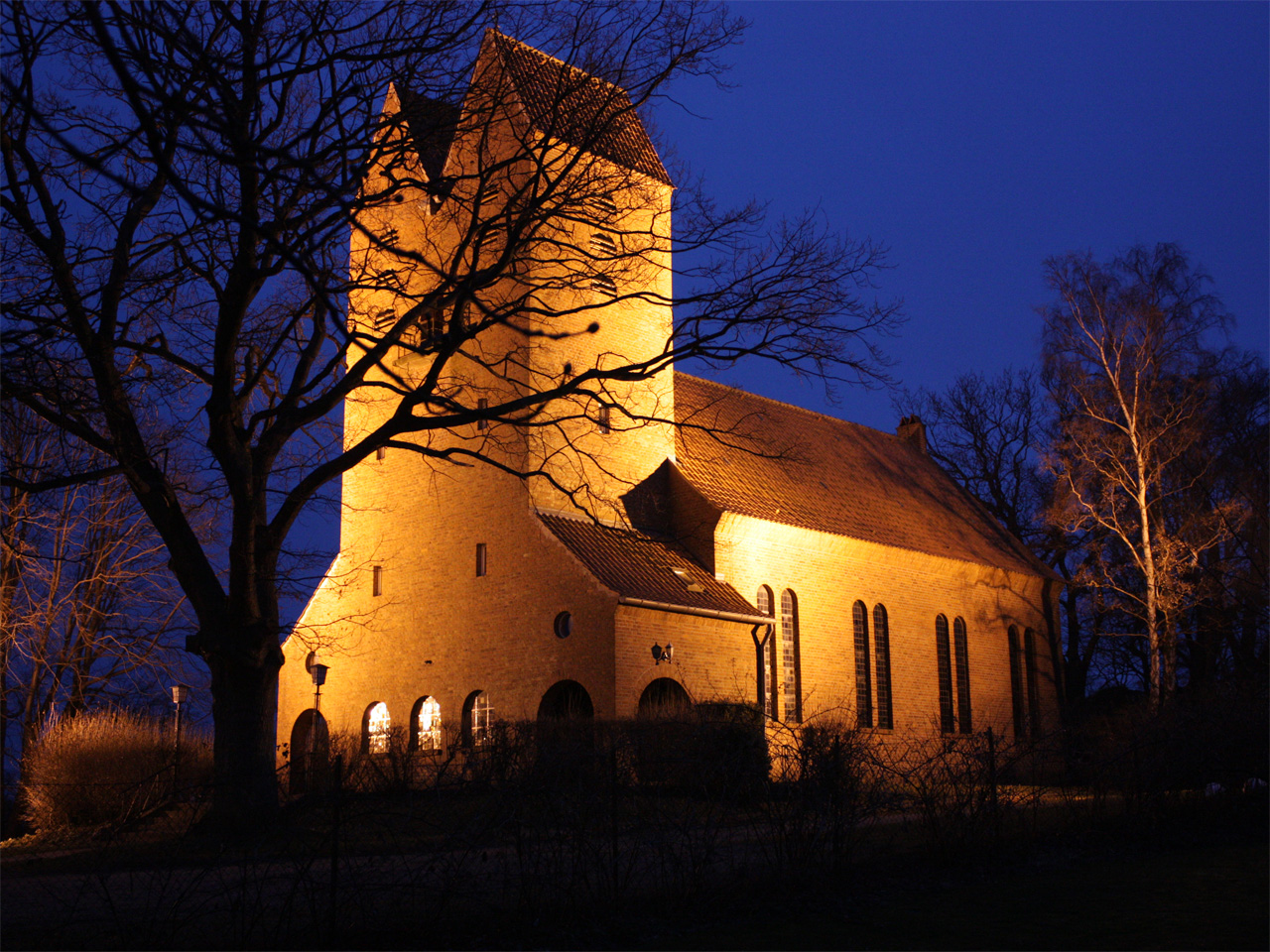
Göhren is a municipality in the Vorpommern-Rügen district, in Mecklenburg-Vorpommern, Germany. Geography The municipality of Göhren adjoins the easternmost point of the island of Rugen: Cape Nordperd. It separates the North Beach (''Nordstrand'') from the South Beach (''Südstrand''). The North Beach is the actual bathing beach with a seaside promenade. Between Göhren Pier and the Nordperd lies the Buskam, the largest glacial erratic boulder in North Germany, which rises one metre about the sea. Sights * Göhren Pier was rebuilt in the 1990s. It is 270 metres long. * Speckbusch Barrow (''Hügelgrab Speckbusch'') is next to Göhren church and dates to the Bronze Age. * The ''Mönchguter Museums'' are four museums that are protected and, together, form an open-air museum. There is a local history museum, the motor yacht ''Luise'', the museum farm (since 1973), and a thatched fisherman's house, the ''Rookhuus''. * The ''Drachenhaus'' was the last home and workshop o ... [...More Info...] [...Related Items...] OR: [Wikipedia] [Google] [Baidu] |
Rügen
Rügen (; la, Rugia, ) is Germany's largest island. It is located off the Pomeranian coast in the Baltic Sea and belongs to the state of Mecklenburg-Western Pomerania. The "gateway" to Rügen island is the Hanseatic city of Stralsund, where it is linked to the mainland by road and railway via the Rügen Bridge and Causeway, two routes crossing the two-kilometre-wide Strelasund, a sound of the Baltic Sea. Rügen has a maximum length of (from north to south), a maximum width of in the south and an area of . The coast is characterized by numerous sandy beaches, lagoons () and open bays (), as well as projecting peninsulas and headlands. In June 2011, UNESCO awarded the status of a World Heritage Site to the Jasmund National Park, famous for its vast stands of beeches and chalk cliffs like King's Chair, the main landmark of Rügen island. The island of Rügen is part of the district of Vorpommern-Rügen, with its county seat in Stralsund. The towns on Rügen are: Bergen, S ... [...More Info...] [...Related Items...] OR: [Wikipedia] [Google] [Baidu] |
Southeast Rügen Biosphere Reserve
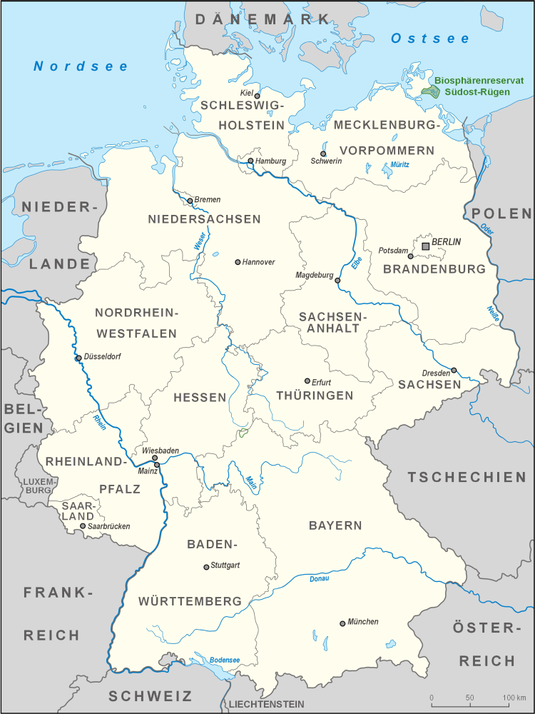
The Southeast Rügen Biosphere Reserve (german: Biosphärenreservat Südost-Rügen) is a biosphere reserve in the German state of Mecklenburg-Vorpommern, which covers the southeastern part of the island of Rügen (including Granitz and Mönchgut), the lagoon of Rügischer Bodden between Putbus and Thiessow, the outer coast between Thiessow and Binz and the island of Vilm. In the biosphere reserve all the classic landscape and coastal features of the Mecklenburg-Vorpommern littoral are found within one small area. The land is deeply indented here by the sea. One the one hand, peninsulas and coastal headlands are linked by narrow strips of land, on the other side they are separated by lagoons known as ''boddens'' and open bays called ''Wieken'' locally. There are fine-sanded beaches and rugged cliffed coastlines, at the foot of which are impressive rocky beaches. Broad belts of reed girdle the shores. Beech woods or poor grasslands are found on the sites of terminal moraines and ... [...More Info...] [...Related Items...] OR: [Wikipedia] [Google] [Baidu] |
Göhren Pier
Göhren Pier (german: Seebrücke Göhren) is a pier in the Baltic seaside resort of Göhren (Rügen), Göhren on the German island of Rügen. The pier is 350 metres long, of which 270 metres projects into the Baltic Sea. The structure was built in 1993. Access is through a traditional, white-painted and green roofed pier house (''Brückenhaus'') onto the pier with its wooden decking. Cruise vessels dock at the landing stage at the end of the pier. In 1898, a 1,002 metre long pier was built on Göhren's south beach. This was demolished during the First World War. On Göhren's north beach a 500 metre long pier had been erected; this was still being used in the early 1950s. External links Information about the bridge on the resort administration's page Buildings and structures in Vorpommern-Rügen Göhren, Rügen Piers in Germany Mönchgut {{rügen-geo-stub ... [...More Info...] [...Related Items...] OR: [Wikipedia] [Google] [Baidu] |
Geography Of Rügen
Geography (from Greek: , ''geographia''. Combination of Greek words ‘Geo’ (The Earth) and ‘Graphien’ (to describe), literally "earth description") is a field of science devoted to the study of the lands, features, inhabitants, and phenomena of Earth. The first recorded use of the word γεωγραφία was as a title of a book by Greek scholar Eratosthenes (276–194 BC). Geography is an all-encompassing discipline that seeks an understanding of Earth and its human and natural complexities—not merely where objects are, but also how they have changed and come to be. While geography is specific to Earth, many concepts can be applied more broadly to other celestial bodies in the field of planetary science. One such concept, the first law of geography, proposed by Waldo Tobler, is "everything is related to everything else, but near things are more related than distant things." Geography has been called "the world discipline" and "the bridge between the human and ... [...More Info...] [...Related Items...] OR: [Wikipedia] [Google] [Baidu] |
Headlands Of Germany
A headland, also known as a head, is a coastal landform, a point of land usually high and often with a sheer drop, that extends into a body of water. It is a type of promontory. A headland of considerable size often is called a cape.Whittow, John (1984). ''Dictionary of Physical Geography''. London: Penguin, 1984, pp. 80, 246. . Headlands are characterised by high, breaking waves, rocky shores, intense erosion, and steep sea cliff. Headlands and bays are often found on the same coastline. A bay is flanked by land on three sides, whereas a headland is flanked by water on three sides. Headlands and bays form on discordant coastlines, where bands of rock of alternating resistance run perpendicular to the coast. Bays form when weak (less resistant) rocks (such as sands and clays) are eroded, leaving bands of stronger (more resistant) rocks (such as chalk, limestone, and granite) forming a headland, or peninsula. Through the deposition of sediment within the bay and the erosion of th ... [...More Info...] [...Related Items...] OR: [Wikipedia] [Google] [Baidu] |
Mönchgut
Mönchgut (''Monk's Estates'' in German) is a peninsula of 29.44 square kilometers with 6600 inhabitants in the southeast of Rügen island in Mecklenburg-Western Pomerania, Germany. It lies just between the Greifswalder Bodden and the rest of the Baltic Sea. Mönchgut contains the districts of Göhren and Thiessow; the peninsula is part of the Mönchgut-Granitz administration area. It is also a part of the Biosphere Reserve of Südost-Rügen. The name translates as ''the monks' estates''. In 1252, Jaromar II, Prince of Rügen sold the area to the Cistercian monks of Eldena Abbey, which was founded by one of his predecessors, Jaromar I, Prince of Rügen in 1199 and by that time also belonged to the Danish Principality of Rügen. To separate the monks' possessions from the rest of the island, a ditch was dug between Baabe and Sellin, known as ''Mönchsgraben'' ("monks' ditch"). Today, a large wooden gate built upon the bridge over the ''Mönchsgraben'' marks the entrance to the ... [...More Info...] [...Related Items...] OR: [Wikipedia] [Google] [Baidu] |
Thiessow
Thiessow is a village and a former municipality in the Vorpommern-Rügen district, in Mecklenburg-Vorpommern, Germany. Since January 2018, it is part of the new municipality Mönchgut Mönchgut (''Monk's Estates'' in German) is a peninsula of 29.44 square kilometers with 6600 inhabitants in the southeast of Rügen island in Mecklenburg-Western Pomerania, Germany. It lies just between the Greifswalder Bodden and the rest of .... Besides Thiessow, the municipality included the village Klein Zicker. References External links Official website of Thiessow (German) Towns and villages on Rügen Mönchgut [...More Info...] [...Related Items...] OR: [Wikipedia] [Google] [Baidu] |
Glacial Erratic
A glacial erratic is glacially deposited rock differing from the type of rock native to the area in which it rests. Erratics, which take their name from the Latin word ' ("to wander"), are carried by glacial ice, often over distances of hundreds of kilometres. Erratics can range in size from pebbles to large boulders such as Big Rock () in Alberta. Geologists identify erratics by studying the rocks surrounding the position of the erratic and the composition of the erratic itself. Erratics are significant because: *They can be transported by glaciers, and they are thereby one of a series of indicators which mark the path of prehistoric glacier movement. Their lithographic origin can be traced to the parent bedrock, allowing for confirmation of the ice flow route. *They can be transported by ice rafting. This allows quantification of the extent of glacial flooding resulting from ice dam failure which release the waters stored in proglacial lakes such as Lake Missoula. Erratics ... [...More Info...] [...Related Items...] OR: [Wikipedia] [Google] [Baidu] |
Buskam
The Buskam, also Buhskam or Buskamen is a large glacial erratic boulder, 325 metres off the coast of Göhren, Rügen, northern Germany.Ingrid Schmidt: ''Hünengrab und Opferstein'', Hinstorff, Rostock 2001, p.42, Erratics (german: Findlinge) have been scattered all over northern Germany by the glaciers of the Ice Age, but are usually much smaller. The Buskam has a volume of about 600 m3, a circumference of about 40 metres, and weights about 1,600 tons. A third of it (206 m3) lies above the water surface. Cavities in the rock indicate that the Buskam was used as a ritual place in prehistory, when such caved rocks were commonly used for ritual sacrifice. An iron crucifix was attached to it after the conversion of Pomerania. According to local legends, the Buskam is the site where witches dance during Walpurgis Night, mermaids are also supposed to dance often on the rock. See also *Glacial erratics on and around Rügen *Early history of Pomerania After the glac ... [...More Info...] [...Related Items...] OR: [Wikipedia] [Google] [Baidu] |
Göhren (Rügen)
Göhren may refer to the following places: ;Germany * Göhren (Tramm), a village in the municipality Tramm in the district Ludwigslust-Parchim, Mecklenburg-Vorpommern * Göhren, Rügen, a municipality in the district Vorpommern-Rügen, Mecklenburg-Vorpommern * Göhren, Thuringia, a municipality in the district Altenburger Land, Thuringia ;Czech Republic * Klíny, a village in Most District ;See also * , a Kriegsmarine coastal tanker {{geodis ... [...More Info...] [...Related Items...] OR: [Wikipedia] [Google] [Baidu] |


