|
Nor Yungas Province
Nor Yungas is a province in the Yungas area of the Bolivian department of La Paz. During the presidency of José Manuel Pando the Yungas Province was divided into two parts, the Nor Yungas and the Sud Yungas Province, by law of January 12, 1899. Its administrative seat is the town of Coroico. Subdivision The province is divided into two municipalities. Places of interest * Cotapata National Park and Integrated Management Natural Area Cotapata National Park and Integrated Management Natural Area (''Parque Nacional y Área Natural de Manejo Integrado Cotapata'') is a protected area in the Yungas of La Paz Department, Bolivia. It is situated in the northwest of the department, ... See also * Kimsa Warmini * P'iqi Q'ara * P'iqi Q'ara (in Coroico) References Provinces of La Paz Department (Bolivia) Yungas {{LaPazBO-geo-stub ... [...More Info...] [...Related Items...] OR: [Wikipedia] [Google] [Baidu] |
Flag Of Bolivia
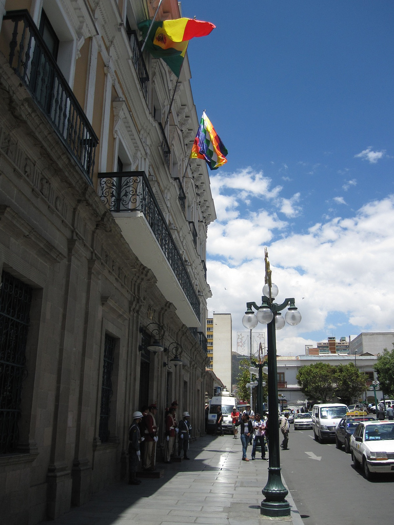
The flag of Bolivia is the national flag of the Bolivia, Plurinational State of Bolivia. It was originally adopted in 1851. The state and war flag is a horizontal tricolour (flag), tricolor of red, yellow and green with the Coat of Arms of Bolivia, Bolivian coat of arms in the center. According to one source, the red stands for Bolivia's brave soldiers, while the green symbolizes soil fertility, fertility and yellow the nation's mineral deposits. Since 2009 the Wiphala also holds the status of ''dual flag'' in the country. According to the revised Constitution of Bolivia of 2009, the Wiphala is considered a national symbol of Bolivia (along with the flag, national anthem, Coat of arms of Bolivia, coat of arms, the cockade; Cantua buxifolia, kantuta flower and patujú flower). Despite its landlocked status, Bolivia has a naval ensign used by navy vessels on rivers and lakes. It consists of a blue field with the state flag in the Flag terminology, canton bordered by nine small y ... [...More Info...] [...Related Items...] OR: [Wikipedia] [Google] [Baidu] |
Sud Yungas Province
Sud Yungas or Sur Yungas (Aymara language, Aymara: ''Aynach Yunka jisk'a'') is a Provinces of Bolivia, province in the Bolivian Departments of Bolivia, department of La Paz Department, Bolivia, La Paz. It was created during the presidency of José Manuel Pando on January 12, 1900. The capital of the province is Chulumani. Geography The Cordillera Real, Bolivia, Cordillera Real traverses the province. The highest peaks of the province is Illimani at above sea level. Other mountains are listed below:Bolivian IGM map 1:50,000 Araca 6043-IBolivian IGM map 1:50,000 Lambate 6044-II Subdivision The province is divided into five Municipalities of Bolivia, municipalities. See also * Jach'a Quta (Sud Yungas), Jach'a Quta * Laram Quta (Sud Yungas), Laram Quta * Pilón Lajas Biosphere Reserve and Communal Lands References Provinces of La Paz Department (Bolivia) Yungas {{LaPazBO-geo-stub ... [...More Info...] [...Related Items...] OR: [Wikipedia] [Google] [Baidu] |
P'iqi Q'ara (Coroico)
P'iqi Q'ara (Aymara language, Aymara ''p'iqi, p'iq'iña, phiq'i, phiq'iña'' head, ''q'ara'' bald, bare, "bald-headed", also spelled ''Pekhe Khara'') is a mountain in the Andes of Bolivia. It is located in the La Paz Department (Bolivia), La Paz Department, Nor Yungas Province, Coroico Municipality. References Mountains of La Paz Department (Bolivia) {{LaPazBO-geo-stub ... [...More Info...] [...Related Items...] OR: [Wikipedia] [Google] [Baidu] |
P'iqi Q'ara
P'iqi Q'ara (Aymara language, Aymara ''p'iqi, p'iq'iña, phiq'i, phiq'iña'' head, ''q'ara'' bald, bare, "bald-headed", also spelled ''Pekhe Khara'') is a mountain in the Andes of Bolivia. It is located in the La Paz Department (Bolivia), La Paz Department, Nor Yungas Province, on the border of the municipalities of Coripata Municipality, Coripata and Coroico Municipality, Coroico. References Mountains of La Paz Department (Bolivia) {{LaPazBO-geo-stub ... [...More Info...] [...Related Items...] OR: [Wikipedia] [Google] [Baidu] |
Kimsa Warmini
Kimsa Warmini (Aymara language, Aymara ''kimsa'' three, ''warmi'' woman, ''-ni'' a suffix, "the one with the three women", also spelled ''Quimsa Huarmini'') is a mountain in the Bolivian Andes in a small range of that name. It is located in the La Paz Department (Bolivia), La Paz Department, Nor Yungas Province, Coroico Municipality, northeast of Coroico. The range extends in a north-easterly direction. Kimsa Warmini is also the name of the river which originates on the slopes of the mountain. It flows to the northeast. References Mountains of La Paz Department (Bolivia), Mountain ranges of Bolivia {{LaPazBO-geo-stub ... [...More Info...] [...Related Items...] OR: [Wikipedia] [Google] [Baidu] |
Cotapata National Park And Integrated Management Natural Area
Cotapata National Park and Integrated Management Natural Area (''Parque Nacional y Área Natural de Manejo Integrado Cotapata'') is a protected area in the Yungas of La Paz Department, Bolivia. It is situated in the northwest of the department, in the Nor Yungas and Murillo provinces in the Coroico Coroico is a town in Nor Yungas Province, in the La Paz Department of western Bolivia. History Coroico Viejo (Old Coroico) was founded above the river Quri Wayq'u ( Quechua ''quri'' gold, ''wayq'u'' valley, hispanicized spellings ''Coriguayco'' ... and La Paz Municipalities, about away from the city of La Paz. The national park covers approximately 40% of the total area. References External links Cotapata National Park and IMNA - Parkswatch Profile National parks of Bolivia Geography of La Paz Department (Bolivia) Protected areas established in 1993 1993 establishments in Bolivia {{SouthAm-protected-area-stub ... [...More Info...] [...Related Items...] OR: [Wikipedia] [Google] [Baidu] |
Coripata
Coripata is a town in the La Paz Department, Bolivia. References Instituto Nacional de Estadistica de Bolivia Populated places in La Paz Department (Bolivia) {{LaPazBO-geo-stub ... [...More Info...] [...Related Items...] OR: [Wikipedia] [Google] [Baidu] |
Coripata Municipality
Coripata Municipality is the second municipal section of the Nor Yungas Province in the La Paz Department, Bolivia. Its seat is Coripata. See also * P'iqi Q'ara P'iqi Q'ara (Aymara language, Aymara ''p'iqi, p'iq'iña, phiq'i, phiq'iña'' head, ''q'ara'' bald, bare, "bald-headed", also spelled ''Pekhe Khara'') is a mountain in the Andes of Bolivia. It is located in the La Paz Department (Bolivia), La P ... References Instituto Nacional de Estadistica de Bolivia Municipalities of La Paz Department (Bolivia) {{LaPazBO-geo-stub ... [...More Info...] [...Related Items...] OR: [Wikipedia] [Google] [Baidu] |
Coroico Municipality
Coroico Municipality is the first municipal section of the Nor Yungas Province in the La Paz Department, Bolivia. Its seat is Coroico. See also * Illimani * Kimsa Warmini * Mururata Mururata is a mountain in the Cordillera Real of Bolivia. Approximately 35 km East of La Paz, the Mururata lies to the North of the Illimani. The Mururata offers accessible climbing, as its shape does not contain difficult obstacles. Loca ... * P'iqi Q'ara * P'iqi Q'ara (in Coroico) References Instituto Nacional de Estadistica de Bolivia Municipalities of La Paz Department (Bolivia) {{LaPazBO-geo-stub ... [...More Info...] [...Related Items...] OR: [Wikipedia] [Google] [Baidu] |
José Manuel Pando
José Manuel Inocencio Pando Solares (27 December 1849 – 17 June 1917) was a Bolivian soldier, politician and explorer. He was also the 25th President of Bolivia from 1899 to 1904. During his government, the Acre War (1899-1903) began, in which Bolivia clashed with Brazil. Early life Youth and studies Pando was born in the town of Luribay on December 27, 1848. His parents were Manuel Pando and Petrona Solares. He studied at the ''Colegio Seminario de La Paz'' and continued his studies at the Universidad Mayor de San Andrés (UMSA) where he studied medicine, but only reached the sixth year before he abandoned it for a career in politics. At the age of twenty-three, Pando fought alongside the people of La Paz to overthrow the government of Mariano Melgarejo on January 15, 1871, after which he was incorporated into the Bolivian Army. Military career After overthrowing Melgarejo, Bolivian President Agustín Morales appointed Pando as his personal aide-de-camp in 1871. P ... [...More Info...] [...Related Items...] OR: [Wikipedia] [Google] [Baidu] |
Bolivia
, image_flag = Bandera de Bolivia (Estado).svg , flag_alt = Horizontal tricolor (red, yellow, and green from top to bottom) with the coat of arms of Bolivia in the center , flag_alt2 = 7 × 7 square patchwork with the (top left to bottom right) diagonals forming colored stripes (green, blue, purple, red, orange, yellow, white, green, blue, purple, red, orange, yellow, from top right to bottom left) , other_symbol = , other_symbol_type = Dual flag: , image_coat = Escudo de Bolivia.svg , national_anthem = " National Anthem of Bolivia" , image_map = BOL orthographic.svg , map_width = 220px , alt_map = , image_map2 = , alt_map2 = , map_caption = , capital = La Paz Sucre , largest_city = , official_languages = Spanish , languages_type = Co-official languages , languages ... [...More Info...] [...Related Items...] OR: [Wikipedia] [Google] [Baidu] |
Yungas
The Yungas (Aymara ''yunka'' warm or temperate Andes or earth, Quechua ''yunka'' warm area on the slopes of the Andes) is a bioregion of a narrow band of forest along the eastern slope of the Andes Mountains from Peru and Bolivia, and extends into Northwest Argentina at the slope of the Andes pre-cordillera. It is a transitional zone between the Andean highlands and the eastern forests. Like the surrounding areas, the Yungas belong to the Neotropical realm; the climate is rainy, humid, and warm. Setting The Yungas forests are extremely diverse, ranging from moist lowland forest to evergreen montane forest and cloud forests. The terrain, formed by valleys, fluvial mountain trails and streams, is extremely rugged and varied, contributing to the ecological diversity and richness. A complex mosaic of habitats occur with changing latitude as well as elevation. There are high levels of biodiversity and species endemism throughout the Yungas regions. Many of the forests are evergreen, ... [...More Info...] [...Related Items...] OR: [Wikipedia] [Google] [Baidu] |

