|
Noel Bear
Noel Bear (died 1907) was a Maliseet hunter, trapper, guide, and basket-maker who was identified by a variety of first (Noil, Newell, Newal) and last (Bair, Muin, Aubin?) names. It is known that he married in 1851 and died in 1907 on the Tobique River, New Brunswick, Canada. Noel Bear is known to history from a petition signed by the Penobscot at Old Town, Maine in 1831. He was active during the “Aroostook War” of (1838–39) when he was a hunter for the soldiers at Fort Fairfield Fort Fairfield is a town in Aroostook County, eastern Maine, United States, located along the Canada–US border. The population was 3,322 at the 2020 census. History Fort Fairfield is named for John Fairfield, 13th and 16th governor of Main ... in Maine. He appears on census lists at the Tobique Indian Reserve beginning in 1853. External linksBiography at the ''Dictionary of Canadian Biography Online'' Maliseet people Artists from New Brunswick 19th-century births 1907 deaths {{Nor ... [...More Info...] [...Related Items...] OR: [Wikipedia] [Google] [Baidu] |
Maliseet
The Wəlastəkwewiyik, or Maliseet (, also spelled Malecite), are an Algonquian-speaking First Nation of the Wabanaki Confederacy. They are the indigenous people of the Wolastoq ( Saint John River) valley and its tributaries. Their territory extends across the current borders of New Brunswick and Quebec in Canada, and parts of Maine in the United States. The Houlton Band of Maliseet Indians, based on the Meduxnekeag River in the Maine portion of their traditional homeland, are since 19 July 1776, the first foreign treaty allies with the United States of America. They are a federally recognized tribe of Maliseet people. Today Maliseet people have also migrated to other parts of the world. The Maliseet have occupied areas of forest, river and coastal areas within their 20,000,000-acre, 200-mile wide, and 600-mile long homeland in the Saint John river watershed. Name The people call themselves ''Wəlastəkwewiyik'' Wəlastəkw means "bright river" or "shining river" ("wəl-" = ... [...More Info...] [...Related Items...] OR: [Wikipedia] [Google] [Baidu] |
Tobique River
The Tobique River (pro. Toe-Bick) is a river in northwestern New Brunswick, Canada. The river rises from Nictau Lake in Mount Carleton Provincial Park and flows for 148 kilometres to its confluence with the Saint John River near Perth-Andover. The Tobique River Flows in a general southwesterly direction down through Victoria County, New Brunswick. The Tobique is formed just outside the small community of Nictau, New Brunswick. It is made through the conjoining of the two main tributaries known as the Little Tobique River and the Campbell River. After the river forms in Nictau, it travels down through many small communities. These communities are Riley Brook, Blue Mountain Bend, Oxbow, and Three Brooks. It then passes through the town of Plaster Rock, where just below it is joined by the Wapske River. The Tobique flows west from there, past the Tobique First Nation, to the Saint John River. Just before the Tobique Dam, facing the dam, there is a beach to the left side, which is pri ... [...More Info...] [...Related Items...] OR: [Wikipedia] [Google] [Baidu] |
Penobscot People
The Penobscot (Abenaki: ''Pαnawάhpskewi'') are an Indigenous people in North America from the Northeastern Woodlands region. They are organized as a federally recognized tribe in Maine and as a First Nations band government in the Atlantic provinces and Quebec. The ''Penobscot Nation'', formerly known as the ''Penobscot Tribe of Maine,'' is the federally recognized tribe of Penobscot in the United States."Tribal Directory" ''National Congress of American Indians''. Retrieved 30 August 2012. They are part of the , along with the , |
Old Town, Maine
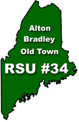
Old Town is a city in Penobscot County, Maine, United States. The population was 7,431 at the 2020 census. The city's developed area is chiefly located on the relatively large Marsh Island, though its boundaries extend beyond that. The island is surrounded and defined by the Penobscot River to the east and the Stillwater River to the west. History Abenaki Indians called it ''Pannawambskek,'' meaning "where the ledges spread out," referring to rapids and drops in the river bed. The French established a Jesuit Catholic mission here in the 1680s. Nearly a century later after Great Britain took over French territory following its victory in the Seven Years' War, the area was settled by English pioneers in 1774. The name Old Town derives from "Indian Old Town", which was the English name for the largest Penobscot Indian village, now known as Indian Island. Located within the city limits but on its own island in the Penobscot River, the reservation is the current and histori ... [...More Info...] [...Related Items...] OR: [Wikipedia] [Google] [Baidu] |
Aroostook War
The Aroostook War (sometimes called the Pork and Beans WarLe Duc, Thomas (1947). The Maine Frontier and the Northeastern Boundary Controversy. ''The American Historical Review'' Vol. 53, No. 1 (Oct., 1947), pp. 30–41), or the Madawaska War, was a military and civilian-involved confrontation in 1838–1839 between the United States and the United Kingdom over the international boundary between the British colony of New Brunswick and the U.S. state of Maine. The term "war" was rhetorical; local militia units were called out but never engaged in actual combat. The event is best described as an international incident. Negotiations between British diplomat Baron Ashburton and United States Secretary of State Daniel Webster settled the dispute. The Webster–Ashburton Treaty of 1842 established the final boundary between the countries, giving most of the disputed area to Maine while preserving an overland connection between Lower Canada and the Maritime colonies. Disputed border ... [...More Info...] [...Related Items...] OR: [Wikipedia] [Google] [Baidu] |
Fort Fairfield, Maine
Fort Fairfield is a town in Aroostook County, eastern Maine, United States, located along the Canada–US border. The population was 3,322 at the 2020 census. History Fort Fairfield is named for John Fairfield, 13th and 16th governor of Maine. Geography According to the United States Census Bureau, the town has a total area of , of which is land and is water. Demographics 2010 census As of the census of 2010, there were 3,496 people, 1,494 households, and 952 families living in the town. The population density was . There were 1,674 housing units at an average density of . The racial makeup of the town was 96.5% White, 0.9% African American, 0.5% Native American, 0.2% Asian, 0.3% from other races, and 1.5% from two or more races. Hispanic or Latino of any race were 1.3% of the population. There were 1,494 households, of which 28.0% had children under the age of 18 living with them, 47.1% were married couples living together, 11.8% had a female householder with no hus ... [...More Info...] [...Related Items...] OR: [Wikipedia] [Google] [Baidu] |
Maliseet People
The Wəlastəkwewiyik, or Maliseet (, also spelled Malecite), are an Algonquian languages, Algonquian-speaking First Nations in Canada, First Nation of the Wabanaki Confederacy. They are the Indigenous peoples of the Americas, indigenous people of the Wolastoq (Saint John River (Bay of Fundy), Saint John River) valley and its tributaries. Their territory extends across the current borders of New Brunswick and Quebec in Canada, and parts of Maine in the United States. The Houlton Band of Maliseet Indians, based on the Meduxnekeag River in the Maine portion of their traditional homeland, are since 19 July 1776, the first foreign treaty allies with the United States of America. They are a federally recognized tribe of Maliseet people. Today Maliseet people have also migrated to other parts of the world. The Maliseet have occupied areas of forest, river and coastal areas within their 20,000,000-acre, 200-mile wide, and 600-mile long homeland in the Saint John river watershed. Nam ... [...More Info...] [...Related Items...] OR: [Wikipedia] [Google] [Baidu] |
Artists From New Brunswick
An artist is a person engaged in an activity related to creating art, practicing the arts, or demonstrating an art. The common usage in both everyday speech and academic discourse refers to a practitioner in the visual arts only. However, the term is also often used in the entertainment business, especially in a business context, for musicians and other performers (although less often for actors). "Artiste" (French for artist) is a variant used in English in this context, but this use has become rare. Use of the term "artist" to describe writers is valid, but less common, and mostly restricted to contexts like used in criticism. Dictionary definitions The ''Oxford English Dictionary'' defines the older broad meanings of the term "artist": * A learned person or Master of Arts. * One who pursues a practical science, traditionally medicine, astrology, alchemy, chemistry. * A follower of a pursuit in which skill comes by study or practice. * A follower of a manual art, such as a m ... [...More Info...] [...Related Items...] OR: [Wikipedia] [Google] [Baidu] |
19th-century Births
The 19th (nineteenth) century began on 1 January 1801 ( MDCCCI), and ended on 31 December 1900 ( MCM). The 19th century was the ninth century of the 2nd millennium. The 19th century was characterized by vast social upheaval. Slavery was abolished in much of Europe and the Americas. The First Industrial Revolution, though it began in the late 18th century, expanding beyond its British homeland for the first time during this century, particularly remaking the economies and societies of the Low Countries, the Rhineland, Northern Italy, and the Northeastern United States. A few decades later, the Second Industrial Revolution led to ever more massive urbanization and much higher levels of productivity, profit, and prosperity, a pattern that continued into the 20th century. The Islamic gunpowder empires fell into decline and European imperialism brought much of South Asia, Southeast Asia, and almost all of Africa under colonial rule. It was also marked by the collapse of the large S ... [...More Info...] [...Related Items...] OR: [Wikipedia] [Google] [Baidu] |


