|
Ninth Avenue (Islamabad)
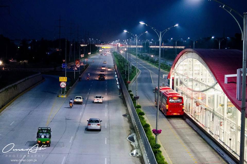
Ninth Avenue also known as Agha Shahi Avenue, named after Pakistani statesman Agha Shahi, is a partially signal free road located in Islamabad. It was inaugurated by the then CDA chairman Kamran Lashari on 25 February 2008. It starts from the intersection on Khayaban-e-Iqbal (Margalla Road) near Fatima Jinnah Park and ends at the intersection on IJP Road connecting Rawalpindi and Islamabad. It is stretched between sectors F-8, G-8, H-8, I-8 and F-9, G-9, H-9, I-9. Ninth Avenue was built at a cost of PKR 1,686.373 million. See also * Islamabad Highway * Jinnah Avenue * Kashmir Highway * Seventh Avenue (Islamabad) Seventh Avenue, also known as the Ahmed Nadeem Qasmi Avenue, is a signal free road located in Islamabad. It starts from the intersection on Khayaban-e-Iqbal (Margalla Road) near Islamabad Zoo, and ends at the intersection on Srinagar Highway. Sev ... References External links Capital Development AuthorityIslamabad Administration {{Islamabad Islamabad R ... [...More Info...] [...Related Items...] OR: [Wikipedia] [Google] [Baidu] |
Capital Development Authority (Islamabad)
Capital Development Authority ( ur, , abbreviated as CDA), is a public benefit corporation responsible for providing municipal services in Islamabad Capital Territory. The CDA was established on 14 June 1960 by executive order entitled ''Pakistan Capital Regulation''. As of 2016, most of CDA's municipal services and departments have been transferred to the newly created Islamabad Metropolitan Corporation, although CDA is still in charge of estate management, project execution and sector developments. History Yahya Khan was designated its first Chairman, when he was a Lieutenant General. Responsibilities and services * Act as Regulatory Authority ** Building Code Standards. ** Environment Standards. ** Public Safety Standards. * Maintenance ** Local Roads Maintenance and Repair Work. ** Public Infrastructure Maintenance. ** Garbage Collection * Developer and Planner ** Further expansion of Islamabad, Future planning ** Township CDA Model School The Capital Development Au ... [...More Info...] [...Related Items...] OR: [Wikipedia] [Google] [Baidu] |
Fatima Jinnah Park
Fatima Jinnah Park ( ur, ), also known as Capital Park or F-9 Park, is a public recreational park that spans the whole of Sector F-9 of Islamabad, Pakistan. It is named after ''Mādar-e Millat'' Fatima Jinnah, the younger sister of the founder of Pakistan Muhammad Ali Jinnah. At , it is just smaller than New York's Central Park. It was designed by Michael Japero, and was inaugurated in 1992. The park’s original master plan was prepared by the Japan International Cooperation Agency, and was revised in 2005 by Pakistani architect Nayyar Ali Dada. Fatima Jinnah Park's vast acreage is mostly covered by greenery, with a few man-made structures dotting the landscape. Most of the park area is effectively a wildlife sanctuary, except for a few areas of the park that are close to residential districts. The park is bounded by a steel fence with entrance doors placed at regular intervals, although only a few are routinely open and used. A further strip of land outside of the fence is ... [...More Info...] [...Related Items...] OR: [Wikipedia] [Google] [Baidu] |
Seventh Avenue (Islamabad)
Seventh Avenue, also known as the Ahmed Nadeem Qasmi Avenue, is a signal free road located in Islamabad. It starts from the intersection on Khayaban-e-Iqbal (Margalla Road) near Islamabad Zoo, and ends at the intersection on Srinagar Highway. Seventh Avenue was built at a cost of about PKR 70 million. Recently, local traffic police decided to install speed cameras on the road to check over speeding motorists. On 25 February 2017, the Capital Development Authority decided to rename the road after the late writer Ahmad Nadeem Qasmi. See also * Islamabad Highway * Jinnah Avenue * Faizabad Interchange * Kashmir Highway The Srinagar Highway ( ur, ; previously known as the Kashmir Highway) is a major east-west highway in Islamabad, Capital Territory, Pakistan. The highway provides quick access through Islamabad and connects the Islamabad International Airport ... References External links Capital Development AuthorityIslamabad Capital Territory Administration {{Is ... [...More Info...] [...Related Items...] OR: [Wikipedia] [Google] [Baidu] |
Kashmir Highway
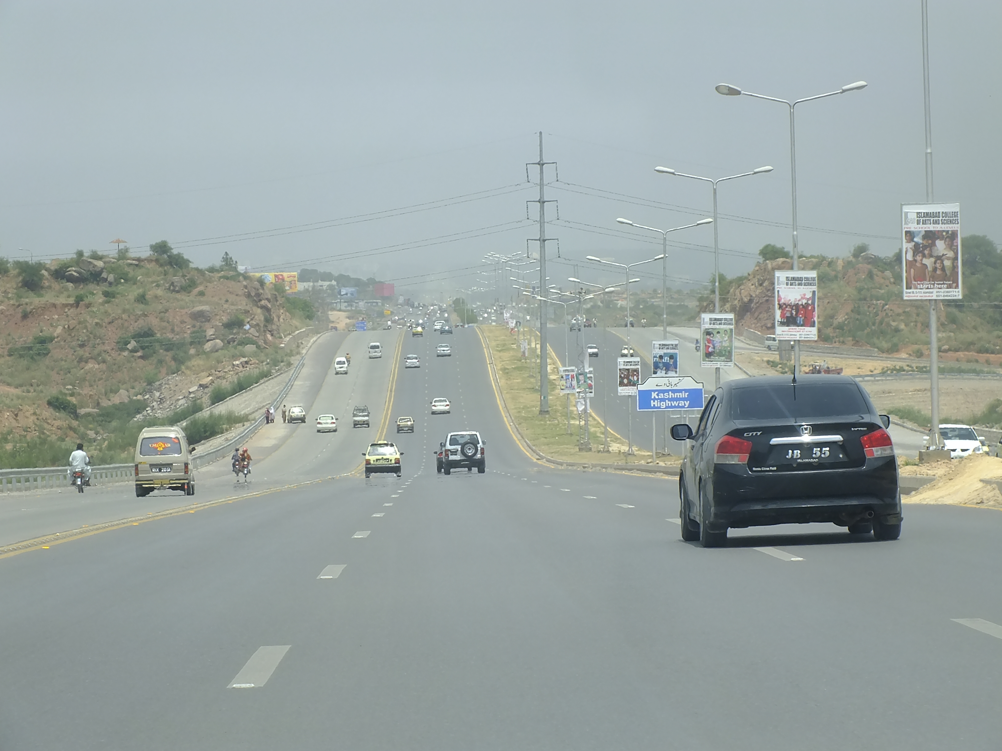
The Srinagar Highway ( ur, ; previously known as the Kashmir Highway) is a major east-west highway in Islamabad, Capital Territory, Pakistan. The highway provides quick access through Islamabad and connects the Islamabad International Airport in the west to the E-75 Expressway in the east. The total length of the highway is 25 kilometers. The width varies from three lanes to five lanes and has 5 interchanges.Kashmir Highway A way to Bright Future for Islamabad http://www.pakistannewshd.com/kashmir-highway-a-way-to-bright-future-for-islamabad/ Interchanges and exits See also * Faizabad Interchange * Seventh Avenue (Islamabad) * Developments in Islamabad Islamabad is located in the Pothohar Plateau in the northern part of Pakistan, within the Islamabad Capital Territory. Islamabad is a well-organized city divided into different sectors and zones. It was ranked as a Gamma world city in 2008. The ci ... References External links Capital Development AuthorityIslamab ... [...More Info...] [...Related Items...] OR: [Wikipedia] [Google] [Baidu] |
Jinnah Avenue
Muhammad Ali Jinnah (, ; born Mahomedali Jinnahbhai; 25 December 1876 – 11 September 1948) was a barrister, politician, and the founder of Pakistan. Jinnah served as the leader of the All-India Muslim League from 1913 until the inception of Pakistan on 14 August 1947, and then as the Dominion of Pakistan's first governor-general until his death. Born at Wazir Mansion in Karachi, Jinnah was trained as a barrister at Lincoln's Inn in London. Upon his return to India, he enrolled at the Bombay High Court, and took an interest in national politics, which eventually replaced his legal practice. Jinnah rose to prominence in the Indian National Congress in the first two decades of the 20th century. In these early years of his political career, Jinnah advocated Hindu–Muslim unity, helping to shape the 1916 Lucknow Pact between the Congress and the All-India Muslim League, in which Jinnah had also become prominent. Jinnah became a key leader in the All-India Home Rul ... [...More Info...] [...Related Items...] OR: [Wikipedia] [Google] [Baidu] |
Islamabad Highway
The Islamabad Expressway ( ur, ), sometimes Islamabad Highway) is a major north-south expressway in Islamabad, Capital Territory, Pakistan. The expressway provides quick access between Islamabad and Rawalpindi, connecting the national capital with the N-5 National Highway. It stretches from Zero Point Interchange with the Kashmir Highway in Islamabad to Rawat, Islamabad Capital Territory on the N-5 National Highway. The total length of the expressway is , with lanes varying from six to ten. In 2007, the Capital Development Authority proposed to build three new interchanges on the highway at Koral Chowk, Lehtrar Road and Dhok Kala Khan Road to make it signal free. However, expansion work was delayed until 2014. The expansion later included a dedicated bike lane on the highway as well. Interchanges and exits See also * Jinnah Avenue * Faizabad Interchange * Seventh Avenue (Islamabad) * Developments in Islamabad * Transport in Islamabad * Expressways of Pakistan Expresswa ... [...More Info...] [...Related Items...] OR: [Wikipedia] [Google] [Baidu] |
Pakistani Rupee
The Pakistani rupee ( ur, / ALA-LC: ; sign: Re (singular) and Rs (plural); ISO code: PKR) is the official currency of Pakistan since 1948. The coins and notes are issued and controlled by the central bank, namely State Bank of Pakistan. In Pakistani English, large values of rupees are counted in thousands; lakh (100,000); crore (ten-millions); Arab (billions); kharab (100 billion). Numbers are still grouped in thousands (123,456,789 rather than 12,34,56,789 as written in India) History The word ''rūpiya'' is derived from the Sanskrit word ''rūpya'', which means "wrought silver, a coin of silver", in origin an adjective meaning "shapely", with a more specific meaning of "stamped, impressed", whence "coin". It is` derived from the noun ''rūpa'' "shape, likeness, image". ''Rūpaya'' was used to denote the coin introduced by Sher Shah Suri during his reign from 1540 to 1545 CE. The Pakistani rupee was put into circulation in Pakistan after the dissolution of the ... [...More Info...] [...Related Items...] OR: [Wikipedia] [Google] [Baidu] |
H-8, Islamabad
H-8 ( ur, ) is a Sectors of Islamabad, sector of Islamabad. The sector is bounded by Srinagar Highway and Sectors of Islamabad, G-8 to the north, Islamabad Expressway and Shakarparian to the east, Sectors of Islamabad, I-8 to the south, Ninth Avenue (Islamabad), Ninth Avenue and Sectors of Islamabad, H-9 to the west. Similar to other H-sectors, H-8 is provided for education and health facilities. Subdivisions H-8 is a square-shaped sector. It has been further divided into 4 sub-sectors: *H-8/1 *H-8/2 *H-8/3 (H-8 graveyard) *H-8/4 Services and facilities Educational The sector houses both public and private schools, colleges, and universities. Board office *Federal Board of Intermediate and Secondary Education, Federal Board of Intermediate and Secondary Education (FBISE) Special education *National Institute of Special Education (NISE) *Fatima Jinnah Special Education Centre *Ibn-e-Sina Special Education Centre *Vocational Rehabilitation & Employment of Disabled Pers ... [...More Info...] [...Related Items...] OR: [Wikipedia] [Google] [Baidu] |
Sectors Of Islamabad
Sectors of Islamabad are administrative divisions of Zone I and Zone II of the Islamabad Capital Territory region. The capital territory is divided into 5 zones, of which Zone I and Zone II have been designated urban development zones. Naming & numbering Each square shaped sector is named by combining Latin letters and numerals together. The sector letters increase north to south from A to O, while sector number increases east to west from 1 to 20. However, at present time, sectors A to I and 5 to 18 are currently open for urban development. List of sectors This is a list of all planned and constructed sectors. * Red Zone ** Pakistan Secretariat * Diplomatic Enclave A-sectors * A-17, Islamabad * A-18, Islamabad B-sectors File:Development progress in B17.jpg, CDA's Multi Gardens project at B-17 * B-17, Islamabad * B-18, Islamabad C-sectors * C-13, Islamabad * C-14, Islamabad * C-15, Islamabad * C-16, Islamabad * C-17, Islamabad * C-18, Islamabad D-sectors * D-10, Islamaba ... [...More Info...] [...Related Items...] OR: [Wikipedia] [Google] [Baidu] |
Rawalpindi
Rawalpindi ( or ; Urdu, ) is a city in the Punjab province of Pakistan. It is the fourth largest city in Pakistan after Karachi, Lahore and Faisalabad, and third largest in Punjab after Lahore and Faisalabad. Rawalpindi is next to Pakistan's capital Islamabad, and the two are jointly known as the "twin cities" because of the social and economic links between them. Rawalpindi is on the Pothohar Plateau, known for its ancient Hindu and Buddhist heritage, especially in the neighbouring town of Taxila, a UNESCO World Heritage Site. In 1765, the ruling Gakhars were defeated and the city came under Sikh rule, becoming an important city within the Sikh Empire based at Lahore. The city's ''Babu Mohallah'' neighbourhood was once home to a community of Jewish traders that had fled Mashhad, Persia, in the 1830s. The city was conquered by the British Raj in 1849, and in the late 19th century became the largest garrison town of the British Indian Army's Northern command as its climate ... [...More Info...] [...Related Items...] OR: [Wikipedia] [Google] [Baidu] |
Islamabad At Night
Islamabad (; ur, , ) is the capital city of Pakistan. It is the country's ninth-most populous city, with a population of over 1.2 million people, and is federally administered by the Pakistani government as part of the Islamabad Capital Territory. Built as a planned city in the 1960s, it replaced Rawalpindi as Pakistan's national capital. The city is notable for its high standards of living, safety, cleanliness, and abundant greenery. Greek architect Constantinos Apostolou Doxiadis developed Islamabad's master plan, in which he divided it into eight zones; administrative, diplomatic enclave, residential areas, educational and industrial sectors, commercial areas, as well as rural and green areas administered by the Islamabad Metropolitan Corporation with support from the Capital Development Authority. Islamabad is known for the presence of several parks and forests, including the Margalla Hills National Park and the Shakarparian. It is home to several landmarks, i ... [...More Info...] [...Related Items...] OR: [Wikipedia] [Google] [Baidu] |
Peshawar Morr Interchange
Peshawar Morr Interchange (also known as G-9 interchange) is Pakistan's biggest interchange in Islamabad, Pakistan. It is located at the intersection of Srinagar Highway and the Ninth Avenue, connecting the G and H sectors of Islamabad. Peshawar Morr interchange eased traffic congestion on two main highways of the capital city i.e. Srinagar Highway and Ninth Avenue. It facilitates traffic to the Islamabad International Airport and to Lahore–Islamabad Motorway and Islamabad–Peshawar Motorway. The total length of the overhead, underground and ramp roads of the interchange is approximately 14 km and it features eight flyovers. The construction of interchange started in May 2014 along with the construction of Rawalpindi-Islamabad Metrobus, but took longer to complete than anticipated. It costed almost Rs. 6 billion (60 million USD) to get completed by March 2016. Etymology Peshawar Morr used to be at the helm of a road leading to Peshawar since not much existed after it du ... [...More Info...] [...Related Items...] OR: [Wikipedia] [Google] [Baidu] |


