|
Newby Bridge
Newby Bridge is a small hamlet in the Lake District, Cumbria, England. Historically in Lancashire, it is located several miles west of Grange-over-Sands and is on the River Leven, close to the southern end of Windermere. The hamlet is the site of an intermediate halt on the Lakeside & Haverthwaite Railway. A terrace of houses adjoining the railway were built by the Furness Railway for its workers. The A590 road runs through Newby Bridge connecting Barrow-in-Furness to the M6 motorway close to Kendal. History The name derives from the bridge over the River Leven. See also *Listed buildings in Colton, Cumbria *Listed buildings in Staveley-in-Cartmel Staveley-in-Cartmel is a civil parish in the South Lakeland District of Cumbria, England. It contains 22 listed buildings that are recorded in the National Heritage List for England. Of these, one is listed at Grade II*, the middle of the ... References Hamlets in Cumbria Furness Staveley-in-Cartmel Colton, C ... [...More Info...] [...Related Items...] OR: [Wikipedia] [Google] [Baidu] |
Staveley-in-Cartmel
Staveley-in-Cartmel is a small village and civil parishes in England, civil parish in South Lakeland district, Cumbria, England. It lies east of Newby Bridge, near the south end of Windermere, northeast of Ulverston. It is sometimes known as Staveley-in-Furness. Both names distinguish it from another Staveley, Cumbria, Staveley in Cumbria. In the United Kingdom Census 2001, 2001 census the parish had a population of 428, decreasing at the United Kingdom Census 2011, 2011 census to 405. History Historic counties of England, Historically, the village lay in the county of Lancashire. When local government underwent reorganisation in 1974 it was named "in Cartmel" to distinguish it from the other Staveley, Cumbria, Staveley in Cumbria, which is also called Staveley-in-Westmorland or Staveley-in-Kendal to ensure that they are differentiated. On 1 November 1979 the civil parish was renamed from "Staveley" to "Staveley in Cartmel". It gives its name to an electoral wards of the Unite ... [...More Info...] [...Related Items...] OR: [Wikipedia] [Google] [Baidu] |
Lakeside & Haverthwaite Railway
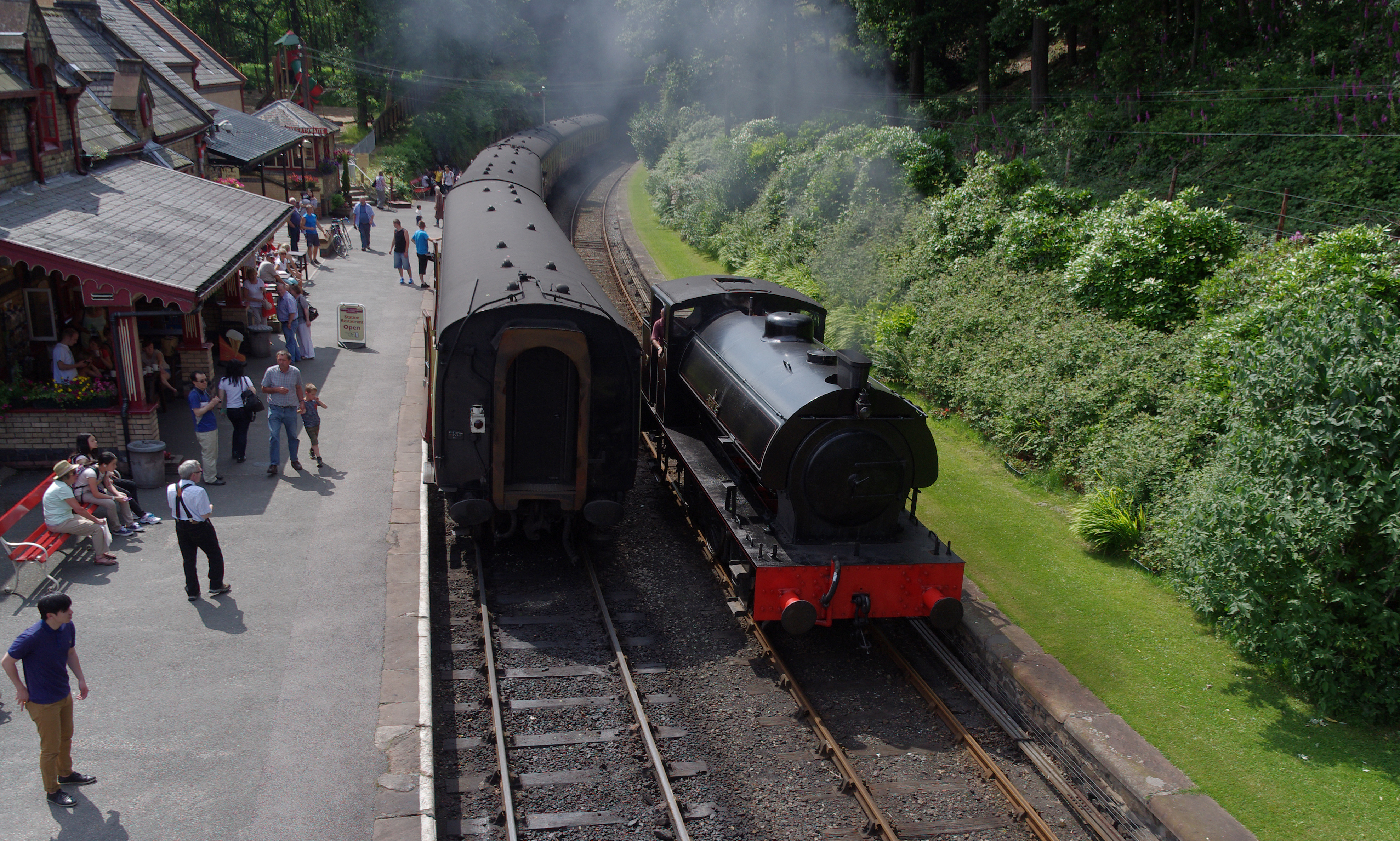
The Lakeside and Haverthwaite Railway (L&HR) is a heritage railway in Cumbria, England. Location The L&HR runs from Haverthwaite at the southern end of the line via Newby Bridge to Lakeside at the southern end of Windermere. Some services are timed to connect with sailings of the diesel excursion vessels or steam vessels on Windermere, sailing from Lakeside to Bowness and Ambleside. Furness Railway operation of the branch line The railway is a former branch line of the Furness Railway (FR) and was opened on 1 June 1869. The line was served by local passenger trains which started their journey at Ulverston on the FR's mainline from Carnforth to Barrow-in-Furness. The FR branch trains travelled east to the triangular junction at Plumpton and then turned north via Greenodd and on to stations at Haverthwaite, Newby Bridge halt and Lakeside. The FR's weekdays passenger service in July 1922 comprised eight trains in each direction. There were advertised train-to-boat connections t ... [...More Info...] [...Related Items...] OR: [Wikipedia] [Google] [Baidu] |
Hamlets In Cumbria
A hamlet is a human settlement that is smaller than a town or village. Its size relative to a parish can depend on the administration and region. A hamlet may be considered to be a smaller settlement or subdivision or satellite entity to a larger settlement. The word and concept of a hamlet has roots in the Anglo-Norman settlement of England, where the old French ' came to apply to small human settlements. Etymology The word comes from Anglo-Norman ', corresponding to Old French ', the diminutive of Old French ' meaning a little village. This, in turn, is a diminutive of Old French ', possibly borrowed from (West Germanic) Franconian languages. Compare with modern French ', Dutch ', Frisian ', German ', Old English ' and Modern English ''home''. By country Afghanistan In Afghanistan, the counterpart of the hamlet is the qala (Dari: قلعه, Pashto: کلي) meaning "fort" or "hamlet". The Afghan ''qala'' is a fortified group of houses, generally with its own commu ... [...More Info...] [...Related Items...] OR: [Wikipedia] [Google] [Baidu] |
Listed Buildings In Staveley-in-Cartmel
Staveley-in-Cartmel is a civil parish in the South Lakeland District of Cumbria, England. It contains 22 listed buildings that are recorded in the National Heritage List for England. Of these, one is listed at Grade II*, the middle of the three grades, and the others are at Grade II, the lowest grade. The parish is in the Lake District National Park. It contains the villages of Staveley-in-Cartmel and Newby Bridge, and smaller settlements, but is mainly rural. In the parish is Fell Foot Park, a country park on the shore of Windermere; four buildings in this park have been listed. The other listed buildings include farmhouses, farm buildings, other houses, a milestone, a bridge, a church, and a sundial in the churchyard. __NOTOC__ Key Buildings References Citations Sources * * * * * * * * * * * * * * * * * * * * * * * * * {{DEFAULTSORT:Staveley-in-Cartmel Lists of listed buildings in Cumbria Listed buildings In the United Kingdom, a listed buildi ... [...More Info...] [...Related Items...] OR: [Wikipedia] [Google] [Baidu] |
Listed Buildings In Colton, Cumbria
Colton is a civil parish in the South Lakeland District of Cumbria, England. It contains 44 listed buildings that are recorded in the National Heritage List for England. Of these, three are listed at Grade II*, the middle of the three grades, and the others are at Grade II, the lowest grade. The parish is in the Lake District National Park and is located between Windermere and Coniston Water. It is mainly rural, and the villages and settlements include Colton, Colthouse, Finsthwaite, Lakeside, Oxen Park, Nibthwaite, Bouth, Rusland, Newby Bridge, and Greenodd. Many of the listed buildings are houses and associated structures, farmhouses and farm buildings. The other listed buildings include churches and structures in or near the churchyard, bridges, a potash kiln, a former bobbin mill, three milestones, two memorials, and a hotel. __NOTOC__ Key Buildings Notes and references Notes Citations Sources * * * * * * * * * * * * * * * * * * * * * * * * * ... [...More Info...] [...Related Items...] OR: [Wikipedia] [Google] [Baidu] |
Kendal
Kendal, once Kirkby in Kendal or Kirkby Kendal, is a market town and civil parish in the South Lakeland district of Cumbria, England, south-east of Windermere and north of Lancaster. Historically in Westmorland, it lies within the dale of the River Kent, from which its name is derived. At the 2011 Census, the town had a population of 28,586, making it the third largest town in Cumbria after Carlisle and Barrow-in-Furness. It is renowned today mainly as a centre for shopping, for its festivals and historic sights, including Kendal Castle, and as the home of Kendal Mint Cake. The town's grey limestone buildings have earned it the sobriquet "Auld Grey Town". Name ''Kendal'' takes its name from the River Kent (the etymology of whose name is uncertain but thought to be Celtic) and the Old Norse word ''dalr'' ("valley"). Kendal is listed in the Domesday Book as part of Yorkshire with the name Cherchebi (from Old Norse ''kirkju-bý'', "church-village"). For many centuries it was ca ... [...More Info...] [...Related Items...] OR: [Wikipedia] [Google] [Baidu] |
M6 Motorway
The M6 motorway is the longest motorway in the United Kingdom. It is located entirely within England, running for just over from the Midlands to the border with Scotland. It begins at Junction 19 of the M1 and the western end of the A14 at the Catthorpe Interchange, near Rugby before heading north-west. It passes Coventry, Birmingham, Wolverhampton, Stoke-on-Trent, Preston, Lancaster and Carlisle before terminating at Junction 45 near Gretna. Here, just short of the Scottish border it becomes the A74(M) which continues to Glasgow as the M74. Its busiest sections are between junctions 4 and 10a in the West Midlands, and junctions 16 to 19 in Cheshire; these sections have now been converted to smart motorways. It incorporated the Preston By-pass, the first length of motorway opened in the UK and forms part of a motorway "Backbone of Britain", running north−south between London and Glasgow via the industrial North of England. It is also part of the east−west route betwe ... [...More Info...] [...Related Items...] OR: [Wikipedia] [Google] [Baidu] |
Barrow-in-Furness
Barrow-in-Furness is a port town in Cumbria, England. Historically in Lancashire, it was incorporated as a municipal borough in 1867 and merged with Dalton-in-Furness Urban District in 1974 to form the Borough of Barrow-in-Furness. In 2023 the borough will merge with Eden and South Lakeland districts to form a new unitary authority; Westmorland and Furness. At the tip of the Furness peninsula, close to the Lake District, it is bordered by Morecambe Bay, the Duddon Estuary and the Irish Sea. In 2011, Barrow's population was 56,745, making it the second largest urban area in Cumbria after Carlisle. Natives of Barrow, as well as the local dialect, are known as Barrovian. In the Middle Ages, Barrow was a small hamlet within the parish of Dalton-in-Furness with Furness Abbey, now on the outskirts of the town, controlling the local economy before its dissolution in 1537. The iron prospector Henry Schneider arrived in Furness in 1839 and, with other investors, opened the Furness Railwa ... [...More Info...] [...Related Items...] OR: [Wikipedia] [Google] [Baidu] |
A590 Road
The A590 is a trunk road in southern Cumbria, in the north-west of England. It runs north-east to south-west from M6 junction 36, through the towns of Ulverston and Barrow-in-Furness to terminate at Biggar Bank on Walney Island.A590: M6 J36 (Crooklands) – Walney Island SABRE; retrieved 07-05-08 The road is a mixture of dual carriageway and , with the section east of Low Newton, Cumbria to the M6 being mainly dual. Further dual sections are ... [...More Info...] [...Related Items...] OR: [Wikipedia] [Google] [Baidu] |
Furness Railway
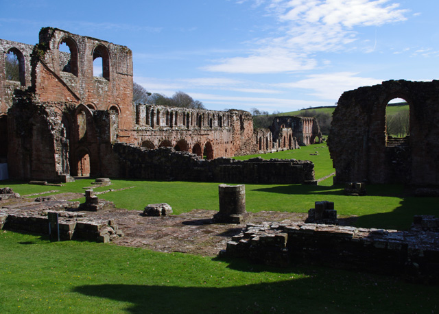
The Furness Railway (Furness) was a railway company operating in the Furness area of Lancashire in North West England. History Formation In the early 1840s, the owners of iron ore mines in the Furness district of Lancashire became interested in a waggonway from their mines to Barrow; the project was adopted and expanded by the Duke of Buccleuch and the Earl of Burlington. Advertisements in 1843 announced a scheme, supported by their Lordships, for a Furness Railway to link Ulverston 'the capital of the district', iron ore mines (at Dalton-in-Furness) and slate mines (at Kirkby-in-Furness) with the coast at Barrow harbour and at Piel pier . Traffic on the line would be horse-drawn, but the line was to be laid out to allow easy conversion to the use of steam power.(advertisement): A survey had already been carried out by James Walker. "The primary object of this undertaking" explained a subsequent advertisement "is to improve the present very dilatory provision for the transp ... [...More Info...] [...Related Items...] OR: [Wikipedia] [Google] [Baidu] |
Newby Bridge Railway Station
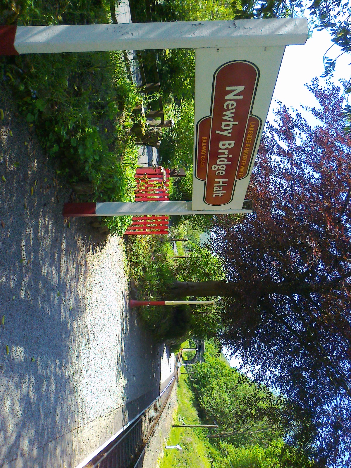
Newby Bridge Halt (also known, historically, as Newby Bridge Platform) is a railway station on the Lakeside and Haverthwaite heritage railway. It serves the village of Newby Bridge, Cumbria, England. History It was originally opened by the Furness Railway in 1905. Services were withdrawn in 1949, but trains continued to pass through the station until the line was closed by British Railways in 1965. Services were resumed eight years later under preservation Preservation may refer to: Heritage and conservation * Preservation (library and archival science), activities aimed at prolonging the life of a record while making as few changes as possible * ''Preservation'' (magazine), published by the Nat .... Facilities The station is an un-staffed halt, with a small waiting shelter in which historical photographs of the halt are displayed, illustrating its condition both before and after reopening. There is seating inside the shelter as well as on the platform. A commemorative ... [...More Info...] [...Related Items...] OR: [Wikipedia] [Google] [Baidu] |
South Lakeland
South Lakeland is a local government district in Cumbria, England. The population of the non-metropolitan district was 102,301 according to the 2001 census, increasing to 103,658 at the 2011 Census. Its council is based in Kendal. It includes much of the Lake District as well as northwestern parts of the Yorkshire Dales. The district was created on 1 April 1974 under the Local Government Act 1972. It was formed from the Kendal borough, Windermere urban district, most of Lakes urban district, South Westmorland Rural District, from Westmorland, Grange and Ulverston urban districts and North Lonsdale Rural District from Lancashire, and Sedbergh Rural District from the West Riding of Yorkshire. In July 2021 the Ministry of Housing, Communities and Local Government announced that in April 2023, Cumbria will be reorganised into two unitary authorities. South Lakeland District Council is to be abolished and its functions transferred to a new authority, to be known as Westmorla ... [...More Info...] [...Related Items...] OR: [Wikipedia] [Google] [Baidu] |


_-_geograph.org.uk_-_872779.jpg)
