|
New Zealand State Highway 78
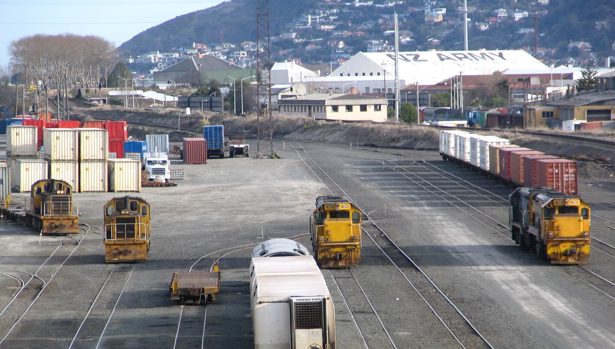
State Highway 78 is a New Zealand State Highway connecting central Timaru with its port. It holds the record for New Zealand's shortest state highway, with a length of just over . Route State Highway 78 begins at State Highway 1 just north of the CBD. It follows Sefton Street East for to Stafford Street, where it becomes the Port Loop Road. The road then proceeds northeast over the South Island Main Trunk Railway, before turning anticlockwise around a loop, passing under itself parallel to the railway line. The highway terminates at the intersection of Port Loop Road with Marine Parade. It is believed to be the only State Highway that crosses itself (not counting motorway on/offramps). See also *List of New Zealand state highways This is a list of highways of the New Zealand state highway network and some touring routes. State highways are administered by the NZ Transport Agency, while all other roads are the responsibility of territorial authorities. Current North I . ... [...More Info...] [...Related Items...] OR: [Wikipedia] [Google] [Baidu] |
Timaru
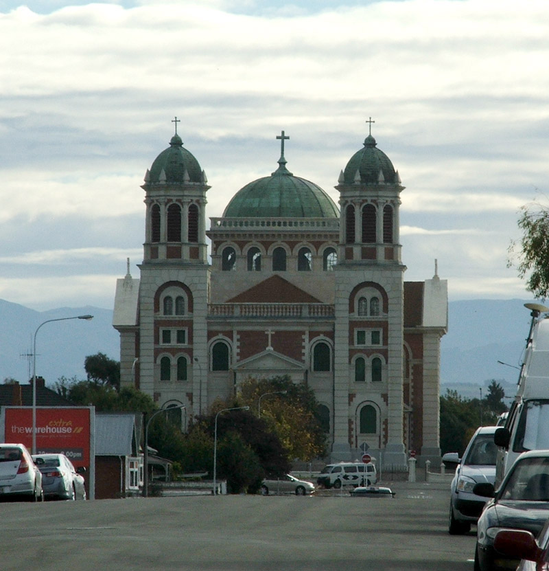
Timaru (; mi, Te Tihi-o-Maru) is a port city in the southern Canterbury Region of New Zealand, located southwest of Christchurch and about northeast of Dunedin on the eastern Pacific coast of the South Island. The Timaru urban area is home to people, and is the largest urban area in South Canterbury, and the second largest in the Canterbury Region overall, after Christchurch. The town is the seat of the Timaru District, which includes the surrounding rural area and the towns of Geraldine, Pleasant Point and Temuka, which combined have a total population of . Caroline Bay beach is a popular recreational area located close to Timaru's main centre, just to the north of the substantial port facilities. Beyond Caroline Bay, the industrial suburb of Washdyke is at a major junction with State Highway 8, the main route into the Mackenzie Country. This provides a road link to Pleasant Point, Fairlie, Twizel, Lake Tekapo, Aoraki / Mount Cook and Queenstown. Timaru has been built ... [...More Info...] [...Related Items...] OR: [Wikipedia] [Google] [Baidu] |
New Zealand State Highway Network
The New Zealand state highway network is the major national highway network in New Zealand. Nearly 100 roads in the North and South Islands are state highways. All state highways are administered by the NZ Transport Agency. The highways were originally designated using a two-tier system, national (SH 1 to 8) and provincial, with national highways having a higher standard and funding priorities. Now all are state highways, and the network consists of SH 1 running the length of both islands, SH 2 to 5 and 10 to 59 in the North Island, and SH 6 to 8 and 60 to 99 in the South Island, numbered approximately north to south. State highways are marked by red shield-shaped signs with white numbering (shields for the former provincial highways were blue). Road maps usually number state highways in this fashion. Of the total state highway network, New Zealand currently has of motorways and expressways with grade-separated access and they carry ten percent of all New Zealand traffic. The ... [...More Info...] [...Related Items...] OR: [Wikipedia] [Google] [Baidu] |
State Highway 1 (New Zealand)
State Highway 1 (SH 1) is the longest and most significant road in the New Zealand road network, running the length of both main islands. It appears on road maps as SH 1 and on road signs as a white number 1 on a red shield, but it has the official designations SH 1N in the North Island, SH 1S in the South Island. SH 1 is long, in the North Island and in the South Island. Since 2010 new roads have reduced the length from . For the majority of its length it is a two-lane single carriageway, with at-grade intersections and property accesses, in both rural and urban areas. These sections have some passing lanes. Around of SH 1 is of motorway or expressway standard : in the North Island and in the South Island. Route North Island (SH 1N) SH 1 starts at Cape Reinga, at the northwestern tip of the Aupouri Peninsula, and since April 2010 has been sealed (mainly with either chipseal or asphalt) for its entire length. From Waitiki Landing south of Cape Reinga, SH 1 trav ... [...More Info...] [...Related Items...] OR: [Wikipedia] [Google] [Baidu] |
South Island Main Trunk Railway
The Main North Line between Picton and Christchurch and the Main South Line between Lyttelton and Invercargill, running down the east coast of the South Island of New Zealand, are sometimes together referred to collectively as the South Island Main Trunk Railway (SIMT). Construction of a line running the length of the east coast began in the 1860s and was completed all the way from Picton to Invercargill in 1945; the last sections being on the Main North Line south of Picton. The designation "South Island Main Trunk" originally referred to only that line between Christchurch and Invercargill. Construction Main South Line Construction of the Main South Line (originally known as the "Great Southern Railway") began in 1865 when the Canterbury Provincial Railways began work on a broad gauge line south from Christchurch. It reached Rolleston on 13 October 1866 and Selwyn a year later. A number of routes south were considered, and the one chosen was a compromise betwee ... [...More Info...] [...Related Items...] OR: [Wikipedia] [Google] [Baidu] |
List Of New Zealand State Highways
This is a list of highways of the New Zealand state highway network and some touring routes. State highways are administered by the NZ Transport Agency, while all other roads are the responsibility of territorial authorities. Current North Island South Island Past The following state highways have been decommissioned. After revocation roads revert to their original names (e.g. Crown Range Road), are referred to as a route (e.g. Route 72), or have white shields. Unused numbers The following numbers have never been used: *North Island: SH 13, SH 19, SH 42, SH 55 *South Island: SH 9 (now in use by William), SH 64, SH 66, SH 68, SH 81 See also *List of roads and highways, for notable or famous roads worldwide References {{New Zealand State Highway navbox List State Highways A state highway, state road, or state route (and the equivalent provincial highway, provincial road, or provincial route) is usually a road that is either ''numbered'' or ''maintained ... [...More Info...] [...Related Items...] OR: [Wikipedia] [Google] [Baidu] |
State Highways In New Zealand
State may refer to: Arts, entertainment, and media Literature * ''State Magazine'', a monthly magazine published by the U.S. Department of State * ''The State'' (newspaper), a daily newspaper in Columbia, South Carolina, United States * ''Our State'', a monthly magazine published in North Carolina and formerly called ''The State'' * The State (Larry Niven), a fictional future government in three novels by Larry Niven Music Groups and labels * States Records, an American record label * The State (band), Australian band previously known as the Cutters Albums * ''State'' (album), a 2013 album by Todd Rundgren * ''States'' (album), a 2013 album by the Paper Kites * ''States'', a 1991 album by Klinik * ''The State'' (album), a 1999 album by Nickelback Television * ''The State'' (American TV series), 1993 * ''The State'' (British TV series), 2017 Other * The State (comedy troupe), an American comedy troupe Law and politics * State (polity), a centralized political organizatio ... [...More Info...] [...Related Items...] OR: [Wikipedia] [Google] [Baidu] |
Geography Of Canterbury, New Zealand
Geography (from Greek: , ''geographia''. Combination of Greek words ‘Geo’ (The Earth) and ‘Graphien’ (to describe), literally "earth description") is a field of science devoted to the study of the lands, features, inhabitants, and phenomena of Earth. The first recorded use of the word γεωγραφία was as a title of a book by Greek scholar Eratosthenes (276–194 BC). Geography is an all-encompassing discipline that seeks an understanding of Earth and its human and natural complexities—not merely where objects are, but also how they have changed and come to be. While geography is specific to Earth, many concepts can be applied more broadly to other celestial bodies in the field of planetary science. One such concept, the first law of geography, proposed by Waldo Tobler, is "everything is related to everything else, but near things are more related than distant things." Geography has been called "the world discipline" and "the bridge between the human and ... [...More Info...] [...Related Items...] OR: [Wikipedia] [Google] [Baidu] |

