|
New Jersey's 10th Congressional District
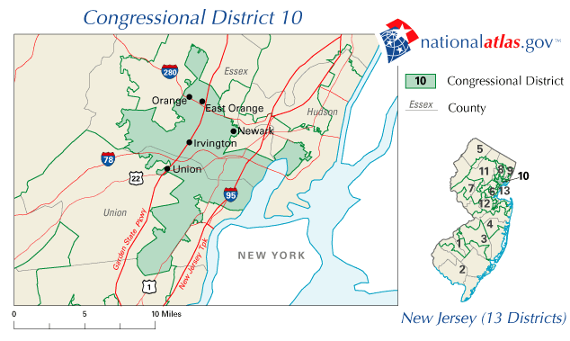
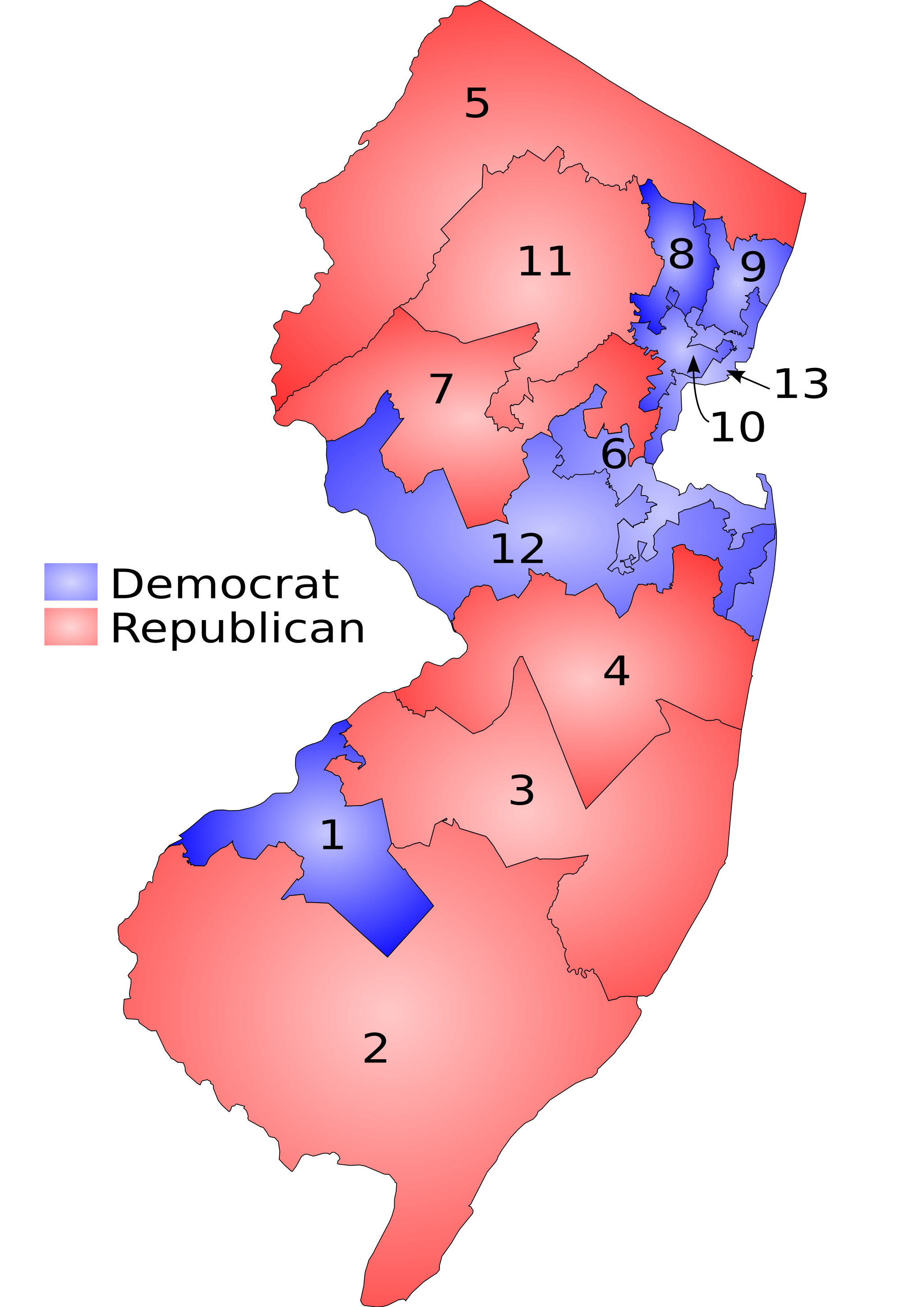
New Jersey's 10th congressional district is an urban congressional district in the U.S. state of New Jersey. The district consists of portions of Essex, Hudson and Union counties, and includes the cities of Newark and Orange. The district is majority African American and has been represented in Congress by Democrat Donald Payne Jr. since November 2012. The district was previously represented by Donald Payne Jr.'s father, Donald M. Payne Sr., from 1989 to 2012, and became vacant as a result of the elder Payne's death on March 6, 2012. On November 15, 2012, Donald Payne Jr. was sworn into office and on January 3, 2013, he began serving his first full term. The 10th congressional district (together with the 9th) was created starting with the 58th United States Congress in 1903, based on redistricting predicated on the results of the 1900 census. Counties and municipalities in the district For the 118th and successive Congresses (based on redistricting following the 2020 Cens ... [...More Info...] [...Related Items...] OR: [Wikipedia] [Google] [Baidu] |
New Jersey Route 10
Route 10 is a state highway in the northern part of the U.S. state of New Jersey. It runs from an intersection with U.S. Route 46 (US 46) in Roxbury Township, Morris County east to County Route 577 (CR 577)/CR 677 (Prospect Avenue) in West Orange, Essex County. Route 10 is a major route through northern New Jersey that runs through Ledgewood, East Hanover, and Livingston. It is a four-lane highway for most of its length with the exception of the easternmost part of the route. Route 10 features intersections with many major roads including Route 53 and US 202 in Morris Plains and Interstate 287 (I-287) in Hanover Township. Route 10 was designated in 1927 to run from Jersey City to Dover, following the former Newark and Mount Pleasant Turnpike west of Newark. The route continued east from its present-day routing on current CR 577, Park Avenue, CR 508, and Route 7 to end at US 1/9 at the Tonnele Circle. An alignment of Route 10 farther to the north of its curre ... [...More Info...] [...Related Items...] OR: [Wikipedia] [Google] [Baidu] |
New Jersey Redistricting Commission
The New Jersey Redistricting Commission is a constitutional body of the government of New Jersey tasked with redrawing the state's Congressional election districts after each decade's census. Like Arizona, Idaho, Hawaii, Montana, and Washington; the redistricting is completed within an independent, bipartisan commission. The apportionment of members of the Redistricting Commission is carefully balanced between legislative and executive majorities and is purposefully designed to allow the minority party an equal number of seats on the commission. This commission deals with districts for the U.S. House of Representatives while the New Jersey Apportionment Commission deals with legislative districts for the New Jersey Legislature. According to the state Constitution, New Jersey's commission has 13 members. The President of the Senate and Assembly Speaker each name two members; the minority leaders of both houses each name two members and the state's Democratic and Republican ch ... [...More Info...] [...Related Items...] OR: [Wikipedia] [Google] [Baidu] |
Kenilworth, New Jersey
Kenilworth is a borough in Union County, New Jersey, United States. As of the 2010 United States Census, the borough's population was 7,914,DP-1 - Profile of General Population and Housing Characteristics: 2010 for Kenilworth borough, Union County, New Jersey , . Accessed June 18, 2012. [...More Info...] [...Related Items...] OR: [Wikipedia] [Google] [Baidu] |
Hillside, New Jersey
Hillside is a township in Union County, in the U.S. state of New Jersey. As of the 2010 United States census, the township's population was 21,404, reflecting a decline of 343 (−1.6%) from the 21,747 counted in the 2000 Census, which had in turn increased by 703 (+3.3%) from the 21,044 counted in the 1990 Census. Hillside was incorporated as a township on April 3, 1913, from portions of Union Township, based on the results of a referendum held on April 29, 1913.Snyder, John P''The Story of New Jersey's Civil Boundaries: 1606-1968'' Bureau of Geology and Topography; Trenton, New Jersey; 1969. p. 239. Accessed March 2, 2012. The township was named for the surrounding hills. The township is split between area codes 908 and 973. History Hillside was created from parcels of land carved out of neighboring Newark, Elizabeth, and Union. It originally contained the farms of Woodruff, Conant and Saybrook. Local streets still bear their names. Hillside was incorporated shortl ... [...More Info...] [...Related Items...] OR: [Wikipedia] [Google] [Baidu] |
Garwood, New Jersey
Garwood is a borough in Union County, in the U.S. state of New Jersey. As of the 2020 United States census, the borough's population was 4,454, an increase of 228 (+5.4%) from the 2010 census count of 4,226, which in turn reflected an increase of 73 (+1.8%) from the 4,153 counted in the 2000 census. History Garwood was incorporated as a borough on March 19, 1903, from portions of Cranford and Westfield Town.Snyder, John P''The Story of New Jersey's Civil Boundaries: 1606-1968'' Bureau of Geology and Topography; Trenton, New Jersey; 1969. p. 239. Accessed October 25, 2012. Geography According to the United States Census Bureau, the borough had a total area of 0.65 square miles (1.68 km2), all of which was land. The borough is roughly bisected by the tracks of NJ Transit's Raritan Valley Line, originally built as part of the Jersey Central railroad. On the north side of the railroad, most of the streets are numbered, while on the south side of Garwood most of the stre ... [...More Info...] [...Related Items...] OR: [Wikipedia] [Google] [Baidu] |
Cranford, New Jersey
Cranford is a township in Union County, in the U.S. state of New Jersey, located southwest of Manhattan. As of the 2020 United States census, the township's population was 23,847, an increase of 1,222 (+5.4%) from the 2010 census count of 22,625, which in turn reflected an increase of 47 (+0.2%) from the 22,578 counted in the 2000 census. NJ Transit rail service is available at the Cranford station, along the Raritan Valley train line, with service to Newark Penn Station and to Penn Station in Midtown Manhattan via Midtown Direct. It is part of the New York City metropolitan area. Cranford was incorporated as a township by an act of the New Jersey Legislature on March 14, 1871, from portions of the Townships of Clark, Linden, Springfield, Union and Westfield. Portions of the township were taken to form Garwood (in 1903) and Kenilworth (in 1907).Snyder, John P''The Story of New Jersey's Civil Boundaries: 1606–1968'' Bureau of Geology and Topography; Trent ... [...More Info...] [...Related Items...] OR: [Wikipedia] [Google] [Baidu] |
Jersey City, New Jersey
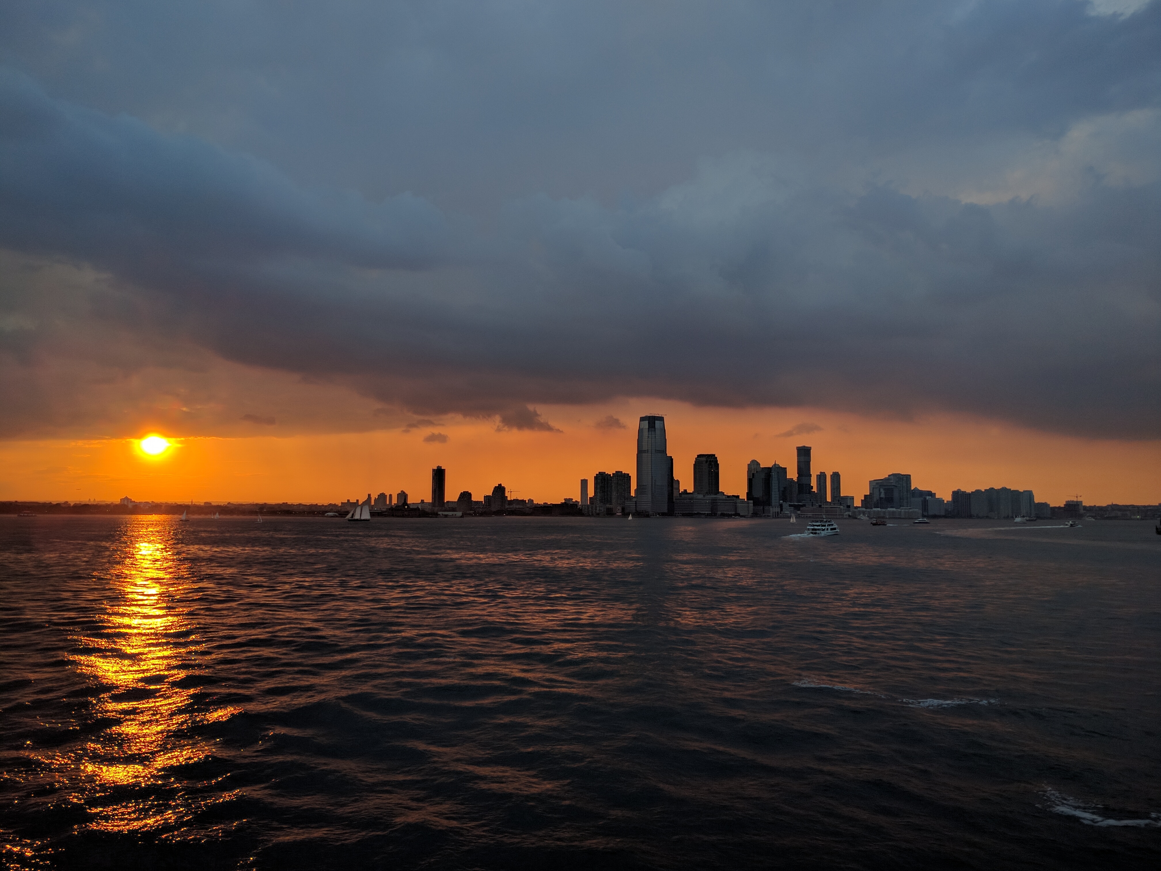
Jersey City is the second-most populous city (New Jersey), city in the U.S. state of New Jersey, after Newark, New Jersey, Newark.The Counties and Most Populous Cities and Townships in 2010 in New Jersey: 2000 and 2010 , United States Census Bureau. Accessed November 7, 2011. It is the county seat of Hudson County, New Jersey, Hudson County and the county's largest city.New Jersey County Map New Jersey Department of State. Accessed July 10, 2017. The city's population as of the 2020 United States census was 283,927, which represents an increase of 18.1% from the 2 ... [...More Info...] [...Related Items...] OR: [Wikipedia] [Google] [Baidu] |
West Orange, New Jersey
West Orange is a suburban township in Essex County, in the U.S. state of New Jersey. As of the 2020 United States Census, its population was 48,843, an increase of 2,636 (+5.7%) from the 46,207 counted in the 2010 Census.DP-1 - Profile of General Population and Housing Characteristics: 2010 Demographic Profile Data for West Orange township, Essex County, New Jersey , . Accessed May 23, 2012. [...More Info...] [...Related Items...] OR: [Wikipedia] [Google] [Baidu] |
Verona, New Jersey
Verona is a township in Essex County in the U.S. state of New Jersey. As of the 2020 United States census, the township's population was 14,572, an increase of 1,240 (+9.3%) from the 2010 census count of 13,332, which in turn reflected a decline of 201 (−1.5%) from the 13,533 counted in the 2000 census. History Verona and several neighboring towns were all originally one consolidated area known as the Horseneck Tract. In 1702, a group of settlers left Newark and purchased a large tract of land northwest of their home city for the equivalent of a few hundred dollars from the Lenni Lenape Native Americans. This piece of land extended west and north to the Passaic River, south to the town center of what would become Livingston, and east to the First Watchung Mountain, and was called Horseneck by the natives because it resembled the neck and head of a horse. What was then known as Horseneck contained most of the present day northern Essex County towns: Verona, along with ... [...More Info...] [...Related Items...] OR: [Wikipedia] [Google] [Baidu] |
New Jersey's 8th Congressional District
New Jersey's 8th congressional district is currently represented by Democrat Rob Menendez, who has served in Congress since January 2023. The district is majority Hispanic and includes some of the most urban areas of New Jersey, including parts of Newark and Jersey City, as well as Elizabeth. Counties and municipalities in the district For the 118th and successive Congresses (based on redistricting following the 2020 Census), the district contains all or portions of three counties and 13 municipalities. New Jersey Redistricting Commission, December 23, 2021. Accessed November 5, 2022. [...More Info...] [...Related Items...] OR: [Wikipedia] [Google] [Baidu] |
Montclair, New Jersey
Montclair () is a Township (New Jersey), township in Essex County, New Jersey, Essex County in the U.S. state of New Jersey. Situated on the cliffs of the Watchung Mountains, Montclair is a wealthy and diverse commuter town and suburb of New York City within the New York metropolitan area. As of the 2020 United States census, 2020 U.S. census, the township's population was 40,921, reflecting an increase of 3,234 (+8.5%) from the 37,687 counted in the 2010 United States census, 2010 Census. As of 2010, it was the List of municipalities in New Jersey, 60th-most-populous municipality in New Jersey. Montclair was first formed as a Township (New Jersey), township on April 15, 1868, from portions of Bloomfield, New Jersey, Bloomfield Township, so that a second railroad could be built to Montclair. After a referendum held on February 21, 1894, Montclair was reincorporated as a Town (New Jersey), town, effective February 24, 1894.Snyder, John P''The Story of New Jersey's Civil Boundaries ... [...More Info...] [...Related Items...] OR: [Wikipedia] [Google] [Baidu] |
Irvington, New Jersey
Irvington is a township in Essex County, New Jersey, United States. Per the 2020 census, the population was 61,176. The township had the ninth-highest property tax rate in New Jersey, with an equalized rate of 4.890% in 2020, compared to 2.824% in the county as a whole and a statewide average of 2.279%. History Clinton Township, which included what is now Irvington, Maplewood and parts of Newark and South Orange, was created on April 14, 1834. The area was known as ''Camptown'' until the mid-1800s. In 1850, after Stephen Foster published his ballad, '' Camptown Races'', residents were concerned that the activities described in the song would be associated with their community. The town was renamed, ''Irvingtown'', in honor of Washington Irving. Irvington was incorporated as an independent village on March 27, 1874, from portions of Clinton Township. [...More Info...] [...Related Items...] OR: [Wikipedia] [Google] [Baidu] |


