|
Neighborhoods In Woodbridge Township, New Jersey
Woodbridge is a township in Middlesex County, New Jersey. According to the United States Census Bureau, the township had a total land area of including 23.213 square miles (60.122 km2). There are many distinct sections,Virginia B. Troeger and Robert James McEwen, ''Woodbridge: New Jersey's Oldest Township'' (Arcadia Publishing, 2002; ), p. 103. many of which are census-designated places (CDPs). Some have their own ZIP Codes. Woodbridge Township's municipal administration officially recognizes ten geographical sections, reflected in its slogan "Ten small towns, one great community"; These are Avenel, Colonia, Fords, Hopelawn, Iselin, Keasbey, Menlo Park Terrace, Port Reading, Sewaren, Woodbridge (Woodbridge Proper). Sections and neighborhoods See also *Middlesex Greenway (New Jersey) *List of neighborhoods in Edison, New Jersey *Neighborhoods in Perth Amboy, New Jersey References {{Middlesex County, New Jersey Woodbridge Township, New Jersey W Neighborhoods ... [...More Info...] [...Related Items...] OR: [Wikipedia] [Google] [Baidu] |
Woodbridge Township, New Jersey
Woodbridge Township is a township in Middlesex County, in the U.S. state of New Jersey. The township is both a regional hub for Central New Jersey and a major bedroom suburb of New York City in the New York metropolitan area located within the core of the Raritan Valley region. As of the 2020 U.S. census, the township had a total population of 103,212, compared to 99,585 in the 2010 census, reflecting an increase of 2,382 (+2.5%) from the 97,203 counted in the 2000 census. Woodbridge was the seventh-most-populous municipality in New Jersey in the 2020 census,Table 1. New Jersey Counties and Most Populous Cities and Townships: 2020 and 2010 Censuses |
Iselin, New Jersey
Iselin is an unincorporated community and census-designated place (CDP) located within Woodbridge Township, in Middlesex County, New Jersey.New Jersey: 2010 - Population and Housing Unit Counts - 2010 Census of Population and Housing (CPH-2-32) , August 2012. Accessed November 30, 2012. As of the , the CDP's population was 18,695. [...More Info...] [...Related Items...] OR: [Wikipedia] [Google] [Baidu] |
Edison, New Jersey
Edison is a township located in Middlesex County,in the U.S. state of New Jersey. Situated in Central New Jersey within the core of the state's Raritan Valley region, Edison is a commercial hub, home to Menlo Park Mall and Little India. It is a bedroom community of New York City within the New York metropolitan area. As of the 2020 U.S. census, Edison had a total population of 107,588, making it the sixth-most populous municipality in New Jersey after ranking fifth in 2010. What is now Edison Township was originally incorporated as Raritan Township by an act of the New Jersey Legislature on March 17, 1870, from portions of both Piscataway Township and Woodbridge Township. The township got its original name from the Raritan indigenous people. Portions of the township were taken to form Metuchen on March 20, 1900, and Highland Park on March 15, 1905. The name was officially changed to Edison Township on November 10, 1954, in honor of inventor Thomas Edison, who had his mai ... [...More Info...] [...Related Items...] OR: [Wikipedia] [Google] [Baidu] |
Oak Tree Road (Middlesex County, New Jersey)
Little India, Edison/Iselin, also known as Oak Tree Road, is a predominantly South Asian shopping, business, and dining district centered on a road, designated County Route 604, situated in Middlesex County, in Central New Jersey, and set amidst a suburban residential region home to many South Asian families. One food and entertainment critic has named the "atmospheric" Little India as one of the "50 Best Reasons to Live in New Jersey." Location Little India on Oak Tree Road runs for about one-and-a-half miles through Edison and neighboring Iselin, New Jersey. The epicenter of Little India retail is traditionally on the two-block stretch of Oak Tree Road between Correja Avenue and Middlesex Avenue in Iselin, an area officially known as India Square; there, as of 2017, rents were roughly double over the rest of the strip. The intersection of Wood Avenue and Oak Tree Road is where the two towns meet. Little India is located in Central Jersey in Middlesex County, the U.S. county w ... [...More Info...] [...Related Items...] OR: [Wikipedia] [Google] [Baidu] |
New Jersey Route 27
Route 27 is a state highway in New Jersey, United States. It runs from U.S. Route 206 (US 206) in Princeton, Mercer County northeast to an interchange with Route 21 (McCarter Highway) and Broad Street in Newark, Essex County. The route passes through many communities along the way, including New Brunswick, Highland Park, Edison, Metuchen, Rahway, and Elizabeth. Route 27 is a two- to four-lane undivided highway for most of its length, passing through a variety of urban and suburban environments. It intersects many roads along the way, including Route 18 in New Brunswick, Interstate 287 (I-287) in Edison, the Garden State Parkway in Woodbridge Township, Route 35 in Rahway, Route 28 in Elizabeth, and U.S. Route 22 in Newark. Route 27 crosses the Raritan River on the Albany Street Bridge, which connects Highland Park on the east with New Brunswick on the west. Route 27 was part of the alignment through New Jersey of the Lincoln Highway, the United States' first transc ... [...More Info...] [...Related Items...] OR: [Wikipedia] [Google] [Baidu] |
Metropark Station - April 2015 , a train station in Iselin, New Jersey
{{disambig ...
Metropark may refer to: *A regional park, sometimes known as a metropolitan park (metropark) *Cleveland Metroparks, a regional parks system in the Greater Cleveland area * Huron-Clinton Metroparks, a regional parks system in the Detroit area *Metropark Communications, a telecommunications corporation *Metropark station Metropark station is an intermodal transportation hub on the Northeast Corridor in the Iselin section of Woodbridge Township in Middlesex County, New Jersey that is located 24.6 miles southwest of New York Penn Station. It is owned and opera ... [...More Info...] [...Related Items...] OR: [Wikipedia] [Google] [Baidu] |
Metuchen, New Jersey
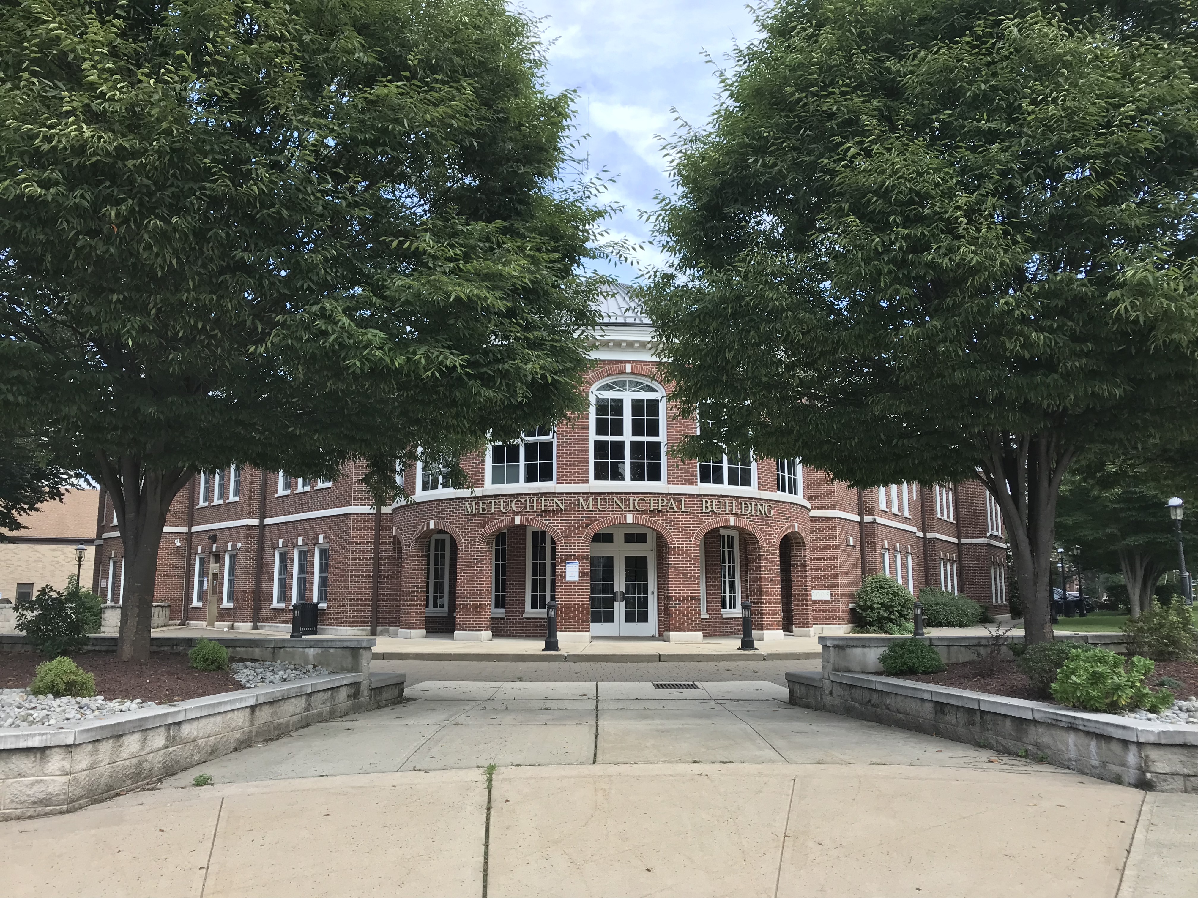
Metuchen ( ) is a suburban borough in Middlesex County, New Jersey, United States. The borough is a commuter town of New York City, located in the heart of the Raritan Valley region within the New York Metropolitan area. The borough, along with Edison (which completely surrounds Metuchen), is a regional commercial hub for Central New Jersey. The borough is northeast of New Brunswick, southwest of Newark, southwest of Jersey City, and southwest of Manhattan. As of the 2010 United States Census, the borough's population was 13,574,DP-1 - Profile of General Population and Housing Characteristics: 2010 for Metuchen borough, Middlesex County, New Jersey , |
Woodbridge CDP, New Jersey
Woodbridge is an unincorporated community and census-designated place (CDP) within Woodbridge Township, in Middlesex County, New Jersey, United States.New Jersey: 2010 - Population and Housing Unit Counts - 2010 Census of Population and Housing (CPH-2-32) , August 2012. Accessed November 30, 2012. [...More Info...] [...Related Items...] OR: [Wikipedia] [Google] [Baidu] |
Menlo Park Mall
Menlo Park Mall is a two-level super regional shopping mall, located on U.S. Route 1 and Parsonage Road in Edison, New Jersey. The mall has a gross leasable area of .Menlo Park Mall , backed up by the as of February 5, 2012. Accessed September 4, 2018. Menlo Park Mall is currently owned and managed by |
Garden State Parkway
The Garden State Parkway (GSP) is a controlled-access toll road that stretches the north–south length of eastern New Jersey from the state's southernmost tip near Cape May to the New York state line at Montvale. Its name refers to New Jersey's nickname, the "Garden State". The parkway is designated by the New Jersey Department of Transportation (NJDOT) as Route 444, although this designation is unsigned. At its north end, the road becomes the Garden State Parkway Connector, a component of the New York State Thruway system that connects to the Thruway mainline in Ramapo. The parkway is the longest highway in the state at approximately , and, according to the International Bridge, Tunnel and Turnpike Association, was the busiest toll road in the United States in 2006. Most of the highway north of the Raritan River runs through heavily populated areas. Between the Raritan River and the township of Toms River, the highway passes through lighter suburban development, whil ... [...More Info...] [...Related Items...] OR: [Wikipedia] [Google] [Baidu] |
Perth Amboy, New Jersey
Perth Amboy is a city (New Jersey), city in Middlesex County, New Jersey, Middlesex County, New Jersey. Perth Amboy is part of the New York metropolitan area. As of the 2020 United States census, 2020 U.S. census, the city's population was 55,436. Perth Amboy has a List of U.S. communities with Hispanic-majority populations in the 2010 census, Hispanic majority population. In the 2010 census, the Race and ethnicity in the United States Census#2010 Census, Hispanic population made up 78.1% of the population, the second-highest in the state, behind Union City, New Jersey, Union City at 84.7%. Perth Amboy is known as the "City by the Bay", referring to its location adjoining Raritan Bay. The earliest residents of the area were the Lenape Native Americans of the United States, Native Americans, who called the point on which the city lies "Ompoge". Perth Amboy was settled in 1683 by Scottish colonists and was called "New Perth" after James Drummond, 4th Earl of Perth; the native name ... [...More Info...] [...Related Items...] OR: [Wikipedia] [Google] [Baidu] |
Raritan River
Raritan River is a major river of New Jersey. Its Drainage basin, watershed drains much of the mountainous area of the central part of the state, emptying into the Raritan Bay on the Atlantic Ocean. History Geologists assert that the lower Raritan provided the course of the mouth of the Hudson River approximately 6,000 years ago. Following the end of the last ice age, the Narrows had not yet been formed and the Hudson flowed along the Watchung Mountains to present-day Bound Brook, New Jersey, Bound Brook, then followed the course of the Raritan eastward into Lower New York Bay. The name Raritan possibly derives from a branch of the Lenape people called the Nariticongs, the first people known to settle the Raritan Valley. Following conflict with the arriving Dutch colonization of the Americas, Dutch colonists, the native people of the region were forced to sell their territory near the Raritan Bay and move further inland along the river valley. As Colonial history of the Unite ... [...More Info...] [...Related Items...] OR: [Wikipedia] [Google] [Baidu] |


