|
National Weather Service Lincoln, Illinois
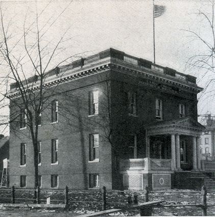
National Weather Service Lincoln, Illinois also known as National Weather Service Central Illinois is a weather forecast office responsible for monitoring weather conditions for 35 counties in Central and Southeastern Illinois. The Central Illinois office initially consisted of two forecast offices in Peoria and Springfield until the current location in Lincoln became the sole local forecast office in 1995. Federal meteorology offices and stations in the region date back to the 19th century when the Army Signal Service began taking weather observations using weather equipment at the Springer Building in Springfield. Since that time the presence of the National Weather Service greatly increased with the installation of new weather radars, stations and forecast offices. The current office in Lincoln maintains a WSR-88D (NEXRAD) radar system, and Advanced Weather Interactive Processing System (AWIPS) that greatly improve forecasting in the region. Lincoln is in charge of weather fo ... [...More Info...] [...Related Items...] OR: [Wikipedia] [Google] [Baidu] |
Federal Government Of The United States
The federal government of the United States (U.S. federal government or U.S. government) is the national government of the United States, a federal republic located primarily in North America, composed of 50 states, a city within a federal district (the city of Washington in the District of Columbia, where most of the federal government is based), five major self-governing territories and several island possessions. The federal government, sometimes simply referred to as Washington, is composed of three distinct branches: legislative, executive, and judicial, whose powers are vested by the U.S. Constitution in the Congress, the president and the federal courts, respectively. The powers and duties of these branches are further defined by acts of Congress, including the creation of executive departments and courts inferior to the Supreme Court. Naming The full name of the republic is "United States of America". No other name appears in the Constitution, and this i ... [...More Info...] [...Related Items...] OR: [Wikipedia] [Google] [Baidu] |
Abraham Lincoln Capital Airport
Abraham Lincoln Capital Airport is a civil-military airport in Sangamon County, Illinois, United States, three miles (6 km) northwest of downtown Springfield. It is owned by the Springfield Airport Authority (SAA). The airport is included in the Federal Aviation Administration (FAA) National Plan of Integrated Airport Systems for 2019–2023, in which it is categorized as a non-hub primary commercial service facility. It is the seventh busiest airport of the 12 commercial airports in Illinois. History The airport has dedicated in November 1947 under the name "Capital Airport." It came after pressure to construct a modern facility, as American Airlines and Chicago & Southern Airlines had canceled flight to Springfield a year earlier due to inadequate facilities at Capital Airport's predecessor. Construction on the new airport was began soon after those cancellations but were delayed due to World War II. The original airport had three 5300-foot runways, a service apron, ... [...More Info...] [...Related Items...] OR: [Wikipedia] [Google] [Baidu] |
Logan County Airport (Illinois)
Logan County Airport is a public use airport located 2.2 nautical miles (4 km) northeast of the central business district of Lincoln, a city in Logan County, Illinois, United States. It is owned by the Logan County Board. The airport is also the site of the National Weather Service Central Illinois (Central Illinois Forecast Office). Although most U.S. airports use the same three-letter location identifier for the FAA and IATA, this airport is assigned AAA by the FAA but has no designation from the IATA (which assigned AAA to Anaa Airport in Anaa, French Polynesia). Facilities and aircraft Logan County Airport covers an area of at an elevation of 597 feet (182 m) above mean sea level. It has two runways: 3/21 with an asphalt pavement measuring 3,999 x 75 ft (1,219 x 23 m) and 14/32 with a turf surface measuring 3,003 x 135 ft (915 x 41 m). The airport has an FBO offering food and restrooms. For the 12-month period ending August 31, 2019, the airport had 7,000 air ... [...More Info...] [...Related Items...] OR: [Wikipedia] [Google] [Baidu] |
Automated Surface Observing System
Airport weather stations are automated sensor suites which are designed to serve aviation and meteorological operations, weather forecasting and climatology. Automated airport weather stations have become part of the backbone of weather observing in the United States and Canada and are becoming increasingly more prevalent worldwide due to their efficiency and cost-savings. System types within the United States In the United States, there are several varieties of automated weather stations that have somewhat subtle but important differences. These include the automated weather observing system (AWOS) and the automated surface observing system (ASOS). Automated weather observing system (AWOS) The automated weather observing system (AWOS) units are mostly operated, maintained and controlled by state or local governments and other non-federal entities and are certified under the FAA non-federal AWOS Program. The FAA completed an upgrade of the 230 FAA owned AWOS and former automate ... [...More Info...] [...Related Items...] OR: [Wikipedia] [Google] [Baidu] |
Moline, Illinois
Moline ( ) is a city located in Rock Island County, Illinois, United States. With a population of 42,985 in 2020, it is the largest city in Rock Island County. Moline is one of the Quad Cities, along with neighboring East Moline, Illinois, East Moline and Rock Island, Illinois, Rock Island in Illinois and the cities of Davenport, Iowa, Davenport and Bettendorf, Iowa, Bettendorf in Iowa. The Quad Cities have an estimated population of 381,342. The city is the ninth-most populated city in Illinois outside the Chicago Metropolitan Area. The John Deere World Headquarters, corporate headquarters of Deere & Company is located in Moline, as was Montgomery Elevator, which was founded and headquartered in Moline until 1997, when it was acquired by Kone Elevator, which has its U.S. Division headquartered in Moline. Quad City International Airport, Black Hawk College, and the Quad Cities campus of Western Illinois University-Quad Cities are located in Moline. Moline is a retail hub for the Il ... [...More Info...] [...Related Items...] OR: [Wikipedia] [Google] [Baidu] |
Marseilles, Illinois
Marseilles ( ) is a city in LaSalle County, Illinois, LaSalle County, Illinois, United States. An Illinois River town, the population was 4,845 at the 2020 United States census, 2020 census, down from 5,094 at the 2010 census. It is part of the Ottawa, IL Micropolitan Statistical Area. History Lovell Kimball arrived at the area along the Illinois River known as the Grand Rapids in 1833 from Watertown, New York. Kimball, aware that the Illinois-Michigan Canal, Illinois-Michigan Canal Bill had passed and the canal would eventually reach the rapids, hired a surveyor to lay out a town. Kimball called the town Marseilles in reference to the France, French city of Marseille, France, Marseille as he hoped it would become a similar industrial center in Illinois. Marseilles, pronounced the same as the French city, was officially platted on June 3, 1835; the plat was revised twice for railroad and canal right-of-way (transportation), right-of-ways. Nabisco Building In 1921 the National Bis ... [...More Info...] [...Related Items...] OR: [Wikipedia] [Google] [Baidu] |
National Oceanic And Atmospheric Administration
The National Oceanic and Atmospheric Administration (abbreviated as NOAA ) is an United States scientific and regulatory agency within the United States Department of Commerce that forecasts weather, monitors oceanic and atmospheric conditions, charts the seas, conducts deep sea exploration, and manages fishing and protection of marine mammals and endangered species in the U.S. exclusive economic zone. Purpose and function NOAA's specific roles include: * ''Supplying Environmental Information Products''. NOAA supplies to its customers and partners information pertaining to the state of the oceans and the atmosphere, such as weather warnings and forecasts via the National Weather Service. NOAA's information services extend as well to climate, ecosystems, and commerce. * ''Providing Environmental Stewardship Services''. NOAA is a steward of U.S. coastal and marine environments. In coordination with federal, state, local, tribal and international authorities, NOAA manages the ... [...More Info...] [...Related Items...] OR: [Wikipedia] [Google] [Baidu] |
Environmental Science Services Administration
The Environmental Science Services Administration (ESSA) was a United States Federal executive agency created in 1965 as part of a reorganization of the United States Department of Commerce. Its mission was to unify and oversee the meteorological, climatological, hydrographic, and geodetic operations of the United States. It operated until 1970, when it was replaced by the new National Oceanic and Atmospheric Administration (NOAA). The first U.S. Government organization with the word "environment" in its title, ESSA was the first such organization chartered to study the global natural environment as whole, bringing together the study of the oceans with that of both the lower atmosphere and the ionosphere. This allowed the U.S. Government for the first time to take a comprehensive approach to studying the oceans and the atmosphere, also bringing together various technologies – ships, aircraft, satellites, radar, and communications systems – that could operate together in gat ... [...More Info...] [...Related Items...] OR: [Wikipedia] [Google] [Baidu] |
WSR-57
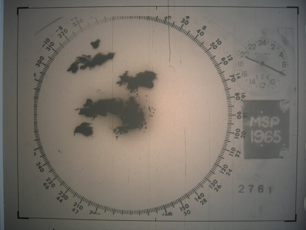
WSR-57 radars were the USA's main weather surveillance radar for over 35 years. The National Weather Service operated a network of this model radar across the country, watching for severe weather. History The WSR-57 (Weather Surveillance Radar - 1957) was the first 'modern' weather radar. Initially commissioned at the Miami Hurricane Forecast Center, the WSR-57 was installed in other parts of the CONUS (continental United States). The WSR-57 was the first generation of radars designed expressly for a national warning network. The WSR-57 was designed in 1957 by Dewey Soltow using World War II technology. It gave only coarse reflectivity data and no velocity data, which made it extremely difficult to predict tornadoes. Weather systems were traced across the radar screen using grease pencils. Forecasters had to manually turn a crank to adjust the radar's scan elevation, and needed considerable skill to judge the intensity of storms based on green blotches on the radar scope. T ... [...More Info...] [...Related Items...] OR: [Wikipedia] [Google] [Baidu] |
Saint Louis, Missouri
St. Louis () is the second-largest city in Missouri, United States. It sits near the confluence of the Mississippi and the Missouri Rivers. In 2020, the city proper had a population of 301,578, while the bi-state metropolitan area, which extends into Illinois, had an estimated population of over 2.8 million, making it the largest metropolitan area in Missouri and the second-largest in Illinois. Before European settlement, the area was a regional center of Native American Mississippian culture. St. Louis was founded on February 14, 1764, by French fur traders Gilbert Antoine de St. Maxent, Pierre Laclède and Auguste Chouteau, who named it for Louis IX of France. In 1764, following France's defeat in the Seven Years' War, the area was ceded to Spain. In 1800, it was retroceded to France, which sold it three years later to the United States as part of the Louisiana Purchase; the city was then the point of embarkation for the Corps of Discovery on the Lewis and Clark Ex ... [...More Info...] [...Related Items...] OR: [Wikipedia] [Google] [Baidu] |


.jpg)