|
National Register Of Historic Places Listings In The Highlands, Louisville, Kentucky
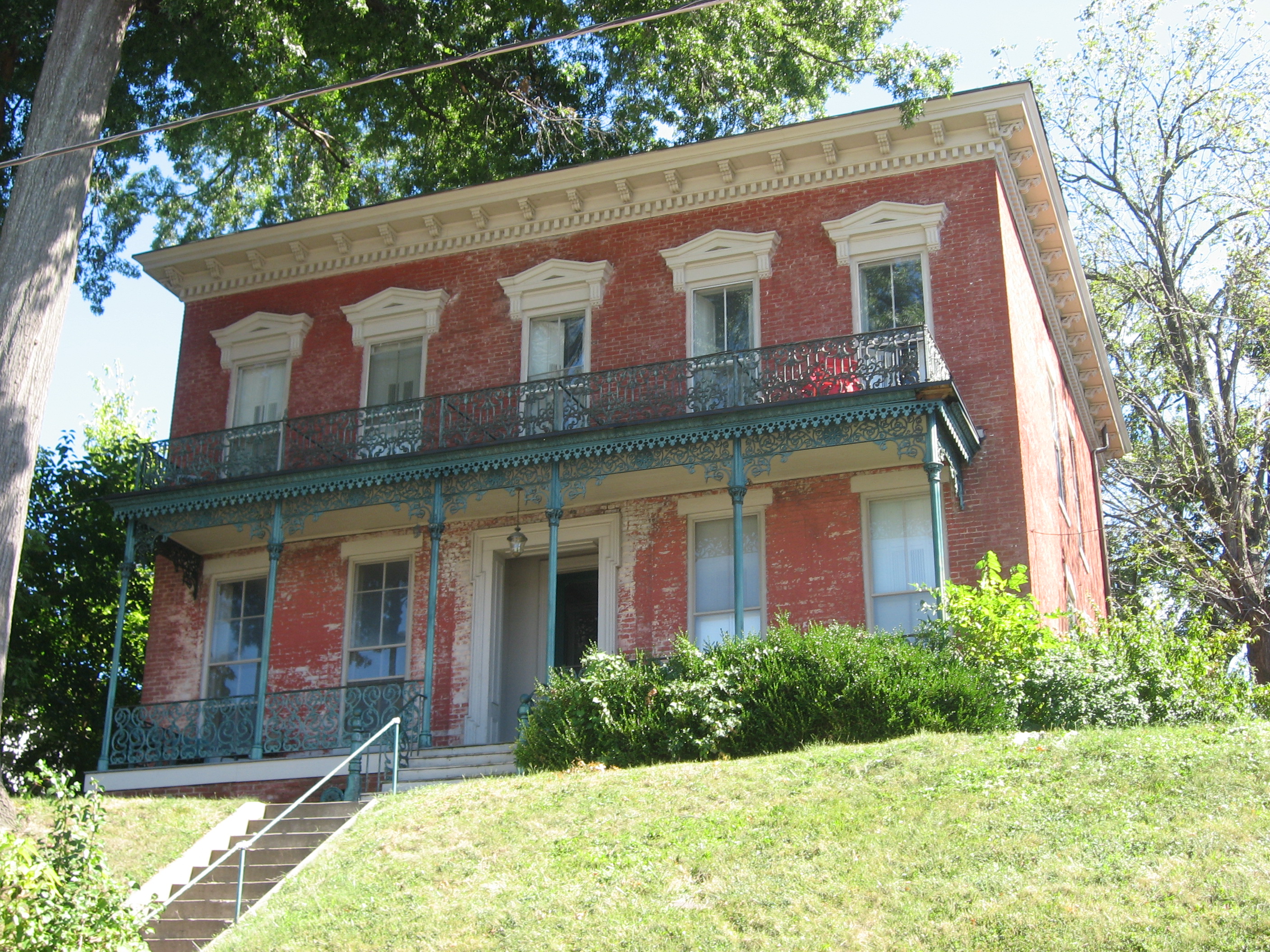
__NOTOC__ This is a list of properties and historic districts on the National Register of Historic Places in The Highlands, Louisville, Kentucky. The table below includes 30 listings in the following neighborhoods: Latitude and longitude coordinates of the sites listed on this page may be displayed in a map or exported in several formats by clicking on one of the links in the box below the map to the right. National Register sites elsewhere in Jefferson County are listed separately. Current listings Former listing See also * National Register of Historic Places listings in Jefferson County, Kentucky * List of National Historic Landmarks in Kentucky * List of attractions and events in the Louisville metropolitan area References {{Jefferson County, Kentucky Highlands Highland is a broad term for areas of higher elevation, such as a mountain range or mountainous plateau. Highland, Highlands, or The Highlands, may also refer to: Pla ... [...More Info...] [...Related Items...] OR: [Wikipedia] [Google] [Baidu] |
National Register Of Historic Places
The National Register of Historic Places (NRHP) is the United States federal government's official list of districts, sites, buildings, structures and objects deemed worthy of preservation for their historical significance or "great artistic value". A property listed in the National Register, or located within a National Register Historic District, may qualify for tax incentives derived from the total value of expenses incurred in preserving the property. The passage of the National Historic Preservation Act (NHPA) in 1966 established the National Register and the process for adding properties to it. Of the more than one and a half million properties on the National Register, 95,000 are listed individually. The remainder are contributing resources within historic districts. For most of its history, the National Register has been administered by the National Park Service (NPS), an agency within the U.S. Department of the Interior. Its goals are to help property owners and inte ... [...More Info...] [...Related Items...] OR: [Wikipedia] [Google] [Baidu] |
Original Highlands, Louisville
The Original Highlands is a historic neighborhood in the Highlands area of Louisville, Kentucky, United States. History The neighborhood was built on land surveyed in 1774 and granted to Colonial William Preston, surveyor of Fincastle County, Virginia. He died in 1781, and eventually his son, Major William Preston, and wife moved onto the land in 1814 and established a plantation called the "Briar Patch". The 1819 construction of the Louisville and Bardstown Turnpike (now Bardstown Road) would eventually lead to many people moving to the area. Before the American Civil War the area was agricultural and attracted many German immigrants, and was known as New Hamburg. Formal subdivision began after the land was inherited by Preston's daughter, Susan Preston Christy (after whom Christy Avenue is named). In 1869, Sydney J. Rogers subdivided Hepburn Avenue between Barrett and Baxter. Interest in the neighborhood picked up with the extension of a horse-drawn streetcar line to Highland ... [...More Info...] [...Related Items...] OR: [Wikipedia] [Google] [Baidu] |
List Of National Historic Landmarks In Kentucky
This is a complete list of National Historic Landmarks in Kentucky. , National Park Service, accessed May, 2006. There are 32 such landmarks in Kentucky; one landmark has had its designation withdrawn. See also * *References {{Kentucky |
Frazier History Museum
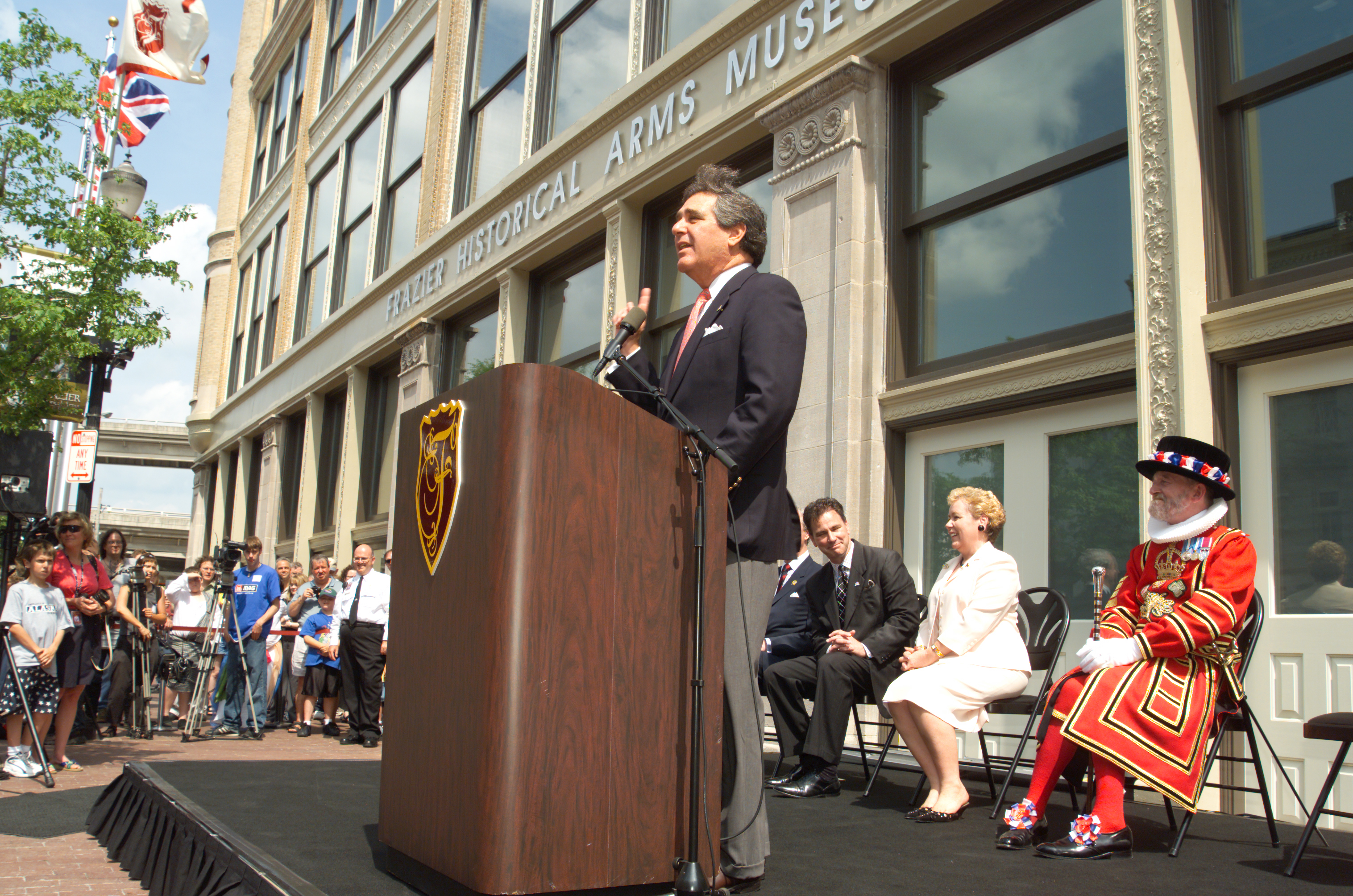
The Frazier History Museum, previously known as the Frazier Historical Arms Museum and the Frazier International History Museum, is a history museum located on Museum Row in the West Main District of downtown Louisville, Kentucky. An affiliate of the Smithsonian Institution, the Frazier documents and reinterprets stories from history using artifacts, gallery talks, and live interpretations that are written and performed in costume by a staff of teaching artists. Founded in 2004 as a museum of historical arms and armor, the Frazier has since expanded its focus to cover regional, national, and international history. The museum is home to one of the largest collections of toy soldiers and historic miniatures on permanent public display in the world, The Stewart Collection. Subjects of other permanent exhibitions include historic arms, bourbon whiskey, and the Lewis and Clark Expedition. In 2018, the Frazier became the official starting point of the Kentucky Bourbon Trail. History ... [...More Info...] [...Related Items...] OR: [Wikipedia] [Google] [Baidu] |
Cave Hill Cemetery
Cave Hill Cemetery is a Victorian era National Cemetery and arboretum located at Louisville, Kentucky. Its main entrance is on Baxter Avenue and there is a secondary one on Grinstead Drive. It is the largest cemetery by area and number of burials in Louisville. Cave Hill was listed on the National Register of Historic Places in 1979. Cave Hill National Cemetery, containing military graves, is also on the National Register, added in 1998. History Cave Hill was chartered in 1848 on what was William Johnston's Cave Hill Farm, then a rural property some distance east of Louisville. Johnston, who died in 1798, had built the first brick house in Louisville on the grounds circa 1788. City officials had purchased part of the land in the 1830s in anticipation of building a railroad through it, and a workhouse was built there. The railroad was built elsewhere, and the land was leased to local farmers. In 1846, Mayor Frederick A. Kaye began investigating the possibility of develop ... [...More Info...] [...Related Items...] OR: [Wikipedia] [Google] [Baidu] |
Eastern Parkway (Louisville, Kentucky)
The parkway system of Louisville, Kentucky, also known as the Olmsted Park System, was designed by the firm of preeminent 19th century landscape architect Frederick Law Olmsted. The system was built from the early 1890s through the 1930s, and initially owned by a state-level parks commission, which passed control to the city of Louisville in 1942. The system was intended to form a circuit around what was then the fringes of the city of Louisville. However, there is a disconnect of several blocks between Eastern and Southern Parkways, because of a planned parkway running from the terminus of Western (today's Northwestern) Parkway along the Ohio River and around to Eastern Parkway was never built. Today, the system falls under direct management of the Louisville Olmsted Parks Conservancy, and under broader supervision by Louisville's Metro Parks Department Development The system was first proposed in 1887 by businessman Andrew Cowan, an enthusiastic early supporter of Louisvil ... [...More Info...] [...Related Items...] OR: [Wikipedia] [Google] [Baidu] |
Bardstown Road
Bardstown Road is a major road in Louisville, Kentucky. It is known as "Restaurant Row". It carries U.S. Route 31E and U.S. Route 150, from the intersection of Baxter Avenue (US 31E) and Broadway (US 150), southeast through Jefferson and Bullitt counties; in Spencer and Nelson counties, the road is named Louisville Road; that road becomes 3rd Street in Bardstown, where US 31E and US 150 split at the intersection with U.S. Route 62 (Stephen Foster Avenue). There is a segment in The Highlands from Douglass Boulevard to Bardstown Road's northern terminus at Baxter Avenue, along with several blocks of Baxter Avenue north of the terminus, that has four lanes, with the outer two lanes used for on-street parking during non-peak traffic hours. Parking is banned during morning and evening commuting hours, during which all four lanes become traffic lanes with movements controlled by lane lights. Two lanes are dedicated to traffic in the normal com ... [...More Info...] [...Related Items...] OR: [Wikipedia] [Google] [Baidu] |
Jefferson County, Kentucky
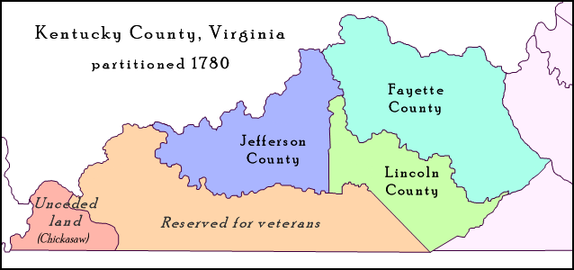
Jefferson County is located in the north central portion of the U.S. state of Kentucky. As of the 2020 census, the population was 782,969. It is the most populous county in the commonwealth (with more than twice the population of second ranked Fayette County). Since a city-county merger in 2003, the county's territory, population and government have been coextensive with the city of Louisville, which also serves as county seat. The administrative entity created by this merger is the Louisville/Jefferson County Metro Government, abbreviated to Louisville Metro. Jefferson County is the anchor of the Louisville-Jefferson County, KY-IN Metropolitan Statistical Area, locally referred to as Kentuckiana. History Jefferson County—originally Jefferson County, Virginia—was established by the Virginia General Assembly in June 1780, when it abolished and partitioned Kentucky County into three counties: Fayette, Jefferson and Lincoln. Named for Thomas Jefferson, who was governor ... [...More Info...] [...Related Items...] OR: [Wikipedia] [Google] [Baidu] |
National Register Of Historic Places Listings In Jefferson County, Kentucky
__NOTOC__ The table below includes sites listed on the National Register of Historic Places (NRHP) in Jefferson County, Kentucky except those in the following neighborhoods/districts of Louisville: Anchorage, Downtown, The Highlands, Old Louisville, Portland and the West End (including Algonquin, California, Chickasaw, Park Hill, Parkland, Russell and Shawnee). Links to tables of listings in these other areas are provided below. There are 492 properties and districts in the county listed on the National Register, including 8 National Historic Landmarks and 2 National Cemeteries. Latitude and longitude coordinates of the 221 sites listed on this page may be displayed in a map or exported in several formats by clicking on one of the links in the box below the map of Kentucky to the right. Current listings Other neighborhoods ... [...More Info...] [...Related Items...] OR: [Wikipedia] [Google] [Baidu] |
Tyler Park, Louisville
Tyler Park is a neighborhood three miles (5 km) southeast of downtown Louisville, Kentucky, USA. It is considered a part of a larger area of Louisville called The Highlands. Near the middle of the neighborhood is a city park of the same name, and many houses in the neighborhood feature park views. The neighborhood boundaries are St Louis Cemetery to the north, Bardstown Road to the east, Eastern Parkway to the south and Beargrass Creek to the west. History The first subdivision was laid out in 1873 by John H. Tucker between Baxter Avenue, Bardstown Road, Edenside Avenue, and about where Windsor Place would later be. However, because of its relatively remote location from downtown, development did not pick up until the 1880s. All early subdivisions were in the eastern section of the area, near Bardstown Road and away from the steep hills to the west. The extension of a streetcar line down Bardstown Road to Bonnycastle Avenue and the establishment of nearby Cherokee Park cre ... [...More Info...] [...Related Items...] OR: [Wikipedia] [Google] [Baidu] |
Irish Hill, Louisville
Irish Hill is a neighborhood east of downtown Louisville, Kentucky USA. It is bounded by Baxter Avenue to the west, Lexington Road to the north, the middle fork of Beargrass Creek and I-64 to the east. Cave Hill Cemetery is located directly south of Irish Hill. It is in the inner Highlands area of Louisville. History Irish Hill was originally known colloquially as ''Billy Goat Hill'' after Whalen's goat farm. Anticipating development, the city annexed the area in 1854. Streets were laid out in 1859 by Benjamin Adams and John Hull in an area known as Adams and Hull's Addition. The rest of the community was developed five years later by Ward Payne. Irish Hill acquired its name because it sits on a ridge above the Ohio River flood plain and was settled by Irish Catholics during the nineteenth century, although many German Catholics settled there as well. A sampling of the 1895 city directory lists the following occupations from Irish Hill occupants: huckster, carpenter, groce ... [...More Info...] [...Related Items...] OR: [Wikipedia] [Google] [Baidu] |
The Highlands (Louisville)
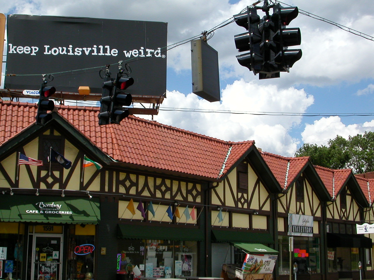
The Highlands is an area in Louisville, Kentucky which contains a high density of nightclubs, eclectic businesses, and many upscale and fast food restaurants. It is centered along a stretch of Bardstown Road and Baxter Avenue (US 31E/US 150) and is so named because it sits atop a ridge between the middle and south forks of Beargrass Creek (Kentucky), Beargrass Creek. The commercial area extends from the intersection of Bardstown Road and Taylorsville Road/Trevillian Way in the south, to the intersection of Baxter Avenue and Lexington Road in the north, a length of . A section of the nearby Barret Avenue also contains many similar businesses. The residential area is separated from other adjacent areas like Germantown, Louisville, Germantown and Crescent Hill, Louisville, Crescent Hill by the south and north forks of Beargrass Creek. The middle fork runs through Cherokee Park, and the south fork divides Germantown from Tyler Park, Louisville, Tyler Park, after flowing past several ... [...More Info...] [...Related Items...] OR: [Wikipedia] [Google] [Baidu] |


