|
National Register Of Historic Places Listings In Cowlitz County, Washington ...
Current listings References {{NRWAextlinks, Cowlitz Cowlitz Cowlitz may refer to: People * Cowlitz people, an indigenous people of the Pacific Northwest ** Cowlitz language, member of the Tsamosan branch of the Coast Salish family of Salishan languages * Cowlitz Indian Tribe, a federally recognized tribe o ... [...More Info...] [...Related Items...] OR: [Wikipedia] [Google] [Baidu] |
Longview, Washington
Longview is a city in Cowlitz County, Washington, United States. It is the principal city of the Longview, Washington Metropolitan Statistical Area, which encompasses all of Cowlitz County. Longview's population was 37,818 at the time of the 2020 census, making it the largest city in Cowlitz County. The city is located in southwestern Washington, at the junction of the Cowlitz and Columbia rivers. Longview shares a border with Kelso to the east, which is the county seat. The Cowlitz Indian Tribe, a federally recognized tribe of Cowlitz people, is headquartered in Longview. The Long-Bell Lumber Company, led by Robert A. Long, decided to buy a great expanse of timberland in Cowlitz County in 1918. A total of 14,000 workers were needed to run the two large mills as well as lumber camps that were planned. The number of workers needed was more than a lumber town, or the nearest town, could provide. Long planned and built a complete city in 1921 that could support a population ... [...More Info...] [...Related Items...] OR: [Wikipedia] [Google] [Baidu] |
Cowlitz County, Washington
Cowlitz County is a county located in the U.S. state of Washington. As of the 2020 census, its population was 110,730. The county seat is Kelso, and its largest city is Longview. The county was formed in April 1854. Its name derives from the anglicized version of the Cowlitz Indian term ''Cow-e-liske'', meaning either 'river of shifting sands' or 'capturing the medicine spirit.' Cowlitz comprises the Longview, WA Metropolitan statistical area, which is also included in the Portland-Vancouver- Salem, OR-WA Combined statistical area. History Prior to the Europeans' arrival to the area, it was inhabited by numerous Native American tribes, with the Cowlitz tribe being the largest. They were drawn to the region by the abundance of salmon. The Cowlitz are considered to be the first regional inhabitants to engage in commerce as they traded extensively with other tribes in Western and Eastern Washington. The Cowlitz Indian population declined significantly from the 1829-1830 smal ... [...More Info...] [...Related Items...] OR: [Wikipedia] [Google] [Baidu] |
Kelso, Washington
Kelso is a city in the southwestern part of the U.S. state of Washington and is the county seat of Cowlitz County. At the 2020 census, the population was 12,720. Kelso is part of the Longview, Washington Metropolitan statistical area, which has a population of 110,730. Kelso shares its long western border with Longview. It is near Mount St. Helens. History The earliest known inhabitants of Kelso were Native Americans from the Cowlitz tribe. The Cowlitz people were separated into the Upper (or Taidnapam) and Lower (or Mountain) Cowlitz tribes, who were members of the Sahaptin and Salish language families, respectively. In 1855, European explorers noted that there numbered over 6,000 individuals of the Cowlitz Tribe. Kelso was founded by Peter W. Crawford, a Scottish surveyor, who, in 1847, took up the first donation land claim on the Lower Cowlitz River. Crawford platted a townsite which he named after his home town of Kelso, Scotland. The original plat was dated a ... [...More Info...] [...Related Items...] OR: [Wikipedia] [Google] [Baidu] |
Woodland, Washington
Woodland is a city in Clark and Cowlitz counties in the State of Washington. Most residents live within Cowlitz County, in which the majority of the city lies. It is part of the ' Longview, Washington Metropolitan Statistical Area'. The population was 6,531 at the 2020 census. Etymology Named for its wooded setting by Christopher Columbus Bozarth, the community's first merchant and postmaster, at the suggestion of his wife. Identically or similarly named unincorporated communities (without post offices) with the same name source exist in Pierce, Snohomish, Island, and Grays Harbor counties. History Hudson's Bay Company retiree Adolphous Le Lewes (alternate spelling: Lewis) established a homestead at the mouth of what is today known as the Lewis River, in 1849 (The Lewis River is the namesake of A. Le Lewes, not Meriwether Lewis as is generally believed). Two Iowa families, related by marriage, came next: the Solomon Strongs filed a claim in September 1850 and the Squire Bozar ... [...More Info...] [...Related Items...] OR: [Wikipedia] [Google] [Baidu] |
Castle Rock, Washington
Castle Rock is a city in Cowlitz County, Washington. Located between the Willapa Hills and the western base of Mount St. Helens, Castle Rock is at the heart of Washington timber country in the Pacific temperate rain forest. Castle Rock is part of the Longview, Washington Metropolitan Statistical Area; the population was 2,446 as of the 2020 census. History Castle Rock is named for a volcanic rock outcropping over the Cowlitz River, "The Rock", rising 190 feet high on the south side of the city. The rock formation, resembling a castle, became a geographic landmark for Cowlitz Indians and Hudson's Bay Company traders as early as 1832. Today, it is the location of The Rock Community Park, with hiking trails, picnic tables, and a historical marker. Castle Rock is centered primarily on the donation land claim of Eliza and William Huntington, who settled at the location in 1852. The city was platted December 12, 1888 and incorporated on June 20, 1890. Castle Rock prospered as a Cow ... [...More Info...] [...Related Items...] OR: [Wikipedia] [Google] [Baidu] |
Cougar, Washington
Cougar is an unincorporated community and former town in Cowlitz County, Washington. Cougar is located around northeast of Woodland along Washington State Route 503 and situated along the northwest bank of Yale Lake, a reservoir on the Lewis River. The population of Cougar was 122 at the 1990 Census, when it was still incorporated as a town, but disincorporated before the 2000 Census. As of 2020, the population is 93. The Cougar community is part of the Woodland School District, a K-12 school district of about 2,200 students. Cougar is the nearest community to Mount St. Helens, which lies 13 miles (20.9215 km) to its northeast. The eruption of Mount St. Helens on May 18, 1980 was the deadliest and most economically destructive volcanic event in the history of the United States. A post office called Cougar was established in 1902. The community was named after the cougar. Geography Cougar is located at (46.0514993, -122.2995413). A notable Cougar resident is Gary B ... [...More Info...] [...Related Items...] OR: [Wikipedia] [Google] [Baidu] |
Cowlitz People
The term Cowlitz people covers two culturally and linguistically distinct indigenous peoples of the Pacific Northwest; the Lower Cowlitz or Cowlitz proper, and the Upper Cowlitz / Cowlitz Klickitat or Taitnapam. Lower Cowlitz refers to a southwestern Coast Salish people, which today are enrolled in the federally recognized tribes: Cowlitz Indian Tribe, Quinault Indian Nation, and Confederated Tribes of the Chehalis Reservation. The Upper Cowlitz or Taitnapam, is a Northwest Sahaptin speaking people, part of the Confederated Tribes and Bands of the Yakama Nation. Their traditional homelands are in western Washington state in the United States. Cowlitz tribal groups or bands There is an ongoing dispute over the Cowlitz people, their history, territory, ancestry, ethnicity, and language; which is important for land claims and treaty negotiations with the U.S. government by Cowlitz descendants. Some scholars believe that they were originally divided into four multi-linguistic ... [...More Info...] [...Related Items...] OR: [Wikipedia] [Google] [Baidu] |
Stella, Washington
Stella is an unincorporated community in Cowlitz County, Washington. Stella is located northwest of the city of Longview, reached by traveling westbound out of the city along Washington State Route 4, also known as Ocean Beach Highway, and turning north onto Stella Road. The Stella community is part of the Longview School District, a K-12 K-1 is a professional kickboxing promotion established in 1993, well known worldwide mainly for its heavyweight division fights and Grand Prix tournaments. In January 2012, K-1 Global Holdings Limited, a company registered in Hong Kong, acqui ... school district of about 6,600 students. The community was named after Stella Packard, the daughter of a local merchant. Geography Stella is located at (46.1906660, -123.1198407). Further reading * References External linksLongview Public Schools website Unincorporated communities in Cowlitz County, Washington Unincorporated communities in Washington (state) {{CowlitzCountyWA-ge ... [...More Info...] [...Related Items...] OR: [Wikipedia] [Google] [Baidu] |
Lewis River (Washington)
The Lewis River is a tributary of the Columbia River, about long, in southwestern Washington in the United States. It drains part of the Cascade Range north of the Columbia River. The drainage basin of the Lewis River covers about . The river's mean annual discharge is about . Unlike nearby Lewis County and Fort Lewis the Lewis River was not named for Meriwether Lewis, but rather for A. Lee Lewis, an early colonizer who homesteaded near the mouth of the river. History Like almost all Native tribes, Indigenous groups on the Lewis River experienced a population collapse as a result of an 1830 epidemic introduced by early colonizers. This is one of the reasons many early recorded observations include large shifts and changes in tribal populations. Tribal listings compiled by anthropologist Verne F. Ray mention a village about upstream from the mouth of the Lewis, which was originally populated by the Cowlitz, but transitioned after 1830 to a Klickitat population. Lewis and Clark ... [...More Info...] [...Related Items...] OR: [Wikipedia] [Google] [Baidu] |
Washington State Route 503
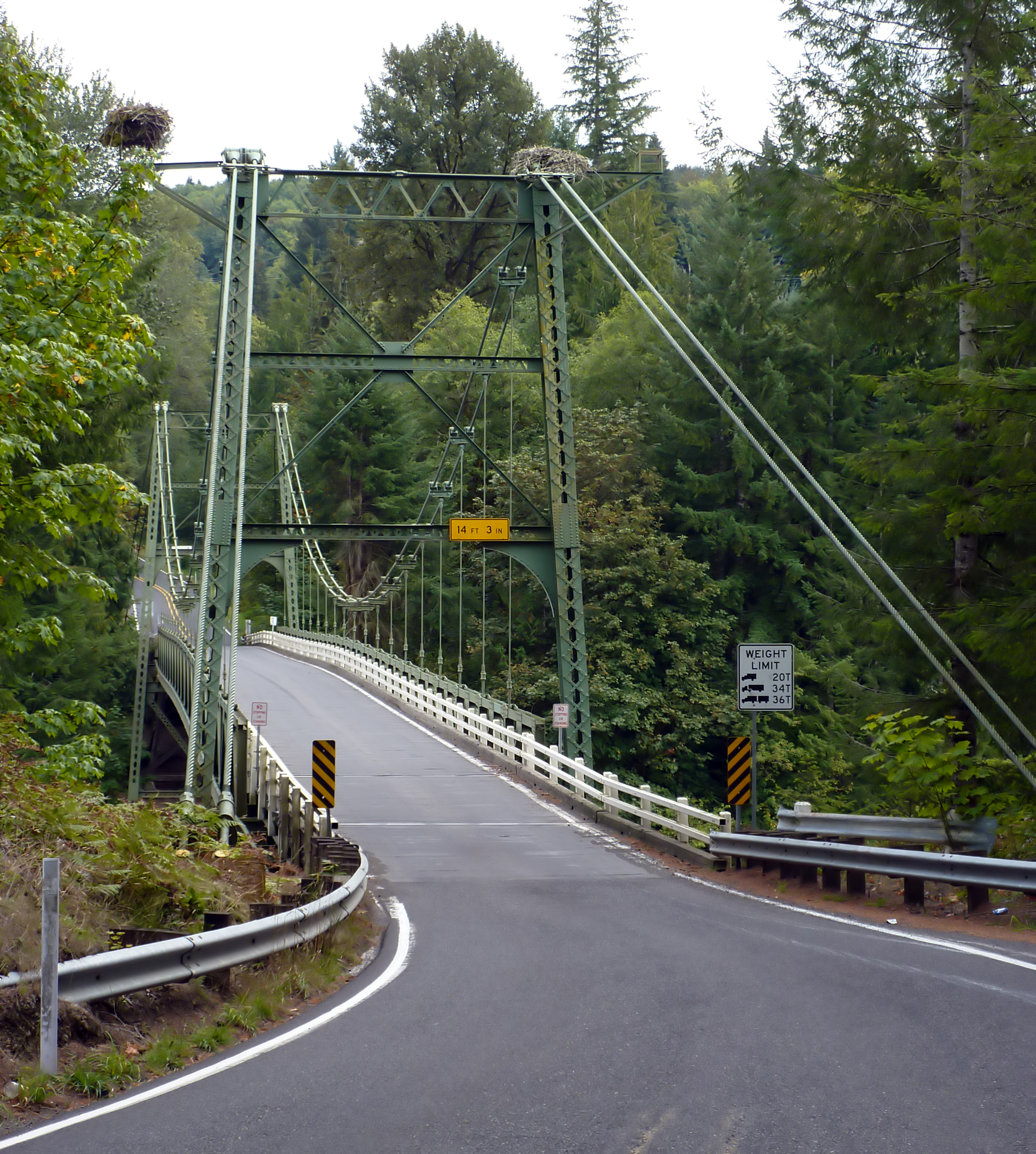
State Route 503 (SR 503) is a state highway serving Clark and Cowlitz counties in the U.S. state of Washington. The highway travels north from a short concurrency with SR 500 in Orchards through Battle Ground, the eastern terminus of SR 502, and communities in rural Clark County before crossing the Lewis River on the Yale Bridge. SR 503 intersects its spur route and turns west to parallel the Lewis River downstream to Woodland, where the highway ends at an interchange with Interstate 5 (I-5). The highway was part of the Lewis River Road, signed as State Road 15, from 1909 until 1919. The current route of SR 503 was split between Secondary State Highway 1S (SSH 1) from Woodland to Battle Ground and SSH 1U from Battle Ground to Orchards in 1937, combined to form SR 503 during the 1964 highway renumbering. A spur route, established in 1991, travels northeast into the Gifford Pinchot National Forest along Yale La ... [...More Info...] [...Related Items...] OR: [Wikipedia] [Google] [Baidu] |
Yale, Washington
Yale is an unincorporated community in Cowlitz County, Washington, northeast of the city of Woodland. Yale is located northeast of Woodland along Washington State Route 503 and situated between Yale Lake and Lake Merwin, both reservoirs on the Lewis River. The rock-fill hydro-electric Yale Dam is nearby. Named for Yale University, the only school teaching forestry in the 19th century,"Naming Clark County," Jolotta, Pat, Fort Vancouver Historical Society, 1993, p. 61 the Yale community is part of the Woodland School District, a K-12 school district of about 2,200 students. Yale is second nearest community, after Cougar The cougar (''Puma concolor'') is a large cat native to the Americas. Its range spans from the Canadian Yukon to the southern Andes in South America and is the most widespread of any large wild terrestrial mammal in the Western Hemisphere. ..., to Mount St. Helens, which lies to its northeast. The eruption of Mount St. Helens on May 18, 1980 was the ... [...More Info...] [...Related Items...] OR: [Wikipedia] [Google] [Baidu] |
Clark County, Washington
Clark County is the southernmost county in the U.S. state of Washington. As of the 2020 census, the population was 503,311, making it Washington's fifth-most populous county. Its county seat and largest city is Vancouver. It was the first county in Washington, named after William Clark of the Lewis and Clark Expedition. It was created by the provisional government of Oregon Territory on August 20, 1845, and at that time covered the entire present-day state. Clark County is the third-most-populous county in the Portland-Vancouver- Hillsboro, OR-WA Metropolitan Statistical Area, and is across the Columbia River from Portland. History Clark County began as the ''District of Vancouver'' on July 27, 1844. It included all the land north of the Columbia River, west of the Rocky Mountains, and south of Alaska. In 1845 the provisional government changed its name to Vancouver County. At that time it stretched from the Columbia River to 54 degrees 40 minutes North Latitude in wh ... [...More Info...] [...Related Items...] OR: [Wikipedia] [Google] [Baidu] |


