|
National Grassland
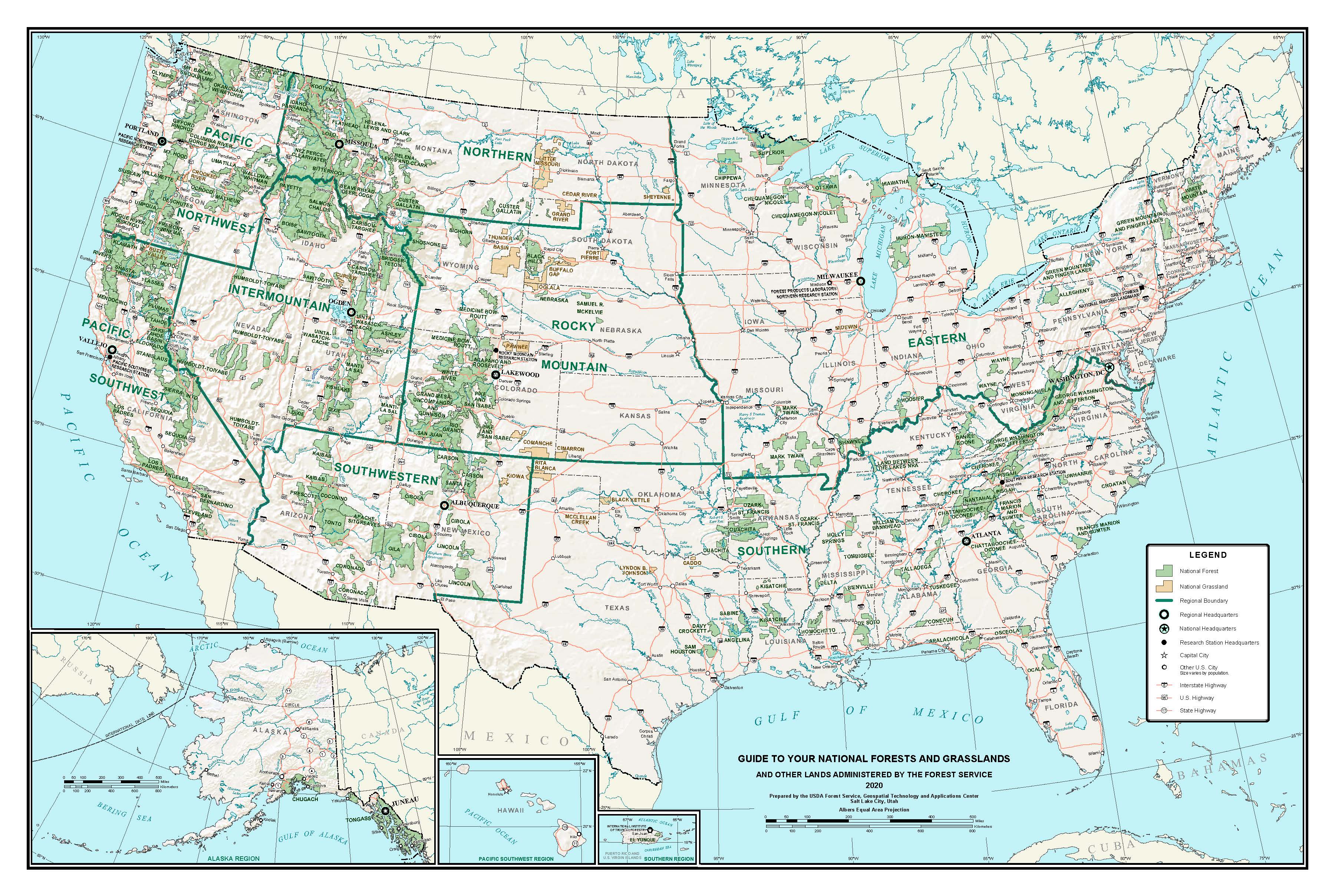
A national grassland is an area of protected and managed federal lands in the United States authorized by Title III of the Bankhead–Jones Farm Tenant Act of 1937. For administrative purposes, they are essentially identical to national forests, except that grasslands are areas primarily consisting of prairie. Like national forests, national grasslands may be open for hunting, grazing, mineral extraction, recreation and other uses. Various national grasslands are typically administered in conjunction with nearby national forests. All but four national grasslands are on or at the edge of the Great Plains. Those four are in southeastern Idaho, northeastern California, central Oregon, and a reserve in Illinois. The three national grasslands in North Dakota, together with one in northwestern South Dakota, are administered jointly as the Dakota Prairie Grasslands. National grasslands are generally much smaller than national forests – while a typical national forest would be about ... [...More Info...] [...Related Items...] OR: [Wikipedia] [Google] [Baidu] |
USA National Forests Map
The United States of America (U.S.A. or USA), commonly known as the United States (U.S. or US) or America, is a country Continental United States, primarily located in North America. It consists of 50 U.S. state, states, a Washington, D.C., federal district, five major unincorporated territories, nine United States Minor Outlying Islands, Minor Outlying Islands, and 326 Indian reservations. The United States is also in Compact of Free Association, free association with three Oceania, Pacific Island Sovereign state, sovereign states: the Federated States of Micronesia, the Marshall Islands, and the Palau, Republic of Palau. It is the world's List of countries and dependencies by area, third-largest country by both land and total area. It shares land borders Canada–United States border, with Canada to its north and Mexico–United States border, with Mexico to its south and has maritime borders with the Bahamas, Cuba, Russia, and other nations. With a population of over 333 m ... [...More Info...] [...Related Items...] OR: [Wikipedia] [Google] [Baidu] |
Dust Bowl
The Dust Bowl was a period of severe dust storms that greatly damaged the ecology and agriculture of the American and Canadian prairies during the 1930s. The phenomenon was caused by a combination of both natural factors (severe drought) and manmade factors (a failure to apply dryland farming methods to prevent aeolian processes, wind erosion, most notably the destruction of the natural topsoil by settlers in the region). The drought came in three waves: 1934–35 North American drought, 1934, 1936, and 1939–1940, but some regions of the High Plains (United States), High Plains experienced drought conditions for as many as eight years. The Dust Bowl has been the subject of many cultural works, notably the novel ''The Grapes of Wrath'' (1939) by John Steinbeck, the folk music of Woody Guthrie, and photographs depicting the conditions of migrants by Dorothea Lange, particularly the ''Migrant Mother'', taken in 1936. Geographic characteristics and early history With insuffic ... [...More Info...] [...Related Items...] OR: [Wikipedia] [Google] [Baidu] |
Butte Valley National Grassland
Butte Valley National Grassland is a United States National Grassland located in northern California. Administered by the United States Forest Service, Klamath National Forest, it is located in northern Siskiyou County, near the Oregon border, between the communities of Dorris and Macdoel along U.S. Highway 97. It was dedicated in July 1991 as the nation's 20th National Grassland. It is administered as part of the Klamath National Forest, and is the sole National Grassland in California and in Region 5 (Pacific Southwest) of the Forest Service. Administrative offices are located in Macdoel, California. Geography The area is located in the Klamath River basin at an elevation of approximately . The annual precipitation is approximately . It consists primarily of flat, sandy soils and a dry lake bed. The area includes sweeping views of the Cascade Range and Mount Shasta. History The area attracted homesteaders in the late 19th century who ditched, drained, plowed, and graze ... [...More Info...] [...Related Items...] OR: [Wikipedia] [Google] [Baidu] |
Black-footed Ferret
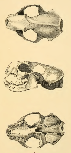
The black-footed ferret (''Mustela nigripes''), also known as the American polecatHeptner, V. G. (Vladimir Georgievich); Nasimovich, A. A; Bannikov, Andrei Grigorovich; Hoffmann, Robert S. (2001)''Mammals of the Soviet Union''Volume: v. 2, pt. 1b. Washington, D.C. : Smithsonian Institution Libraries and National Science Foundation. or prairie dog hunter, is a species of mustelid native to central North America. The black-footed ferret is roughly the size of a mink and is similar in appearance to the European polecat and the Asian steppe polecat. It is largely nocturnal and solitary, except when breeding or raising litters. Up to 90% of its diet is composed of prairie dogs. The species declined throughout the 20th century, primarily as a result of decreases in prairie dog populations and sylvatic plague. It was declared extinct in 1979, but a residual wild population was discovered in Meeteetse, Wyoming in 1981. A captive-breeding program launched by the United States Fish and W ... [...More Info...] [...Related Items...] OR: [Wikipedia] [Google] [Baidu] |
Badlands
Badlands are a type of dry terrain where softer sedimentary rocks and clay-rich soils have been extensively eroded."Badlands" in ''Chambers's Encyclopædia''. London: George Newnes, 1961, Vol. 2, p. 47. They are characterized by steep slopes, minimal vegetation, lack of a substantial regolith, and high drainage density.A.J. Parsons and A.D. Abrahams, Editors (2009) ''Geomorphology of Desert Environments'' (2nd ed.) Springer Science & Business Media Ravines, gullies, buttes, hoodoos and other such geologic forms are common in badlands. Badlands are found on every continent except Antarctica, being most common where there are unconsolidated sediments. They are often difficult to navigate by foot, and are unsuitable for agriculture. Most are a result of natural processes, but destruction of vegetation by overgrazing or pollution can produce anthropogenic badlands. Badlands topography Badlands are characterized by a distinctive badlands topography. This is terrain in which w ... [...More Info...] [...Related Items...] OR: [Wikipedia] [Google] [Baidu] |
Nebraska National Forest
The Nebraska National Forest is a United States National Forest located within the U.S. state of Nebraska. The total area of the national forest is 141,864 acres, or 222 sq miles (574 km2). The forest is managed by the U.S. Forest Service's Nebraska Forests and Grasslands Supervisor's Office in Chadron, Nebraska. The national forest includes two ranger districts, the Bessey Ranger District and the Pine Ridge Ranger District. In descending order of land, the forest lies in parts of Thomas, Dawes, Blaine, and Sioux counties. History The Nebraska National Forests & Grasslands began in 1902 as an experiment. University of Nebraska botany professor Charles Edwin Bessey, with the assistance of Gifford Pinchot, first Forest Service Chief, convinced President Theodore Roosevelt to set aside two treeless tracts of Nebraska sandhills as “forest reserves." Bessey’s intent was to grow trees, which would offset what some thought would be a national timber shortage from large fires, ... [...More Info...] [...Related Items...] OR: [Wikipedia] [Google] [Baidu] |
South Dakota
South Dakota (; Sioux language, Sioux: , ) is a U.S. state in the West North Central states, North Central region of the United States. It is also part of the Great Plains. South Dakota is named after the Lakota people, Lakota and Dakota people, Dakota Sioux Native Americans in the United States, Native American tribes, who comprise a large portion of the population with nine Indian reservation, reservations currently in the state and have historically dominated the territory. South Dakota is the List of U.S. states and territories by area, seventeenth largest by area, but the List of U.S. states and territories by population, 5th least populous, and the List of U.S. states and territories by population density, 5th least densely populated of the List of U.S. states, 50 United States. As the southern part of the former Dakota Territory, South Dakota became a state on November 2, 1889, simultaneously with North Dakota. They are the 39th and 40th states admitted to the union; Pr ... [...More Info...] [...Related Items...] OR: [Wikipedia] [Google] [Baidu] |
Buffalo Gap National Grassland
Buffalo Gap National Grassland is a National Grassland located primarily in southwestern South Dakota, United States. It is also the second largest National Grassland, after Little Missouri National Grassland in North Dakota. Characteristics of the grasslands include mixed prairie and chalky badlands. The grassland is managed by the U.S. Forest Service and is a division of Nebraska National Forest. In descending order of land area it is located in parts of Fall River, Pennington, Jackson, and Custer counties. Buffalo Gap National Grassland is managed by the Forest Service together with the Nebraska and Samuel R. McKelvie National Forests and the Fort Pierre and Oglala National Grasslands from common offices in Chadron, Nebraska. There are local ranger district offices located in Hot Springs and Wall. It also surrounds Badlands National Park and Minuteman Missile National Historic Site. In what is known as the Conata Basin region of the grassland, the most successful Black-f ... [...More Info...] [...Related Items...] OR: [Wikipedia] [Google] [Baidu] |
Washita River
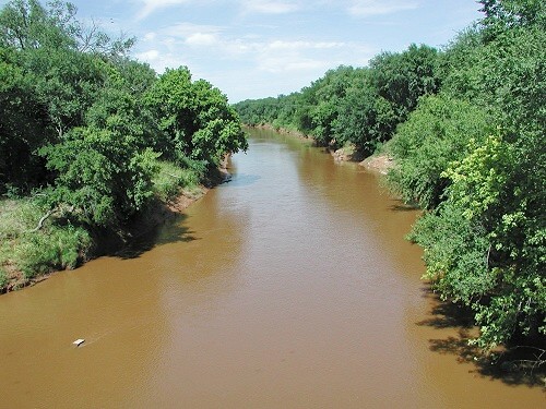
The Washita River () is a river in the states of Texas and Oklahoma in the United States. The river is long and terminates at its confluence with the Red River, which is now part of Lake Texoma () on the TexasOklahoma border. Geography The Washita River forms in eastern Roberts County, Texas (), near the town of Miami in the Texas Panhandle. The river crosses Hemphill County, Texas and enters Oklahoma in Roger Mills County. It cuts through the Oklahoma counties of Roger Mills, Custer, Washita, Caddo, Grady, Garvin, Murray, Carter, and Johnston County, Oklahoma, Johnston before emptying into Lake Texoma Lake Texoma is one of the largest reservoirs in the United States, the 12th largest US Army Corps of Engineers' (USACE) lake, and the largest in USACE Tulsa District. Lake Texoma is formed by Denison Dam on the Red River in Bryan County, Oklaho ..., which is the modern border between Bryan County, Oklahoma, Bryan County and Marshall County, Oklahoma, Marshall County ... [...More Info...] [...Related Items...] OR: [Wikipedia] [Google] [Baidu] |
Cibola National Forest
The Cibola National Forest (pronounced SEE-bo-lah) is a 1,633,783 acre (6,611.7 km2) United States National Forest in New Mexico, USA. The name Cibola is thought to be the original Zuni Indian name for their pueblos or tribal lands. The name was later interpreted by the Spanish to mean "buffalo." The forest is disjointed with lands spread across central and northern New Mexico, west Texas and Oklahoma. The Cibola National Forest is divided into four Ranger Districts: the Sandia, Mountainair, Mt. Taylor, and Magdalena. The Forest includes the San Mateo, Magdalena, Datil, Bear, Gallina, Manzano, Sandia, Mt. Taylor, and Zuni Mountains of west-central New Mexico. The Forest also manages four National Grasslands that stretch from northeastern New Mexico eastward into the Texas Panhandle and western Oklahoma. The Cibola National Forest and Grassland is administered by Region 3 of the United States Forest Service from offices in Albuquerque, New Mexico. Elevation ranges from 5,0 ... [...More Info...] [...Related Items...] OR: [Wikipedia] [Google] [Baidu] |
Texas
Texas (, ; Spanish language, Spanish: ''Texas'', ''Tejas'') is a state in the South Central United States, South Central region of the United States. At 268,596 square miles (695,662 km2), and with more than 29.1 million residents in 2020, it is the second-largest U.S. state by both List of U.S. states and territories by area, area (after Alaska) and List of U.S. states and territories by population, population (after California). Texas shares borders with the states of Louisiana to the east, Arkansas to the northeast, Oklahoma to the north, New Mexico to the west, and the Mexico, Mexican States of Mexico, states of Chihuahua (state), Chihuahua, Coahuila, Nuevo León, and Tamaulipas to the south and southwest; and has a coastline with the Gulf of Mexico to the southeast. Houston is the List of cities in Texas by population, most populous city in Texas and the List of United States cities by population, fourth-largest in the U.S., while San Antonio is the second most pop ... [...More Info...] [...Related Items...] OR: [Wikipedia] [Google] [Baidu] |


