|
National Cycle Route 700
The Bay Cycle Way is an cycling route around Morecambe Bay in Lancashire and Cumbria in north west England. Most of it forms National Cycle Route 700 (NCN 700), while other sections are waymarked as NCN 6 (London to the Lake District), NCN 69 (Hest Bank to Cleethorpes) and NCN 70 (Walney to Sunderland). It has been recommended by ''The Daily Telegraph'' ("20 amazing ways to enjoy the English seaside this summer"), the ''i'' newspaper ("20 best cycle routes in the UK: from coastal pathways to woodland rides") and the Touring Club Italiano ("Inghilterra, Scozia e Galles in bicicletta, le ciclabili più belle per una vacanza green"). Route The end points of the route are Walney Island, west of Barrow-in-Furness, and Glasson Dock, a former port on the River Lune south west of Lancaster. The route goes inland to Milnthorpe to cross the River Kent at Levens Bridge, near Levens Hall, the lowest crossing point of the river by road; there are hopes that a footpath and cycleway may so ... [...More Info...] [...Related Items...] OR: [Wikipedia] [Google] [Baidu] |
Morecambe Bay
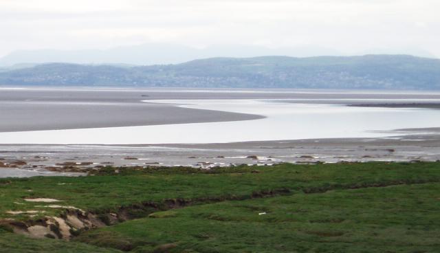
Morecambe Bay is a large estuary in northwest England, just to the south of the Lake District National Park. It is the largest expanse of intertidal mudflats and sand in the United Kingdom, covering a total area of . In 1974, the second largest gas field in the UK was discovered west of Blackpool, with original reserves of over 7 trillion cubic feet (tcf) (200 billion cubic metres). At its peak, 15% of Britain's gas supply came from the bay but production is now in decline. It is also one of the homes of the high brown fritillary butterfly. Natural features The rivers Leven, Kent, Keer, Lune and Wyre drain into the Bay, with their various estuaries making a number of peninsulas within the bay. Much of the land around the bay is reclaimed, forming salt marshes used in agriculture. Morecambe Bay is also an important wildlife site, with abundant birdlife and varied marine habitats, and there is a bird observatory at Walney Island. The bay has rich cockle beds, which have been ... [...More Info...] [...Related Items...] OR: [Wikipedia] [Google] [Baidu] |
Levens Hall
Levens Hall is a manor house in the Kent valley, near the village of Levens and south of Kendal in Cumbria, Northern England. History The first house on the site was a pele tower built by the Redman family in around 1350. Much of the present building dates from the Elizabethan era, when the Bellingham family extended the house. The Bellinghams, who were responsible for the fine panelling and plasterwork in the main rooms, sold the house and estate in 1689 to Colonel James Grahme, or Graham, Keeper of the Privy Purse to King James II, who made a number of additions to the house in the late 17th century. His son Henry Graham was a knight of the shire for Westmorland. Further additions were made in the early 19th century. Levens is now owned by the Bagot family and is open to the public. The small collection of steam road vehicles includes several traction engines which are usually steamed on Sundays and Bank Holidays. In October 2021, the building was one of 142 sites acro ... [...More Info...] [...Related Items...] OR: [Wikipedia] [Google] [Baidu] |
Silverdale, Lancashire
Silverdale is a village and civil parish within the City of Lancaster district of Lancashire, England. The village stands on Morecambe Bay, near the border with Cumbria, north west of Carnforth and of Lancaster. The parish had a population of 1,519 recorded in the 2011 census. Silverdale forms part of the Arnside and Silverdale Area of Outstanding Natural Beauty. The RSPB's Leighton Moss nature reserve is close to the village train station. The National Trust owns several pieces of land in the area. The former Tarmac-owned Trowbarrow quarry is now a SSSI and popular climbing location. The Lancashire Coastal Way footpath goes from Silverdale to Freckleton, and the Cumbria Coastal Way goes from Silverdale to Gretna. It is served by nearby Silverdale railway station on the line from Lancaster to Barrow in Furness. Governance Silverdale is in the UK Parliamentary Constituency of Morecambe and Lunesdale, represented since 2010 by David Morris (Conservative), who was r ... [...More Info...] [...Related Items...] OR: [Wikipedia] [Google] [Baidu] |
Grange-over-Sands
Grange-over-Sands is a town and civil parish located on the north side of Morecambe Bay in Cumbria, England, a few miles south of the Lake District National Park. In the 2001 census the parish had a population of 4,042, increasing at the 2011 census to 4,114. Historically part of Lancashire, the town was created as an urban district in 1894. Since the 1974 local government re-organisation, it has been of the South Lakeland district of Cumbria, though it remains part of the Duchy of Lancaster. Travelling by road, Grange-over-Sands is to the south of Kendal, to the east of Ulverston, to the east of Barrow-in-Furness and to the west of Lancaster. History The town developed in the Victorian era from a small fishing village and the arrival of the railway in 1857 made it a popular seaside resort on the north side of Morecambe Bay, across the sands from Morecambe. The "over-Sands" suffix was added in the late 19th or early 20th century by the local vicar, who was fed up with ... [...More Info...] [...Related Items...] OR: [Wikipedia] [Google] [Baidu] |
Flookburgh
Flookburgh is an ancient village on the Cartmel peninsula in Cumbria, England, until 1974 part of Lancashire. Being close to Morecambe Bay, cockle and shrimp fishing plays a big part in village life. Flookburgh is sometimes thought to derive its name from a flat fish, known as the Fluke, found in the area. (Many people in Flookburgh say, in fact, that Flookburgh wasn't named after the Fluke; the Fluke was named after the village.) However, it is far more likely that the name is Norse, an adaptation of 'Flugga's Town'. Location Flookburgh is located away from the nearest town, Grange-Over-Sands. Travelling by road, it is to the south of Kendal, to the east of Ulverston, to the east of Barrow-in-Furness and to the west of Lancaster. Modern times Flookburgh is also home to Furness Fish & Game who produce Morecambe Bay potted Shrimps, the famous Cartmel Sticky Toffee Pudding is made in the village. Cark airfield, which is actually in Flookburgh, is home to the North We ... [...More Info...] [...Related Items...] OR: [Wikipedia] [Google] [Baidu] |
Cark
Cark (sometimes Cark in Cartmel) is a village in Cumbria, England. It lies on the B5278 road to Haverthwaite (and to the A590 road) and is ½ mile north of Flookburgh, 2 miles southwest of Cartmel and 3 miles west of Grange-over-Sands. It is in the historic county of Lancashire. The village is served by the Cark and Cartmel railway station on the Furness Line between Barrow-in-Furness and Lancaster. The village used to have a water-powered cotton mill between 1785 and c1815. Cark is ½ mile south of Holker Hall owned by Lord and Lady Cavendish. Royal Air Force Station Cark was constructed near Flookburgh in late 1940. It was used by training and anti-aircraft co-operation units from March 1941 until closure in December 1945. After many years of disuse, it was reopened for civilian use and is the location of the North West Parachute Centre. Notable people * Christopher Rawlinson (1677–1733) of Carke Hall in Cartmel, antiquary * Edith Allonby (1875-1905), writer and ... [...More Info...] [...Related Items...] OR: [Wikipedia] [Google] [Baidu] |
Cartmel
Cartmel is a village in Cumbria, England, northwest of Grange-over-Sands close to the River Eea. The village takes its name from the Cartmel Peninsula, and was historically known as Kirkby in Cartmel. The village is the location of the 12th-century Cartmel Priory, around which it initially grew. Historically in Lancashire, since 1974 it has been in the administrative county of Cumbria. Whilst its history has been in its ecclesiastical and agricultural communities, Cartmel has since the mid-twentieth century developed as a minor tourist destination, being just outside the Lake District National Park. Several attractions in the village, including Cartmel Racecourse and a Michelin-starred restaurant, cater to this tourist trade. History The name Cartmel means ‘sandbank by rocky ground’, from the Old Norse (rocky ground) and . The place-name is first attested in 677, when the Cartmel Peninsula was granted to St Cuthbert, whose influence may explain why by the Norman Conque ... [...More Info...] [...Related Items...] OR: [Wikipedia] [Google] [Baidu] |
Greenodd
Greenodd is a village in the Furness area of the county of Cumbria, England, but within the historical county of Lancashire. For local government purposes the village is also within the area of South Lakeland District. It is located 3 miles (5 km) north-east of Ulverston at the junction of the A590 trunk road and the A5092 trunk road. The village is just outside the boundary of the Lake District National Park at ( OS grid ref. SD 315825). Greenodd is within the Crake Valley area of South Lakeland District. The 2001 UK census gives a population of 1823 for the Crake Valley. Greenodd and adjacent Penny Bridge are the main districts in the Crake Valley. The River Crake flows into the estuary of the River Leven at Greenodd. History The name ''Greenodd'' is of Scandinavian origin, the ''odd'' meaning ''ness'' (headland) in this case (the name translates literally as 'The Green Promontory'). Swedish toponymist Eilert Ekwall speculated that the name was not an old one, as ... [...More Info...] [...Related Items...] OR: [Wikipedia] [Google] [Baidu] |
Roosebeck
Roosebeck is a hamlet in South Lakeland, Cumbria, England, on the north west coast of Morecambe Bay. It is in the civil parish of Aldingham. Roosebeck is on the A5087 road, the coastal route from Ulverston to Barrow-in-Furness via Rampside, and is in the south west corner of South Lakeland district: immediately to its west is the boundary of the Borough of Barrow-in-Furness Barrow-in-Furness is a local government district with borough status in Cumbria, England. It is named after its main town, Barrow-in-Furness. Other settlements include Dalton-in-Furness and Askam-in-Furness. It is the smallest district in the .... A Wesleyan Methodist chapel was opened at Roosebeck in 1879, closed in 1962, and has since been demolished. In 1870 seven human skeletons, arranged in two rows, and a celt (stone tool) were found at Roosebeck. References Hamlets in Cumbria Populated coastal places in Cumbria Aldingham {{Cumbria-geo-stub ... [...More Info...] [...Related Items...] OR: [Wikipedia] [Google] [Baidu] |
Rampside
Rampside is a village in Cumbria, England. Historically in Lancashire, it is located a few miles south-east of the town of Barrow-in-Furness, in the north-western corner of Morecambe Bay on the Furness peninsula. History There is evidence that the village was inhabited as early as 1292, in the records of the monks of Furness Abbey, though Viking and Roman artefacts have been found in the village's church. As well as agriculture, the village acted as a small port, with shipping trade coming to Furness Abbey through Roa Island, which itself was defended by the fortified Piel Island, both around one mile south of Rampside.''Barrow and District'' by Fred Barnes, Barrow-in-Furness Corporation, Barrow-in-Furness (Lancs) 1968 Thomas Lawson, a herbalist and botanist, was born at Rampside in 1630 and became minister at the village church. He invited George Fox to preach from the pulpit after one Sunday service, and subsequently became a Quaker himself in 1653. He published various rel ... [...More Info...] [...Related Items...] OR: [Wikipedia] [Google] [Baidu] |
Warton Crag
Warton Crag is a limestone hill in north west Lancashire, England. It lies to the north west of Warton village, in City of Lancaster district. At it is the highest point in the Arnside and Silverdale Area of Outstanding Natural Beauty, and is listed as a "HuMP" or "Hundred Metre Prominence", having a "drop" or "prominence" of with its parent being Hutton Roof Crags. Two areas are Local Nature Reserves, called Warton Crag and Warton Crag Quarry. Different sections are owned by Lancashire County Council, the Wildlife Trust for Lancashire, Manchester and North Merseyside, Lancaster City Council and the Royal Society for the Protection of Birds. Two caves on the west side of the hill called Dog Holes and Badger Hole show signs of early human occupation, with excavations finding a range of artefacts. The summit of the hill is the site of a small multivallate hillfort, which has long been assumed to date to the Iron Age period. The approximately enclosure was defended by r ... [...More Info...] [...Related Items...] OR: [Wikipedia] [Google] [Baidu] |
Bigland Barrow
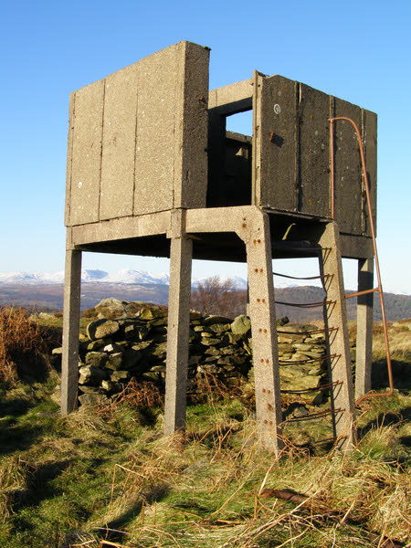
Bigland Barrow is a hill in the English Lake District, near Backbarrow, Cumbria. It is the subject of a chapter of Alfred WainwWainwright's book ''The Outlying Fells of Lakeland''. It reaches , and there is a concrete lookout tower on the summit which Wainwright describes as "a wartime relic". Wainwright's route is an anticlockwise circuit from Newby Bridge. References Fells of the Lake District {{Cumbria-geo-stub ... [...More Info...] [...Related Items...] OR: [Wikipedia] [Google] [Baidu] |


