|
Nant Llwydiarth
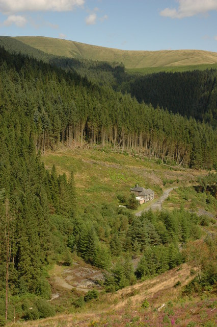
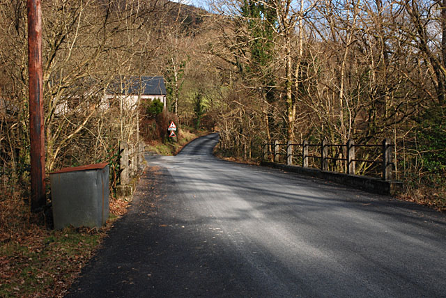
The Nant Llwydiarth is a small river in Mid Wales. It flows from the southern flank of Mynydd Hendre-ddu down to Pont Cymerau, north-east of Aberllefenni. Here it joins the Nant Ceiswyn to form the Afon Dulas The Afon Dulas, or North Dulas, is a river forming the border between Merionethshire/Gwynedd and Montgomeryshire/Powys in Wales. Another river called Afon Dulas joins the Dyfi from the south, upstream of its confluence with the North Dulas: loca ... that flows south to the Afon Dyfi. There was an ancient bridge at Pont Cymerau. References {{authority control Rivers of Gwynedd Rivers of Snowdonia Aberllefenni ... [...More Info...] [...Related Items...] OR: [Wikipedia] [Google] [Baidu] |
Wales
Wales ( cy, Cymru ) is a Countries of the United Kingdom, country that is part of the United Kingdom. It is bordered by England to the Wales–England border, east, the Irish Sea to the north and west, the Celtic Sea to the south west and the Bristol Channel to the south. It had a population in 2021 of 3,107,500 and has a total area of . Wales has over of coastline and is largely mountainous with its higher peaks in the north and central areas, including Snowdon (), its highest summit. The country lies within the Temperateness, north temperate zone and has a changeable, maritime climate. The capital and largest city is Cardiff. Welsh national identity emerged among the Celtic Britons after the Roman withdrawal from Britain in the 5th century, and Wales was formed as a Kingdom of Wales, kingdom under Gruffydd ap Llywelyn in 1055. Wales is regarded as one of the Celtic nations. The Conquest of Wales by Edward I, conquest of Wales by Edward I of England was completed by 1283, th ... [...More Info...] [...Related Items...] OR: [Wikipedia] [Google] [Baidu] |
Mynydd Hendre-ddu
Mynydd Hendre-ddu or Mynydd Hendreddu is a mountain in southern Snowdonia, Wales. It is one of a line of mountains running from Mynydd Dolgoed in the north, through Mynydd Llwydiarth to Mynydd Hendre-ddu and on to Mynydd y Foel, Y Grug, Mynydd Tri-Arglwyd and Mynydd Gwyn to the south of the village of Aberangell. It forms the watershed between Nant Llwydiarth, which flows to the south-west and into the Afon Dulas, and streams flowing into Afon Angell to the north, which flow east into the River Dyfi. The summit is notable for a set of parallel ridges about across and long that run across it. On the northern slope of the mountain lay the Hendre Ddu slate quarry which was connected to Aberangell by the Hendre-Ddu Tramway The Hendre-Ddu Tramway was a narrow gauge industrial railway built in 1874 in Mid-Wales to connect the Hendre-Ddu slate quarry to Aberangell station on the Mawddwy Railway. It consisted of a main line long and several branch lines and spurs .... M ... [...More Info...] [...Related Items...] OR: [Wikipedia] [Google] [Baidu] |
Aberllefenni
Aberllefenni is a village in the south of Gwynedd, Wales. It lies in the historic county of Merionethshire/ Sir Feirionnydd, in the valley of the Afon Dulas, and in the Community of Corris. Government The village has a community council. The current representatives are elected residents and the local councillor who often attends is John Pughe Roberts. The community council system replaced the old parish council system and tackles local issues, acts as a contact point between local government and residents for information and resource on many environmental, equality, ethnicity and gender Gender is the range of characteristics pertaining to femininity and masculinity and differentiating between them. Depending on the context, this may include sex-based social structures (i.e. gender roles) and gender identity. Most cultures u ... issues and other problems [...More Info...] [...Related Items...] OR: [Wikipedia] [Google] [Baidu] |
River
A river is a natural flowing watercourse, usually freshwater, flowing towards an ocean, sea, lake or another river. In some cases, a river flows into the ground and becomes dry at the end of its course without reaching another body of water. Small rivers can be referred to using names such as Stream#Creek, creek, Stream#Brook, brook, rivulet, and rill. There are no official definitions for the generic term river as applied to Geographical feature, geographic features, although in some countries or communities a stream is defined by its size. Many names for small rivers are specific to geographic location; examples are "run" in some parts of the United States, "Burn (landform), burn" in Scotland and northeast England, and "beck" in northern England. Sometimes a river is defined as being larger than a creek, but not always: the language is vague. Rivers are part of the water cycle. Water generally collects in a river from Precipitation (meteorology), precipitation through a ... [...More Info...] [...Related Items...] OR: [Wikipedia] [Google] [Baidu] |
Mid Wales
Mid Wales ( cy, Canolbarth Cymru or simply ''Y Canolbarth'', meaning "the midlands") or Central Wales refers to a region of Wales, encompassing its midlands, in-between North Wales and South Wales. The Mid Wales Regional Committee of the Senedd covered the unitary authority areas of Ceredigion and Powys and the area of Gwynedd that had previously been the district of Meirionnydd. A similar definition is used by the BBC. The Wales Spatial Plan defines a region known as "Central Wales" which covers Ceredigion and Powys. Mid Wales is dominated by the Cambrian Mountains, including the Green Desert of Wales. The region is sparsely populated, with an economy dependent on farming and small businesses. Major settlements * Aberaeron * Aberdyfi * Aberporth * Aberystwyth * Bala * Barmouth * Borth * Brecon * Builth Wells * Caersws * Cardigan * Crickhowell * Dolgellau * Fairbourne * Harlech * Hay-on-Wye * Knighton * Lampeter * Llandrindod Wells * Llandysul * Llanidloes * Llanwrtyd * M ... [...More Info...] [...Related Items...] OR: [Wikipedia] [Google] [Baidu] |
Nant Ceiswyn
The Nant Ceiswyn (sometimes known as the ''Afon Ceiswyn'') is a small river in Mid Wales. It flows from the northern flank of Mynydd Dolgoed down to Pont Cymerau, north-east of Aberllefenni. Here it joins the Nant Llwydiarth to form the Afon Dulas that flows south to the Afon Dyfi. There was an ancient bridge at Pont Cymerau. The valley of the river is often known as ''Cwm Ratgoed'' (or ''Ralltgoed''), after the Ratgoed slate quarry about two miles north of Pont Cymerau. The quarry was connected to the Corris Railway at Aberllefenni by the horse-worked Ratgoed Tramway, which crossed the river as it passes Cymerau Quarry. To the east of the valley is Mynydd Ceiswyn, part of the chain of ridges running southwards from Maesglase Maesglase is a mountain in Snowdonia, North Wales, situated approximately four miles to the south-west of Aran Fawddwy. It is the highest of the Dyfi Hills. It can be reached by an easy but steep walk through the forestry from Dinas Mawd .... ... [...More Info...] [...Related Items...] OR: [Wikipedia] [Google] [Baidu] |
Afon Dulas
The Afon Dulas, or North Dulas, is a river forming the border between Merionethshire/Gwynedd and Montgomeryshire/Powys in Wales. Another river called Afon Dulas joins the Dyfi from the south, upstream of its confluence with the North Dulas: locally this is referred to as the South Dulas. Route of North Dulas Afon Dulas rises from a source in the hills above Aberllefenni and passes through Corris, Esgairgeiliog and Pantperthog before joining the Afon Dyfi at Ffridd Gate near Machynlleth. History The Dulas is recorded as an important land boundary in 1200, in a document written in 1428. This document describes the land owned by Einion ap Seisyllt, in the time of Llywelyn the Great, as "tota terra inter aquas de Dyfi et Delwas" (Latin, meaning: all the land between the rivers Dyfi and Dulas). Roads and railways in the Dulas valley * The A487 trunk road follows the valley from Ffridd Gate to Corris * The Roman road Sarn Helen probably followed the valley from Aberllefenni to ... [...More Info...] [...Related Items...] OR: [Wikipedia] [Google] [Baidu] |
Afon Dyfi
The River Dyfi ( cy, Afon Dyfi; ), also known as the River Dovey (; ), is an approximately long river in Wales. Its large estuary forms the boundary between the counties of Gwynedd and Ceredigion, and its lower reaches have historically been considered the border between North Wales and South Wales. Name Nowadays the Welsh spelling ''Dyfi'' is widely used locally and by the Welsh Government, Natural Resources Wales and the BBC. The anglicised spelling ''Dovey'' continues to be used by some entities. Sources The River Dyfi rises in the small lake Creiglyn Dyfi at about above sea level, below Aran Fawddwy, flowing south to Dinas Mawddwy and Cemmaes Road ( cy, Glantwymyn), then south west past Machynlleth to Cardigan Bay ( cy, Bae Ceredigion) at Aberdyfi. It shares its watershed with the River Severn ( cy, Afon Hafren) and the River Dee ( cy, Afon Dyfrdwy) before flowing generally south-westwards down to a wide estuary. The only large town on its route is Machynlleth. T ... [...More Info...] [...Related Items...] OR: [Wikipedia] [Google] [Baidu] |
Rivers Of Gwynedd
A river is a natural flowing watercourse, usually freshwater, flowing towards an ocean, sea, lake or another river. In some cases, a river flows into the ground and becomes dry at the end of its course without reaching another body of water. Small rivers can be referred to using names such as creek, brook, rivulet, and rill. There are no official definitions for the generic term river as applied to geographic features, although in some countries or communities a stream is defined by its size. Many names for small rivers are specific to geographic location; examples are "run" in some parts of the United States, "burn" in Scotland and northeast England, and "beck" in northern England. Sometimes a river is defined as being larger than a creek, but not always: the language is vague. Rivers are part of the water cycle. Water generally collects in a river from precipitation through a drainage basin from surface runoff and other sources such as groundwater recharge, springs, a ... [...More Info...] [...Related Items...] OR: [Wikipedia] [Google] [Baidu] |
Rivers Of Snowdonia
A river is a natural flowing watercourse, usually freshwater, flowing towards an ocean, sea, lake or another river. In some cases, a river flows into the ground and becomes dry at the end of its course without reaching another body of water. Small rivers can be referred to using names such as Stream#Creek, creek, Stream#Brook, brook, rivulet, and rill. There are no official definitions for the generic term river as applied to Geographical feature, geographic features, although in some countries or communities a stream is defined by its size. Many names for small rivers are specific to geographic location; examples are "run" in some parts of the United States, "Burn (landform), burn" in Scotland and northeast England, and "beck" in northern England. Sometimes a river is defined as being larger than a creek, but not always: the language is vague. Rivers are part of the water cycle. Water generally collects in a river from Precipitation (meteorology), precipitation through a ... [...More Info...] [...Related Items...] OR: [Wikipedia] [Google] [Baidu] |


