|
Nakijin Castle
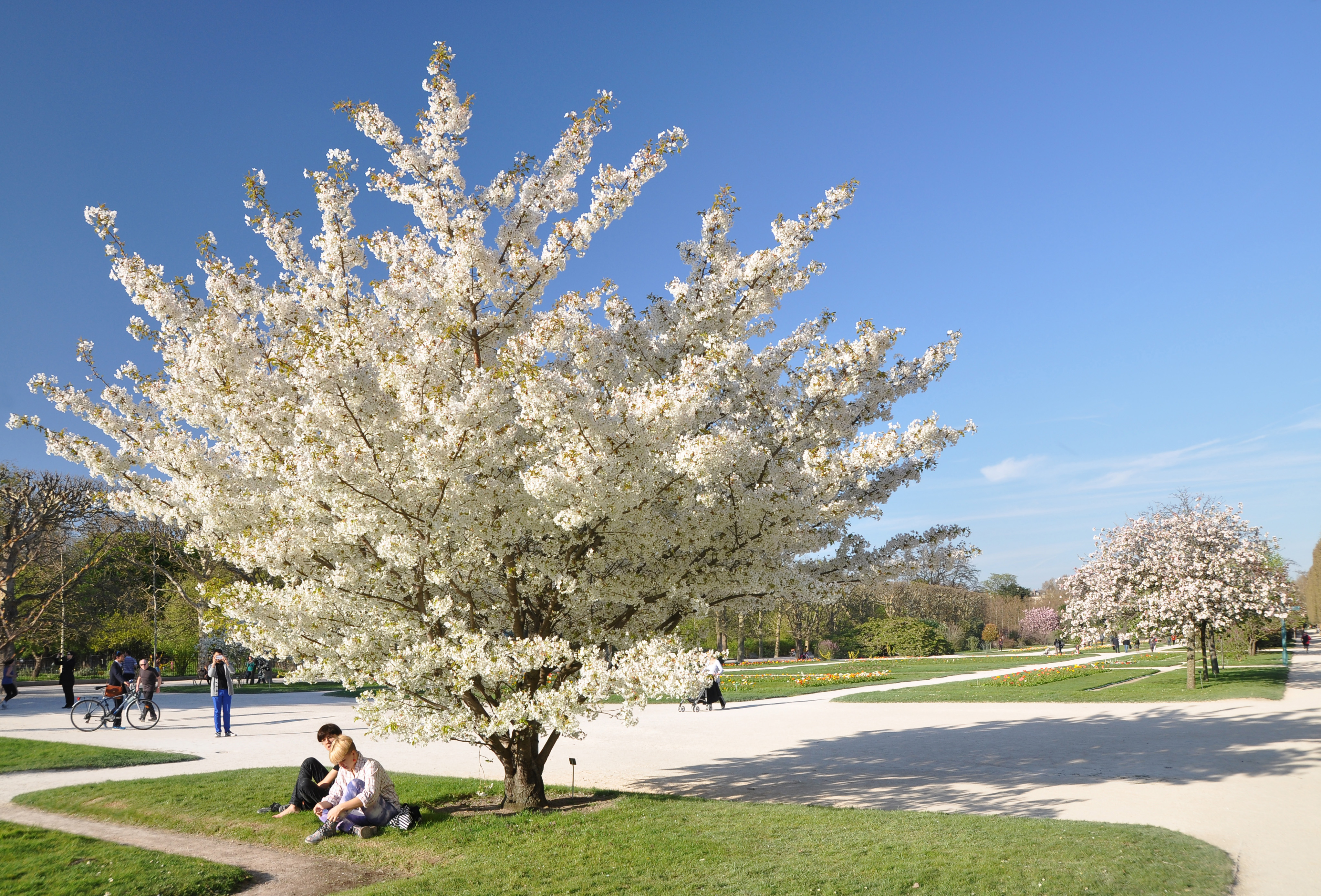
is a Ryukyuan ''gusuku'' located in Nakijin, Okinawa. It is currently in ruins. In the late 14th century, the island of Okinawa consisted of three principalities: Nanzan to the south, Chūzan in the central area, and Hokuzan in the north. Nakijin was the capital of Hokuzan. The fortress includes several sacred Utaki groves, reflecting the castle's role as a center of religious activity. It is today known for the Hikan cherries which bloom in northern Okinawa between mid-January and early February, providing the first cherry blossoms each year in Japan. In 2000, Nakijin Castle was designated as a World Heritage Site, as a part of the Gusuku Sites and Related Properties of the Kingdom of Ryukyu. History Though there had been Lords of Nakijin prior to the creation of the Hokuzan kingdom, and thus some form of chiefly residence can be presumed to have been on or near the site before, it is believed that the ''gusuku'' form of Nakijin castle only emerged at the founding of the kingdom ... [...More Info...] [...Related Items...] OR: [Wikipedia] [Google] [Baidu] |
Nakijin, Okinawa
is a village located in Kunigami District, Okinawa Prefecture, Japan. As of 2003, the village has an estimated population of 9,529 and a population density of 239.00 persons per km2. The total area is 39.87 km2. Education The village operates its public elementary and junior high schools. * Nakijin Junior High School ( 今帰仁中学校) * Amesoko Elementary School (天底小学校) * Kaneshi Elementary School (兼次小学校) * Nakijin Elementary School (今帰仁小学校) Okinawa Prefectural Board of Education operates . Notable people *Seiji Shimota, novelist * Shun Medoruma, novelist See also *Nakijin Castle is a Ryukyuan '' gusuku'' located in Nakijin, Okinawa. It is currently in ruins. In the late 14th century, the island of Okinawa consisted of three principalities: Nanzan to the south, Chūzan in the central area, and Hokuzan in the north. Na ... Notes External links * Nakijin official website Villages in Okinawa Prefecture Port settlements in ... [...More Info...] [...Related Items...] OR: [Wikipedia] [Google] [Baidu] |
Ryukyuan Religion
The Ryukyuan religion (琉球信仰), Ryūkyū Shintō (琉球神道), Nirai Kanai Shinkō (ニライカナイ信仰), or Utaki Shinkō (御嶽信仰) is the indigenous belief system of the Ryukyu Islands. While specific legends and traditions may vary slightly from place to place and island to island, the Ryukyuan religion is generally characterized by ancestor worship and the respecting of relationships between the living, the dead, and the gods and spirits of the natural world. Some of its beliefs, such as those concerning '' genius loci'' spirits and many other beings classified between gods and humans, are indicative of its ancient animistic roots, as is its concern with , or life essence. Over time, Ryukyuan religious practice has been influenced by Japanese Shinto and Chinese religions (White Lotus, Manichaeism, Taoism, Confucianism, and folk beliefs) along with Christianity and Buddhism. One of its most ancient features is the belief , the spiritual superiority of women ... [...More Info...] [...Related Items...] OR: [Wikipedia] [Google] [Baidu] |
Former Castles In Japan
A former is an object, such as a template, gauge or cutting die, which is used to form something such as a boat's hull. Typically, a former gives shape to a structure that may have complex curvature. A former may become an integral part of the finished structure, as in an aircraft fuselage, or it may be removable, being using in the construction process and then discarded or re-used. Aircraft formers Formers are used in the construction of aircraft fuselage, of which a typical fuselage has a series from the nose to the empennage, typically perpendicular to the longitudinal axis of the aircraft. The primary purpose of formers is to establish the shape of the fuselage and reduce the column length of stringers to prevent instability. Formers are typically attached to longerons, which support the skin of the aircraft. The "former-and-longeron" technique (also called stations and stringers) was adopted from boat construction, and was typical of light aircraft built until the ad ... [...More Info...] [...Related Items...] OR: [Wikipedia] [Google] [Baidu] |
World Heritage Sites In Japan
Japan accepted the UNESCO World Heritage Convention on 30 June 1992. As of July 2021, twenty-five properties have been inscribed on the World Heritage List: twenty cultural sites and five natural sites. A further five sites and one site extension have been submitted for future inscription and are currently on the Tentative List as of 2017. Map World Heritage Sites Tentative list The Tentative List consists of sites previously nominated, but not yet inscribed. Other UNESCO heritage lists See also * Cultural Properties of Japan * National Treasures of Japan * Cultural Landscapes of Japan * National parks of Japan References External links *World Heritage Sites in Japan*Database of National Cultural Properties - World Heritage (世界遺産) {{DEFAULTSORT:World Heritage Sites in Japan Japan Japan ( ja, 日本, or , and formally , ''Nihonkoku'') is an island country in East Asia. It is situated in the northwest Pacific Ocean, and is bordered on the w ... [...More Info...] [...Related Items...] OR: [Wikipedia] [Google] [Baidu] |
Sakura
A cherry blossom, also known as Japanese cherry or sakura, is a flower of many trees of Prunus, genus ''Prunus'' or Prunus subg. Cerasus, ''Prunus'' subg. ''Cerasus''. They are common species in East Asia, including China, Korea and especially in Japan. They generally refer to ornamental cherry trees, not to be confused with cherry tree, cherry trees that produce fruit for eating.Toshio Katsuki. (2015) ''Sakura''. pp.14–18 Iwanami Shoten. It is considered the national flower of Japan. Wild species of the cherry tree is widely distributed mainly in the Northern hemisphere. In the mainstream classification in Europe and North America, cherry trees for ornamental purposes are classified into the genus ''Prunus'' which consists of about 400 species. In the mainstream classification in Japan, China, and Russia, on the other hand, ornamental cherry trees are classified into the genus ''Cerasus'', which consists of about 100 species separated from the genus ''Prunus'', and the g ... [...More Info...] [...Related Items...] OR: [Wikipedia] [Google] [Baidu] |
Amami Islands
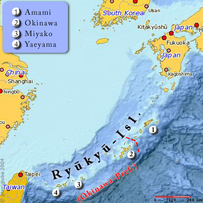
The The name ''Amami-guntō'' was standardized on February 15, 2010. Prior to that, another name, ''Amami shotō'' (奄美諸島), was also used. is an archipelago in the Satsunan Islands, which is part of the Ryukyu Islands, and is southwest of Kyushu. Administratively, the group belongs to Kagoshima Prefecture, Japan. The Geospatial Information Authority of Japan and the Japan Coast Guard agreed on February 15, 2010, to use the name of for the Amami Islands. Prior to that, was also used. The name of Amami is probably cognate with , the goddess of creation in the Ryukyuan creation myth. Geography The Amami Islands are limestone islands of coralline origin and have a total area of approximately , of which constitute the city (''-shi'') of Amami, and constitute the district (''-gun'') of Oshima. The highest elevation is ''Yuwandake'' with a height of on Amami Ōshima. The climate is a humid subtropical climate (Köppen climate classification ''Cfa'') with very warm summer ... [...More Info...] [...Related Items...] OR: [Wikipedia] [Google] [Baidu] |
Satsuma Domain
The , briefly known as the , was a domain (''han'') of the Tokugawa shogunate of Japan during the Edo period from 1602 to 1871. The Satsuma Domain was based at Kagoshima Castle in Satsuma Province, the core of the modern city of Kagoshima, located in the south of the island of Kyushu. The Satsuma Domain was ruled for its existence by the '' Tozama'' ''daimyō'' of the Shimazu clan, who had ruled the Kagoshima area since the 1200s, and covered territory in the provinces of Satsuma, Ōsumi and Hyūga. The Satsuma Domain was assessed under the '' Kokudaka'' system and its value peaked at 770,000 '' koku'', the second-highest domain in Japan after the Kaga Domain. Totman, Conrad. (1993) ''Early Modern Japan'', p. 119 The Satsuma Domain was one of the most powerful and prominent of Japan's domains during the Edo period, conquering the Ryukyu Kingdom as a vassal state after the invasion of Ryukyu in 1609, and clashing with the British during the bombardment of Kagoshima in 186 ... [...More Info...] [...Related Items...] OR: [Wikipedia] [Google] [Baidu] |
Shuri, Okinawa
''Sui'' or ''Shui'', Northern Ryukyuan languages, Northern Ryukyuan: ''Shiyori'' is a district of the city of Naha, Okinawa. It was formerly a separate city in and of itself, and the royal capital of the Ryūkyū Kingdom. A number of famous historical sites are located in Shuri, including Shuri Castle, the Shureimon gate, Sunuhyan-utaki (a sacred space of the native Ryukyuan religion), and royal mausoleum Tamaudun, all of which are designated World Heritage Sites by UNESCO. Originally established as a castle town surrounding the royal palace, Shuri ceased to be the capital when the kingdom was abolished and incorporated into Japan as Okinawa prefecture. In 1896, Shuri was made a of the new prefectural capital, Naha, though it was made a separate city again in 1921. In 1954, it was merged again into Naha. History Medieval and early modern periods Shuri Castle was first built during the reign of Shunbajunki (r. 1237–1248), who ruled from nearby Urasoe Castle.George H. Kerr, K ... [...More Info...] [...Related Items...] OR: [Wikipedia] [Google] [Baidu] |
East China Sea
The East China Sea is an arm of the Western Pacific Ocean, located directly offshore from East China. It covers an area of roughly . The sea’s northern extension between mainland China and the Korean Peninsula is the Yellow Sea, separated by an imaginary line between the eastern tip of Qidong at the Yangtze River estuary and the southwestern tip of South Korea's Jeju Island. The East China Sea is bounded in the east and southeast by the middle portion of the first island chain off the eastern Eurasian continental mainland, including the Japanese island of Kyushu and the Ryukyu Islands, and in the south by the island of Taiwan. It connects with the Sea of Japan in the northeast through the Korea Strait, the South China Sea in the southwest via the Taiwan Strait, and the Philippine Sea in the southeast via gaps between the various Ryukyu Islands (e.g. Tokara Strait and Miyako Strait). Most of the East China Sea is shallow, with almost three-fourths of it being less than ... [...More Info...] [...Related Items...] OR: [Wikipedia] [Google] [Baidu] |
Motobu Peninsula
The is a peninsula in the Yanbaru region of Okinawa Island. It is surrounded by Nago Bay to the east, the Haneda Inland Sea to the north, and the East China Sea to the west.Okinawa Island Guide " Nago City / Motobu Town / Nakijin VillageOkinawa Island Guide » Nago City / Motobu Town / Nakijin Village accessdate: April 4, 2017Google MapsGoogle Maps accessdate: April 3, 2017 It is mostly mountainous, with a few plains. The peninsula's northeasternmost point is Cape Bise.Figure 5 of 6terminal point accessdate: April 3, 2017 Its highest point is Mount Yae, whose summit is .Stripes OkinawaJapan's cherry blossom season starts here , Stripes Okinawa, accessdate: April 3, 2017 Due to a US military communications tower, the summit is off-limits.Map It! Okinawa: January 2017Map It! Okinawa: January 2017 accessdate: April 5, 2017Map It! Okinawa: Cherry Blossoms on Yaedake (Mt. Yae) accessdate: April 5, 2017 The peninsula was the center of power for the kingdom of Hokuzan in medieval t ... [...More Info...] [...Related Items...] OR: [Wikipedia] [Google] [Baidu] |


