|
Nagahori Tsurumi-ryokuchi Line (Osaka)
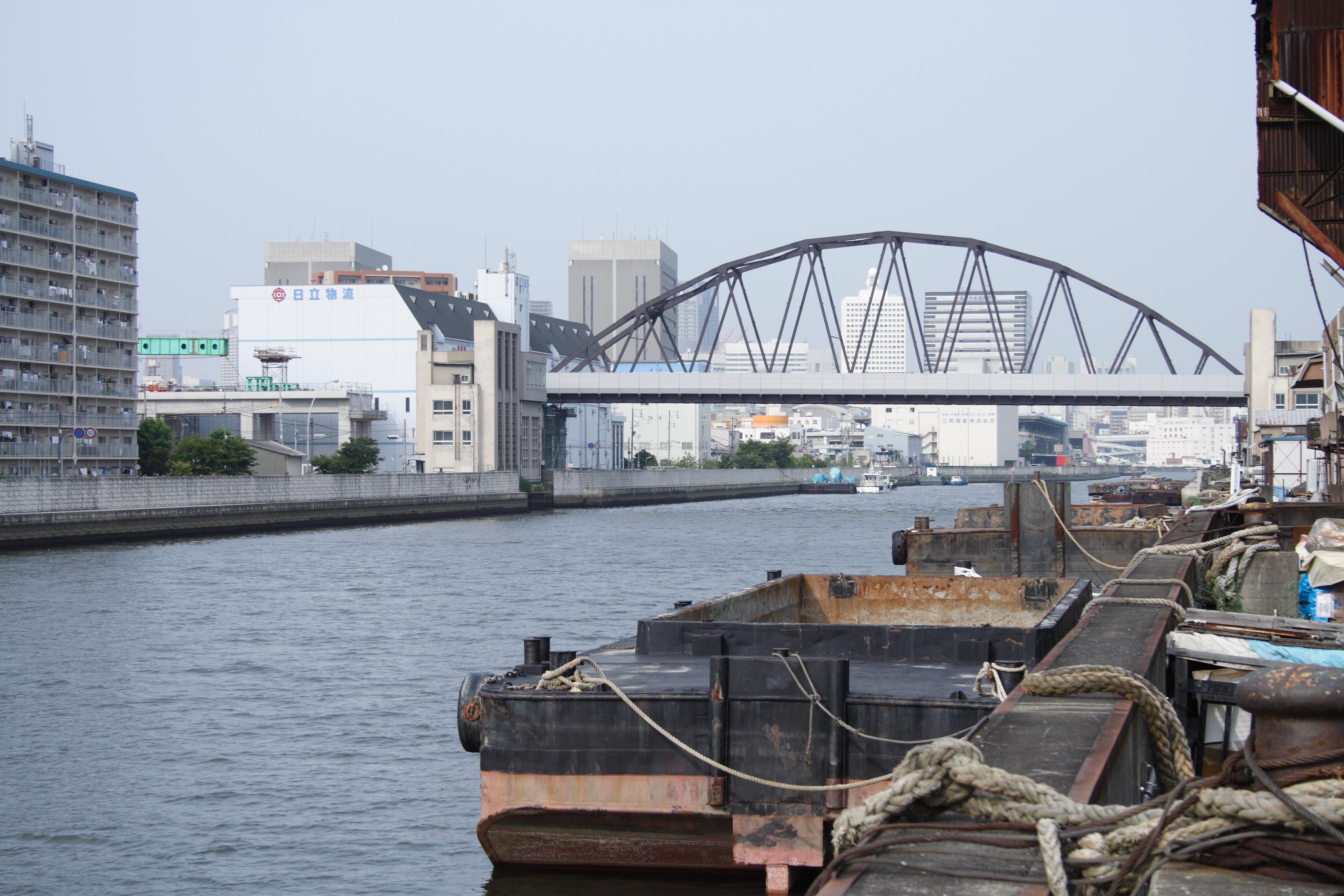
The is an underground rapid transit system in Osaka, Japan, operated by Osaka Metro. It was the first linear motor rapid transit line constructed in Japan (and the first outside North America, predated only by the Intermediate Capacity Transit System in Vancouver). Its official name is , and in MLIT publications, it is written as . Station numbers are indicated by the letter "N". History The line is named after Nagahori-dori, a major avenue which it follows through central Osaka, and the Tsurumi-ryokuchi, a park in northeastern Osaka which hosted the International Flower and Greenery Exposition in 1990. The line was built not only to provide access to the park during the exhibition, but also to relieve congestion from the Chūō Line. Its first segment opened on 31 March 1990 between Kyōbashi and Tsurumi-ryokuchi, at which time it was called the . Under its original plan, the line would have provided access to the Osaka prefectural government offices near Osaka Cast ... [...More Info...] [...Related Items...] OR: [Wikipedia] [Google] [Baidu] |
Rapid Transit
Rapid transit or mass rapid transit (MRT), also known as heavy rail or metro, is a type of high-capacity public transport generally found in urban areas. A rapid transit system that primarily or traditionally runs below the surface may be called a subway, tube, or underground. Unlike buses or trams, rapid transit systems are railways (usually electric railway, electric) that operate on an exclusive right-of-way (transportation), right-of-way, which cannot be accessed by pedestrians or other vehicles, and which is often grade-separated in tunnels or on elevated railways. Modern services on rapid transit systems are provided on designated lines between rapid transit station, stations typically using electric multiple units on rail tracks, although some systems use guided rubber tires, magnetic levitation (''maglev''), or monorail. The stations typically have high platforms, without steps inside the trains, requiring custom-made trains in order to minimize gaps between train a ... [...More Info...] [...Related Items...] OR: [Wikipedia] [Google] [Baidu] |
Shinsaibashi Station
is a metro station on the Osaka Metro located in Shinsaibashi, Chūō-ku, Osaka, Japan. Lines * ** (Station number: M19) **] (Station number: N15) ** (, Station number: Y14) For the purpose of fare calculation, Shinsaibashi Station is treated as the same station as Yotsubashi Station on the Yotsubashi Line. History *May 20, 1933 - The Midōsuji Line from transient Umeda Station to Shinsaibashi Station opened. *December 11, 1996 - The Tsurumi-ryokuchi Line from Kyobashi to Shinsaibashi was opened, and the line was renamed the Nagahori Tsurumi-ryokuchi Line. *August 29, 1997 - The Nagahori Tsurumi-ryokuchi Line from Shinsaibashi to Taisho and from Tsurumi-ryokuchi and Kadoma-minami were opened. It was announced in 2014 that the Midōsuji Line will get platform screen doors installed at the station. Layout This station has an island platform with two tracks for each line. The one for the Nagahori Tsurumi-ryokuchi Line is fenced with platform gates. ;Midōsuji Line (M19) ;Naga ... [...More Info...] [...Related Items...] OR: [Wikipedia] [Google] [Baidu] |
Chūō-ku, Osaka
is one of 24 wards of Osaka, Japan. It has an area of 8.88 km2, and a population of 60,085. It houses Osaka's financial district, as well as the Osaka Prefecture offices and principal shopping and tourist areas. Consulates Various consulates are found in Chūō-ku. The Consulate-General of South Korea has its own building. Three consulates, Consulate-General of Australia, the Consulate-General of the Netherlands, and the Consulate-General of the Philippines, occupy the twenty-ninth, thirty-third, and twenty-fourth floors, respectively, of the Twin21 MID Tower. The Consulate-General of Canada is on the twelfth floor of the Daisan Shoho Building in Chūō-ku. The Consulate-General of France is on the tenth floor of the Crystal Tower. The Consulate-General of India is on the tenth floor of the Semba I.S. Building. The Consulate-General of Indonesia is on the first floor of the Koike Bldg. The Consulate-General of Singapore is on the fourteenth floor of the Osaka ... [...More Info...] [...Related Items...] OR: [Wikipedia] [Google] [Baidu] |
Nishi-ku, Osaka
is one of 24 wards of Osaka, Japan. It is in the west of central Osaka ("Nishi" means "west"), and is generally flat. 80% of the area was destroyed by bombing in World War II, and was not regenerated until the mid-1960s.Nishi Ward Official Website - "Ward Overview", retrieved 10 September 2007 (dead link now ) Governments and International organizations ;Local government *Osaka city, Nishi ward office (at near Metro Nishi-Nagahori Station) ;Consulate *Chinese Consulate (at near Metro )Culture *Central ...[...More Info...] [...Related Items...] OR: [Wikipedia] [Google] [Baidu] |
Hanshin Namba Line
The is a railway line operated by the private railway operator Hanshin Electric Railway connecting Amagasaki Station in Amagasaki, Hyogo Prefecture, and Ōsaka Namba Station in Chuo-ku, Osaka, Osaka Prefecture, Japan. History The , the predecessor of the Hanshin Namba Line, was planned as a bypass for the Hanshin Railway Main Line, and to connect from Amagasaki to Noda via Dempō. Then the plan was changed to connect to Nishikujō. The line was finally extended to Namba station in 2009. *January 20, 1924 - The Dempō Line was opened (Daimotsu - Dempō). *August 1, 1924 - The line was extended from Dempō to Chidoribashi. *December 28, 1928 - The line was extended from Daimotsu to Amagasaki. *June 1960 - The first stage of construction to extend line to Namba was started (Chidoribashi - Nishikujō). *May 20, 1964 - The first stage of construction to extend the line to Namba was completed, thus, the line was extended from Chidoribashi to Nishikujō. The Dempo Line was renamed ... [...More Info...] [...Related Items...] OR: [Wikipedia] [Google] [Baidu] |
Osaka Loop Line
The is a railway loop line in Japan operated by the West Japan Railway Company (JR West). It encircles central Osaka. Part of a second, proposed outer loop line, the Osaka Higashi Line, from Hanaten to Kyuhoji was opened on March 15, 2008, and the line from Shigino to Shin-Ōsaka opened in March 2019. This entry covers the original central loop line. Outline This loop line consists of two tracks around the heart of metropolitan Osaka. All trains consist of 8 carriages, with distinctive orange colour with white JR graphics on the front, rear and sides. The train schedule varies, but on average, two trains leave Tennōji Station and Ōsaka Station every five minutes, in opposite directions. Operation On this line, JR West operates several types of trains. The line serves as a link between Ōsaka Station in northern Osaka (actually the Umeda district), and Tennōji in southern central Osaka. Some Limited Express trains linking north and south of the Osaka-Kobe-Kyoto area us ... [...More Info...] [...Related Items...] OR: [Wikipedia] [Google] [Baidu] |
Geographic Coordinate System
The geographic coordinate system (GCS) is a spherical or ellipsoidal coordinate system for measuring and communicating positions directly on the Earth as latitude and longitude. It is the simplest, oldest and most widely used of the various spatial reference systems that are in use, and forms the basis for most others. Although latitude and longitude form a coordinate tuple like a cartesian coordinate system, the geographic coordinate system is not cartesian because the measurements are angles and are not on a planar surface. A full GCS specification, such as those listed in the EPSG and ISO 19111 standards, also includes a choice of geodetic datum (including an Earth ellipsoid), as different datums will yield different latitude and longitude values for the same location. History The invention of a geographic coordinate system is generally credited to Eratosthenes of Cyrene, who composed his now-lost ''Geography'' at the Library of Alexandria in the 3rd century ... [...More Info...] [...Related Items...] OR: [Wikipedia] [Google] [Baidu] |
Automatic Train Control
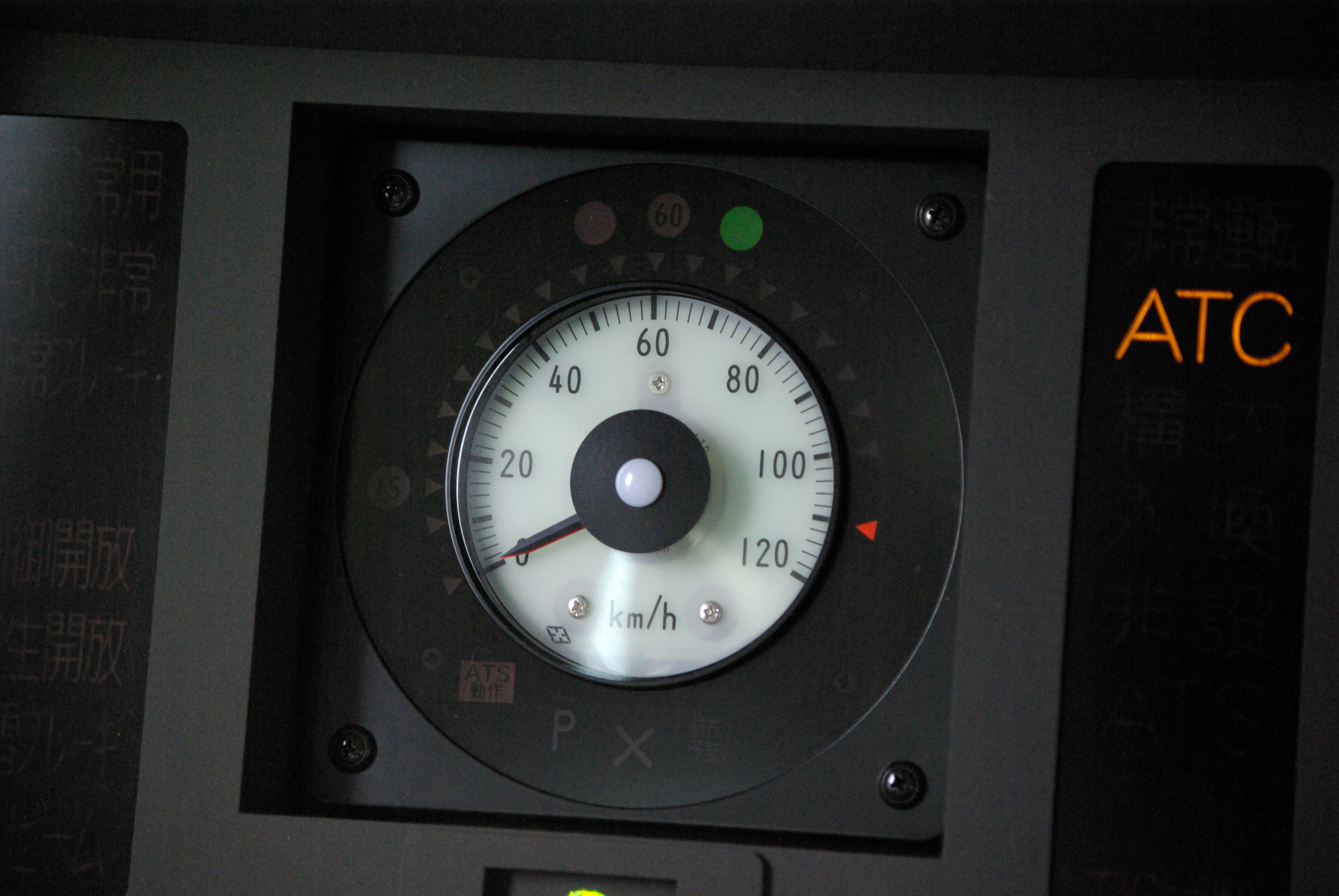
Automatic train control (ATC) is a general class of train protection systems for railways that involves a speed control mechanism in response to external inputs. For example, a system could effect an emergency brake application if the driver does not react to a signal at danger. ATC systems tend to integrate various cab signalling technologies and they use more granular deceleration patterns in lieu of the rigid stops encountered with the older automatic train stop (ATS) technology. ATC can also be used with automatic train operation (ATO) and is usually considered to be the safety-critical part of a railway system. Over time, there have been many different safety systems labelled as "automatic train control". The first experimental apparatus was installed on the Henley branch line in January 1906 by the Great Western Railway, although it would now be referred to as an automatic warning system (AWS) because the driver retained full command of braking. The term is especially co ... [...More Info...] [...Related Items...] OR: [Wikipedia] [Google] [Baidu] |
Train Protection System
A train protection system is a railway technical installation to ensure safe operation in the event of human error. Development Train stops The earliest systems were train stops, as still used by the New York City Subway, the Toronto subway, the London Underground, the Moscow Subway (only on the older lines) and the Berlin S-Bahn. Beside every signal is a moveable arm. If the signal is red, levers connected to valves on any passing train hit the arm, opening the brake line, applying the emergency brake, If the signal shows green, the arm is turned away from the levers and there is no contact. The Great Western Railway in the UK introduced its 'automatic train control' system in the early years of the 20th century. Each distant signal had before it a ramp between the running rails. If the signal showed green, the ramp was energised with a low voltage current which was passed to the locomotive when a shoe came into contact with the ramp. A bell rang in the locomotive's cab t ... [...More Info...] [...Related Items...] OR: [Wikipedia] [Google] [Baidu] |
Automatic Block Signal
Automatic block signaling (ABS), spelled automatic block signalling or called track circuit block (TCB ) in the UK, is a railroad communications system that consists of a series of signals that divide a railway line into a series of sections, called ''blocks''. The system controls the movement of trains between the blocks using automatic signals. ABS operation is designed to allow trains operating in the same direction to follow each other in a safe manner without risk of rear-end collision. The introduction of ABS reduced railways' costs and increased their capacity. Older manual block systems required human operators. The automatic operation comes from the system's ability to detect whether blocks are occupied or otherwise obstructed, and to convey that information to approaching trains. The system operates without any outside intervention, unlike more modern traffic control systems that require external control to establish a flow of traffic. History The earliest way of ... [...More Info...] [...Related Items...] OR: [Wikipedia] [Google] [Baidu] |


