|
Nag's Head, London
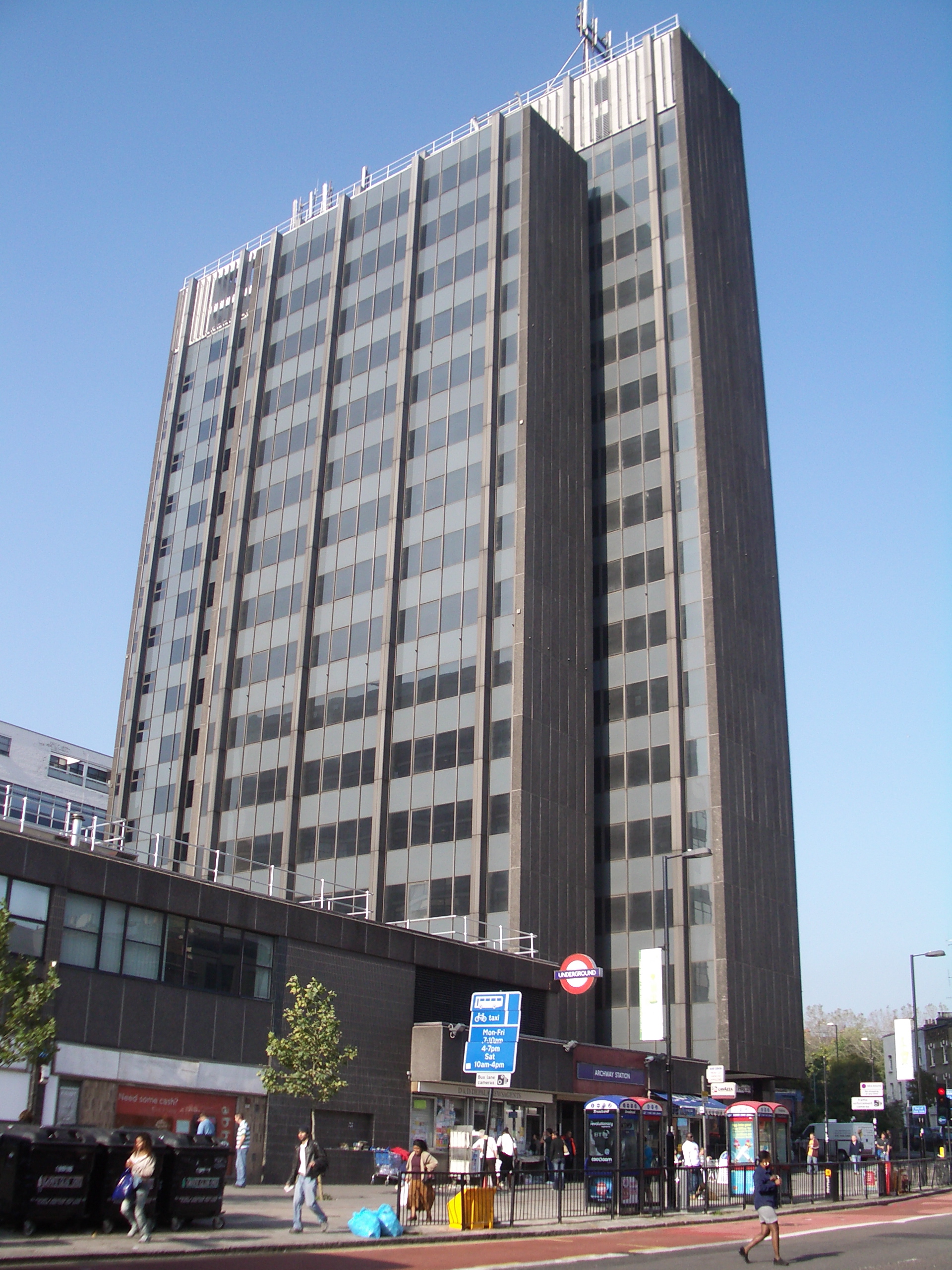
Nag's Head is a locality within the Holloway area of the London Borough of Islington. Toponymy The area is named after the Nag's Head public house. The pub, also previously called the Mustang Diner and O'Neills, closed in 2004; the original early Victorian building is in use today as a gambling establishment. Governance Nag's Head Town Centre, a shopping arcade between Morrisons and Selby's, is governed by the Nag's Head Town Centre Management Group. Geography The name refers to the junction of Holloway Road (the A1) with Seven Sisters Road, where the Nag's Head pub stood, and also to the surrounding area, particularly the stretch of Holloway Road between the former pub and its junction with Camden Road. Economy The area is identified in the London Plan as one of 35 major centres in Greater London. The shopping and entertainment area includes the Nag's Head Market (behind Holloway Road on the northwest corner of Hertslet Road) and the Nag's Head Shopping Centre. It hosts a J ... [...More Info...] [...Related Items...] OR: [Wikipedia] [Google] [Baidu] |
Holloway, London
Holloway is an inner-city district of the London Borough of Islington, north of Charing Cross, which follows the line of the Holloway Road ( A1). At the centre of Holloway is the Nag's Head commercial area which sits between the more residential Upper Holloway and Lower Holloway neighbourhoods. Holloway has a multicultural population. It is the home of Arsenal F.C., and was once home to the largest women's prison in Europe, Holloway Prison, until 2016. Holloway is in the historic county of Middlesex. History The origins of the name are disputed; some believe that it derives from '' Hollow'', or '' Hollow way'', due to a dip in the road caused by the passage of animals and water erosion, as this was the main cattle driving route from the North into Smithfield. In Lower Holloway, the former ''Back Road'', now Liverpool Road was used to rest and graze the cattle before entering London. Others believe the name derives from ''Hallow'' and refers to the road's historic significan ... [...More Info...] [...Related Items...] OR: [Wikipedia] [Google] [Baidu] |
London Borough Of Islington
The London Borough of Islington ( ) is a London borough in Inner London. Whilst the majority of the district is located in north London, the borough also includes a significant area to the south which forms part of central London. Islington has an estimated population of 215,667. It was formed in 1965 under the London Government Act 1963, which simultaneously abolished the metropolitan boroughs of Islington and Finsbury. The new entity remains the second smallest borough in London and the third-smallest district in England. The borough contains two Westminster parliamentary constituencies, both formerly represented by Labour Members of Parliament: Jeremy Corbyn, the party's leader from 2015 to 2020, represents Islington North and currently sits as an independent after the whip was withdrawn from him in October 2020, and Emily Thornberry represents Islington South & Finsbury. The local authority is Islington Council. The borough is home to football club Arsenal, one of the ... [...More Info...] [...Related Items...] OR: [Wikipedia] [Google] [Baidu] |
Holloway Road
Holloway Road is a road in London, in length. It is one of the main shopping streets in North London, and carries the A1 road as it passes through Holloway, in the London Borough of Islington. The road starts in Archway, near Archway Underground station, then heads south-east, past Upper Holloway railway station, Whittington Park, past the North London campus of London Metropolitan University near Nag's Head, past Holloway Road Underground station, and the main campus of the university, and then becomes Highbury Corner, near Highbury & Islington station. Name The origins of the name are disputed; some believe that it derives from "hollow" due to the dip in the road from the cattle that made their way along the route to the cattle markets in London, whilst some believe it derives from "hallow" and refers to the road's historic significance as part of the pilgrimage route to Walsingham. No documentary evidence can be found to support either derivation. History The earli ... [...More Info...] [...Related Items...] OR: [Wikipedia] [Google] [Baidu] |
A1 Road (Great Britain)
The A1 is the longest numbered road in the UK, at . It connects Greater London, London, the capital of England, with Edinburgh, the capital of Scotland. It passes through or near North London, Hatfield, Hertfordshire, Hatfield, Welwyn Garden City, Stevenage, Baldock, Letchworth, Letchworth Garden City, Biggleswade, St Neots, Huntingdon, Peterborough, Stamford, Lincolnshire, Stamford, Grantham, Newark-on-Trent, Retford, Doncaster, York, Pontefract, Wetherby, Ripon, Darlington, Durham, England, Durham, Sunderland, Tyne and Wear, Sunderland, Gateshead, Newcastle upon Tyne, Morpeth, Northumberland, Morpeth, Alnwick and Berwick-upon-Tweed. It was designated by the Department for Transport, Ministry of Transport in 1921, and for much of its route it followed various branches of the historic Great North Road (Great Britain), Great North Road, the main deviation being between Boroughbridge and Darlington. The course of the A1 has changed where towns or villages have been bypass (road), ... [...More Info...] [...Related Items...] OR: [Wikipedia] [Google] [Baidu] |
London Plan
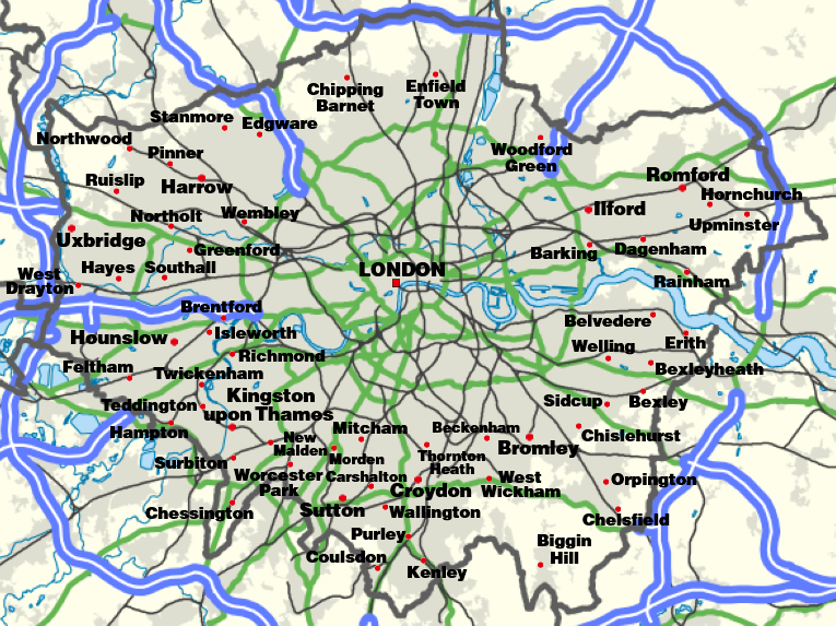
The London Plan is the statutory spatial development strategy for the Greater London area in the United Kingdom that is written by the Mayor of London and published by the Greater London Authority. The regional planning document was first published in final form on 10 February 2004. In addition to minor alterations, it was substantially revised and republished in February 2008 and again in July 2011. In October 2013, minor alterations were made to the plan to comply with the National Planning Policy Framework and other changes in national policy. The London Plan of March 2016 was published, and amended, in January 2017. The current plan has a formal end-date of 2036. As of March 2021, a new London Plan was adopted by the Greater London Authority, planning for the next 20-25 years. Mandate The plan replaced the previous strategic planning guidance for London issued by the Secretary of State and known as RPG It is a requirement of the Greater London Authority Act 1999 that ... [...More Info...] [...Related Items...] OR: [Wikipedia] [Google] [Baidu] |
Greater London Authority
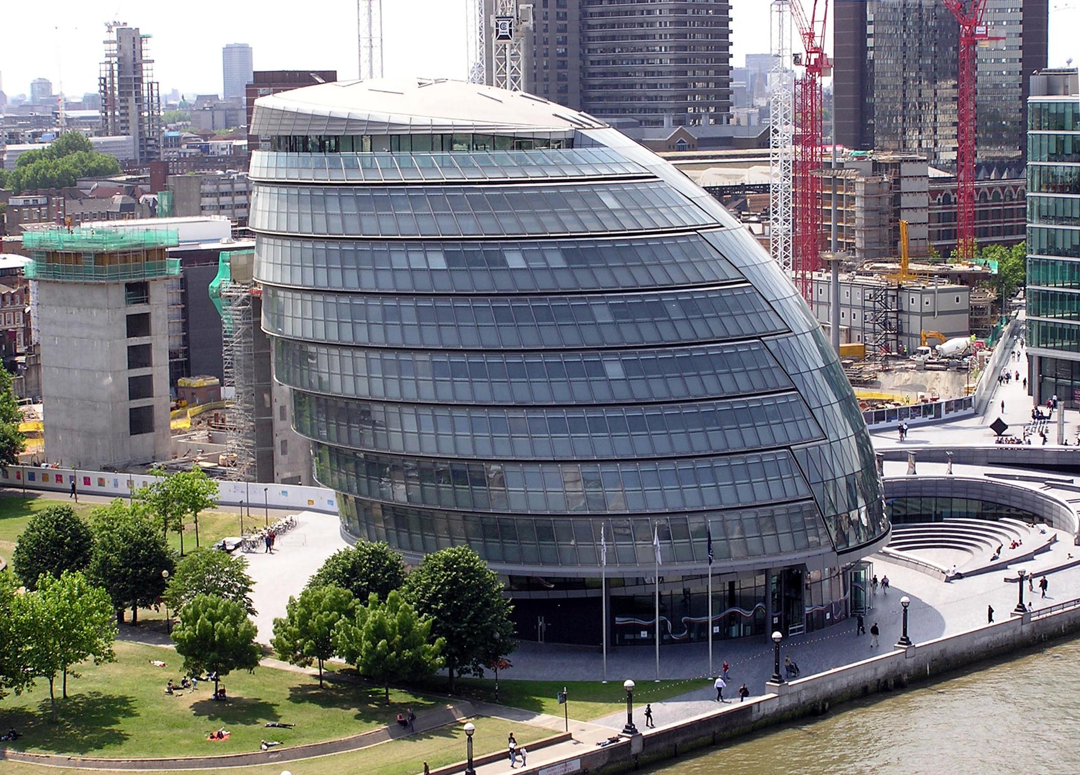
The Greater London Authority (GLA), colloquially known by the metonym "City Hall", is the devolved regional governance body of Greater London. It consists of two political branches: the executive Mayoralty (currently led by Sadiq Khan) and the 25-member London Assembly, which serves as a means of checks and balances on the former. Since May 2016, both branches have been under the control of the London Labour Party. The authority was established in 2000, following a local referendum, and derives most of its powers from the Greater London Authority Act 1999 and the Greater London Authority Act 2007. It is a strategic regional authority, with powers over transport, policing, economic development, and fire and emergency planning. Three functional bodies— Transport for London, the Mayor's Office for Policing and Crime, and the London Fire Commissioner—are responsible for delivery of services in these areas. The planning policies of the Mayor of London are detailed in a statuto ... [...More Info...] [...Related Items...] OR: [Wikipedia] [Google] [Baidu] |
Nag's Head Market
Nag's Head Market is a market in London. It is situated on Seven Sisters Road in the Holloway area of the London Borough of Islington. It is named after the Nag's Head public house A pub (short for public house) is a kind of drinking establishment which is licensed to serve alcoholic drinks for consumption on the premises. The term ''public house'' first appeared in the United Kingdom in late 17th century, and was ..., which closed in 2004; the original early Victorian building is in use today as a gambling establishment. As part of Nag's Head Town Centre, a shopping arcade between Morrisons, Marks & Spencers and Selby's, it is governed by the Nag's Head Town Centre Management Group, made up of local businesses and services. References Retail markets in London {{London-geo-stub ... [...More Info...] [...Related Items...] OR: [Wikipedia] [Google] [Baidu] |
James Selby
Morleys Stores is a group of eight department stores in Greater London, a business-to-business furniture supply subsidiary called Morley's of Bicester Ltd and a department store & furniture centre called Camp Hopson of Newbury in Newbury, Berkshire. The group is named after the original store that opened in Brixton, south London as Morley & Lanceley. Note that the firm is unrelated to the London fast foods restaurant chain. In the year to January 2014 group profit was £5.6 million on turnover of £90.6 million. Department stores Morleys is a member of the Solihull-based Associated Independent Stores buying group, the supplier of non-food goods to 350 companies with about 600 small and medium-sized independent outlets with textile and other non-food goods. History The Brixton Road shop originally traded as Morley & Lanceley. In 2009 Morleys bought Roomes Fashion and Home in Upminster and in 2010 it bought the Pearsons stores in Enfield and Bishop's Stortford. Smith Bros in To ... [...More Info...] [...Related Items...] OR: [Wikipedia] [Google] [Baidu] |
Areas Of London
London is the capital of and largest city in England and the United Kingdom. It is administered by the Greater London Authority, City of London Corporation and 32 London boroughs. These boroughs are modern, having been created in 1965 and have a weaker sense of identity than their constituent "districts" (considered in speech, "parts of London" or more formally, "areas"). Two major factors have shaped the development of London district and sub-district identities; the ancient parish – which was used for both civil and ecclesiastical functions – and the pre-urban settlement pattern. Ancient parishes and their successors The modern London boroughs were primarily formed from amalgamations of Metropolitan, County and Municipal Boroughs. These were formed from ancient parishes (or groupings of them), with ancient parishes in turn generally based on a single manor, though many were based on more than one and a few manors were so large that they were divided into multiple pari ... [...More Info...] [...Related Items...] OR: [Wikipedia] [Google] [Baidu] |
Districts Of The London Borough Of Islington
A district is a type of administrative division that, in some countries, is managed by the local government. Across the world, areas known as "districts" vary greatly in size, spanning regions or counties, several municipalities, subdivisions of municipalities, school district, or political district. By country/region Afghanistan In Afghanistan, a district (Persian ps, ولسوالۍ ) is a subdivision of a province. There are almost 400 districts in the country. Australia Electoral districts are used in state elections. Districts were also used in several states as cadastral units for land titles. Some were used as squatting districts. New South Wales had several different types of districts used in the 21st century. Austria In Austria, the word is used with different meanings in three different contexts: * Some of the tasks of the administrative branch of the national and regional governments are fulfilled by the 95 district administrative offices (). The area a dis ... [...More Info...] [...Related Items...] OR: [Wikipedia] [Google] [Baidu] |


