|
NY 253
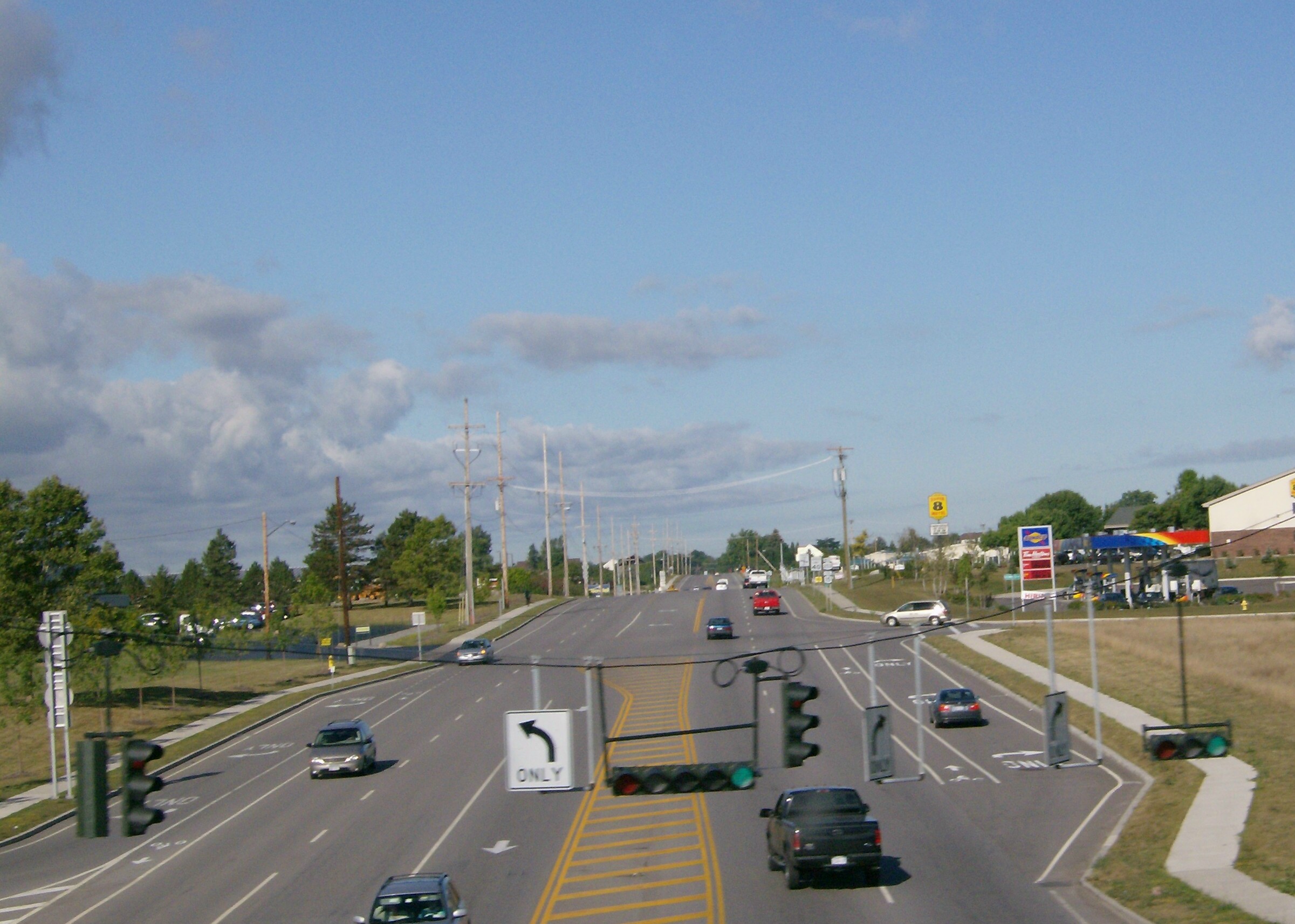
New York State Route 253 (NY 253) is a east–west state highway in Monroe County, New York, in the United States. The western terminus of the route is at NY 383 in the village of Scottsville. Its eastern terminus is at NY 65 in the town of Pittsford. NY 253 meets Interstate 390 (I-390) and connects to the New York State Thruway (I-90) in the town of Henrietta. The majority of NY 253 passes through either rural or residential areas; however, the midsection of NY 253 is located in a heavily commercial portion of Henrietta. NY 253 originally extended from NY 36 in Mumford to NY 64 south of the village of Pittsford when it was assigned as part of the 1930 renumbering of state highways in New York. By 1938, it was truncated to Scottsville on its western end but also extended northeastward to Penfield. The portion of NY 253 through East Rochester and Penfield was realigned twice in the 1960s and 1970s before the rout ... [...More Info...] [...Related Items...] OR: [Wikipedia] [Google] [Baidu] |
NYSDOT
The New York State Department of Transportation (NYSDOT) is the department of the Government of New York (state), New York state government responsible for the development and operation of highways, Rail transport, railroads, mass transit systems, ports, waterways and aviation facilities in the U.S. state of New York (state), New York. This transportation network includes: * A state and local highway system, encompassing over 110,000 miles (177,000 km) of highway and 17,000 bridges. * A 5,000 mile (8,000 km) rail network, carrying over 42 million short tons (38 million metric tons) of equipment, raw materials, manufactured goods and produce each year. * Over 130 public transit operators, serving over 5.2 million passengers each day. * Twelve major public and private ports, handling more than 110 million short tons (100 million metric tons) of freight annually. * 456 public and private aviation facilities, through which more than 31 million people travel each year. It ow ... [...More Info...] [...Related Items...] OR: [Wikipedia] [Google] [Baidu] |
East Rochester, New York
East Rochester is a coterminous town and village located southeast of the City of Rochester in Monroe County, New York, United States. The village, home to approximately 6,600 people, is surrounded by Pittsford on the west side and by Perinton to the east. Most of the southern boundary is delimited by New York State Route 31F. History Beginnings The village of East Rochester was originally known as the Village of Despatch when the community was incorporated in 1897. Despatch was laid out as a planned community designed around the New York Central Railroad mainline that ran through the center of the village. Much of the original land which became the village came from Fairport businessman Walter Parce. This land was used to develop housing for employees of the earliest employers: The Merchants Despatch Corporation and the Aeolian Piano Corporation. The original buildings of the Aeolian Piano Corporation are still in use today as a shopping center and office complex called P ... [...More Info...] [...Related Items...] OR: [Wikipedia] [Google] [Baidu] |
NY 253 Westbound First Shield
NY most commonly refers to: * New York (state), a state in the Northeastern United States * New York City, the most populous city in the United States, located in the state of New York NY, Ny or ny may also refer to: Places * North Yorkshire, an English county * Ny, Belgium, a village * Old number plate of German small town Niesky People * Eric Ny (1909–1945), Swedish runner * Marianne Ny, Swedish prosecutor Letters * ny (digraph), an alphabetic letter * Nu (letter), the 13th letter of the Greek alphabet, transcribed as "Ny" * ñ (énye), sometimes transcribed as "ny" Other uses * New Year * Air Iceland (IATA code: NY) * Chewa language (ISO 639-1 code: ny) See also * New Year (other) * New York (other) * NYC (other) * NYS (other) NYS may refer to: *New York Skyports Seaplane Base (IATA: NYS) * National Youth Service (other), National Youth Service, of several countries * New York State * New York Shipbuilding, a corpor ... [...More Info...] [...Related Items...] OR: [Wikipedia] [Google] [Baidu] |
New York State Route 251
New York State Route 251 (NY 251) is an east–west state highway in western New York in the United States. It extends for from an intersection with NY 383 in Scottsville, Monroe County, to an intersection with NY 96 in the town of Victor, Ontario County. NY 251 connects to Interstate 390 (I-390) in Rush and serves the village of Honeoye Falls (via NY 65) and the hamlet of Mendon within the town of the same name. The route, a two-lane, rural highway for much of its length, also intersects NY 15 and NY 64, two north–south highways leading to the Southern Tier and the Finger Lakes, respectively. Two sections of the route—from south of Scottsville to Rush and from Mendon to western Victor—follow linear east–west alignments. All but of the route are located in Monroe County. From 1911 to 1921, the north–south section of modern NY 251 near Scottsville was part of Route 15, an unsigned legislative route assigned ... [...More Info...] [...Related Items...] OR: [Wikipedia] [Google] [Baidu] |
Interstate 390
Interstate 390 (I-390) is a north–south auxiliary Interstate Highway located entirely within New York in the United States. The southern terminus of the route is at the Southern Tier Expressway (I-86 and New York State Route 17 Y 17 in the town of Avoca. Its northern terminus is at I-490 (Western Expressway) in Gates, just west of Rochester. North of I-490, the expressway continues as NY 390 to the Lake Ontario State Parkway in Greece. I-390 connects to its parent, I-90 (New York State Thruway), in Henrietta, a southern suburb of Rochester. The route is known as the Genesee Expressway from Avoca to I-590 in Brighton, where it becomes part of the Rochester Outer Loop. In addition to serving Rochester, I-390 serves as an important connecting route between the Rochester metropolitan area and Corning and the rest of the Southern Tier of New York. The freeway also serves several smaller communities between Corning and Rochester, including the Livingston County ... [...More Info...] [...Related Items...] OR: [Wikipedia] [Google] [Baidu] |
New York State Route 15
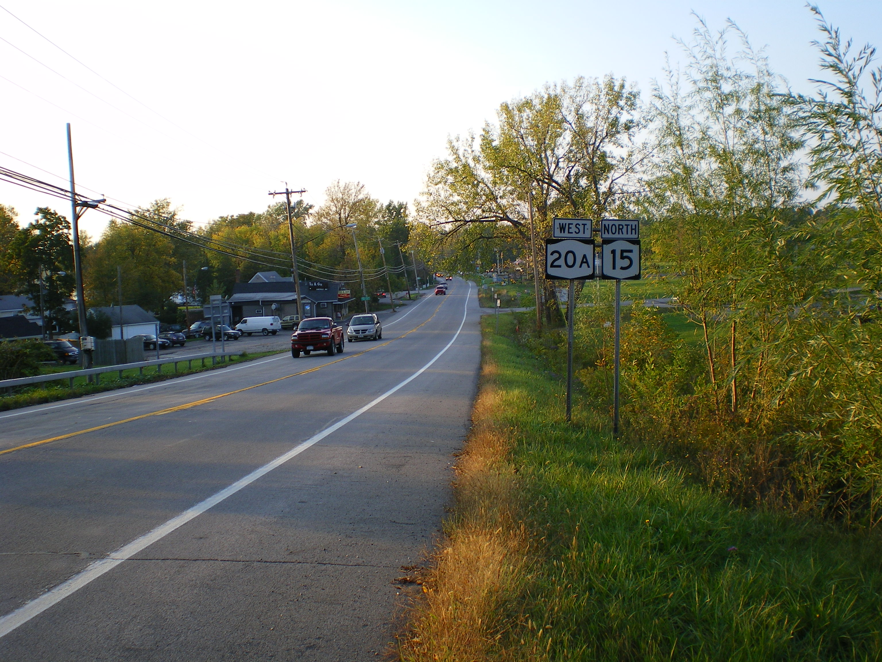
New York State Route 15 (NY 15) is a north–south state highway located in western New York in the United States. The southern terminus of the route is officially at Interstate 390 (I-390) exit 3 south of the village of Wayland, although some signage indicating that NY 15 continues south to the northern terminus of U.S. Route 15 (US 15) in Painted Post still exists. The northern terminus of NY 15 is at an intersection with NY 31 in downtown Rochester. Outside of Monroe County, NY 15 is a rural two-lane highway. In the Rochester suburbs of Henrietta and Brighton, however, NY 15 is a major commercial strip, and the section in Rochester is a two-to-four lane street that serves commercial and residential areas. From Lakeville north to the Rochester city limits, NY 15 is little more than an alternate route to I-390, which closely follows the route through northern Livingston County and southern Monroe County. South of La ... [...More Info...] [...Related Items...] OR: [Wikipedia] [Google] [Baidu] |
Hamlet (New York)
The administrative divisions of New York are the various units of government that provide local services in the State of New York. The state is divided into boroughs, counties, cities, townships called "towns", and villages. (The only boroughs, the five boroughs of New York City, have the same boundaries as their respective counties.) They are municipal corporations, chartered (created) by the New York State Legislature, as under the New York Constitution the only body that can create governmental units is the state. All of them have their own governments, sometimes with no paid employees, that provide local services. Centers of population that are not incorporated and have no government or local services are designated hamlets. Whether a municipality is defined as a borough, city, town, or village is determined not by population or land area, but rather on the form of government selected by the residents and approved by the New York Legislature. Each type of local government ... [...More Info...] [...Related Items...] OR: [Wikipedia] [Google] [Baidu] |
Livonia, Avon And Lakeville Railroad
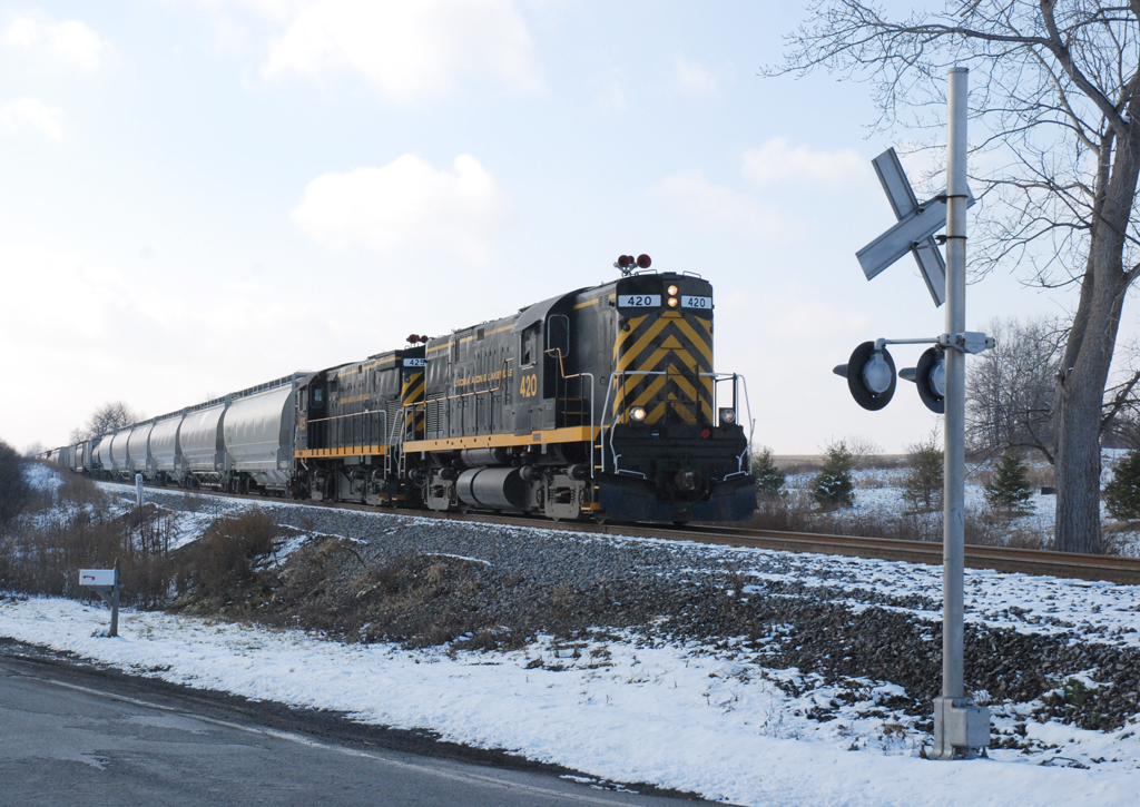
The Livonia, Avon and Lakeville Railroad is a short line railroad that operates in Livingston County and Monroe County in New York, United States. The railroad interchanges with CSX at Genesee Junction in Chili, New York, the Rochester and Southern Railroad (RSR) at Genesee Junction and the RSR's Brooks Avenue Yard in Gates, New York, and with the Rochester & Genesee Valley Railroad Museum at Industry, New York. Their primary freight consists of food products - grains and corn syrup. In 1997, the Livonia, Avon and Lakeville Railroad was selected as Short Line Railroad of the Year by industry trade journal Railway Age. The LAL is also the parent company for the Bath and Hammondsport Railroad, the Western New York and Pennsylvania Railroad and the Ontario Midland Railroad. History The beginning The route that is now the Livonia, Avon & Lakeville started in the mid-19th century. Originally, the line from Mortimer to Avon was part of the Rochester & Genesee Valley Railroad – ... [...More Info...] [...Related Items...] OR: [Wikipedia] [Google] [Baidu] |
Grade Crossing
A level crossing is an intersection where a railway line crosses a road, path, or (in rare situations) airport runway, at the same level, as opposed to the railway line crossing over or under using an overpass or tunnel. The term also applies when a light rail line with separate right-of-way or reserved track crosses a road in the same fashion. Other names include railway level crossing, railway crossing (chiefly international), grade crossing or railroad crossing (chiefly American), road through railroad, criss-cross, train crossing, and RXR (abbreviated). There are more than 100,000 level crossings in Europe and more than 200,000 in North America. History The history of level crossings depends on the location, but often early level crossings had a flagman in a nearby booth who would, on the approach of a train, wave a red flag or lantern to stop all traffic and clear the tracks. Gated crossings became commonplace in many areas, as they protected the railway fro ... [...More Info...] [...Related Items...] OR: [Wikipedia] [Google] [Baidu] |
Rochester, New York
Rochester () is a City (New York), city in the U.S. state of New York (state), New York, the county seat, seat of Monroe County, New York, Monroe County, and the fourth-most populous in the state after New York City, Buffalo, New York, Buffalo, and Yonkers, New York, Yonkers, with a population of 211,328 at the 2020 United States census. Located in Western New York, the city of Rochester forms the core of a larger Rochester metropolitan area, New York, metropolitan area with a population of 1 million people, across six counties. The city was one of the United States' first boomtowns, initially due to the fertile Genesee River Valley, which gave rise to numerous flour mills, and then as a manufacturing center, which spurred further rapid population growth. Rochester rose to prominence as the birthplace and home of some of America's most iconic companies, in particular Eastman Kodak, Xerox, and Bausch & Lomb (along with Wegmans, Gannett, Paychex, Western Union, French's, Cons ... [...More Info...] [...Related Items...] OR: [Wikipedia] [Google] [Baidu] |
Avon (village), New York
Avon is a village in the town of Avon, Livingston County, New York, United States. The village population was 3,394 at the 2010 census, out of 7,146 people in the entire town. The village and town are named after the River Avon in England. History Avon was founded by European Americans along the Genesee River, across from the historic Seneca village known as Conawagus (in a transliterated spelling; also spelled as Ca-noh-wa-gas, Conewaugus, or Canawaugus, and as ''Ga:non'wagês'' in the Seneca language). The Seneca were among the original Five Nations of the Iroquois Confederacy and had occupied this territory for many hundreds of years prior to European encounter. The Seneca village was located on the east side of the Genesee River, "about a mile above the ford". ''Ga:non'wagês'' was an important village to the Seneca during the eighteenth century. Their religious leader Handsome Lake was born here about 1735. One of his nephews, later known as Governor Blacksnake, moved h ... [...More Info...] [...Related Items...] OR: [Wikipedia] [Google] [Baidu] |
Rest Area
A rest area is a public facility located next to a large thoroughfare such as a motorway, expressway, or highway, at which drivers and passengers can rest, eat, or refuel without exiting onto secondary roads. Other names include motorway service area (UK), services (UK), travel plaza, rest stop, oasis (US), service area, rest and service area (RSA), resto, service plaza, lay-by, and service centre (Canada). Facilities may include park-like areas, fuel stations, public toilets, water fountains, restaurants, and dump and fill stations for caravans / motorhomes. A rest area with limited to no public facilities is a lay-by, parking area, scenic area, or scenic overlook. Along some highways and roads are services known as wayside parks, roadside parks, or picnic areas. Overview The standards and upkeep of service station facilities vary by jurisdiction. Service stations have parking areas allotted for cars, trucks, articulated trucks, buses and caravans. Most state-run ... [...More Info...] [...Related Items...] OR: [Wikipedia] [Google] [Baidu] |


