|
N69 Road (Ireland)
The N69 road is a national secondary road in Ireland. It runs from Limerick to Tralee and passes through Mungret, Clarina, Kildimo, Askeaton (bypassed), Foynes, Loghill, Glin, Tarbert, and Listowel. Upgrades The N22/N69 Tralee Bypass opened on 16 August 2013. Four kilometres of dual carriageway were added to the N69, the first such section to be included in this route. The N69 now terminates at the Ballingowan Roundabout on the N22/N69 Tralee Bypass. Route The N69 start at Limerick on the N18 west Limerick bypass which was opened in 2010. It pass though the villages of Mungret, Clarina, Ferrybridge and Kildimo. This section of N69 is the busiest with average traffic volumes of 8,000 daily. It passed Askeaton, which was bypassed since 1990 with 5km of good standard road. After passing though port town of Foynes, it also pass though villages of Loghill and Glin before crossing into County Kerry. In Tarbert it has a junction for N67 before left for Listowel. Some sectio ... [...More Info...] [...Related Items...] OR: [Wikipedia] [Google] [Baidu] |
County Limerick
"Remember Limerick" , image_map = Island_of_Ireland_location_map_Limerick.svg , subdivision_type = Country , subdivision_name = Ireland , subdivision_type1 = Province , subdivision_name1 = Munster , subdivision_type2 = Region , subdivision_name2 = Southern (Mid-West) , seat_type = County town , seat = Limerick and Newcastle West , leader_title = Local authority , leader_name = Limerick City and County Council , leader_title2 = Dáil constituencies , leader_name2 = Limerick City and Limerick County , leader_title3 = EP constituency , leader_name3 = South , area_total_km2 = 2756 , area_rank = 10th , blank_name_sec1 = Vehicle indexmark code , blank_info_sec1 = L (since 2014)LK (1987–2013) , population = 205444 , population_density_km2 = 74.544 , population_rank = 9th , population_demonym ... [...More Info...] [...Related Items...] OR: [Wikipedia] [Google] [Baidu] |
Listowel
Listowel ( ; , IPA:[ˈlʲɪsˠˈt̪ˠuəhəlʲ]) is a heritage market town in County Kerry, Ireland. It is on the River Feale, from the county town, Tralee. The town of Listowel had a population of 4,820 according to the Central Statistics Office of Ireland, CSO Census 2016. Described by the organisers of Listowel's writers festival as the "Literary Capital of Ireland", a number of internationally known playwrights and authors have lived there, including Bryan MacMahon (writer), Bryan MacMahon and John B. Keane. Location Listowel is on the N69 road (Ireland), N69 Limerick – Foynes – Tralee Roads in Ireland, road. Bus Éireann provides daily services to Tralee, Cork (city), Cork, and Limerick. The nearest railway station is Tralee. Listowel used to have its own railway station on a broad gauge line between Tralee and Limerick city; however, this was closed to passengers in 1963, to freight in 1978, and finally abandoned and lifted in 1988. The station building has been ... [...More Info...] [...Related Items...] OR: [Wikipedia] [Google] [Baidu] |
National Secondary Roads In The Republic Of Ireland
National may refer to: Common uses * Nation or country ** Nationality – a ''national'' is a person who is subject to a nation, regardless of whether the person has full rights as a citizen Places in the United States * National, Maryland, census-designated place * National, Nevada, ghost town * National, Utah, ghost town * National, West Virginia, unincorporated community Commerce * National (brand), a brand name of electronic goods from Panasonic * National Benzole (or simply known as National), former petrol station chain in the UK, merged with BP * National Car Rental, an American rental car company * National Energy Systems, a former name of Eco Marine Power * National Entertainment Commission, a former name of the Media Rating Council * National Motor Vehicle Company, Indianapolis, Indiana, USA 1900-1924 * National Supermarkets, a defunct American grocery store chain * National String Instrument Corporation, a guitar company formed to manufacture the first resonator g ... [...More Info...] [...Related Items...] OR: [Wikipedia] [Google] [Baidu] |
Department Of Transport, Tourism And Sport
The Department of Transport ( ga, An Roinn Iompair) is a department of the Government of Ireland that is responsible for transport policy and overseeing transport services and infrastructure. The department is led by the Minister for Transport who is assisted by one Minister of State. Departmental team The official headquarters and ministerial offices of the department are in Leeson Lane, Dublin. It also has offices in Killarney and Loughrea. The departmental team consists of the following: *Minister for Transport: Eamon Ryan, TD ** Minister of State for International and Road Transport and Logistics: Hildegarde Naughton, TD *Secretary General of the Department: Ken Spratt Affiliated bodies State Agencies Among the State Agencies that report to, are appointed by the Minister, or are otherwise affiliated to the department are: * National Transport Authority *Road Safety Authority *Transport Infrastructure Ireland *Irish Aviation Authority *Irish Coast Guard *Commission for ... [...More Info...] [...Related Items...] OR: [Wikipedia] [Google] [Baidu] |
Dual Carriageway
A dual carriageway ( BE) or divided highway ( AE) is a class of highway with carriageways for traffic travelling in opposite directions separated by a central reservation (BrE) or median (AmE). Roads with two or more carriageways which are designed to higher standards with controlled access are generally classed as motorways, freeways, etc., rather than dual carriageways. A road without a central reservation is a single carriageway regardless of the number of lanes. Dual carriageways have improved road traffic safety over single carriageways and typically have higher speed limits as a result. In some places, express lanes and local/collector lanes are used within a local-express-lane system to provide more capacity and to smooth traffic flows for longer-distance travel. History A very early (perhaps the first) example of a dual carriageway was the ''Via Portuensis'', built in the first century by the Roman emperor Claudius between Rome and its port Ostia at the mouth of t ... [...More Info...] [...Related Items...] OR: [Wikipedia] [Google] [Baidu] |
Limerick
Limerick ( ; ga, Luimneach ) is a western city in Ireland situated within County Limerick. It is in the province of Munster and is located in the Mid-West which comprises part of the Southern Region. With a population of 94,192 at the 2016 census, Limerick is the third-most populous urban area in the state, and the fourth-most populous city on the island of Ireland at the 2011 census. The city lies on the River Shannon, with the historic core of the city located on King's Island, which is bounded by the Shannon and Abbey Rivers. Limerick is also located at the head of the Shannon Estuary, where the river widens before it flows into the Atlantic Ocean. Limerick City and County Council is the local authority for the city. Geography and political subdivisions At the 2016 census, the Metropolitan District of Limerick had a population of 104,952. On 1 June 2014 following the merger of Limerick City and County Council, a new Metropolitan District of Limerick was formed within ... [...More Info...] [...Related Items...] OR: [Wikipedia] [Google] [Baidu] |
Republic Of Ireland
Ireland ( ga, Éire ), also known as the Republic of Ireland (), is a country in north-western Europe consisting of 26 of the 32 counties of the island of Ireland. The capital and largest city is Dublin, on the eastern side of the island. Around 2.1 million of the country's population of 5.13 million people resides in the Greater Dublin Area. The sovereign state shares its only land border with Northern Ireland, which is part of the United Kingdom. It is otherwise surrounded by the Atlantic Ocean, with the Celtic Sea to the south, St George's Channel to the south-east, and the Irish Sea to the east. It is a unitary, parliamentary republic. The legislature, the , consists of a lower house, ; an upper house, ; and an elected President () who serves as the largely ceremonial head of state, but with some important powers and duties. The head of government is the (Prime Minister, literally 'Chief', a title not used in English), who is elected by the Dáil and appointed by ... [...More Info...] [...Related Items...] OR: [Wikipedia] [Google] [Baidu] |
National Secondary Road
A national secondary road ( ga, Bóthar Náisiúnta den Dara Grád) is a category of road in Ireland. These roads form an important part of the national route network but are secondary to the main arterial routes which are classified as national primary roads. National secondary roads are designated with route numbers higher than those used for primary roads, but with the same "N" prefix. Routes N51 and higher are all national secondary roads. National secondary roads have a default speed limit of 100 km/h (62.5 mph) as, along with national primary routes, they fall into the speed limit category of ''national roads''. There are 2657 km of national secondary roads in Ireland, making up slightly over 50% of the entire national route (national primary and national secondary) network. TII: ... [...More Info...] [...Related Items...] OR: [Wikipedia] [Google] [Baidu] |
N22 Road (Ireland)
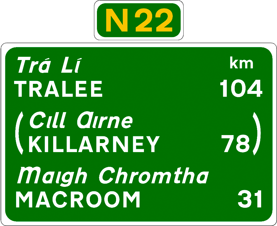
The N22 road is a national primary road in Ireland which goes through counties Kerry and Cork, from Tralee in the west through Killarney, Macroom and Ballincollig to Cork City in the east. Improvements Sections of the N22 were upgraded in the late 20th and early 21st century. During the 1980s and 1990s, a section between Killarney and the border with County Cork was rebuilt and widened. An auxiliary climbing lane has been provided on the steep grade sections. The late 1980s saw a bypass of Killarney. In 2004, the Ballincollig bypass west of Cork city was completed. This is an dual carriageway road built to Motorway standards that connects with the N40 Cork South Ring Road. In 2005, of the road between Tralee and Farranfore was upgraded. This added to a section opened in 2002. In August 2013, a new section of road was added as part of the Tralee N22/ N69 bypass project at Ballingrelagh replacing the section of road where the N22 originally ended at the N21 John ... [...More Info...] [...Related Items...] OR: [Wikipedia] [Google] [Baidu] |
Tralee
Tralee ( ; ga, Trá Lí, ; formerly , meaning 'strand of the Lee River') is the county town of County Kerry in the south-west of Ireland. The town is on the northern side of the neck of the Dingle Peninsula, and is the largest town in County Kerry. The town's population (including suburbs) was 23,691 census, thus making it the eighth largest town, and List of urban areas in the Republic of Ireland by population, 14th largest urban settlement, in Ireland. Tralee is well known for the Rose of Tralee (festival), Rose of Tralee International Festival, which has been held annually in August since 1959. History Situated at the confluence of some small rivers and adjacent to marshy ground at the head of Tralee Bay, Tralee is located at the base of an ancient roadway that heads south over the Slieve Mish Mountains. On this old track is located a large boulder sometimes called Scotia's Grave, reputedly the burial place of an Egyptian Pharaoh's daughter. Anglo-Normans founded the to ... [...More Info...] [...Related Items...] OR: [Wikipedia] [Google] [Baidu] |
N67 Road (Ireland)
The N67 road is a national secondary road in Ireland. It runs from Galway to Tarbert and passes through Oranmore, Clarinbridge, Kinvara, Ballyvaughan, Lisdoonvarna, Ennistymon, Lahinch, Milltown Malbay, Quilty, Doonbeg, Kilkee, Moyasta, Kilrush and Killimer. See also *Roads in Ireland *Motorways in Ireland *National primary road * Regional road ReferencesRoads Act 1993 (Classification of National Roads) (Amendment) Order 2018– Department of Transport The Department for Transport (DfT) is a department of His Majesty's Government responsible for the English transport network and a limited number of transport matters in Scotland, Wales and Northern Ireland that have not been devolved. The d ... {{Roads in Ireland National secondary roads in the Republic of Ireland Roads in County Kerry Roads in County Limerick ... [...More Info...] [...Related Items...] OR: [Wikipedia] [Google] [Baidu] |


_1.jpg)


