|
Neu-Mecklenburg
New Mecklenburg may refer to: * Gomersal, South Australia Gomersal is a locality on the western side of the Barossa Valley in South Australia. It is between the Sturt Highway (which mostly bypasses the valley to the west and north) and the North Para River and town of Tanunda on the valley floor. Prio ..., village in the Barossa Valley renamed in 1918 * Marysville, California, county seat of Yuba County * New Ireland (island), large island in the state of Papua New Guinea, known as Neu Mecklenburg while under German colonial control from 1885 to 1914 * New Ireland Province, administrative division of Papua New Guinea * Westgarthtown, Victoria was known as Neu Mecklenburg from establishment around 1850 until World War I when it was absorbed into Thomastown {{geodis ... [...More Info...] [...Related Items...] OR: [Wikipedia] [Google] [Baidu] |
New Ireland Province
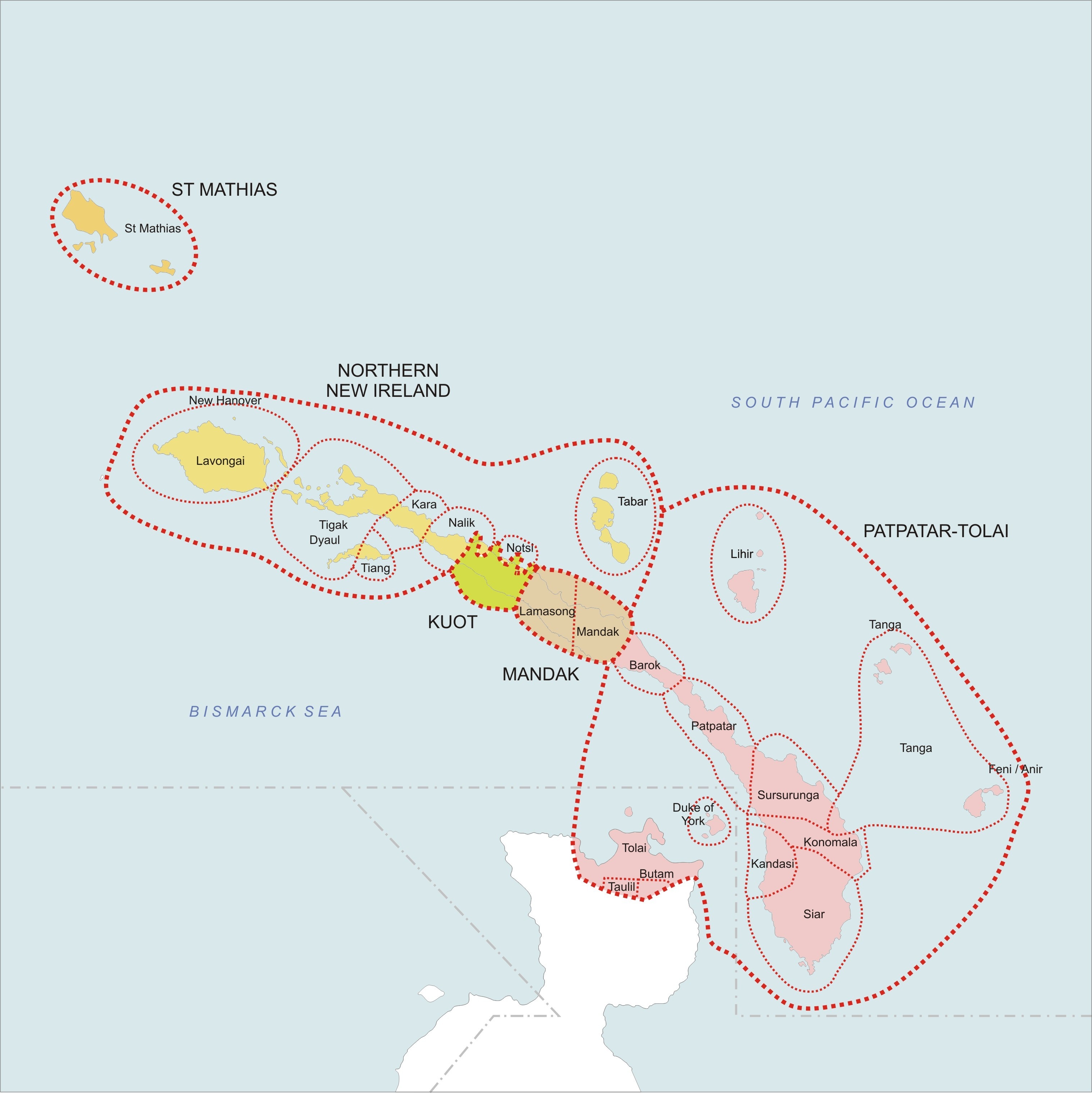
New Ireland Province, formerly New Mecklenburg (german: Neu-Mecklenburg), and Nova Hibernia, is the northeasternmost province of Papua New Guinea. Physical geography The largest island of the province is New Ireland. Also part of the province are numerous smaller islands, including Saint Matthias Group (Mussau, Emirau), New Hanover, Djaul, Tabar Group ( Tabar, Tatau, Simberi), Lihir, Tanga Group (Malendok, Boang), Feni Islands (Ambitle, Babase) and Anir. The land area of the province is around 9 560 km². The sea area within the Exclusive Economic Zone (EEZ) of New Ireland Province is around 230,000 km². Ecology In the early days of the French Revolution while searching for a lost scientific expedition the vessel La Recherche passed by New Ireland. On board was the prominent botanist Jacques-Julien Houtou de Labillardière who noted in his journal fine stands of teak (tectona grandis) trees growing at the southern end of the island. This marks the easter ... [...More Info...] [...Related Items...] OR: [Wikipedia] [Google] [Baidu] |
Gomersal, South Australia
Gomersal is a locality on the western side of the Barossa Valley in South Australia. It is between the Sturt Highway (which mostly bypasses the valley to the west and north) and the North Para River and town of Tanunda on the valley floor. Prior to 1918, it was known as New Mecklenburg, but like many others, the name was changed due to anti-German sentiment in World War I. The new name was derived from the town of Gomersal, West Yorkshire. Gomersal Road was developed in the 1990s as a freight bypass route to assist trucks to avoid the major town centres. It connects Barossa Valley Way south of Tanunda near Bethany Bethany ( grc-gre, Βηθανία,Murphy-O'Connor, 2008, p152/ref> Syriac: ܒܝܬ ܥܢܝܐ ''Bēṯ ʿAnyā'') or what is locally known as Al-Eizariya or al-Azariya ( ar, العيزرية, " laceof Lazarus"), is a Palestinian town in the West B ... Road west over the hills to the Sturt Highway south of Shea-Oak Log. Gomersal school (opened 1929) and post offi ... [...More Info...] [...Related Items...] OR: [Wikipedia] [Google] [Baidu] |
Marysville, California
Marysville is a city and the county seat of Yuba County, California, located in the Gold Country region of Northern California. As of the 2010 United States Census, the population was 12,072, reflecting a decrease of 196 from the 12,268 counted in the 2000 Census. It is part of the Yuba-Sutter area of Greater Sacramento. History Marysville is located on the ancestral land of the Maidu, who occupied the area for 10,000 years prior to the arrival of Jedediah Smith and trappers from the Hudson Bay Company in 1828, who were the first non-natives to explore the area. Spanish and Mexican explorers never reached that far north on the Feather River. In 1842, John Sutter leased part of his Rancho New Helvetia land to Theodore Cordua, a native of Mecklenburg in Germany, who raised livestock, and in 1843 built a home and trading post he called New Mecklenburg. The trading post and home was situated at what would later become the southern end of 'D' Street, Marysville's main street. In ... [...More Info...] [...Related Items...] OR: [Wikipedia] [Google] [Baidu] |
New Ireland (island)
New Ireland (Tok Pisin: ''Niu Ailan'') or Latangai, is a large island in Papua New Guinea, approximately in area with 120,000 people. It is named after the island of Ireland. It is the largest island of New Ireland Province, lying northeast of the island of New Britain. Both islands are part of the Bismarck Archipelago, named after Otto von Bismarck, and they are separated by Saint George's Channel. The administrative centre of the island and of New Ireland province is the town of Kavieng located at the northern end of the island. While the island was part of German New Guinea, it was named Neumecklenburg ("New Mecklenburg"). Geography The island is part of the Bismarck Archipelago and is often described as having the shape of a musket. New Ireland is surrounded by the Bismarck Sea in the southwest and by the Pacific Ocean in the northeast. For much of its in length, the island's width varies between less than to , yet the central mountainous spine is very steep an ... [...More Info...] [...Related Items...] OR: [Wikipedia] [Google] [Baidu] |


