|
National Register Of Historic Places Listings In Yavapai County, Arizona
__NOTOC__ This is a list of the National Register of Historic Places listings in Yavapai County, Arizona. It is intended to be a complete list of the properties and districts on the National Register of Historic Places in Yavapai County, Arizona, United States. The locations of National Register properties and districts for which the latitude and longitude coordinates are included below, may be seen in a map. There are 132 properties and districts listed on the National Register in the county, including 1 that is also a National Historic Landmark. 65 of these properties and districts are located in the city of Prescott, and are listed separately, while the remaining properties and districts (including the National Historic Landmark) are located elsewhere in the county, and are listed here. Three properties listed outside Prescott have been removed from the register. Current listings Prescott Exclusive of Prescott ... [...More Info...] [...Related Items...] OR: [Wikipedia] [Google] [Baidu] |
Map Of Arizona Highlighting Yavapai County
A map is a symbolic depiction emphasizing relationships between elements of some space, such as Physical body, objects, regions, or themes. Many maps are static, fixed to paper or some other durable medium, while others are dynamic or interactive. Although most commonly used to depict geography, maps may represent any space, real or fictional, without regard to Context (language use), context or Scale (map), scale, such as in brain mapping, DNA mapping, or computer network topology mapping. The space being mapped may be two dimensional, such as the surface of the earth, three dimensional, such as the interior of the earth, or even more abstract spaces of any dimension, such as arise in modeling phenomena having many independent variables. Although the earliest maps known are of the heavens, geographic maps of territory have a very long tradition and exist from ancient times. The word "map" comes from the , wherein ''mappa'' meant 'napkin' or 'cloth' and ''mundi'' 'the world'. ... [...More Info...] [...Related Items...] OR: [Wikipedia] [Google] [Baidu] |
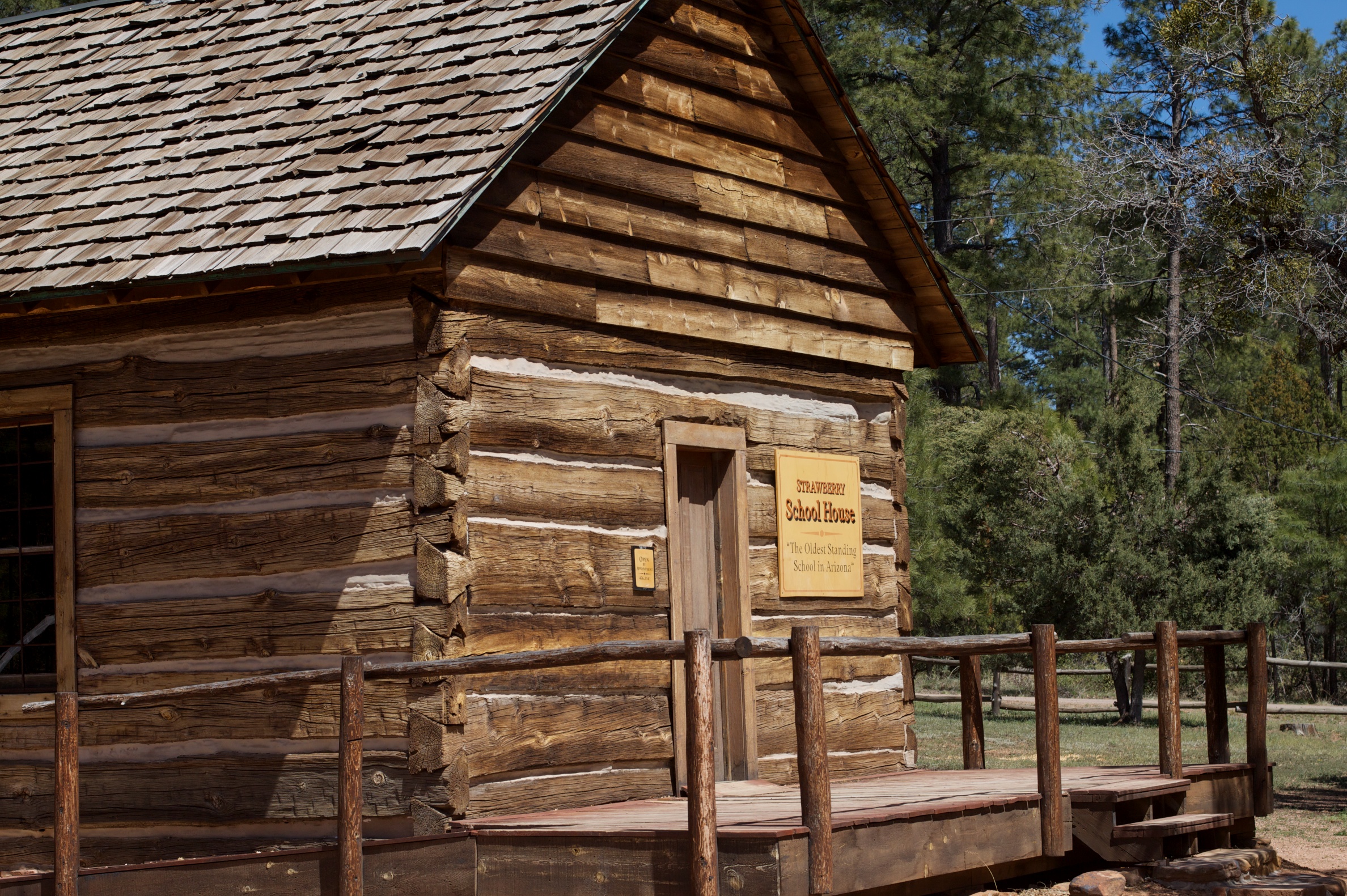
Strawberry, Arizona
Strawberry is an unincorporated community and census-designated place (CDP) in Gila County, Arizona, United States. The population was 961 at the 2010 census. History In June 1931, the Bureau of Prohibition destroyed a large whiskey still in Sandrock Canyon, north of Strawberry. The still had an estimated worth of $20,000. Seven hundred gallons of "mountain whiskey" were destroyed and three men arrested. Geography Strawberry is located in the northwest corner of Gila County at (34.4078063, -111.4934754). It is bordered to the south and east by Pine, and to the north by Coconino County. The county line follows the edge of the Mogollon Rim. Arizona State Route 87 passes through Strawberry. It is a two-hour drive——northeast from Phoenix. The town of Payson is southeast via Route 87, and Winslow is to the northeast. According to the United States Census Bureau, the Strawberry CDP has a total area of , of which , or 0.04%, is water. The community is in the valley of Stra ... [...More Info...] [...Related Items...] OR: [Wikipedia] [Google] [Baidu] |
Jerome, Arizona
Jerome is a town in the Black Hills of Yavapai County in the U.S. state of Arizona. Founded in the late 19th century on Cleopatra Hill overlooking the Verde Valley, Jerome is located more than above sea level. It is about north of Phoenix along State Route 89A between Sedona and Prescott. Supported in its heyday by rich copper mines, it was home to more than 10,000 people in the 1920s. As of the 2010 census, its population was 444. It is now known for its tourist attractions, such as its "ghost town" status and local wineries. The town owes its existence mainly to two ore bodies that formed about 1.75billion years ago along a ring fault in the caldera of an undersea volcano. Tectonic plate movements, plate collisions, uplift, deposition, erosion, and other geologic processes eventually exposed the tip of one of the ore bodies and pushed the other close to the surface, both near Jerome. In the late 19th century, the United Verde Mine, developed by William A. Clark, extract ... [...More Info...] [...Related Items...] OR: [Wikipedia] [Google] [Baidu] |
Camp Wood, Arizona
Camp may refer to: Outdoor accommodation and recreation * Campsite or campground, a recreational outdoor sleeping and eating site * a temporary settlement for nomads * Camp, a term used in New England, Northern Ontario and New Brunswick to describe a cottage * Military camp * Summer camp, typically organized for groups of children or youth * Tent city, a housing facility often occupied by homeless people or protesters Areas of imprisonment or confinement * Concentration camp * Extermination camp * Federal prison camp, a minimum-security United States federal prison facility * Internment camp, also called a concentration camp, resettlement camp, relocation camp, or detention camp * Labor camp * Prisoner-of-war camp ** Parole camp guards its own soldiers as prisoners of war Gatherings of people * Camp, a mining community * Camp, a term commonly used in the titles of technology-related unconferences * Camp meeting, a Christian gathering which originated in 19th-century Ameri ... [...More Info...] [...Related Items...] OR: [Wikipedia] [Google] [Baidu] |
Drake, Arizona
Drake was an unincorporated community on the Verde River in Yavapai County, Arizona, United States, and a station on the BNSF Railway's Phoenix Subdivision. Drake is also the junction and western terminus of the Verde Canyon Railroad. Drake is the site of the old Hell Canyon Bridge (built in 1923), formerly used by US Route 89, and now on the National Register of Historic Places. History Drake was a town in the early 1900s, which grew out of a railway work camp for construction of the very high "Big Hell Canyon Railroad Bridge", on high trestles, completed in 1901. It was first known as Cedar Glade, and had a population of 70 in 1909. It was renamed to "Drake" in 1920. (Internet version) In 1912 Cedar Glade "became the junction for the Verde Valley Railroad, which accessed a copper smelter in Clarkdale .... Approximately 20 structures had been built there by the railroad, including a depot, agent's house, water tank, a number of section houses, bunkhouse, and freight wareh ... [...More Info...] [...Related Items...] OR: [Wikipedia] [Google] [Baidu] |
Groom Creek, Arizona
Groom Creek is an unincorporated community in Yavapai County, in the U.S. state of Arizona Arizona ( ; nv, Hoozdo Hahoodzo ; ood, Alĭ ṣonak ) is a state in the Southwestern United States. It is the 6th largest and the 14th most populous of the 50 states. Its capital and largest city is Phoenix. Arizona is part of the Fou .... History A post office called Groom Creek was in operation between 1901 and 1942. The community was named for Robert W. Groom, a prospector. References {{authority control Unincorporated communities in Yavapai County, Arizona Unincorporated communities in Arizona ... [...More Info...] [...Related Items...] OR: [Wikipedia] [Google] [Baidu] |
Fort Verde State Historic Park
Fort Verde State Historic Park in the town of Camp Verde, Arizona is a small park that attempts to preserve parts of the Apache Wars The Apache Wars were a series of armed conflicts between the United States Army and various Apache tribal confederations fought in the southwest between 1849 and 1886, though minor hostilities continued until as late as 1924. After the Mexi ...-era fort as it appeared in the 1880s. The park was established in 1970 and was added to the National Register of Historic Places a year later. Fort Verde was established at its current location in 1871. It is significant as "the best preserved and least altered of any military post associated with General Crook’s 1872-73 campaign against the northern Apaches." () Settlers in the mid-19th century near the Verde River grew corn and other crops with the prospect of getting good prices from nearby Prescott, Arizona, Prescott, which was the territorial capital, and from nearby miners. The rapid increas ... [...More Info...] [...Related Items...] OR: [Wikipedia] [Google] [Baidu] |
Paulden, Arizona
Paulden is a census designated place (CDP) in Yavapai County, Arizona, United States. The population was 5,231 at the 2010 census. Geography Paulden is located at (34.900785, -112.484205). According to the United States Census Bureau, the CDP has a total area of 62.8 square miles (162.7 km2), of which, 62.8 square miles (162.5 km2) is land and 0.1 square mile (0.2 km2) (0.10%) is water. Demographics As of the census of 2010, there were 5,231 people, 1,917 households, and 1,420 families living in the CDP. The population density was . There were 1,334 housing units at an average density of 21.3/sq mi (8.2/km2). The racial makeup of the CDP was 82.8% White, 0.7% Black or African American, 1.4% Native American, 0.4% Asian, 0.1% Pacific Islander, 11.9% from other races, and 2.8% from two or more races. 24.3% of the population were Hispanic or Latino of any race. There were 1,420 households, out of which 27.2% had children under the age of ... [...More Info...] [...Related Items...] OR: [Wikipedia] [Google] [Baidu] |
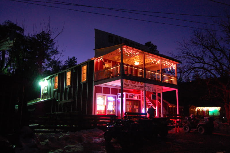
Crown King, Arizona
Crown King is an unincorporated community in Yavapai County, Arizona, United States, located at an elevation of 5,771 feet (1,759 m). Crown King has a ZIP Code of 86343; in 2000, the population of the 86343 ZCTA was 133. The site of a former gold mining town, Crown King is 28 miles west of Interstate 17 on Senator Highway, high in the Bradshaw Mountains. The community is named after the Crowned King mine, but the name was shortened to Crown King in 1888. Horsethief Basin Lake resides 6.5 miles southeast of Crown King on Crown King Rd/Forest 259 Rd. History An estimated US$2,000,000 in gold was taken from the Crowned King Mine alone; the mines have been closed since the 1950s and for the past half-century tourism has been the only reliable source of income in the area, despite the fact that the unpaved, mountainous access roads are rocky, rough and slow to drive. The first recorded gold claim in Crown King was "Buckeye" and was filed by Rod McKinnon on July 1, 187 ... [...More Info...] [...Related Items...] OR: [Wikipedia] [Google] [Baidu] |
Prescott National Forest
The Prescott National Forest is a 1.25 million-acre (510,000 ha) United States National Forest located in north central Arizona in the vicinity of Prescott. The forest is located in the mountains southwest of Flagstaff and north of Phoenix in Yavapai County, with a small portion (about 3.5 percent) extending into southwestern Coconino County. The Forest Service divides the forest into 3 administrative districts. The northern section of the forest is the Chino Valley Ranger District, the southwest section is the Bradshaw Ranger District, and the southeast section is the Verde Ranger District. Central administrative offices are in Prescott with local ranger district offices in Camp Verde, Chino Valley, and Prescott. Wilderness There are eight designated wilderness areas comprising more than , located entirely or partially within the Prescott National Forest. These are: * Apache Creek Wilderness ''(Chino Valley District)'' * Castle Creek Wilderness ''(Bradshaw District)'' ... [...More Info...] [...Related Items...] OR: [Wikipedia] [Google] [Baidu] |
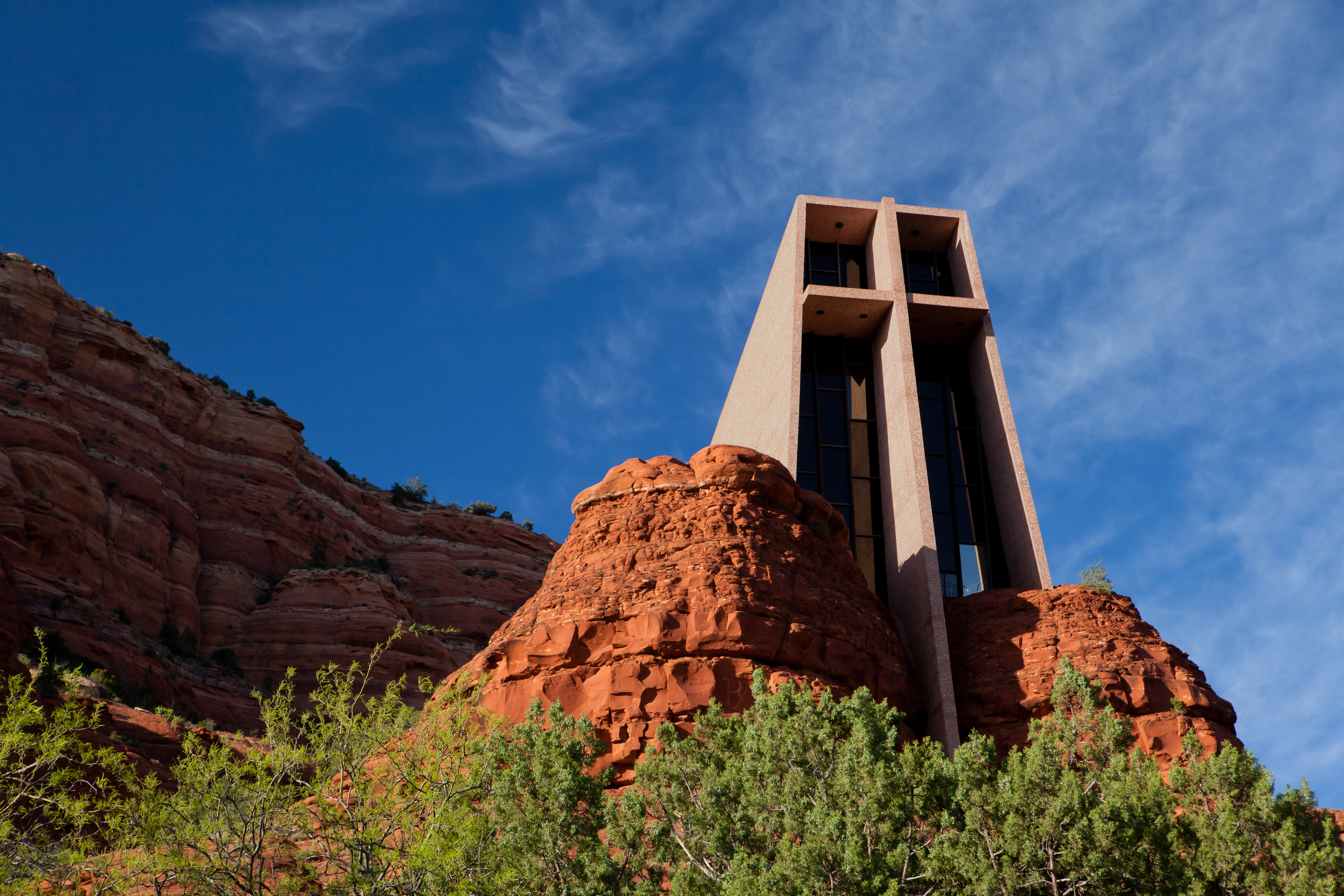
Sedona, Arizona
Sedona is a city that straddles the county line between Coconino and Yavapai counties in the northern Verde Valley region of the U.S. state of Arizona. As of the 2010 census, its population was 10,031. It is within the Coconino National Forest. Sedona's main attraction is its array of red sandstone formations. The formations appear to glow in brilliant orange and red when illuminated by the rising or setting sun. The red rocks form a popular backdrop for many activities, ranging from spiritual pursuits to the hundreds of hiking and mountain biking trails. Sedona is also the home to the nationally recognized McDonald's with turquoise arches, instead of the traditional Golden Arches. Sedona was named after Sedona Arabella Miller Schnebly (1877–1950), the wife of Theodore Carlton Schnebly, the city's first postmaster. She was celebrated for her hospitality and industriousness. Her mother, Amanda Miller, claimed to have made the name up because "it sounded pretty". Hist ... [...More Info...] [...Related Items...] OR: [Wikipedia] [Google] [Baidu] |
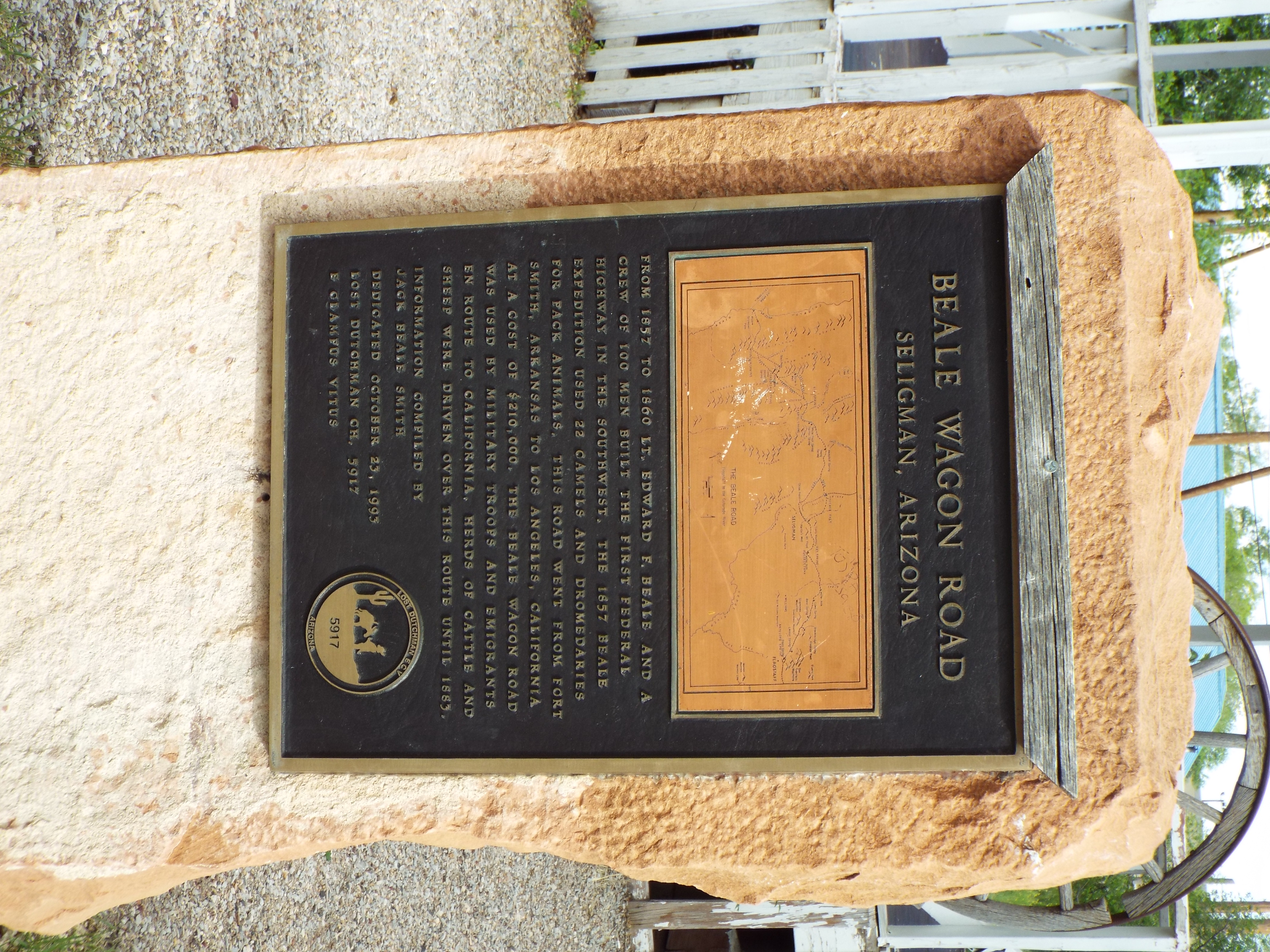
Seligman, Arizona
Seligman ( yuf-x-hav, Thavgyalyal) is a census-designated place (CDP) on the northern border of Yavapai County, in northwestern Arizona, United States. The population was 456 at the 2000 census. Geography Seligman is located at (35.328199, −112.874303), at in elevation, alongside the Big Chino Wash, in a northern section of Chino Valley. The wash is a major tributary of the Verde River. Seligman is a popular stopping point along Historic U.S. Route 66. According to the United States Census Bureau, the Seligman CDP has a total area of , all land. History The region was in the longtime homeland of the Havasupai people, who had a settlement in the present day Seligman area. The town site was on Beale's Wagon Road, and a stage stop on the Mojave Road Originally, Seligman was called "Prescott Junction" because it was the railroad stop on the Santa Fe mainline junction with the Prescott and Arizona Central Railway Company feeder line running to Prescott, in the Arizona Te ... [...More Info...] [...Related Items...] OR: [Wikipedia] [Google] [Baidu] |


