|
Narail District
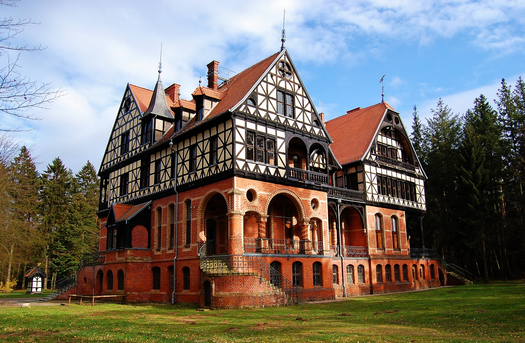
Narail ( bn, নড়াইল, pron: ''nɔɽail'') is a district in south-western Bangladesh. It is a part of Khulna Division. History Narail town was named after a feudal lord (a zamindar). The zamindars established a market at Roopgonj, also named after a zamindar. They established a post office for the first time in the district during British Raj near Rotongonj, named after another member of the zamindar's family. They modernised Narail, and promoted culture, sports and education. The large playing field, Kuriddobe, was a gift of the zamindar's family. They introduced football competition, with a shield given to the champions, a cup to the runners-up, and medals to all players from the early twentieth century. One of the zamindars moved away from Narail, settled in Hatbaria, and established another large manor (''Jomidarbaari''). Geography Narail District has an area of . It is located to the south of Magura District, north of Khulna District, with the Faridpur District ... [...More Info...] [...Related Items...] OR: [Wikipedia] [Google] [Baidu] |
Lohagara Upazila, Narail
Lohagara ( bn, লোহাগড়া) is an upazila of Narail District in the Division of Khulna, Bangladesh. Lohagara Thana was established in 1861 and was converted into an upazila in 1984. It is named after its administrative center, the town of Lohagara. Geography Lohagara Upazila has a total area of . Situated between the Nabaganga and Madhumati rivers, it borders Magura District to the north, Dhaka Division to the east, Kalia Upazila to the south, and Narail Sadar Upazila to the west. Demographics According to the 2011 Bangladesh census, Lohagara Upazila had 51,233 households and a population of 228,594, 11.1% of whom lived in urban areas. 10.9% of the population was under the age of 5. The literacy rate (age 7 and over) was 61.9%, compared to the national average of 51.8%. Points of interest Kalibari Mandir is a Hindu temple in Lakshmipasha dedicated to the goddess Kali. Writing in 1870, James Westland, former Magistrate and Collector of Jessore, gave an account of it ... [...More Info...] [...Related Items...] OR: [Wikipedia] [Google] [Baidu] |
Gorai-Madhumati River
The Gorai-Madhumati River ( bn, গড়াই-মধুমতি ''Gôŗai-Modhumoti'') is one of the longest rivers in Bangladesh and a distributary of the Ganges. In the upper reaches it is called the Gorai, and the name changes to Madhumati. Madhumati continuous stream through Kushtia, Jessore, Rajbari, Faridpur, Khulna, Pirojpur and Barguna districts in Bangladesh. See also * List of rivers in Bangladesh Bangladesh is a riverine country. According to Bangladesh Water development board (BWDB) about 230 rivers currently flow in Bangladesh (during summer and winter), although the number stated are ambiguous in some sources. As stated by a publica ... References Rivers of Bangladesh Distributaries of the Ganges Rivers in Buddhism Rivers of Khulna Division Rivers of Dhaka Division Rivers of Barisal Division {{Bangladesh-river-stub ... [...More Info...] [...Related Items...] OR: [Wikipedia] [Google] [Baidu] |
Bengal
Bengal ( ; bn, বাংলা/বঙ্গ, translit=Bānglā/Bôngô, ) is a geopolitical, cultural and historical region in South Asia, specifically in the eastern part of the Indian subcontinent at the apex of the Bay of Bengal, predominantly covering present-day Bangladesh and the Indian state of West Bengal. Geographically, it consists of the Ganges-Brahmaputra delta system, the largest river delta in the world and a section of the Himalayas up to Nepal and Bhutan. Dense woodlands, including hilly rainforests, cover Bengal's northern and eastern areas, while an elevated forested plateau covers its central area; the highest point is at Sandakphu. In the littoral southwest are the Sundarbans, the world's largest mangrove forest. The region has a monsoon climate, which the Bengali calendar divides into six seasons. Bengal, then known as Gangaridai, was a leading power in ancient South Asia, with extensive trade networks forming connections to as far away as Roman Egypt. ... [...More Info...] [...Related Items...] OR: [Wikipedia] [Google] [Baidu] |
Mansion
A mansion is a large dwelling house. The word itself derives through Old French from the Latin word ''mansio'' "dwelling", an abstract noun derived from the verb ''manere'' "to dwell". The English word '' manse'' originally defined a property large enough for the parish priest to maintain himself, but a mansion is no longer self-sustaining in this way (compare a Roman or medieval villa). '' Manor'' comes from the same root—territorial holdings granted to a lord who would "remain" there. Following the fall of Rome, the practice of building unfortified villas ceased. Today, the oldest inhabited mansions around the world usually began their existence as fortified houses in the Middle Ages. As social conditions slowly changed and stabilised fortifications were able to be reduced, and over the centuries gave way to comfort. It became fashionable and possible for homes to be beautiful rather than grim and forbidding allowing for the development of the modern mansion. In British Engl ... [...More Info...] [...Related Items...] OR: [Wikipedia] [Google] [Baidu] |
Union Councils Of Bangladesh
Union council ( bn, ইউনিয়ন পরিষদ, translit=iūniyan pariṣad, translit-std=IAST), also known as union parishad, rural council, rural union and simply union, is the smallest rural administrative and local government unit in Bangladesh. Each union council is made up of nine wards. Usually one village is designated as a ward. There are 4,562 unions in Bangladesh. A union council consists of a chairman and twelve members including three members exclusively reserved for women. Union councils are formed under the ''Local Government (Union Parishads) Act, 2009''. The boundary of each union council is demarcated by the Deputy Commissioner of the District. A union council is the body primarily responsible for agricultural, industrial and community development within the local limits of the union. History The term ''union'' dates back to the 1870 British legislation titled the ''Village Chowkidari Act'' which established union ''panchayats'' for collecting tax ... [...More Info...] [...Related Items...] OR: [Wikipedia] [Google] [Baidu] |
Kalia Upazila
Kalia ( bn, কালিয়া) is an upazila of Narail District in the Division of Khulna, Bangladesh. Kalia Thana was established in 1866 and was converted into an upazila in 1984. It is named after its administrative center, the town of Kalia. Geography Kalia Upazila has a total area of . It borders Lohagara Upazila to the north, Dhaka Division to the east, Bagerhat and Khulna districts to the south, Jessore District to the southwest, and Narail Sadar Upazila to the northwest. The Nabaganga River flows south through the upazila. Demographics According to the 2011 Bangladesh census, Kalia Upazila had 48,579 households and a population of 220,202, 16.3% of whom lived in urban areas. 10.8% of the population was under the age of 5. The literacy rate (age 7 and over) was 55.3%, compared to the national average of 51.8%. Administration Kalia Upazila is divided into Kalia Municipality and 14 union parishads: Babrahasla, Baioshona, Boronaleliasabad, Chacuri, Hamidpur, Jaynagor, ... [...More Info...] [...Related Items...] OR: [Wikipedia] [Google] [Baidu] |
Narail Sadar Upazila
Narail Sadar ( bn, নড়াইল সদর) is an upazila of Narail District in the Division of Khulna, Bangladesh. Narail Thana was established in 1861 and was converted into an upazila (a sub-district) in 1984. The upazila takes its name from the district and the Bengali word ''sadar'' (headquarters). It is the subdistrict where the district headquarters, Narail town, is located. Geography Narail Sadar Upazila has a total area of . It borders Magura District to the north, Lohagara Upazila to the north and east, Kalia Upazila to the southeast, and Jessore District to the south and west. The Chitra River flows south through the upazila. Demographics According to the 2011 Bangladesh census, Narail Sadar Upazila had 62,795 households and a population of 272,872, 18.8% of whom lived in urban areas. 9.4% of the population was under the age of 5. The literacy rate (age 7 and over) was 65.5%, compared to the national average of 51.8%. Arts and culture A weeklong festival is held ... [...More Info...] [...Related Items...] OR: [Wikipedia] [Google] [Baidu] |
Upazila
An ''upazila'' ( bn, উপজেলা, upôzela, lit=sub-district pronounced: ), formerly called ''thana'', is an administrative region in Bangladesh, functioning as a sub-unit of a district. It can be seen as an analogous to a county or a borough of Western countries. Rural upazilas are further administratively divided into union council areas (union parishads). Bangladesh ha495 upazilas(as of 20 Oct 2022). The upazilas are the second lowest tier of regional administration in Bangladesh. The administrative structure consists of divisions (8), districts (64), upazilas (495) and union parishads (UPs). This system of devolution was introduced by the former military ruler and president of Bangladesh, Lieutenant General Hossain Mohammad Ershad, in an attempt to strengthen local government. Below UPs, villages (''gram'') and ''para'' exist, but these have no administrative power and elected members. The Local Government Ordinance of 1982 was amended a year later, redesignatin ... [...More Info...] [...Related Items...] OR: [Wikipedia] [Google] [Baidu] |
River Chitra
A river is a natural flowing watercourse, usually freshwater, flowing towards an ocean, sea, lake or another river. In some cases, a river flows into the ground and becomes dry at the end of its course without reaching another body of water. Small rivers can be referred to using names such as creek, brook, rivulet, and rill. There are no official definitions for the generic term river as applied to geographic features, although in some countries or communities a stream is defined by its size. Many names for small rivers are specific to geographic location; examples are "run" in some parts of the United States, "burn" in Scotland and northeast England, and "beck" in northern England. Sometimes a river is defined as being larger than a creek, but not always: the language is vague. Rivers are part of the water cycle. Water generally collects in a river from precipitation through a drainage basin from surface runoff and other sources such as groundwater recharge, spring ... [...More Info...] [...Related Items...] OR: [Wikipedia] [Google] [Baidu] |
Haor
A ( bn, হাওর) is a wetland ecosystem in the north eastern part of Bangladesh which physically is a bowl or saucer shaped shallow depression, also known as a backswamp.MK Alam; ''Wave attack in Haor areas of Bangladesh and cement concrete blocks as structural revetment material''; ''Progress in Structural Engineering, Mechanics and Computation: Proceedings'' (ed. Alphose Zingoni); page 325; Taylor & Francis; 2004; ''Bio-ecological Zones of Bangladesh''; International Union for Conservation of Nature and Natural Resources, Bangladesh Country Office; page 31; The World Conservation Union (IUCN); 2002; Bangladesh & Desertification , Sustainable Development Networking Programme (SDNP), Bangladesh; ''Retrieved: 2007-12-04'' During |
Beel
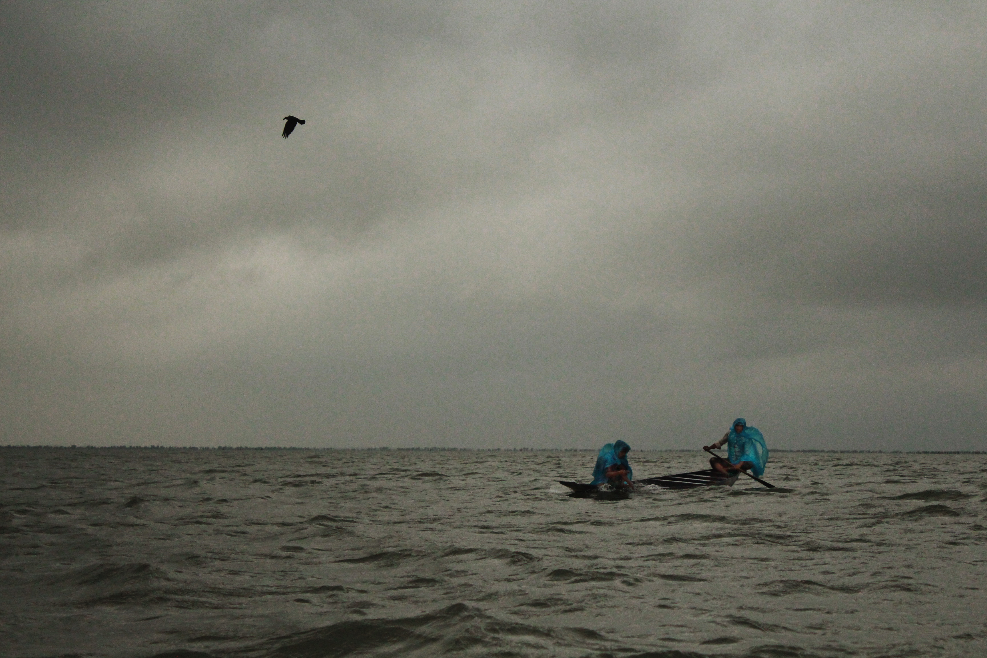
A beel (Bengali and Assamese: বিল) is a billabong or a lake-like wetland with static water (as opposed to moving water in rivers and canals - typically called in Bengali, in the Ganges - Brahmaputra flood plains of the Eastern Indian states of West Bengal, and Assam and in the country of Bangladesh. The term owes its origins to the word of the same pronunciation meaning "pond" and "lake" in the Bengali and Assamese languages. Formation Typically, beels are formed by inundation of low-lying lands during flooding, where some water gets trapped even after flood waters recede back from the flood plains. Beels may also be caused by filling up of low-lying areas during rains, especially during the monsoon season. There are different causes for the formation of beels. A string of beels is indicative of there being the remains of a great river that deserted its channel, moving to a new one elsewhere. Haor, baor In north eastern Bangladesh there are large water bodies called ... [...More Info...] [...Related Items...] OR: [Wikipedia] [Google] [Baidu] |


