|
Myola
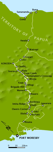
Myola is a locality on the Kokoda Track in the Territory of Papua and the modern state of New Guinea. It is one of two closely located dry lake beds located near where the Kokoda Track crosses the crest of the Owen Stanley Range – also known as "the Gap" or "the Kokoda Gap". Myola, the smaller of the two lake beds, was located and named by Lieutenant Bert Kienzle on 3 August 1943. It became a major resupply point and drop zone for Australian forces during the Kokoda Track campaign The Kokoda Track campaign or Kokoda Trail campaign was part of the Pacific War of World War II. The campaign consisted of a series of battles fought between July and November 1942 in what was then the Australian Territory of Papua. It was primar .... Kienzle then cut a track toward Eora Creek which rejoined the original track at Templeton's Crossing, which he also named. Myola was named (there being no local name) for the wife of his friend and commanding officer, Major Sydney Elliot-Smith. M ... [...More Info...] [...Related Items...] OR: [Wikipedia] [Google] [Baidu] |
Kokoda Track Campaign
The Kokoda Track campaign or Kokoda Trail campaign was part of the Pacific War of World War II. The campaign consisted of a series of battles fought between July and November 1942 in what was then the Australian Territory of Papua. It was primarily a land battle, between the Japanese South Seas Detachment under Major General Tomitarō Horii and Australian and Papuan land forces under command of New Guinea Force. The Japanese objective was to seize Port Moresby by an overland advance from the north coast, following the Kokoda Track over the mountains of the Owen Stanley Range, as part of a strategy to isolate Australia from the United States. Japanese forces landed and established beachheads near Gona and Buna on 21 July 1942. Opposed by Maroubra Force, then consisting of four platoons of the 39th Battalion and elements of the Papuan Infantry Battalion, they quickly advanced and captured Kokoda and its strategically vital airfield on 29 July. Despite reinforcement, the Austr ... [...More Info...] [...Related Items...] OR: [Wikipedia] [Google] [Baidu] |
Herbert Thomson Kienzle
Captain Herbert Thomson "Bert" Kienzle (19 May 1905 – 7 January 1988) was an Australian soldier and plantation owner from the Territory of Papua. He is notable for his contribution as officer in charge of native labour supporting Australian forces fighting along the Kokoda Track. He identified and named the dry lake beds, Myola, that were to become an important supply dropping area and staging point during the Kokoda Track campaign. In later life, he was recognised for his contribution to the development of Papua New Guinea. Early life Herbert Thomson "Bert" Kienzle was born on 15 May 1905 at Levuka on the island of Ovalau, Fiji. He was the eldest of four children born to Alfred Kienzle, a German national and Mary (née Wilson). Mary was the daughter of an English father and a Samoan mother. She died in 1914 after giving birth to a son. The following year, Alfred was remarried to an Australian, Mena Hallet "Hally" Pearse. In 1916, Alfred was inte ... [...More Info...] [...Related Items...] OR: [Wikipedia] [Google] [Baidu] |
Templeton's Crossing
Templeton's Crossing is a locality on the Kokoda Track in New Guinea. The original track, at the start of the Kokoda Track campaign, proceeded north from Kagi and crossed over the Drainage divide, watershed of the Owen Stanley Range as it passed through "the Gap" – skirting the eastern side of Mount Bellamy. The track then proceeded north through the steep-sided Eora Creek valley. Templeton's Crossing is where the original track first crosses Eora Creek. It was named by (then) Lieutenant Herbert Thomson Kienzle, Bert Kienzle in memory of Captain Sam Templeton. Templeton commanded B Company, 39th Battalion (Australia), 39th Battalion. It was the first of the battalion's companies to deploy overland for the defence of Kokoda – arriving shortly before the Invasion of Buna-Gona, Japanese landings. Templeton was killed in the early stages of the Japanese advance. Kienzle was an officer of the Australian New Guinea Administrative Unit, that had been tasked, among other things ... [...More Info...] [...Related Items...] OR: [Wikipedia] [Google] [Baidu] |
George Alan Vasey
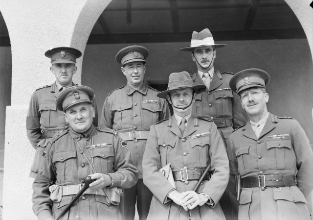
Major General George Alan Vasey, (29 March 1895 – 5 March 1945) was an Australian Army officer. He rose to the rank of major general during the Second World War, before being killed in a plane crash near Cairns in 1945. A professional soldier, Vasey graduated from Royal Military College, Duntroon in 1915 and served on the Western Front with the Australian Imperial Force, for which he was awarded the Distinguished Service Order and twice Mentioned in Despatches. For nearly twenty years, Vasey remained in the rank of major, serving on staff posts in Australia and with the Indian Army. Shortly after the outbreak of Second World War in September 1939, Lieutenant General Sir Thomas Blamey appointed Vasey to the staff of the 6th Division. In March 1941, Vasey took command of 19th Infantry Brigade, which he led in the Battle of Greece and Battle of Crete. Returning to Australia in 1942, Vasey was promoted to major general and became Deputy Chief of the General Staff. In Septe ... [...More Info...] [...Related Items...] OR: [Wikipedia] [Google] [Baidu] |
Kokoda Trail NE At Top
Kokoda is a station town in the Oro Province of Papua New Guinea. It is famous as the northern end of the Kokoda Track, site of the eponymous Kokoda Track campaign of World War II. In that campaign, it had strategic significance because it had the only airfield along the Track. In the decades preceding, it had been a foothills settlement near the gold fields. Kokoda is located within the administrative divisions of Kokoda Rural LLG. Establishment of the station town The British colonial administration found that a base for the Papuan Native Constabulary and colonial control was required to subdue the region and the government station of Kokoda was founded in 1904. Government officer Henry Griffin forced local people to become laborers and carriers to construct the town and build roads in the region. If they refused, Griffin would order his troopers to shoot their pigs and steal their taro plants. From Kokoda, the British and Anglo-Australian forces subdued the Orokaiva and neig ... [...More Info...] [...Related Items...] OR: [Wikipedia] [Google] [Baidu] |
Kokoda Track
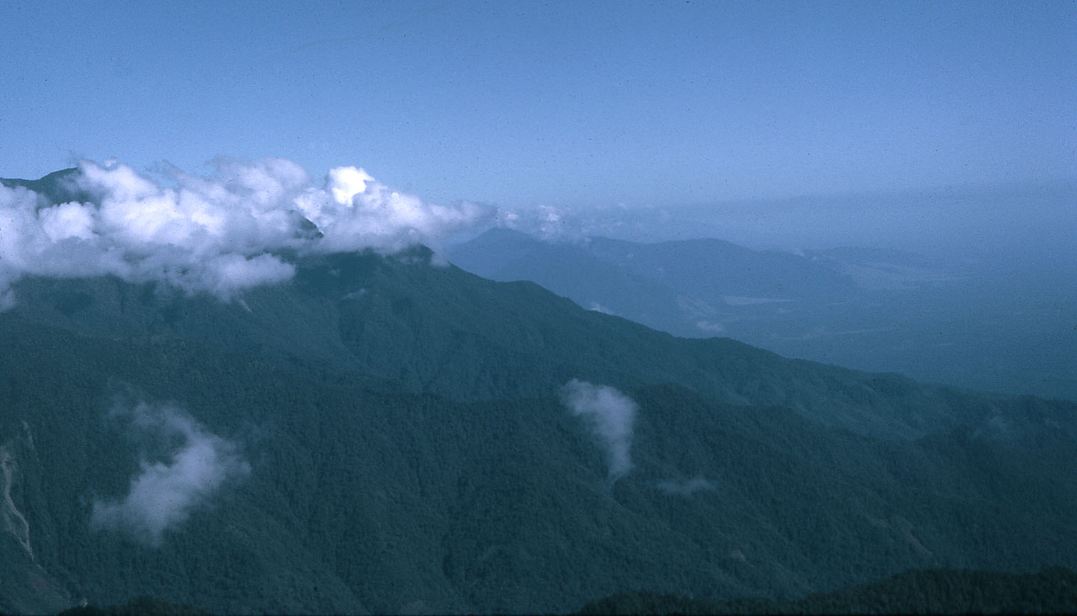
The Kokoda Track or Trail is a single-file foot thoroughfare that runs overland – in a straight line – through the Owen Stanley Range in Papua New Guinea (PNG). The track was the location of the 1942 World War II battle between Japanese and Allied – primarily Australian – forces in what was then the Australian territory of Papua. The track runs from Owers' Corner in Central Province, east of Port Moresby, across rugged and isolated terrain which is only passable on foot, to the village of Kokoda in Oro Province. It reaches a height of as it passes around the peak of Mount Bellamy. The track travels primarily through the land of the Mountain Koiari people. Hot, humid days with intensely cold nights, torrential rainfall and the risk of endemic tropical diseases such as malaria make it a challenging trek. Hiking the trail normally takes between four and twelve days; the fastest recorded time is 16 hours 34 minutes. History The track was first used by European ... [...More Info...] [...Related Items...] OR: [Wikipedia] [Google] [Baidu] |
Territory Of Papua
The Territory of Papua comprised the southeastern quarter of the island of New Guinea from 1883 to 1975. In 1883, the Government of Queensland annexed this territory for the British Empire. The United Kingdom Government refused to ratify the annexation but in 1884 a protectorate was proclaimed over the territory, then called "British New Guinea". There is a certain ambiguity about the exact date on which the entire territory was annexed by the British. The Papua Act 1905 recites that this happened "on or about" 4 September 1888.''Commonwealth and Colonial Law'' by Kenneth Roberts-Wray, London, Stevens, 1966. P. 132 On 18 March 1902, the Territory was placed under the authority of the Commonwealth of Australia. Resolutions of acceptance were passed by the Commonwealth Parliament, which accepted the territory under the name of Papua. In 1949, the Territory and the Territory of New Guinea were established in an administrative union by the name of the Territory of Papua and New Gui ... [...More Info...] [...Related Items...] OR: [Wikipedia] [Google] [Baidu] |
New Guinea
New Guinea (; Hiri Motu Hiri Motu, also known as Police Motu, Pidgin Motu, or just Hiri, is a language of Papua New Guinea, which is spoken in surrounding areas of Port Moresby (Capital of Papua New Guinea). It is a simplified version of Motu, from the Austronesian l ...: ''Niu Gini''; id, Papua, or , historically ) is the List of islands by area, world's second-largest island with an area of . Located in Oceania in the southwestern Pacific Ocean, the island is separated from Mainland Australia, Australia by the wide Torres Strait, though both landmasses lie on the same continental shelf. Numerous smaller islands are located to the west and east. The eastern half of the island is the major land mass of the independent state of Papua New Guinea. The western half, known as Western New Guinea, forms a part of Indonesia and is organized as the provinces of Papua (province), Papua, Central Papua, Highland Papua, South Papua, Southwest Papua, and West Papua (province), West ... [...More Info...] [...Related Items...] OR: [Wikipedia] [Google] [Baidu] |
Owen Stanley Range
Owen Stanley Range is the south-eastern part of the central mountain-chain in Papua New Guinea. Its highest point is Mount Victoria at , while its most prominent peak is Mount Suckling. History Owen Stanley Range was seen in 1849 by Captain Owen Stanley while surveying the south coast of Papua and named after him. The eastern extremity of the range is Mount Victoria, which was climbed by Sir William MacGregor in 1888, and it extends as far west as Mount Thynne and Lilley. But the name is generally used to denote the whole of the chain of the Papuan Peninsula, from Mount Chapman to the south-eastern end of the island, and to include Mount Albert Edward which is really separated from it by the Wharton Chain. Geography The range is flanked by broken and difficult country, particularly on the south-western side. There are few practicable passes, the easiest being the famous Kokoda Track which crosses the range between Port Moresby and Buna and was in use for more than 50 yea ... [...More Info...] [...Related Items...] OR: [Wikipedia] [Google] [Baidu] |
Battle Of Ioribaiwa
The Battle of Ioribaiwa took place between 14 and 16 September 1942, during the Kokoda Track campaign in Papua during the Second World War. Involving forces from Australia, the United States, and Japan, the fighting centred on a high feature known as Ioribaiwa Ridge, south of Ofi Creek on the Kokoda Track, in the Territory of Papua. It was the last of three defensive battles fought by the Australians along the Kokoda Track to halt the Japanese advance from the north coast of Papua towards Port Moresby. Although the Japanese were successful in pushing the Australian defenders back in the centre of their position on the track, heavy fighting on the flanks of the position blunted the Japanese attack, bringing it to a standstill. In the aftermath, the Australian commander, Brigadier Kenneth Eather, perceiving that the attack could not be held any further and that Ioribaiwa Ridge was unsuited to launching a counter-attack, withdrew his force back to Imita Ridge. The Japanese, howev ... [...More Info...] [...Related Items...] OR: [Wikipedia] [Google] [Baidu] |
Arthur Samuel Allen
Major General Arthur Samuel "Tubby" Allen, (10 March 1894 – 25 January 1959) was an Australian Army officer and accountant. During the Second World War he reached the rank of major general and commanded Allied forces in the Syria–Lebanon and New Guinea campaigns. Allen was frequently referred to during the Second World War by the nickname "Tubby"; an indication of his stocky build and the affection with which he was regarded by both soldiers and the Australian public. Early life Allen was born in Hurstville, in Sydney. He attended Hurstville Superior Public School before gaining work as an audit clerk with the New South Wales Government Railways. Allen also joined the cadets and then the 39th Battalion of the Militia. First World War Allen was commissioned in 1913 and joined the Australian Imperial Force (AIF) on 24 June 1915. Allen embarked for Egypt with reinforcements for the 13th Battalion in August. In March 1916 he was promoted to captain an ... [...More Info...] [...Related Items...] OR: [Wikipedia] [Google] [Baidu] |

.jpg)
.jpg)
.jpg)


