|
Muttar River
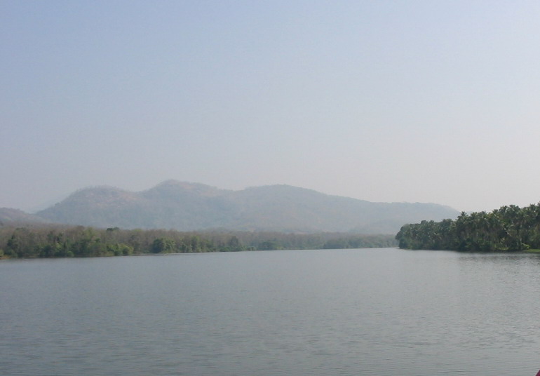
Muttar River is a major distributary of Periyar flowing through Eranakulam District of Kerala. Malayalam:മുട്ടാർ. The river is a major source of water for Aluva, Choornikkara, Kalamassery, Kadungaloor, Alangad, Cheranalloor, Varapuzha Varappuzha, , (also known by its former name Verapoly) is a northern suburb of the city of Kochi. It is a census town in Paravur Taluk, Ernakulam district in the Indian state of Kerala. Situated around 15 km (9 mi) from the city centr ... and parts of Kochi corporation. The river has a length of 12 kilometers and an average width of 50 meters. Muttar river is currently under threat of pollution from nearby industries. Edappally Canal is a link between the two industrial hubs Udyogamandal and Ambalamugal. It connects the Muttar River on northern end and Chitrapuzha River on the Southern end. References Rivers of Ernakulam district {{India-river-stub ... [...More Info...] [...Related Items...] OR: [Wikipedia] [Google] [Baidu] |
Periyar (river)
Periyar, , (meaning: ''big river'') is the longest river and the river with the largest discharge potential in the Indian state of Kerala. It is one of the few perennial rivers in the region and provides drinking water for several major towns. The Periyar is of utmost significance to the economy of Kerala. It generates a significant proportion of Kerala's electrical power via the Idukki Dam and flows along a region of industrial and commercial activity. The river also provides water for irrigation and domestic use throughout its course besides supporting a rich fishery. Due to these reasons, the river has been named the "Lifeline of Kerala". Kochi city, in the vicinity of the river mouth draws its water supply from Aluva, an upstream site sufficiently free of seawater intrusion. Twenty five percent of Kerala's industries are along the banks of river Periyar. These are mostly crowded within a stretch of in the Eloor-Edayar region (Udhyogamandal), about north of Kochi harbor. ... [...More Info...] [...Related Items...] OR: [Wikipedia] [Google] [Baidu] |
Eranakulam District
Ernakulam, ; ISO: ''Eṟaṇākuḷaṁ'', in Malayalam: എറണാകുളം), is one of the 14 districts in the Indian state of Kerala, that takes its name from the eponymous city division in Kochi. It is situated in the central part of the state, spans an area of about , and is home to over 9% of Kerala's population. Its headquarters are located at Kakkanad. The district includes Kochi, also known as the commercial capital of Kerala, which is famous for its ancient Churches, Hindu temples, synagogues and mosques. The district includes the largest metropolitan region of the state: Greater Cochin. Ernakulam is the district that yields the most revenue and the largest number of industries in the state. Ernakulam is the third most populous district in Kerala, after Malappuram and Thiruvananthapuram (out of 14 districts). The district also hosts the highest number of international and domestic tourists in Kerala state. The most commonly spoken language in Ernakulam is Mal ... [...More Info...] [...Related Items...] OR: [Wikipedia] [Google] [Baidu] |
Kerala
Kerala ( ; ) is a state on the Malabar Coast of India. It was formed on 1 November 1956, following the passage of the States Reorganisation Act, by combining Malayalam-speaking regions of the erstwhile regions of Cochin, Malabar, South Canara, and Thiruvithamkoor. Spread over , Kerala is the 21st largest Indian state by area. It is bordered by Karnataka to the north and northeast, Tamil Nadu to the east and south, and the Lakshadweep Sea to the west. With 33 million inhabitants as per the 2011 census, Kerala is the 13th-largest Indian state by population. It is divided into 14 districts with the capital being Thiruvananthapuram. Malayalam is the most widely spoken language and is also the official language of the state. The Chera dynasty was the first prominent kingdom based in Kerala. The Ay kingdom in the deep south and the Ezhimala kingdom in the north formed the other kingdoms in the early years of the Common Era (CE). The region had been a prominent spic ... [...More Info...] [...Related Items...] OR: [Wikipedia] [Google] [Baidu] |
Aluva
Aluva (; also known by its former name Alwaye) is a town in the Ernakulam District in Kerala, India. It is a part of the Kochi metropolitan area and is situated around from the city center on the banks of Periyar River. A major transportation hub, with easy access to all major forms of transportation, Aluva acts as a corridor which links the highland districts to the rest of Kerala. Cochin International Airport at Nedumbassery is 11.7 km from Aluva. Aluva is accessible through rail (Aluva railway station), air (Cochin International Airport), metro (Kochi Metro) along with major highways and roadlines. Aluva KSRTC bus station is an important transport hub in Kerala and one of the busiest stations in central part of the state. Aluva, home to the summer residency of the Travancore royal family–the Alwaye Palace-is also famous for the Sivarathri festival celebrated annually at the sandbanks of Periyar. The Advaita Ashrams in Aluva founded in 1913 by Sree Narayana ... [...More Info...] [...Related Items...] OR: [Wikipedia] [Google] [Baidu] |
Choornikkara
Choornikkara is a census town in Aluva in Ernakulam District in Kerala, India. Demographics India census, Choornikkara had a population of 36,998. Males constitute 50% of the population and females 50%. Choornikkara has an average literacy rate of 83%, higher than the national average of 59.5%; with male literacy of 85% and female literacy of 80%. 11% of the population is under 6 years of age. Borders *South - Kalamassery Municipality, Eloor municipality *North -Aluva Municipality, Keezhmadu, Kadungalloore Panchayath in Aluva taluk *East - Edathala, Keezhmadu Panchayath *West - Eloor, Kadungallore Panchayath Eminent Personalities * M.V. Devan * N. F. Varghese Nadakkaparambil Francis Varghese (6 January 1950 – 19 June 2002) was an Indian actor who worked in Malayalam film industry. He began his career as a mimicry artist in Kalabhavan, acting in minor roles, but later he turned to strong villain r ... * Xavier Pulppatt * J. Pallassery References Cities and town ... [...More Info...] [...Related Items...] OR: [Wikipedia] [Google] [Baidu] |
Kalamassery
Kalamassery () is a major industrial region in the city of Kochi in the state of Kerala, India. It houses companies like Apollo Tyres and HMT; IT/Electronics Parks like KINFRA Hi Tech Park, Startup Village, and Electronics City. Kalamassery is also home to educational institutions such as the National University of Advanced Legal Studies, Ernakulam Medical College, and the Cochin University of Science and Technology. The Thrikkakara temple, Unichira and Eloor industrial township, are in the vicinity of Kalamassery. The Periyar river flows through Kalamassery. In local administration it is a municipality named Kalamassery Municipality. Government Medical College Ernakulam is situated in Kalamassery. The neighbouring localities of Kalamassery are Thrikkakara, Eloor, Edappally, Choornikkara, Edathala and Aluva.Cochin International Airport is 18 km away from Kalamassery. Etymology The name Kalamassery is derived from Kalabhasery. In Malayalam, a word can have multiple mea ... [...More Info...] [...Related Items...] OR: [Wikipedia] [Google] [Baidu] |
Kadungalloor
Kadungalloor, , is a village situated near Aluva. The village belongs to the Paravur Taluk of the Ernakulam district in the Indian state of Kerala. The industrial estates of Muppathadam and Edayar are located in Kadungalloor. Demographics According to 2001 census data, Kadungalloor has a population of 35,451, evenly distributed between men and women. The average literacy rate is 81%, which is above the national average of 59.5%. About 13% of the population is below the age of 7. According to reports, there are 10,125 houses situated in Kadungalloor. Transport The nearest railway station is the Aluva railway station, which is about from Kadungalloor. The Cochin International Airport (CIAL) is situated at a distance of from Kadungalloor. Landmarks and attractions The Kadungalloor Panchayat is divided into East Kadungalloor and West Kadungalloor. The temple at Uliyannoor is believed to be built by Perumthachan. Sree Narasimha Swami Temple is the largest temple situate ... [...More Info...] [...Related Items...] OR: [Wikipedia] [Google] [Baidu] |
Alangad
Alangad is a village located in Paravur Taluk of Ernakulam District in the Indian state of Kerala. It lies almost in the middle of North Paravur and Aluva. The Kochi city is 15 km away from Alangad. Etymology The name Alangad has been derived from ''alam'' meaning ''sugarcane'' and ''gad'' which refers to the Malayalam word ''കാട് aadu' ''meaning jungle''. History Alangad was once famous in the state for its sugarcane fields. In the past, Alangad was a small kingdom ruled by the Alangad Kings. Visscher refers the battle that took place between the Alangad King (Alangad Mootha Karthakal) and the Paravoor (N.Parur) King in his 'Letters from Malabar' written in 1720CE. In the last decade of the 16th century, a Syrian Christian named Mathoo Chakkarayakathoottu was the Akambady Sena Nayakar(Captain of Guards) of the Alangad Raja's Christian subjects. During the time of Diamper Synod(Udayamperur Sunnahados) a milestone in the history of St.Thomas Christians, Akambady Na ... [...More Info...] [...Related Items...] OR: [Wikipedia] [Google] [Baidu] |
Cheranallur
Cheranallur or Cheranellore or Cheranelloor is a suburb of Kochi city in the state of Kerala, India and lies on the banks of the Periyar River. According to tradition, the area was named by its earlier inhabitants who found this place very fertile and beautiful. The name in its local language Malayalam means "Good Village of Cheras". The National Highway 66, which connects Cochin with Mumbai-Panvel, goes through Cheranalloor crossing the Vallarpadam International Container National Highway National Highway 47C (India) (the only junction between the two Highways). Cheranallur is a place surrounded by backwaters, and brackish lagoons which are commonplace in Kerala. The former ruler of these area was known as "Cheranallor Karthavu" - he was one of the influential lords around Cochin area before the Sakthan Thampuran of Cochin. Location Demographics India census, Cheranallur had a population of 26,330. Males constitute 50% of the population and females 50%. Cheranallur has an ... [...More Info...] [...Related Items...] OR: [Wikipedia] [Google] [Baidu] |
Varappuzha
Varappuzha, , (also known by its former name Verapoly) is a northern suburb of the city of Kochi. It is a census town in Paravur Taluk, Ernakulam district in the Indian state of Kerala. Situated around 15 km (9 mi) from the city centre and 8 km (5 mi) from Edapally, the areas lies in the NH 66 connecting Vytilla with North Paravur. Its specialty is that considerably large-scale paddy cultivating area is situating western part of Varapuzha which is called Devaswompadam, specialised with Pokkali paddy cultivation and interim crop as fish cultivation locally called 'Kettu'. The common work of the natives are fishing and agriculture. Varapuzha is known for its fish market (Chettibagam market). The Varapuzha Bridge (Near Historical Varapuzha Island) connects Varapuzha (Mannantturuthu) with the neighboring Cheranallur. Demographics India census, Varappuzha had a population of 24,516. Males constitute 48% of the population and females 52%. Varappuzha has an average ... [...More Info...] [...Related Items...] OR: [Wikipedia] [Google] [Baidu] |


