|
Mount Shasta City Park
Mount Shasta City Park is an urban park located in the city of Mount Shasta, California, United States. It is one of two parks within the Mt. Shasta Recreation and Parks District and hosts the district's headquarters. The park and offers a variety of opportunities for recreation such as hiking, picnicking and biking. Many community events occur within the park buildings and in the surrounding park land. The park is also home to the headwaters of the Upper Sacramento River. Recreation Mt. Shasta City Park is complete with picnic tables, benches, playground equipment, trails for viewing nature, the Headwaters Bridge, biking trails, a large field, community buildings and the Headwaters Spring. Many of the buildings onsite are available for rental and to host events throughout the year. Upper Lodge Recreation Center features a stage, commercial kitchen, and is capable of seating over 185 people. Overlooking the headwaters spring, Lower Lodge offers similar activities as the Upper Lo ... [...More Info...] [...Related Items...] OR: [Wikipedia] [Google] [Baidu] |
Mount Shasta, California
Mount Shasta (also known as Mount Shasta City) is a city in Siskiyou County, California, at about above sea level on the flanks of Mount Shasta, a prominent northern California landmark. The city is less than southwest of the summit of its namesake volcano. Its population is 3,223 as of the 2020 census, down from 3,394 from the 2010 census. __TOC__ Commerce and tourism The city of Mount Shasta is located in the Shasta Cascade area of Northern California.Welcome to Mount Shasta Mount Shasta Chamber of Commerce, accessed April 23, 2013 Visitors use the city as a base for in the nearby |
Okwanuchu
The Okwanuchu were one of a number of small Shastan-speaking tribes of Native Americans in Northern California, who were closely related to the adjacent larger Shasta tribe. Geography The Okwanuchu occupied territory south, southwest, and southeast of Mount Shasta in California, including the present-day cities of Mount Shasta, California, McCloud, California and Dunsmuir, California; on the upper Sacramento River downstream to North Salt Creek; in the Squaw Valley Creek drainage; and on the upper McCloud River downstream to where it meets Squaw Valley Creek. Anthropologist Alfred L. Kroeber suggested in 1918 that the Okwanuchu had become extinct. Very little is known about the location of their villages and settlements, or about their culture, other than a presumed similarity to their Shasta and Achomawi neighbors. The archaeological sites associated with their range date back in excess of 5,000 years. Language The Okwanuchu were speakers of the Okwanuchu language, an older ... [...More Info...] [...Related Items...] OR: [Wikipedia] [Google] [Baidu] |
Sustainable Groundwater Management Act
The Sustainable Groundwater Management Act (SGMA) is a three-bill package that passed the California state legislature and was signed into California state law by Governor Jerry Brown in September 2014. Its purpose is to ensure better local and regional management of groundwater use and it seeks to have a sustainable groundwater management in California by 2042. It emphasizes local management and formed groundwater sustainability agencies (GSAs) from local and regional authorities. Proposition 1 provides $100 million to financially support sustainable groundwater management as well as cleanup and storage. Background Groundwater in California is used by 85% of the population, mostly used by the agriculture industry as the main water source for crops. For years, groundwater use has been poorly managed and under-regulated to a point where the state is facing major depletion. Groundwater is particularly crucial in California because the dearth of surface water means that it ... [...More Info...] [...Related Items...] OR: [Wikipedia] [Google] [Baidu] |
Crystal Geyser Water Company
Crystal Geyser Water Company, or just Crystal Geyser, is a private company founded in 1977 in Calistoga, California. They produce bottled sparkling water based on mineral water and spring water sources at their original facility in Calistoga. About Besides sparkling water drinks, the company also produces ready-to-drink teas called Tejava in Bakersfield, California. In 1990 Crystal Geyser was acquired by Otsuka Pharmaceutical's parent company Otsuka Holdings Co. Ltd. In 2014, the company had plans to bottle water from an aquifer in Mount Shasta, California, but many local residents criticized the plan. In August 2019, Siskiyou Superior Court struck down a lawsuit brought by an environmental group and Native Indian tribe claiming the presence of their plant in the area would negatively impact the environment. Water Sources Crystal Geyser Water Company produces sparkling mineral water and sparkling spring water out of their Calistoga facility. Mineral water and spring w ... [...More Info...] [...Related Items...] OR: [Wikipedia] [Google] [Baidu] |
Hummingbirds
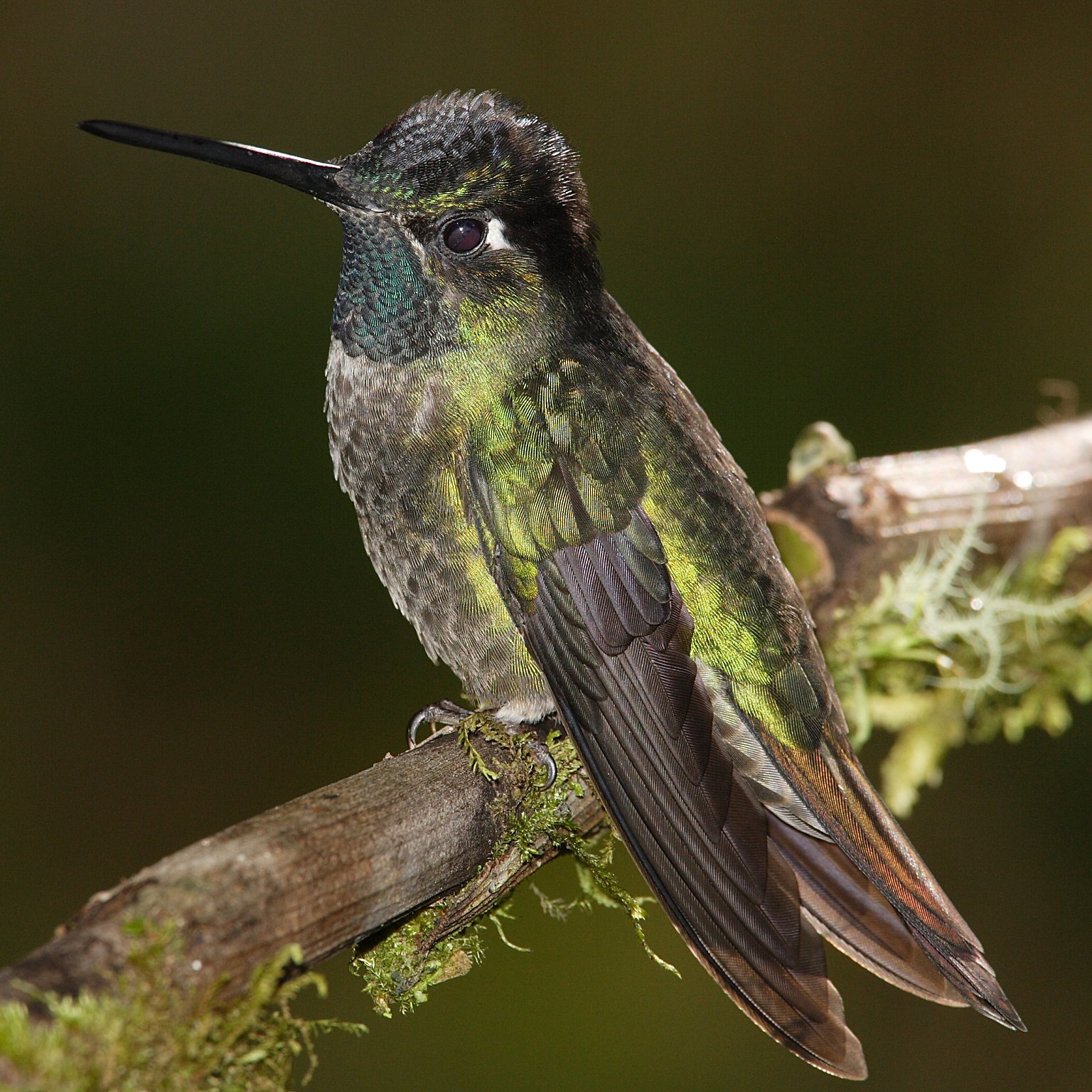
Hummingbirds are birds native to the Americas and comprise the biological family Trochilidae. With about 361 species and 113 genera, they occur from Alaska to Tierra del Fuego, but the vast majority of the species are found in the tropics around the equator. They are small birds, with most species measuring in length. The smallest extant hummingbird species is the bee hummingbird, which weighs less than . The largest hummingbird species is the giant hummingbird, weighing . They are specialized for feeding on flower nectar, but all species also consume flying insects or spiders. Hummingbirds split from their sister group, the swifts and treeswifts, around 42 million years ago. The common ancestor of extant hummingbirds is estimated to have lived 22 million years ago in South America. They are known as hummingbirds because of the humming sound created by their beating wings, which flap at high frequencies audible to humans. They hover in mid-air at rapid wing-flapping rates, ... [...More Info...] [...Related Items...] OR: [Wikipedia] [Google] [Baidu] |
Mount Shasta City Park - Mount Shasta City, California - DSC02767
Mount is often used as part of the name of specific mountains, e.g. Mount Everest. Mount or Mounts may also refer to: Places * Mount, Cornwall, a village in Warleggan parish, England * Mount, Perranzabuloe, a hamlet in Perranzabuloe parish, Cornwall, England * Mounts, Indiana, a community in Gibson County, Indiana, United States People * Mount (surname) * William L. Mounts (1862–1929), American lawyer and politician Computing and software * Mount (computing), the process of making a file system accessible * Mount (Unix), the utility in Unix-like operating systems which mounts file systems Displays and equipment * Mount, a fixed point for attaching equipment, such as a hardpoint on an airframe * Mounting board, in picture framing * Mount, a hanging scroll for mounting paintings * Mount, to display an item on a heavy backing such as foamcore, e.g.: ** To pin a biological specimen, on a heavy backing in a stretched stable position for ease of dissection or display ** ... [...More Info...] [...Related Items...] OR: [Wikipedia] [Google] [Baidu] |
Aquifer
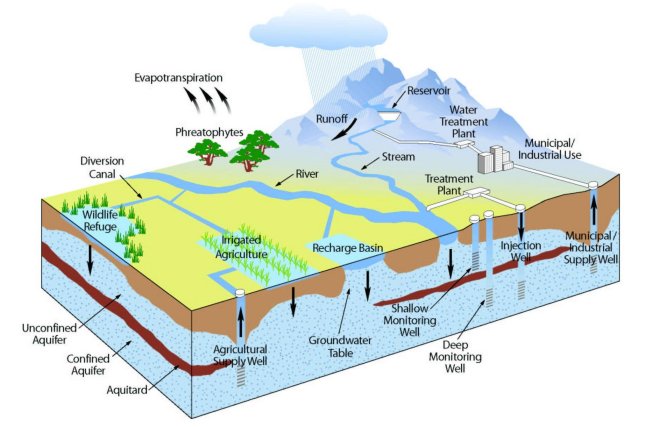
An aquifer is an underground layer of water-bearing, permeable rock, rock fractures, or unconsolidated materials (gravel, sand, or silt). Groundwater from aquifers can be extracted using a water well. Aquifers vary greatly in their characteristics. The study of water flow in aquifers and the characterization of aquifers is called hydrogeology. Related terms include aquitard, which is a bed of low permeability along an aquifer, and aquiclude (or ''aquifuge''), which is a solid, impermeable area underlying or overlying an aquifer, the pressure of which could create a confined aquifer. The classification of aquifers is as follows: Saturated versus unsaturated; aquifers versus aquitards; confined versus unconfined; isotropic versus anisotropic; porous, karst, or fractured; transboundary aquifer. Challenges for using groundwater include: overdrafting (extracting groundwater beyond the Dynamic equilibrium, equilibrium yield of the aquifer), groundwater-related subsidence of land, gro ... [...More Info...] [...Related Items...] OR: [Wikipedia] [Google] [Baidu] |
California State University, Chico
California State University, Chico, or commonly, Chico State, is a public university in Chico, California. Founded in 1887, it is the second oldest campus in the California State University system. As of the fall 2020 semester, the university had a total enrollment of 16,630 students. The university offers 126 bachelor's degree programs, 35 master's degree programs, and four types of teaching credentials. Chico is a Hispanic-serving institution (HSI). History On March 12, 1887, a legislative act was enacted to create the Northern Branch of the California State Normal School. Less than a month later, Chico was chosen as the location. On June 24, 1887, General John Bidwell donated of land from his cherry orchard. Then on July 4, 1888, the first cornerstone was laid. On September 3, 1889, doors opened for the 90 enrolled students. The library opened on January 11, 1890, with 350 books. On June 20, 1891, the first graduation took place, a class of 15. In 1910, Annie Kennedy Bidw ... [...More Info...] [...Related Items...] OR: [Wikipedia] [Google] [Baidu] |
Maidu
The Maidu are a Native American people of northern California. They reside in the central Sierra Nevada, in the watershed area of the Feather and American rivers. They also reside in Humbug Valley. In Maiduan languages, ''Maidu'' means "man." Local division The Maidu people are geographically dispersed into many subgroups or bands who live among and identify with separate valleys, foothills, and mountains in Northeastern Central California. There are three subcategories of Maidu: * The Nisenan or Southern Maidu occupied the whole of the American, Bear, and Yuba River drainages. They live in lands that were previously home to the Martis. * The Northeastern or Mountain Maidu, also known as Yamani Maidu, lived on the upper North and Middle forks of the Feather River. * The Konkow (Koyom'kawi/Concow) occupied a valley between present-day Cherokee, and Pulga, along the north fork of the Feather River and its tributaries. The Mechupda live in the area of Chico, California. Populati ... [...More Info...] [...Related Items...] OR: [Wikipedia] [Google] [Baidu] |
Wintun
The Wintun are members of several related Native American peoples of Northern California, including the Wintu (northern), Nomlaki (central), and Patwin (southern).Pritzker, 152California Indians and Their Reservations: W. ''San Diego State University Library and Information Access.'' 2010 (retrieved 30 June 2010) Their range is from approximately present-day to , along the western side of the |
Sacramento River
The Sacramento River ( es, Río Sacramento) is the principal river of Northern California in the United States and is the largest river in California. Rising in the Klamath Mountains, the river flows south for before reaching the Sacramento–San Joaquin River Delta and San Francisco Bay. The river drains about in 19 California counties, mostly within the fertile agricultural region bounded by the California Coast Ranges, Coast Ranges and Sierra Nevada (U.S.), Sierra Nevada known as the Sacramento Valley, but also extending as far as the volcanic plateaus of Northeastern California. Historically, its watershed has reached as far north as south-central Oregon where the now, primarily, endorheic basin, endorheic (closed) Goose Lake (Oregon-California), Goose Lake rarely experiences southerly outflow into the Pit River, the most northerly tributary of the Sacramento. The Sacramento and its wide natural floodplain were once abundant in fish and other aquatic creatures, notably one ... [...More Info...] [...Related Items...] OR: [Wikipedia] [Google] [Baidu] |
Headwaters Of The Sacramento River-spring-750px
The headwaters of a river or stream is the farthest place in that river or stream from its estuary or downstream confluence with another river, as measured along the course of the river. It is also known as a river's source. Definition The United States Geological Survey (USGS) states that a river's "length may be considered to be the distance from the mouth to the most distant headwater source (irrespective of stream name), or from the mouth to the headwaters of the stream commonly known as the source stream". As an example of the second definition above, the USGS at times considers the Missouri River as a tributary of the Mississippi River. But it also follows the first definition above (along with virtually all other geographic authorities and publications) in using the combined Missouri—lower Mississippi length figure in lists of lengths of rivers around the world. Most rivers have numerous tributaries and change names often; it is customary to regard the longest t ... [...More Info...] [...Related Items...] OR: [Wikipedia] [Google] [Baidu] |


.jpg)

