|
Mount Norikura
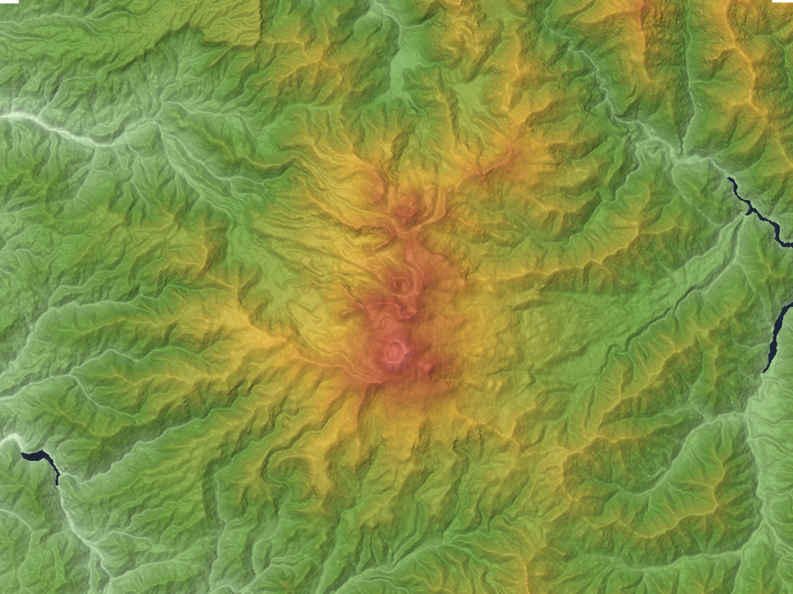
is a potentially active volcano located on the borders of Gifu and Nagano prefectures in Japan. It is part of the Hida Mountains and is listed among the 100 Famous Japanese Mountains and the New 100 Famous Japanese Mountains. Outline The mountain is located on the borders of Gifu and Nagano prefectures in Chūbu-Sangaku National Park. The Norikura Plateau borders the mountain on its northern side in Nagano Prefecture. The mountain, whose name means "riding saddle," received its name because its shape looks like a horse saddle. It is known for being the easiest to climb among the mountains in Japan that are above 3000-meters. History * 1680s - It is said that Enkū was the first to reach the peak. * 1878 - Englishman William Gowland became the first non-Japanese man to reach the peak. * 1892 - Englishman Walter Weston climbed on the peak. * December 4, 1934 - This area was specified to the Chūbu-Sangaku National Park. * 1973 - Norikura Skyline to the vicinity of the t ... [...More Info...] [...Related Items...] OR: [Wikipedia] [Google] [Baidu] |
Geospatial Information Authority Of Japan
The , or GSI, is the national institution responsible for surveying and mapping the national land of Japan. The former name of the organization from 1949 until March 2010 was Geographical Survey Institute; despite the rename, it retains the same initials. It is an extraordinary organ of the Ministry of Land, Infrastructure, Transport and Tourism. Its main offices are situated in Tsukuba City of Ibaraki Prefecture. It also runs a museum, situated in Tsukuba, the Science Museum of Map and Survey. Earthquake Precursor Prediction Research Stationary MT monitoring systems have been installed in Japan since April 1996, providing a continuous recording of MT signals at the Mizusawa Geodetic Observatory and the Esashi Station of the GSI. These stations measure fluctuations in the earth's electromagnetic field that correspond with seismic activity. The raw geophysical time-series data from these monitoring stations is freely available to the scientific community, enabling further study ... [...More Info...] [...Related Items...] OR: [Wikipedia] [Google] [Baidu] |
Three-thousanders (in Japan)
There are 21 three-thousanders (mountains with elevations of or greater) in Japan. The tallest is Mount Fuji, at . Geography There are three-thousanders in the following regions: * The ''independent peaks'' of Mount Fuji and Mount Ontake. * In the '' Hida Mountains'' ("Northern Alps") are Mount Okuhotaka, Mount Yari, Mount Karasawa, Mount Kitahotaka, Mount Ōbami, Mount Maehotaka, Mount Naka, Mount Minami, Mount Norikura and Mount Tate. * In the '' Akaishi Mountains'' ("Southern Alps") are Mount Kita, Mount Aino, Mount Warusawa, Mount Akaishi, Mount Arakawa, Mount Nishinōtori, Mount Shiomi, Mount Senjō and Mount Hijiri. The next tallest mountain is Mount Tsurugi, which has a height of . In the areas exceeding above sea level, there is a belt of Siberian dwarf pine; the alpine plant grows here naturally. The Siberian dwarf pine belt is a key habitat of the rock ptarmigan. 21 mountains References See also * List of mountains in Japan * 100 Famous Japanese Mounta ... [...More Info...] [...Related Items...] OR: [Wikipedia] [Google] [Baidu] |
Rock Ptarmigan
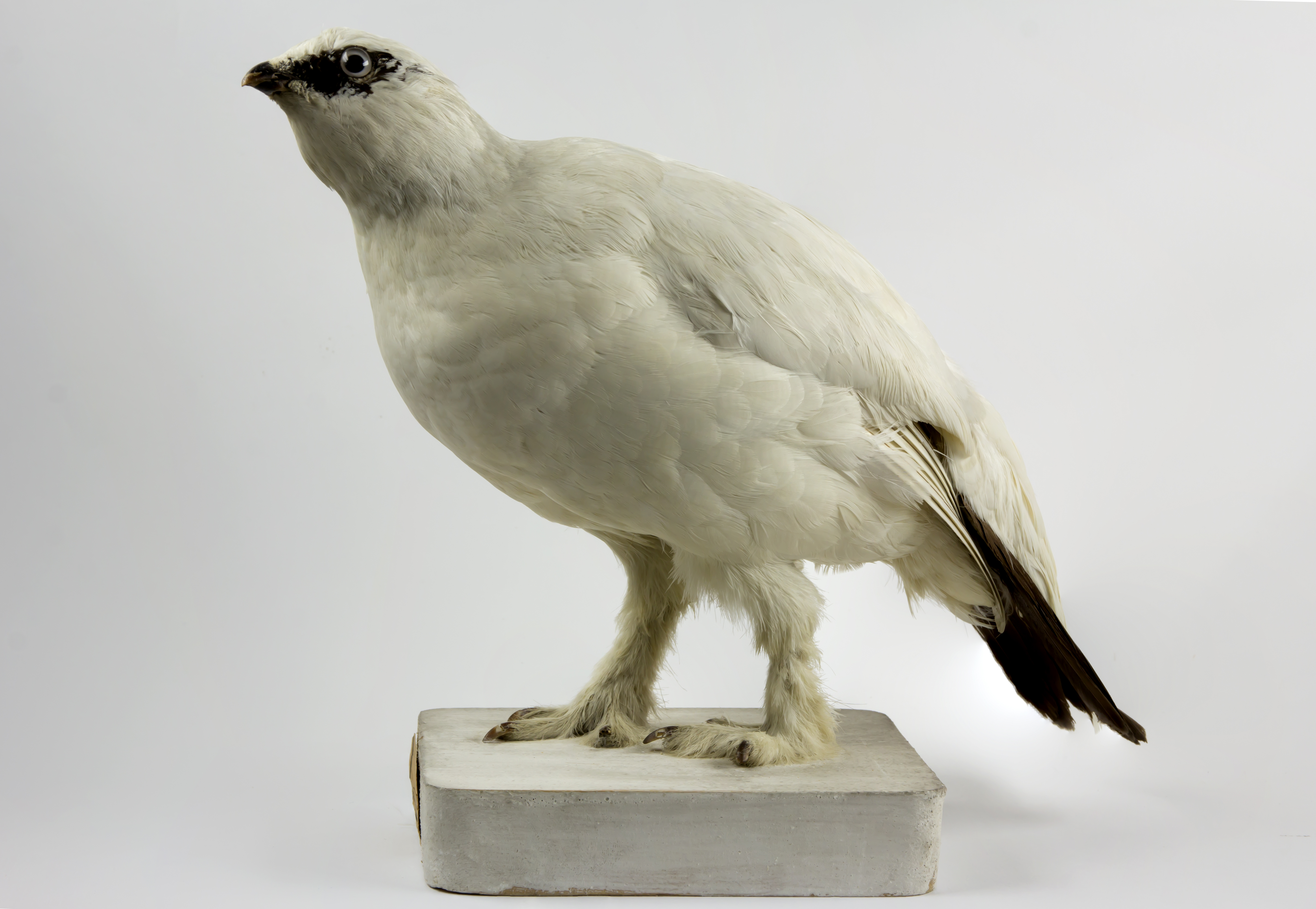
The rock ptarmigan (''Lagopus muta'') is a medium-sized game bird in the grouse family. It is known simply as the ptarmigan in the UK. It is the official bird for the Canadian territory of Nunavut, where it is known as the ''aqiggiq'' (ᐊᕿᒡᒋᖅ), and the official game bird for the province of Newfoundland and Labrador. In Japan, it is known as the ''raichō'' (雷鳥), which means "thunder bird". It is the official bird of Gifu, Nagano, and Toyama Prefectures and is a protected species nationwide. Unlike many arctic bird species, ptarmigan do not gain substantial mass to hibernate over winter. Etymology The ptarmigan's genus name, ''Lagopus'', is derived from Ancient Greek ''lagos'' (λαγώς ''lagṓs''), meaning "hare", + ''pous'' (πούς ''poús''), "foot", in reference to the bird's feathered legs. The species name, ''muta'', comes from New Latin and means "mute", referring to the simple croaking song of the male. It was for a long time misspelt ''mutus'', in the ... [...More Info...] [...Related Items...] OR: [Wikipedia] [Google] [Baidu] |
Common House Martin
The common house martin (''Delichon urbicum''), sometimes called the northern house martin or, particularly in Europe, just house martin, is a migratory passerine bird of the swallow family which breeds in Europe, north Africa and across the Palearctic; and winters in sub-Saharan Africa and tropical Asia. It feeds on insects which are caught in flight, and it migrates to climates where flying insects are plentiful. It has a blue head and upperparts, white rump and pure white underparts, and is found in both open country and near human habitation. It is similar in appearance to the two other martin species of the genus ''Delichon'', which are both endemic to eastern and southern Asia. It has two accepted subspecies. Both the scientific and colloquial name of the bird are related to its use of human-made structures. It builds a closed cup nest from mud pellets under eaves or similar locations on buildings usually in colonies. It is hunted by the Eurasian hobby (''Falco subbut ... [...More Info...] [...Related Items...] OR: [Wikipedia] [Google] [Baidu] |
Alpine Accentor
The alpine accentor (''Prunella collaris'') is a small passerine bird in the family Prunellidae, which is native to Eurasia and North Africa. Taxonomy The Alpine accentor was described by the Austria naturalist Giovanni Antonio Scopoli in 1769. He coined the binomial name ''Sturnus collaris'' and specified the type locality as the Carinthia region of southern Austria. The specific epithet is from the Latin ''collaris'' "of the neck". This species is now placed in the genus '' Prunella'' that was introduced by the French ornithologist Louis Vieillot in 1816. The Alpine accentor, along with the Altai accentor is sometimes separated from the other accentors, into the genus ''Laiscopus''. The word "accentor" is from post-classical Latin and means a person who sings with another. The genus name ''Prunella'' is from the German ''Braunelle'', "dunnock", a diminutive of ''braun'', "brown". Nine subspecies are recognised: * ''P. c. collaris'' (Scopoli, 1769) — southwest Europe to Sl ... [...More Info...] [...Related Items...] OR: [Wikipedia] [Google] [Baidu] |
Volcanic Crater Lake
A volcanic crater lake is a lake in a crater that was formed by explosive activity or a collapse during a volcanic eruption. Formation Lakes in calderas fill large craters formed by the collapse of a volcano during an eruption. Lakes in maars fill medium-sized craters where an eruption deposited debris around a vent. Crater lakes form as the created depression, within the crater rim, is filled by water. The water may come from precipitation, groundwater circulation (often hydrothermal fluids in the case of volcanic craters) or melted ice. Its level rises until an equilibrium is reached between the rates of incoming and outgoing water. Sources of water loss singly or together may include evaporation, subsurface seepage, and, in places, surface leakage or overflow when the lake level reaches the lowest point on its rim. At such a saddle location, the upper portion of the lake is contained only by its adjacent natural volcanic dam; continued leakage through or surface outflow ac ... [...More Info...] [...Related Items...] OR: [Wikipedia] [Google] [Baidu] |
Plain
In geography, a plain is a flat expanse of land that generally does not change much in elevation, and is primarily treeless. Plains occur as lowlands along valleys or at the base of mountains, as coastal plains, and as plateaus or uplands. In a valley, a plain is enclosed on two sides, but in other cases a plain may be delineated by a complete or partial ring of hills, by mountains, or by cliffs. Where a geological region contains more than one plain, they may be connected by a pass (sometimes termed a gap). Coastal plains mostly rise from sea level until they run into elevated features such as mountains or plateaus. Plains are one of the major landforms on earth, where they are present on all continents, and cover more than one-third of the world's land area. Plains can be formed from flowing lava; from deposition of sediment by water, ice, or wind; or formed by erosion by the agents from hills and mountains. Biomes on plains include grassland ( temperate or subtr ... [...More Info...] [...Related Items...] OR: [Wikipedia] [Google] [Baidu] |
Stratovolcano
A stratovolcano, also known as a composite volcano, is a conical volcano built up by many layers (strata) of hardened lava and tephra. Unlike shield volcanoes, stratovolcanoes are characterized by a steep profile with a summit crater and periodic intervals of explosive eruptions and effusive eruptions, although some have collapsed summit craters called calderas. The lava flowing from stratovolcanoes typically cools and hardens before spreading far, due to high viscosity. The magma forming this lava is often felsic, having high-to-intermediate levels of silica (as in rhyolite, dacite, or andesite), with lesser amounts of less-viscous mafic magma. Extensive felsic lava flows are uncommon, but have travelled as far as . Stratovolcanoes are sometimes called composite volcanoes because of their composite stratified structure, built up from sequential outpourings of erupted materials. They are among the most common types of volcanoes, in contrast to the less common shield volca ... [...More Info...] [...Related Items...] OR: [Wikipedia] [Google] [Baidu] |
Volcano
A volcano is a rupture in the crust of a planetary-mass object, such as Earth, that allows hot lava, volcanic ash, and gases to escape from a magma chamber below the surface. On Earth, volcanoes are most often found where tectonic plates are diverging or converging, and most are found underwater. For example, a mid-ocean ridge, such as the Mid-Atlantic Ridge, has volcanoes caused by divergent tectonic plates whereas the Pacific Ring of Fire has volcanoes caused by convergent tectonic plates. Volcanoes can also form where there is stretching and thinning of the crust's plates, such as in the East African Rift and the Wells Gray-Clearwater volcanic field and Rio Grande rift in North America. Volcanism away from plate boundaries has been postulated to arise from upwelling diapirs from the core–mantle boundary, deep in the Earth. This results in hotspot volcanism, of which the Hawaiian hotspot is an example. Volcanoes are usually not created where two tectonic plates slide ... [...More Info...] [...Related Items...] OR: [Wikipedia] [Google] [Baidu] |
Mount Ontake
, also referred to as , is the 14th highest mountain and second highest volcano in Japan (after Mount Fuji) at . It is included in ''100 Famous Japanese Mountains''. Description Mt. Ontake is located around northeast of Nagoya, and around 200 km (125 mi) west of Tokyo, at the borders of Kiso and Ōtaki, Nagano Prefecture, and Gero, Gifu Prefecture. The volcano has five crater lakes, with at being the highest mountain lake in Japan. Ontake is a major sacred mountain, and following older shamanistic practices, actors and artists have gone to the mountain to put themselves into trances in order to get divine inspiration for their creative activities. Eruptions Ontake was thought to be inactive until October 1979, when it underwent a series of explosive phreatic eruptions which ejected 200,000 tons of ash, and had a volcanic explosivity index (VEI) of 2. There were minor non-explosive (VEI 0) phreatic eruptions in 1991 and 2007. On Saturday, September 27, 2014, at ... [...More Info...] [...Related Items...] OR: [Wikipedia] [Google] [Baidu] |


