|
Mount Nelly
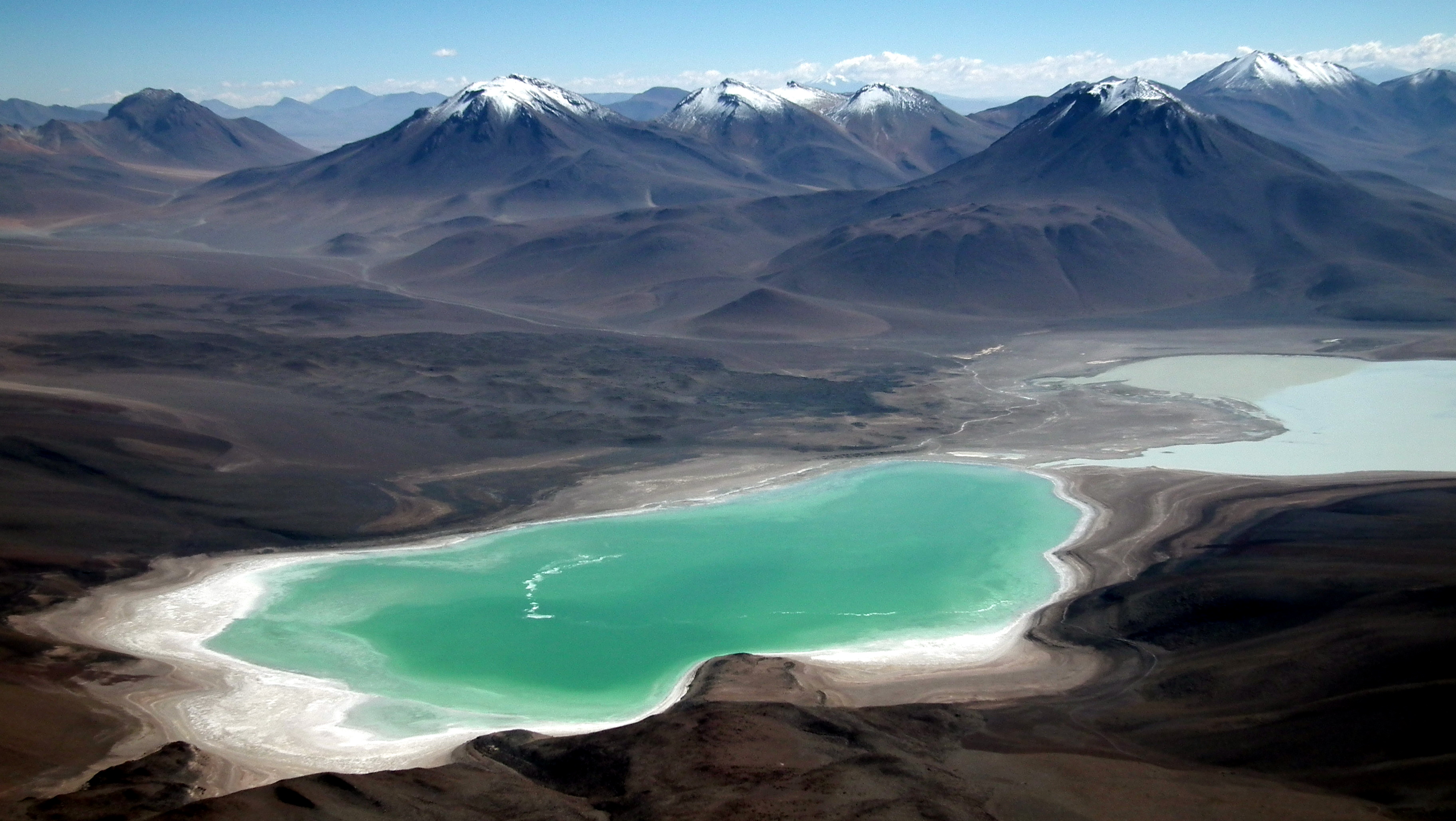
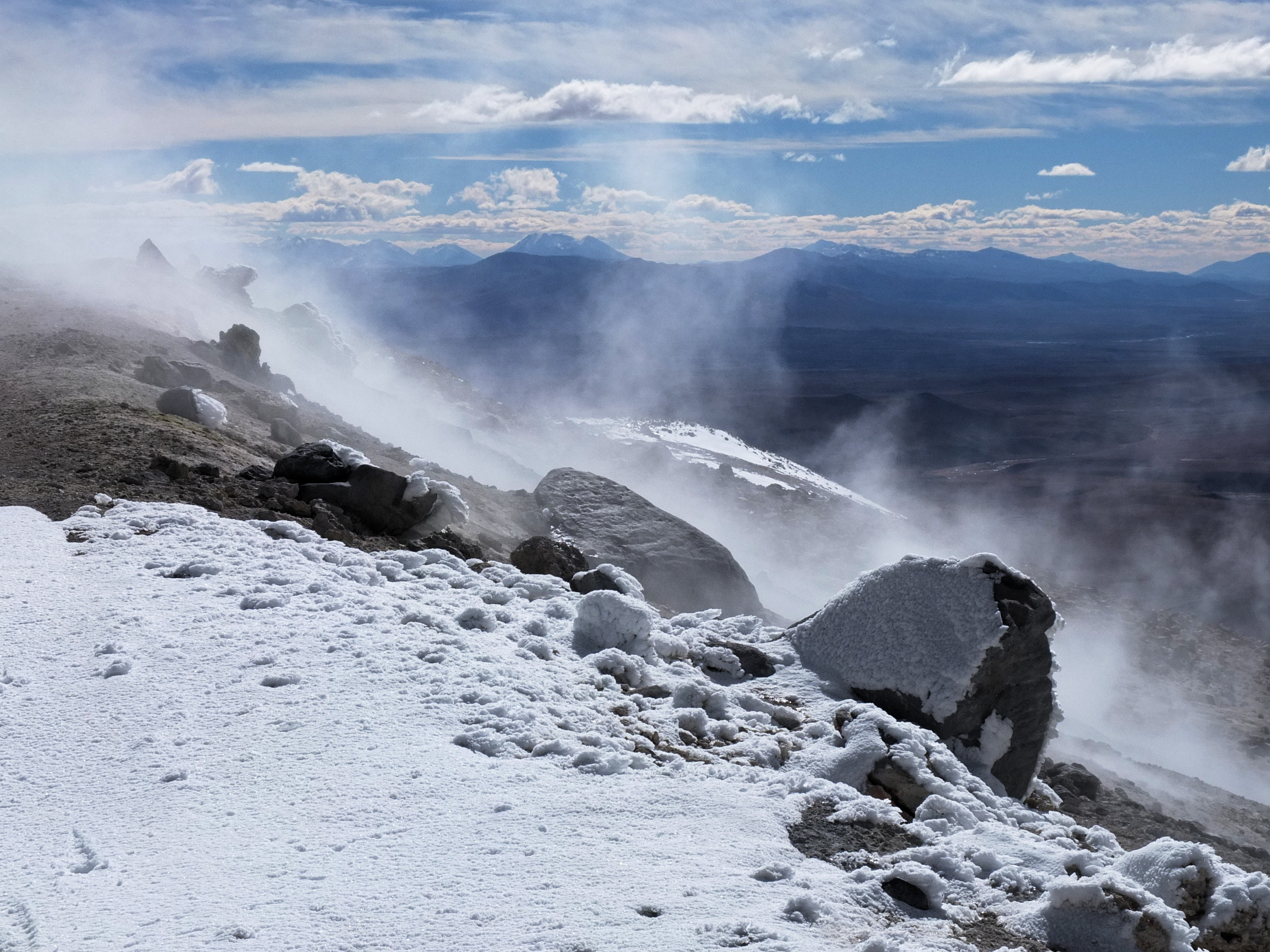
Nelly ( Spanish ''Cerro Nelly'') is a stratovolcano in the Andes located in the Cordillera Occidental of Bolivia, about 5,676 m (18,622 ft) high. It is situated within the Eduardo Avaroa Andean Fauna National Reserve, north east of the Licancabur volcano, Laguna Verde and Laguna Blanca and next to Mount Laguna Verde in the Potosí Department, Sur Lípez Province, San Pablo de Lípez Municipality, Quetena Grande Canton. See also * *[...More Info...] [...Related Items...] OR: [Wikipedia] [Google] [Baidu] |
Bolivia
, image_flag = Bandera de Bolivia (Estado).svg , flag_alt = Horizontal tricolor (red, yellow, and green from top to bottom) with the coat of arms of Bolivia in the center , flag_alt2 = 7 × 7 square patchwork with the (top left to bottom right) diagonals forming colored stripes (green, blue, purple, red, orange, yellow, white, green, blue, purple, red, orange, yellow, from top right to bottom left) , other_symbol = , other_symbol_type = Dual flag: , image_coat = Escudo de Bolivia.svg , national_anthem = " National Anthem of Bolivia" , image_map = BOL orthographic.svg , map_width = 220px , alt_map = , image_map2 = , alt_map2 = , map_caption = , capital = La Paz Sucre , largest_city = , official_languages = Spanish , languages_type = Co-official languages , languages ... [...More Info...] [...Related Items...] OR: [Wikipedia] [Google] [Baidu] |
Laguna Verde (Bolivia)
__NOTOC__ Laguna Verde (Spanish for "green lake") is a salt lake in an endorheic basin, in the southwestern Altiplano in Bolivia. It is located in the Sur Lípez Province of the Potosí Department. It is close to the Chilean border, at the foot of the volcano Licancabur. Geography The Laguna Verde is a lake at elevation. It covers an area of and has a depth of , and a narrow causeway divides it into two parts. It is at the southwestern extremity of the Eduardo Avaroa Andean Fauna National Reserve and Bolivia itself. It has mineral suspensions of arsenic and other minerals which renders colour to the lake waters. Its color varies from turquoise to dark emerald depending on the disturbance caused to sediments in the lake by winds. In the backdrop of the lake there is the inactive volcano Licancabur of in elevation, which is a nearly perfect cone. The shorelines west and east of the lake have different characteristics, with the western and southern shores eroded into volcanoes ... [...More Info...] [...Related Items...] OR: [Wikipedia] [Google] [Baidu] |
Uturunku
Uturuncu is a dormant volcano in the Sur Lípez Province of Bolivia. It is high, has two summit peaks, and consists of a complex of lava domes and lava flows with a total volume estimated to be . It bears traces of a former glaciation, even though it does not currently carry glaciers. Volcanic activity took place during the Pleistocene epoch and the last eruption was 250,000 years ago; since then Uturuncu has not erupted but active fumaroles occur in the summit region, between the two summits. The volcano rises within the Altiplano–Puna volcanic complex, a larger province of large volcanoes and calderas which over the last few million years (mya) have emplaced about of ignimbrites in sometimes very large eruptions. Underneath it lies the so-called Altiplano–Puna magmatic body, a large sill formed by partially molten rocks. Starting in 1992, satellite observations have indicated a large area of regional uplift centered on Uturuncu, which has been interpreted as an i ... [...More Info...] [...Related Items...] OR: [Wikipedia] [Google] [Baidu] |
Hedionda Lake (Sud Lipez) , a saline lake in the mountains of Nor Lípez Province, Potosí Department, Bolivia
{{geodis ...
Laguna Hedionda may refer to: * Laguna Hedionda (Sud Lípez), a lake in the mountains of Potosí Department, Bolivia * Laguna Hedionda (Nor Lípez) Laguna Hedionda (Spanish language, Spanish for "stinking lake") is a saline lake in the Nor Lípez Province, Potosí Department in Bolivia. It is notable for various migratory species of pink and white flamingos. Laguna Hedionda is one of the nin ... [...More Info...] [...Related Items...] OR: [Wikipedia] [Google] [Baidu] |
Colorada Lake
__NOTOC__ Laguna Colorada (''Red Lagoon'') is a shallow salt lake in the southwest of the altiplano of Bolivia, within Eduardo Avaroa Andean Fauna National Reserve and close to the border with Chile. Contents The lake contains borax islands, whose white color contrasts with the reddish color of its waters, which is caused by red sediments and pigmentation of some algae. Geography Laguna Colorada is part of the Los Lípez (formerly Laguna Colorada) Ramsar wetland. It was listed as a "Ramsar Wetland of International Importance" in 1990. On, July 13, 2009, the site was expanded from 513.18 to to include the surrounding high Andean endorheic, hypersaline and brackish lakes and associated wetlands (known as bofedales). Fauna James's flamingos abound in the area. It is also possible to find Andean and Chilean flamingos, but in lesser quantities. See also * Laguna Verde *Mount Nelly Nelly ( Spanish ''Cerro Nelly'') is a stratovolcano in the Andes located in the Cordillera ... [...More Info...] [...Related Items...] OR: [Wikipedia] [Google] [Baidu] |
Celeste Lake
__NOTOC__ Laguna Celeste is a lake of Bolivia in the Sur Lípez Province, Potosí Department Potosí (; Aymara language, Aymara: ''Putusi''; qu, P'utuqsi) is a Departments of Bolivia, department in southwestern Bolivia. It comprises 118,218 km2 with 823,517 inhabitants (2012 census). The capital is the city of Potosí. It is most .... At an elevation of 4529 m, its surface area is 2.3 km². References Lakes of Potosí Department {{Potosí-geo-stub ... [...More Info...] [...Related Items...] OR: [Wikipedia] [Google] [Baidu] |
List Of Mountains In The Andes
A ''list'' is any set of items in a row. List or lists may also refer to: People * List (surname) Organizations * List College, an undergraduate division of the Jewish Theological Seminary of America * SC Germania List, German rugby union club Other uses * Angle of list, the leaning to either port or starboard of a ship * List (information), an ordered collection of pieces of information ** List (abstract data type), a method to organize data in computer science * List on Sylt, previously called List, the northernmost village in Germany, on the island of Sylt * ''List'', an alternative term for ''roll'' in flight dynamics * To ''list'' a building, etc., in the UK it means to designate it a listed building that may not be altered without permission * Lists (jousting), the barriers used to designate the tournament area where medieval knights jousted * ''The Book of Lists'', an American series of books with unusual lists See also * The List (other) * Listing (di ... [...More Info...] [...Related Items...] OR: [Wikipedia] [Google] [Baidu] |
Mount Laguna Verde, Bolivia
Mount is often used as part of the name of specific mountains, e.g. Mount Everest. Mount or Mounts may also refer to: Places * Mount, Cornwall, a village in Warleggan parish, England * Mount, Perranzabuloe, a hamlet in Perranzabuloe parish, Cornwall, England * Mounts, Indiana, a community in Gibson County, Indiana, United States People * Mount (surname) * William L. Mounts (1862–1929), American lawyer and politician Computing and software * Mount (computing), the process of making a file system accessible * Mount (Unix), the utility in Unix-like operating systems which mounts file systems Displays and equipment * Mount, a fixed point for attaching equipment, such as a hardpoint on an airframe * Mounting board, in picture framing * Mount, a hanging scroll for mounting paintings * Mount, to display an item on a heavy backing such as foamcore, e.g.: ** To pin a biological specimen, on a heavy backing in a stretched stable position for ease of dissection or display ** To p ... [...More Info...] [...Related Items...] OR: [Wikipedia] [Google] [Baidu] |
Laguna Blanca (Bolivia)
__NOTOC__ Laguna Blanca is a salt lake in an endorheic basin, in the Sur Lípez Province of the Potosí Department, Bolivia. It is near the Licancabur volcano. Geography The lake is at an elevation of on the Altiplano. Its surface area is 10.9 km². The lake is long and wide. The characteristic white colour of the water, that gave the lake its name, is caused by the high amount of minerals suspended in it. Only a narrow corridor separates Laguna Blanca from the smaller Laguna Verde. Both are within the Eduardo Avaroa Andean Fauna National Reserve See also *Laguna Verde (Bolivia) — ''a salt lake also in Eduardo Avaroa Andean Fauna National Reserve''. * Altiplano region * Licancabur volcano *Mount Nelly Nelly ( Spanish ''Cerro Nelly'') is a stratovolcano in the Andes located in the Cordillera Occidental of Bolivia, about 5,676 m (18,622 ft) high. It is situated within the Eduardo Avaroa Andean Fauna National Reserve, north east of the ... External link ... [...More Info...] [...Related Items...] OR: [Wikipedia] [Google] [Baidu] |
Licancabur
Licancabur () is a stratovolcano on the border between Bolivia and Chile, south of the Sairecabur volcano and west of Juriques. Part of the Andean Central Volcanic Zone, it has a prominent, -high cone. A summit crater containing Licancabur Lake, a crater lake which is among the highest lakes in the world, caps the volcano. Three stages of lava flows emanate from the edifice. Licancabur formed atop of Pleistocene ignimbrites and has been active during the Holocene, after the ice ages. Although no historic eruptions of the volcano are known, lava flows extending into Laguna Verde have been dated to 13,240 ± 100 BP. The volcano has primarily erupted andesite, with small amounts of dacite and basaltic andesite. Its climate is cold, dry and very sunny, with high levels of ultraviolet radiation. Licancabur is not covered by glaciers. Cushion plants and shrubs form the vegetation lower on its slopes. Chinchillas were formerly hunted on the volcano. Licancabur is consider ... [...More Info...] [...Related Items...] OR: [Wikipedia] [Google] [Baidu] |
Potosí Department
Potosí (; Aymara language, Aymara: ''Putusi''; qu, P'utuqsi) is a Departments of Bolivia, department in southwestern Bolivia. It comprises 118,218 km2 with 823,517 inhabitants (2012 census). The capital is the city of Potosí. It is mostly a barren, mountainous region with one large plateau to the west, where the largest Salt pan (geology), salt flat in the world, Salar de Uyuni, is located. Cerro Rico, Cerro Potosí was the richest province in the Spanish empire, providing a great percentage of the silver that was Spanish treasure fleet, shipped to Europe. Potosi is also the location of the San Cristóbal mine (Bolivia), San Cristóbal silver, zinc and lead mines, developed by the US-company Apex Silver Mines Limited of Colorado and in November 2008 sold to the Japanese Sumitomo Corporation. Government The chief executive office of Departments of Bolivia, Bolivia departments (since May 2010) is the governor; until then, the office was called the prefect, and until 2006 ... [...More Info...] [...Related Items...] OR: [Wikipedia] [Google] [Baidu] |
Eduardo Avaroa Andean Fauna National Reserve
The Eduardo Avaroa Andean Fauna National Reserve (''Reserva Nacional de Fauna Andina Eduardo Avaroa''; Spanish acronym: REA) is located in Sur Lípez Province. Situated in the far southwestern region of Bolivia, it is the country's most visited protected area. It is considered the most important protected area in terms of tourist influx in the Potosí Department. Located at an altitude between and in Bolivia, it extends over an area of and includes the Laguna Colorada National Wildlife Sanctuary. Categorized under IUCN Category IV, it is primarily for the protection of birds that inhabit the different lagoons in the reserve. The reserve protects part of the Central Andean dry puna (oligothermic) ecoregion. The reserve's major attractions are erupting volcanoes, hot springs, geysers, lakes, fumaroles, mountains and its three endemic species of flamingos in particular. History Established in 1973, the national park is named after Eduardo Avaroa (1838–1879), the Bolivian war ... [...More Info...] [...Related Items...] OR: [Wikipedia] [Google] [Baidu] |


.jpg)

.jpg)