|
Mount McLoughlin
Mount McLoughlin is a dormant steep-sided stratovolcano, or composite volcano, in the Cascade Range of southern Oregon and within the United States Sky Lakes Wilderness. It is one of the volcanic peaks in the Cascade Volcanic Arc, within the High Cascades sector. A prominent landmark for the Rogue River Valley, the mountain is north of Mount Shasta, and south-southeast of Crater Lake. It was named around 1838 after John McLoughlin, a Chief Factor for the Hudson's Bay Company. Mount McLouglin's prominence has made it a landmark to Native American populations for thousands of years. McLoughlin consists largely of basaltic andesite. It underwent three major eruptive periods before its last activity took place between 30,000 and 20,000 years ago. It is not currently monitored for activity or deformation. Diverse species of flora and fauna inhabit the area, which is subject to frequent snowfall and temperature variation between seasons. The Pacific Crest Trail skirts the eastern an ... [...More Info...] [...Related Items...] OR: [Wikipedia] [Google] [Baidu] |
List Of Highest Points In Oregon By County ...
This is a list of highest points in each county in the U.S. state of Oregon, in alphabetical order by county. All elevations use the North American Vertical Datum of 1988 (NAVD88), the currently accepted vertical control datum for United States, Canada and Mexico. Elevations are from the National Geodetic Survey (NGS) when available. Others are from the United States Geological Survey topographic maps when available. These can be found on the Peakbagger.com web pages. Elevations from the NGS are rounded to the nearest whole number. References * {{DEFAULTSORT:List of Highest Points In Oregon by County Highest by county *Highest Oregon Oregon Oregon () is a state in the Pacific Northwest region of the Western United States. The Columbia River delineates much of Oregon's northern boundary with Washington, while the Snake River delineates much of its eastern boundary with Idaho. T ... [...More Info...] [...Related Items...] OR: [Wikipedia] [Google] [Baidu] |
Hudson's Bay Company
The Hudson's Bay Company (HBC; french: Compagnie de la Baie d'Hudson) is a Canadian retail business group. A fur trading business for much of its existence, HBC now owns and operates retail stores in Canada. The company's namesake business division is Hudson's Bay, commonly referred to as The Bay ( in French). After incorporation by English royal charter in 1670, the company functioned as the ''de facto'' government in parts of North America for nearly 200 years until the HBC sold the land it owned (the entire Hudson Bay drainage basin, known as Rupert's Land) to Canada in 1869 as part of the Deed of Surrender, authorized by the Rupert's Land Act 1868. At its peak, the company controlled the fur trade throughout much of the English- and later British-controlled North America. By the mid-19th century, the company evolved into a mercantile business selling a wide variety of products from furs to fine homeware in a small number of sales shops (as opposed to trading posts) acros ... [...More Info...] [...Related Items...] OR: [Wikipedia] [Google] [Baidu] |
United States Congress
The United States Congress is the legislature of the federal government of the United States. It is bicameral, composed of a lower body, the House of Representatives, and an upper body, the Senate. It meets in the U.S. Capitol in Washington, D.C. Senators and representatives are chosen through direct election, though vacancies in the Senate may be filled by a governor's appointment. Congress has 535 voting members: 100 senators and 435 representatives. The U.S. vice president has a vote in the Senate only when senators are evenly divided. The House of Representatives has six non-voting members. The sitting of a Congress is for a two-year term, at present, beginning every other January. Elections are held every even-numbered year on Election Day. The members of the House of Representatives are elected for the two-year term of a Congress. The Reapportionment Act of 1929 establishes that there be 435 representatives and the Uniform Congressional Redistricting Act requires ... [...More Info...] [...Related Items...] OR: [Wikipedia] [Google] [Baidu] |
Fremont–Winema National Forest
The Fremont–Winema National Forest is a United States National Forest formed from the 2002 merger of the Fremont and Winema National Forests. They cover territory in southern Oregon from the crest of the Cascade Range on the west past the city of Lakeview to the east. The northern end of the forests is bounded by U.S. Route 97 on the west and Oregon Route 31 on the east. To the south, the state border with California forms the boundary of the forests. Klamath Falls is the only city of significant size in the vicinity. The forests are managed by the United States Forest Service, and the national forest headquarters are located in Lakeview. Fremont National Forest The Fremont National Forest was named after John C. Frémont, who explored the area for the United States Army Corps of Engineers in 1843. It is located in western Lake and eastern Klamath counties in Oregon and has a land area of . There are local ranger district offices located in Bly, Lakeview, Paisley, a ... [...More Info...] [...Related Items...] OR: [Wikipedia] [Google] [Baidu] |
Rogue River–Siskiyou National Forest
The Rogue River–Siskiyou National Forest is a United States National Forest in the U.S. states of Oregon and California. The formerly separate Rogue River and Siskiyou National Forests were administratively combined in 2004. Now, the Rogue River–Siskiyou National Forest ranges from the crest of the Cascade Range west into the Siskiyou Mountains, covering almost . Forest headquarters are located in Medford, Oregon. Geography The former ''Rogue River'' portion of the Rogue River–Siskiyou National Forest is located in parts of five counties in southern Oregon and northern California. In descending order of land area they are Jackson, Klamath, Douglas, Siskiyou, and Josephine counties, with Siskiyou County being the only one in California. It has a land area of . There are local ranger district offices located in Ashland, Butte Falls, Grants Pass, Jacksonville, and Prospect. The former ''Siskiyou'' portion of the Rogue River–Siskiyou National Forest is located in p ... [...More Info...] [...Related Items...] OR: [Wikipedia] [Google] [Baidu] |
Interstate 5 In Oregon
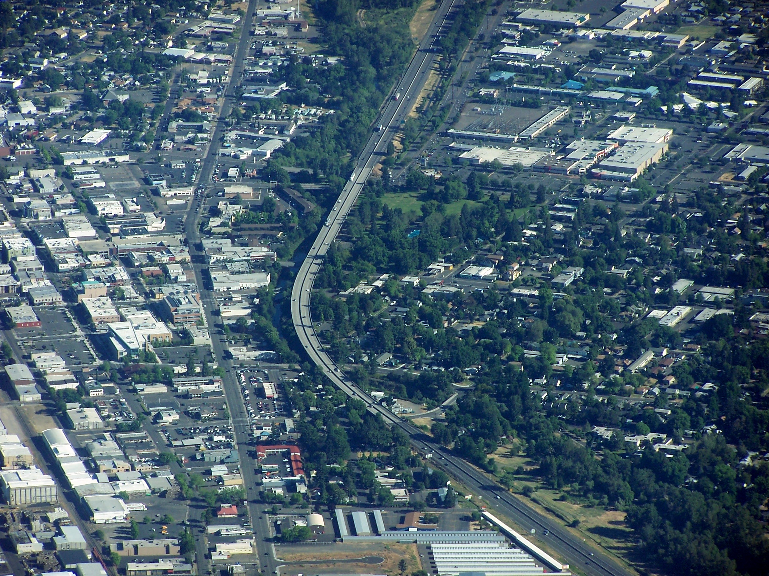
Interstate 5 (I-5) in the U.S. state of Oregon is a major Interstate Highway that traverses the state from north to south. It travels to the west of the Cascade Mountains, connecting Portland to Salem, Eugene, Medford, and other major cities in the Willamette Valley and across the northern Siskiyou Mountains. The highway runs from the California state line near Ashland to the Washington state line in northern Portland, forming the central part of Interstate 5's route between Mexico and Canada. I-5 was designated in 1957 and replaced U.S. Route 99 (US 99) for most of its length, itself preceded by the Pacific Highway and various wagon roads. The freeway incorporated early bypasses and expressways built for US 99 in the 1950s, including a new freeway route from Portland to Salem, and additional bypasses were built using federal funds. The last segment of I-5, on the Marquam Bridge in Portland, was opened in October 1966 and the whole highway was dedicated later t ... [...More Info...] [...Related Items...] OR: [Wikipedia] [Google] [Baidu] |
Oregon State University
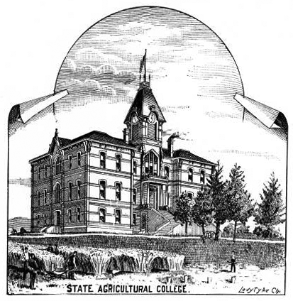
Oregon State University (OSU) is a public land-grant, research university in Corvallis, Oregon. OSU offers more than 200 undergraduate-degree programs along with a variety of graduate and doctoral degrees. It has the 10th largest engineering college in the nation for 2022. Undergraduate enrollment for all colleges combined averages close to 32,000, making it the state's largest university. Out-of-state students make up over one-quarter of undergraduates and an additional 5,500 students are engaged in graduate coursework through the university. Since its founding, over 272,000 students have graduated from OSU. It is classified among "Doctoral Universities – Very high research activity". Chartered as a land-grant university initially, OSU became one of the four inaugural members of the Sea Grant in 1971. It joined the Space Grant and Sun Grant research consortia in 1991 and 2003, respectively, making it the first public university and one of just four in total to attain memb ... [...More Info...] [...Related Items...] OR: [Wikipedia] [Google] [Baidu] |
Klamath County, Oregon
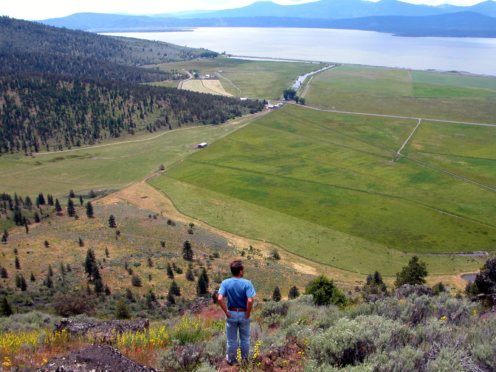
Klamath County ( ) is one of the 36 counties in the U.S. state of Oregon. As of the 2020 census, the population was 69,413. The county seat is Klamath Falls. The county was named for the Klamath, the tribe of Native Americans living in the area at the time the first European explorers entered the region. Klamath County comprises the Klamath Falls, OR Micropolitan Statistical Area. History The Klamath or ''Clamitte'' tribe of Indians, for which Klamath County was named, are the descendants of varying cultures of indigenous peoples, who have lived in the area for more than 10,000 years. When European-Americans began to travel through the area in 1846 along the Applegate Trail, they competed with the Klamath for game and water, which precipitated clashes between the peoples. This was exacerbated by European-American settlers, who cleared the land to farm and encroached on hunting territory. They were successful in demanding the removal of American Indians to reservations. The ... [...More Info...] [...Related Items...] OR: [Wikipedia] [Google] [Baidu] |
South Sister
--> , topo = USGS South Sister and North Sister , type = Two stratovolcanoes (South, Middle) and one shield volcano (North) , age = Quaternary , volcanic_arc = Cascade Volcanic Arc , last_eruption = 440 CE , first_ascent = , easiest_route = Hiking or scrambling, plus glacier travel on some routes The Three Sisters are closely spaced volcanic peaks in the U.S. state of Oregon. They are part of the Cascade Volcanic Arc, a segment of the Cascade Range in western North America extending from southern British Columbia through Washington and Oregon to Northern California. Each more than in elevation, they are the third-, fourth- and fifth-highest peaks in Oregon. Located in the Three Sisters Wilderness at the boundary of Lane and Deschutes counties and the Willamette and Deschutes national forests, they are about south of the nearest town, Sisters. Diverse species of flora and fauna inhabit the area, which is subject to frequent snowfall, occasional rain, and extreme tem ... [...More Info...] [...Related Items...] OR: [Wikipedia] [Google] [Baidu] |
Oregon Volcanoes Map
Oregon () is a state in the Pacific Northwest region of the Western United States. The Columbia River delineates much of Oregon's northern boundary with Washington, while the Snake River delineates much of its eastern boundary with Idaho. The 42° north parallel delineates the southern boundary with California and Nevada. Oregon has been home to many indigenous nations for thousands of years. The first European traders, explorers, and settlers began exploring what is now Oregon's Pacific coast in the early-mid 16th century. As early as 1564, the Spanish began sending vessels northeast from the Philippines, riding the Kuroshio Current in a sweeping circular route across the northern part of the Pacific. In 1592, Juan de Fuca undertook detailed mapping and studies of ocean currents in the Pacific Northwest, including the Oregon coast as well as the strait now bearing his name. Spanish ships – 250 in as many years – would typically not land before reaching Cape Mendocino i ... [...More Info...] [...Related Items...] OR: [Wikipedia] [Google] [Baidu] |
Skiing
Skiing is the use of skis to glide on snow. Variations of purpose include basic transport, a recreational activity, or a competitive winter sport. Many types of competitive skiing events are recognized by the International Olympic Committee (IOC), and the International Ski Federation (FIS). History Skiing has a history of almost five millennia. Although modern skiing has evolved from beginnings in Scandinavia, it may have been practiced more than 100 centuries ago in what is now China, according to an interpretation of ancient paintings. However, this continues to be debated. The word "ski" comes from the Old Norse word "skíð" which means to "split piece of wood or firewood". Asymmetrical skis were used in northern Finland and Sweden until at least the late 19th century. On one foot, the skier wore a long straight non-arching ski for sliding, and a shorter ski was worn on the other foot for kicking. The underside of the short ski was either plain or covered with animal ... [...More Info...] [...Related Items...] OR: [Wikipedia] [Google] [Baidu] |
Pacific Crest Trail
The Pacific Crest Trail (PCT), officially designated as the Pacific Crest National Scenic Trail, is a long-distance hiking and equestrian trail closely aligned with the highest portion of the Cascade and Sierra Nevada mountain ranges, which lie east of the U.S. Pacific coast. The trail's southern terminus is next to the Mexico–United States border, just south of Campo, California, and its northern terminus is on the Canada–US border, upon which it continues unofficially to the Windy Joe Trail within Manning Park in British Columbia; it passes through the states of California, Oregon, and Washington. The Pacific Crest Trail is long and ranges in elevation from roughly above sea level near the Bridge of the Gods on the Oregon–Washington border to at Forester Pass in the Sierra Nevada. The route passes through 25 national forests and 7 national parks. Its midpoint is near Chester, California (near Mt. Lassen), where the Sierra and Cascade mountain ranges meet. It was d ... [...More Info...] [...Related Items...] OR: [Wikipedia] [Google] [Baidu] |


.jpg)
