|
Mount Bartle Frere
Mount Bartle Frere (pronunciation mæÉntÌ¥ ËbÉËɾÉÉ« ËfÉ¹ÉªÉ Ngajanji: Choorechillum) is the highest mountain in Queensland at an elevation of . The mountain was named after Sir Henry Bartle Frere, a British colonial administrator and then president of the Royal Geographical Society by George Elphinstone Dalrymple in 1873. Bartle Frere was British Governor of Cape Colony at the outset of the Anglo-Zulu War. It is located south of Cairns in the Wooroonooran National Park southwest of the town of Babinda on the eastern edge of the Atherton Tablelands. Mount Bartle Frere is part of the Bellenden Ker Range and the watershed of Russell River. The foothill to summit is entirely covered by rainforest, ranging from typical tropical rainforest in the lowlands to low cloud forest at the cooler summit, where temperatures are up to 10 °C (18 °F) lower than on the coast. Despite the treacherous climb, reaching the top offers an expansive view of the surrounding ar ... [...More Info...] [...Related Items...] OR: [Wikipedia] [Google] [Baidu] |
Queensland
) , nickname = Sunshine State , image_map = Queensland in Australia.svg , map_caption = Location of Queensland in Australia , subdivision_type = Country , subdivision_name = Australia , established_title = Before federation , established_date = Colony of Queensland , established_title2 = Separation from New South Wales , established_date2 = 6 June 1859 , established_title3 = Federation of Australia, Federation , established_date3 = 1 January 1901 , named_for = Queen Victoria , demonym = , capital = Brisbane , largest_city = capital , coordinates = , admin_center_type = Administration , admin_center = Local government areas of Queensland, 77 local government areas , leader_title1 = Monarchy of Australia, Monarch , leader_name1 = Charles III , leader_title2 = Governor of Queensland, Governor , leader_name2 = Jeannette Young , leader_title3 = Premier of Queensland, Premier , leader_name3 = Annastacia Palaszczuk (Australian Labor Party (Queensland Branch), AL ... [...More Info...] [...Related Items...] OR: [Wikipedia] [Google] [Baidu] |
Christie Palmerston
Cristofero Palmerston Carandini or Christopher "Christie" Palmerston (1850 â 15 January 1897) was an Australian explorer and prospector in North Queensland. He led several expeditions during the last quarter of the 19th century including the discovery of a route along the Mowbray River, which eventually led to the founding of Port Douglas. Early life It has been claimed that Palmerston was the natural son of Lord Palmerston. However, Palmerston was born in Melbourne to Casino Jerome Carandini, the 10th Marquis of Sarzano and Marie Burgess, an English-born opera singer. Palmerston was baptised Cristofero Palmerston Carandini. This is the name he gives on his marriage registration in 1886, when he listed his father as Casino Carandini. His elder brother Frank succeeded to the marquessate upon their father's death in 1870, and his sister Isabella Sara married in 1886, Sir Norman Montgomery Abercrombie Campbell, 10th Baronet. Employment and conviction in central Queensland In 186 ... [...More Info...] [...Related Items...] OR: [Wikipedia] [Google] [Baidu] |
Bryophytes
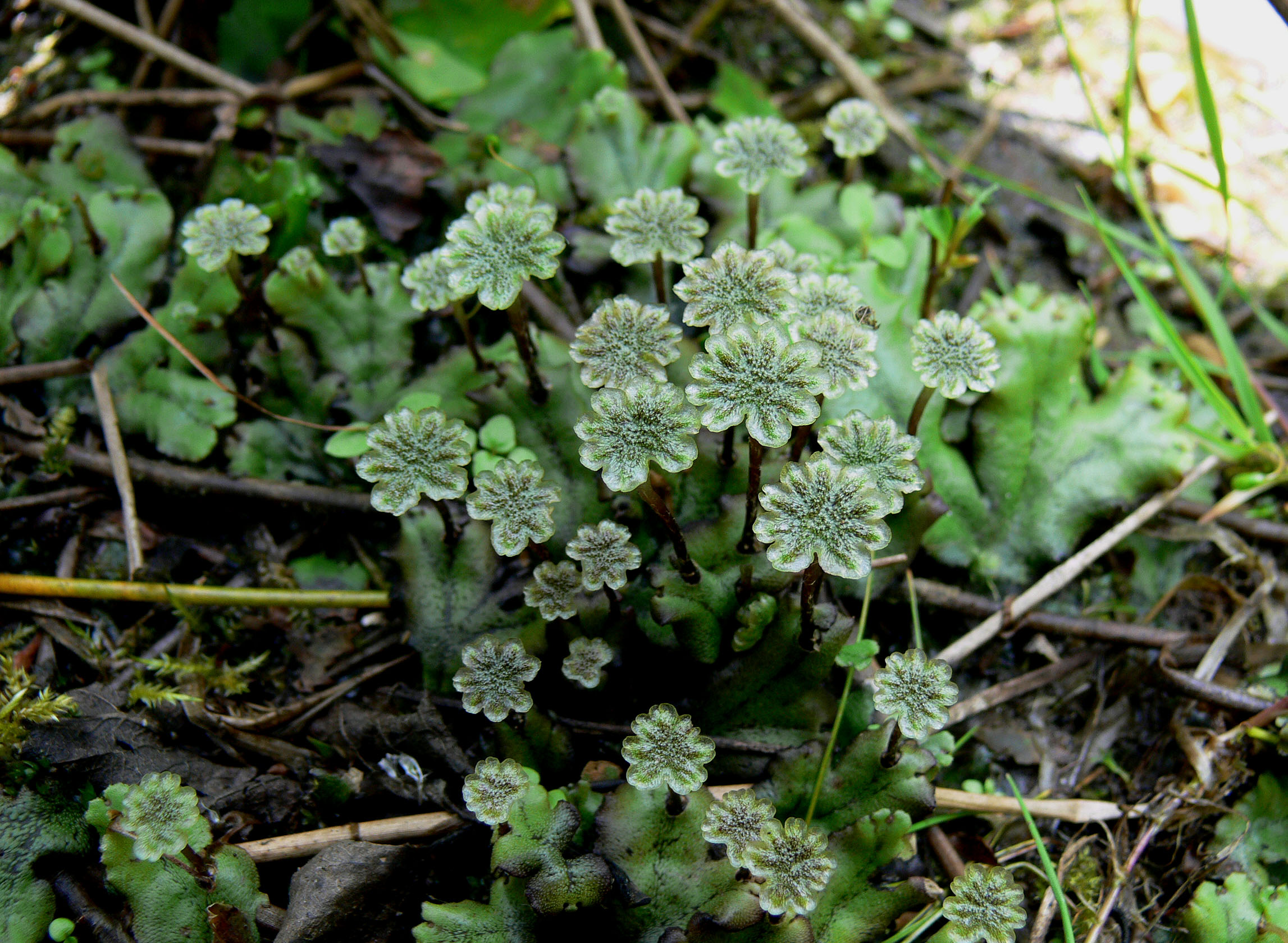
The Bryophyta s.l. are a proposed taxonomic division containing three groups of non-vascular land plants (embryophytes): the liverworts, hornworts and mosses. Bryophyta s.s. consists of the mosses only. They are characteristically limited in size and prefer moist habitats although they can survive in drier environments. The bryophytes consist of about 20,000 plant species. Bryophytes produce enclosed reproductive structures (gametangia and sporangia), but they do not produce flowers or seeds. They reproduce sexually by spores and asexually by fragmentation or the production of gemmae. Though bryophytes were considered a paraphyletic group in recent years, almost all of the most recent phylogenetic evidence supports the monophyly of this group, as originally classified by Wilhelm Schimper in 1879. The term ''bryophyte'' comes . Terminology The term "Bryophyta" was first suggested by Braun in 1864. G.M. Smith placed this group between Algae and Pteridophyta. Features Th ... [...More Info...] [...Related Items...] OR: [Wikipedia] [Google] [Baidu] |
Balanops Australiana
''Balanops'' is a group of flowering plants described as a genus in 1871. The nine species are trees or shrubs, found in New Caledonia, Fiji, Vanuatu, and northern Queensland. They are dioecious, with separate male and female plants. The genus by itself constitutes the family Balanopaceae (formerly the spelling ''Balanopsidaceae'' was also used). It is placed in the order Malpighiales and is related to Chrysobalanaceae, Dichapetalaceae, Euphroniaceae and Trigoniaceae. Species # '' Balanops australiana'' - Queensland # '' Balanops balansae'' - New Caledonia # '' Balanops microstachya'' - New Caledonia # '' Balanops oliviformis'' - New Caledonia # '' Balanops pachyphylla'' - New Caledonia # '' Balanops pancheri'' - New Caledonia # '' Balanops pedicellata'' - Vanuatu, Fiji # '' Balanops sparsifolia'' - New Caledonia # ''Balanops vieillardii ''Balanops'' is a group of flowering plants described as a genus in 1871. The nine species are trees or shrubs, found in ... [...More Info...] [...Related Items...] OR: [Wikipedia] [Google] [Baidu] |
Elaeocarpus Ferruginiflora
''Elaeocarpus'' is a genus of nearly five hundred species of flowering plants in the family Elaeocarpaceae native to the Western Indian Ocean, Tropical and Subtropical Asia, and the Pacific. Plants in the genus ''Elaeocarpus'' are trees or shrubs with simple leaves, flowers with four or five petals usually, and usually blue fruit. Description Plants in the genus ''Elaeocarpus'' are mostly evergreen trees or shrubs, a few are epiphytes or lianes, and some are briefly deciduous. The leaves are arranged alternately, simple (strictly compound with only one leaflet) with a swelling where the petiole meets the lamina, often have toothed edges, usually have prominent veins and often turn red before falling. The flowers are usually arranged in a raceme, usually bisexual, have four or five sepals and petals and many stamens. The petals usually have finely-divided, linear lobes. The fruit is a oval to spherical drupe that is usually blue, sometimes black, with a sculptured endocarp. ... [...More Info...] [...Related Items...] OR: [Wikipedia] [Google] [Baidu] |
Agathis Atropurpurea
''Agathis atropurpurea'', commonly known as the blue kauri, and occasionally as the black kauri or purple kauri, is a species of conifer in the very ancient plant family Araucariaceae. The family was distributed almost worldwide during the Jurassic and Cretaceous periods, but is now mostly confined to the Southern hemisphere. This species is endemic to a small part of northeastern Queensland, Australia. Description ''Agathis atropurpurea'' is a large rainforest emergent tree growing up to in height, and a diameter of up to . The trunk is cylindrical and very straight, with smooth to flaky bark that is mottled with dark blue, purple, and almost black patches. In very large trees the bark is brown and it may then be confused with the bull kauri, '' Agathis microstachya'', a species that is both genetically and geographically related. However even large specimens of the blue kauri will usually have some dark patches that enable a positive identification. The branches are more ... [...More Info...] [...Related Items...] OR: [Wikipedia] [Google] [Baidu] |
Linospadix Minor
''Linospadix minor'' (also known as ''Bacularia intermedia''), more commonly known as the minor walking stick palm (being smaller in stature than the walking stick palm '' Linospadix monostachyos'' ) is a small North-East Queensland tropical forest palm with stems between 7mm and 20mm in diameter, growing from 1 m to 5 m high, with semi-glossy dark green leaves, and a crown of 7 to 12 leaves ''Linospadix minor'' Palms and Cycads Societies of Australia webpage. Accessed 27 June 2009 The minor walking stick palm has a limited distribution in the rainforests of the southern Mcllwraith Range ( Cape York Peninsula), and is most abundant in the [...More Info...] [...Related Items...] OR: [Wikipedia] [Google] [Baidu] |
Tropical Cyclone
A tropical cyclone is a rapidly rotating storm system characterized by a low-pressure center, a closed low-level atmospheric circulation, strong winds, and a spiral arrangement of thunderstorms that produce heavy rain and squalls. Depending on its location and strength, a tropical cyclone is referred to by different names, including hurricane (), typhoon (), tropical storm, cyclonic storm, tropical depression, or simply cyclone. A hurricane is a strong tropical cyclone that occurs in the Atlantic Ocean or northeastern Pacific Ocean, and a typhoon occurs in the northwestern Pacific Ocean. In the Indian Ocean, South Pacific, or (rarely) South Atlantic, comparable storms are referred to simply as "tropical cyclones", and such storms in the Indian Ocean can also be called "severe cyclonic storms". "Tropical" refers to the geographical origin of these systems, which form almost exclusively over tropical seas. "Cyclone" refers to their winds moving in a circle, whirling ... [...More Info...] [...Related Items...] OR: [Wikipedia] [Google] [Baidu] |
Port Douglas, Queensland
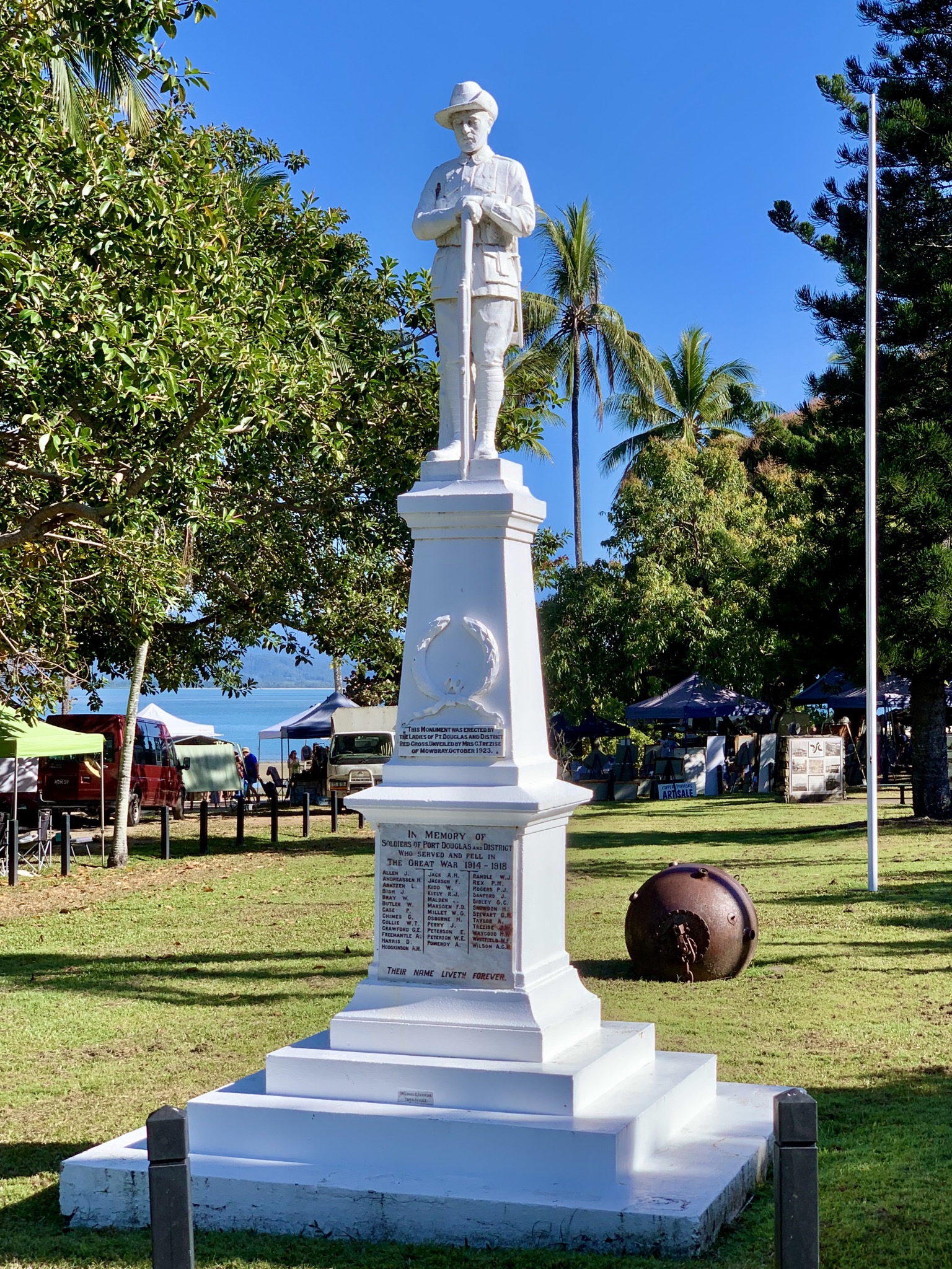
Port Douglas is a coastal town and locality in the Shire of Douglas, Queensland, Australia, approximately 60 km north of Cairns. In the , Port Douglas had a population of 3,504 people. The town's population can often double, however, with the influx of tourists during the peak tourism season from May to September. The town is named in honour of a former Premier of Queensland, John Douglas. Port Douglas developed quickly based on the mining industry. Other parts of the area were established with timber cutting occurring in the area surrounding the Daintree River and with settlement starting to occur on lots around the Mossman River by 1880. Previous names for the town included Terrigal, Island Point, Port Owen and Salisbury. The town is situated adjacent to two World Heritage areas, the Great Barrier Reef and the Daintree Rainforest. Port Douglas was No. 3 on Australian Traveller magazine's list of 100 Best Towns in Australia."100 Best Towns in Australia". Retrieved 21 July 201 ... [...More Info...] [...Related Items...] OR: [Wikipedia] [Google] [Baidu] |
Innisfail, Queensland
Innisfail (from Irish: Inis Fáil) is a regional town and locality in the Cassowary Coast Region, Queensland, Australia. The town was originally called Geraldton until 1910. In the , the town of Innisfail had a population of 7,236 people, while the locality of Innisfail had a population of 1,145 people. Innisfail is the major township of the Cassowary Coast Region and is known for its sugar and banana industries, as well as for being one of Australia's wettest towns. In March 2006, Innisfail gained worldwide attention when severe Tropical Cyclone Larry passed over causing extensive damage. Geography Innisfail's town centre is situated at the junction of the Johnstone River and South Johnstone River, approximately from the coast. It is located near large tracts of old-growth tropical rainforest surrounded by vast areas of extensive farmlands. Queensland's highest mountain, Mount Bartle Frere; part of Australia's Great Dividing Range, is to the north. The town's cen ... [...More Info...] [...Related Items...] OR: [Wikipedia] [Google] [Baidu] |
Josephine Falls
The Josephine Falls is a tiered cascade waterfall on the Josephine Creek located in Wooroonooran, Cairns Region in the Far North region of Queensland, Australia. Location and features The falls are situated at the foot of the southern face of Mount Bartle Frere in Wooroonooran National Park. They descend from the Atherton Tableland at an elevation of above sea level in the range of near a popular recreation site as the water flows over a large rock to form a natural waterslide on Josephine Creek, a tributary of the Russell River. Access to falls is via a sealed road off the Bruce Highway between Babinda Babinda is a rural town and Suburbs and localities (Australia), locality in the Cairns Region, Queensland, Australia. In the , the locality of Babinda had a population of 1,253 people. Geography Babinda is located south of Cairns. The town is ... and Innisfail. The natural rock slide can be dangerous and the occasional flash flooding occurs without warning, with a su ... [...More Info...] [...Related Items...] OR: [Wikipedia] [Google] [Baidu] |
Rock Scrambling
Scrambling is a mountaineering term for ascending steep terrain using one's hands to assist in holds and balance.''New Oxford American Dictionary''. It is also used to describe terrain that falls between hiking and rock climbing (as a âscrambleâ). Sure-footedness and a head for heights are essential. Canyoning and stream climbing are other types of scrambling. Overview Scrambling is ascending or traversing a grade without technical apparatus. Unroped ascent in exposed situations is potentially one of the most dangerous of mountaineering activities. As soon as an ascent involves a rope, going up or down, it is no longer a scramble. Alpine scrambling Alpine scrambling is scrambling in high mountains and may not follow a defined or waymarked path. The Seattle Mountaineers climbing organization defines alpine scrambling as follows: Alpine Scrambles are off-trail trips, often on snow or rock, with a 'non-technical' summit as a destination. A non-technical summit is on ... [...More Info...] [...Related Items...] OR: [Wikipedia] [Google] [Baidu] |


